Mississippi Highway 33
Videos
Mississippi Highway 33 is a state highway in southwestern Mississippi. It runs from north to south for 55.7 miles and serves the counties of Jefferson, Franklin, Amite, and Wilkinson.

Mississippi Highway 33 in Gloster

MS 33 inside the Homochitto National Forest near Fayette
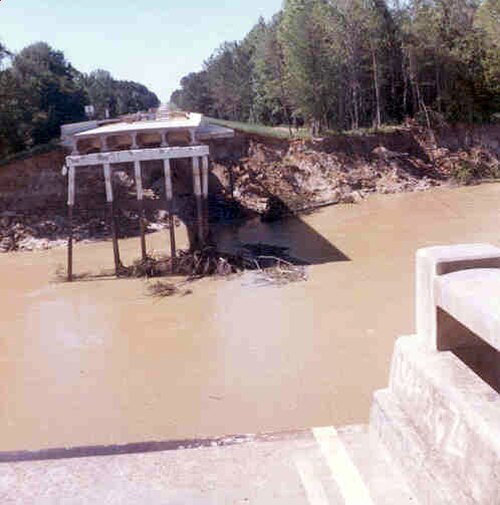
Mississippi Highway 33 bridge failure just north of Rosetta, Mississippi, caused by the April 1974 flood on the Homochitto River.
Mississippi Highway 28
Videos
Mississippi Highway 28 is a state highway in south-central Mississippi, United States, that runs east–west from U.S. Highway 84 west of Laurel to US 61/MS 33 in Fayette. It travels approximately 126 m
Mississippi Highway 33
…Hamburg to cross into Jefferson County. MS 33 passes through the community of McNair before exiting the National Forest and becoming concurrent with MS 28. The highway enters the Fayette city limits and passes by several homes and businesses, bypassing downtown along its western side before both MS 33 and…

MS 28 outside of Taylorsville as it tracks west towards Magee

MS 28 and MS 541 briefly overlap with US 49 in Magee