The Mississippi River–Gulf Outlet Canal is a 76 mi channel constructed by the United States Army Corps of Engineers at the direction of Congress in the mid-20th century that provided a shorter route b

The MRGO and an outlet into Lake Borgne, approximately 50 miles (80 km) up the canal from its mouth and 15 miles (24 km) east of New Orleans (view towards the southwest)

Intersection of MRGO (to right) with the Gulf Intracoastal Waterway, as seen from I-510 Bridge

Tugboat and barge in MRGO at Shell Beach, St. Bernard Parish

Inscription on house in storm-surge devastated neighborhood of Chalmette, Louisiana suggests that the ruins be used to fill MRGO.
After Hurricane Katrina on August 29, 2005, seven major investigations were conducted by civil engineers and other experts in an attempt to identify the cause of the flooding. Specifically, the invest
Breach in 17th Street Canal levee on August 31, showing the inundated Lakeview neighborhood on the right and the largely dry Metairie side on the left (NOAA)

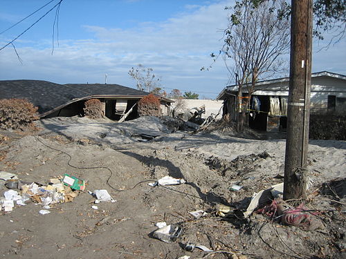
Severely damaged homes in piles of sand near the upper London Avenue Canal breach
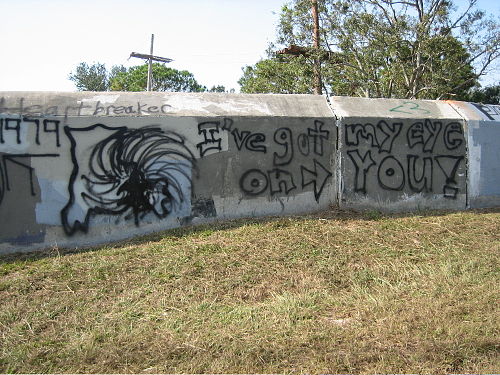
Portion of the flood wall atop 17th Street Canal levee, with Katrina-related graffiti. Notice cracks in the flood wall joints. Operation and maintenance are the responsibility of local levee districts as mandated by the Flood Control Act of 1965.

London Avenue Bridge Memorial