Missoula floods
Videos
The Missoula floods were a series of cataclysmic glacial lake outburst floods that swept periodically across the area that would become eastern Washington, northern Idaho and northern Oregon, and down
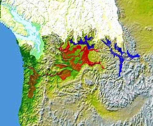
Glacial Lake Columbia (west) and Glacial Lake Missoula (east) are shown south of the Cordilleran ice sheet. The areas inundated in the Columbia and Missoula floods are shown in red.

Giant ripple marks at Markle Pass near Camas Hot Springs, Montana, U.S. View towards the northwest.

During the ice age floods, Dry Falls was under 300 feet (91 m) of water approaching at a speed of 65 miles per hour (105 km/h).

Glacial Lake Missoula high-water mark, 4,200 feet (1,280 m), near Missoula, MT
Glacial lake outburst flood
Videos
A glacial lake outburst flood is a type of outburst flood caused by the failure of a dam containing a glacial lake. An event similar to a GLOF, where a body of water contained by a glacier melts or ov
Missoula floods
…The Missoula floods (also known as the Spokane floods, the Bretz floods, or Bretz's floods) were a series of cataclysmic glacial lake outburst floods that swept periodically across the area that would become eastern Washington, northern Idaho and northern Oregon, and down the Columbia River Gorge at…
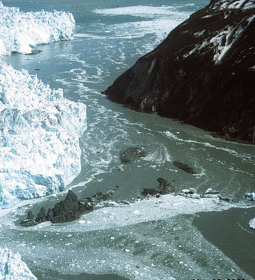
Hubbard Glacier, Alaska, squeezes towards Gibert Point on 20 May 2002. The glacier is close to sealing off Russell Fjord (top) from Disenchantment Bay (below).

In this Hubbard Glacier image from 16 July 2002, the glacier has closed off Russell Fjord from Disenchantment Bay. The waters behind the glacier rose 61 feet (19 m) in 10 weeks, creating a short lived Russell Lake.

The Hubbard Glacier is overwhelmed on 14 August 2002 in the second largest GLOF in historical times.

Tsho Rolpa Glacier Lake is one of the biggest glacial lakes in Nepal. The lake, which is located at an altitude of 4,580 metres (15,030 ft) in the Rolwaling Valley, Dolakha District, has grown considerably over the last 50 years due to glacial melting in the Himalayas.