Moderate Resolution Imaging Spectroradiometer
The Moderate Resolution Imaging Spectroradiometer (MODIS) is a satellite-based sensor used for earth and climate measurements. There are two MODIS sensors in Earth orbit: one on board the Terra satellite, launched by NASA in 1999; and one on board the Aqua satellite, launched in 2002. MODIS has now been replaced by the VIIRS, which first launched in 2011 aboard the Suomi NPP satellite.
Ash plumes on Kamchatka Peninsula, eastern Russia.
Hurricane Katrina near Florida peninsula.
California wildfires.
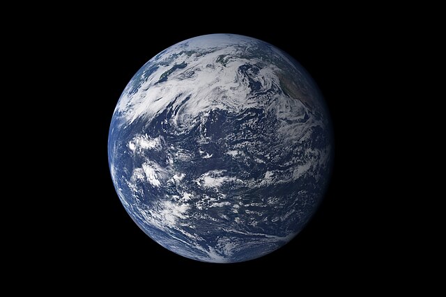
This detailed, photo-like view of Earth is based largely on observations from MODIS.
Terra is a multi-national scientific research satellite operated by NASA in a Sun-synchronous orbit around the Earth. It takes simultaneous measurements of Earth's atmosphere, land, and water to understand how Earth is changing and to identify the consequences for life on Earth. It is the flagship of the Earth Observing System (EOS) and the first satellite of the system which was followed by Aqua and Aura. Terra was launched in 1999.
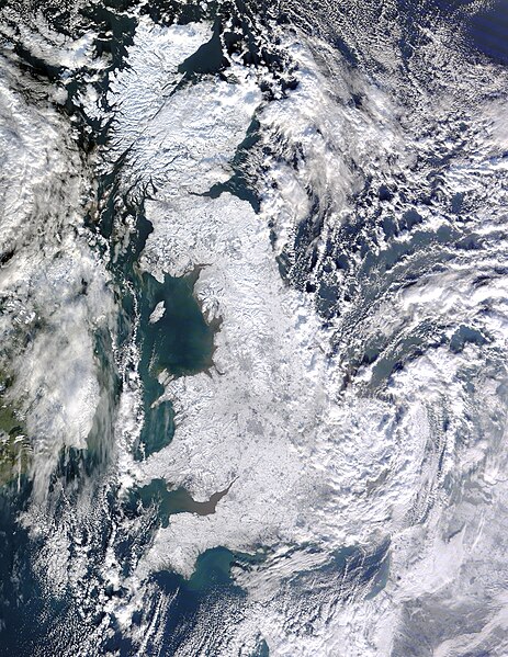
The effects of the European winter storms of 2009–2010 on Great Britain, seen from Terra.
The Deepwater Horizon oil spill oil slick as seen from space by NASA's Terra satellite on May 1, 2010.
Hurricane Karl, the most destructive hurricane of the 2010 Atlantic Hurricane Season, approaches Mexico on September 16.
Satellite image of the Ash distribution over Australia from the 2022 Hunga Tonga–Hunga Ha'apai eruption.