Monongahela National Forest
The Monongahela National Forest is a national forest located in the Allegheny Mountains of eastern West Virginia, USA. It protects over 921,000 acres of federally managed land within a 1,700,000 acres proclamation boundary that includes much of the Potomac Highlands Region and portions of 10 counties.
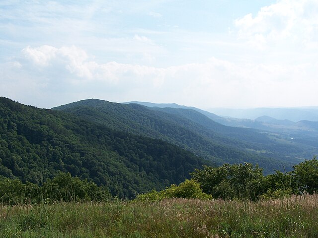
View from the slopes of Back Allegheny Mountain looking east. Visible are Allegheny Mountain (middle distance) and Shenandoah Mountain (far distance). The latter is in the George Washington National Forest of Virginia
Blackwater Canyon
Douglas Falls on the North Fork Blackwater River
Roaring Plains Wilderness
The Allegheny Mountain Range, informally the Alleghenies, is part of the vast Appalachian Mountain Range of the Eastern United States and Canada and posed a significant barrier to land travel in less developed eras. The Allegheny Mountains have a northeast–southwest orientation, running for about 300 miles (480 km) from north-central Pennsylvania, southward through western Maryland and eastern West Virginia.
View from atop Spruce Mountain in eastern West Virginia, the highest point in the Alleghenies
North Fork Mountain, West Virginia, looking south
Blue Knob, the most northern 3,000 footer in the Allegheny Mountain Range.
The Homestead, Hot Springs, Virginia, has catered to spa enthusiasts since 1766.