Morecambe Bay is an estuary in northwest England, just to the south of the Lake District National Park. It is the largest expanse of intertidal mudflats and sand in the United Kingdom, covering a total area of 120 sq mi (310 km2). In 1974, the second largest gas field in the UK was discovered 25 mi (40 km) west of Blackpool, with original reserves of over 7 trillion cubic feet (tcf). At its peak, 15% of Britain's gas supply came from the bay but production is now in decline. Morecambe Bay is also an important wildlife site, with abundant birdlife and varied marine habitats.
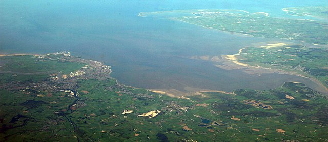
A panorama of most of Morecambe Bay looking from east (bottom of photo) to west (top of photo). Barrow-in-Furness and Walney Island can be seen in the upper part of the photo and Lancaster and Morecambe are visible in the lower left-hand corner of the photo.
Morecambe Bay from Ulverston
Rampside Gas Terminal
Morecambe Bay at low tide from Hest Bank, looking towards Grange-over-Sands
The Lake District, also known as the Lakes or Lakeland, is a mountainous region and national park in Cumbria, North West England. It is famous for its landscape, including its lakes, coast, and the Cumbrian mountains; and for its literary associations with Beatrix Potter, John Ruskin, and the Lake Poets.
The Skiddaw massif, town of Keswick and Derwent Water seen from Walla Crag
The A591 road as it passes through the countryside between Ambleside and Grasmere
A panorama from the summit of Scafell Pike, August 2007
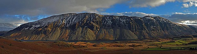
Panorama of the Wasdale screes descending into Wastwater, the deepest lake in England.