Motutapu Island is a 1,510 ha island in the Hauraki Gulf to the northeast of the city of Auckland, New Zealand. The island is part of the Hauraki Gulf Maritime Park. Its full name, rarely used, is Te Motutapu a Taikehu, "The sacred island of Taikehu", Taikehu having been a tohunga of the Tainui iwi. 'Motutapu', meaning "sacred" or "sanctuary" island, is a term used for various islands in a number of Polynesian cultures. The island can be accessed via regular ferry services departing from Auckland City.
The nearest two headlands in this view from Rangitoto are part of Motutapu
View from the south of Rangitoto Island and Motutapu Island
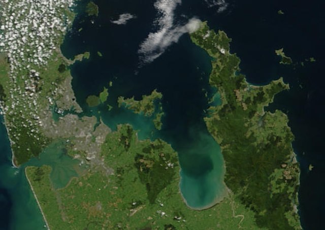
The Hauraki Gulf / Tīkapa Moana is a coastal feature of the North Island of New Zealand. It has an area of 4000 km2, and lies between, in anticlockwise order, the Auckland Region, the Hauraki Plains, the Coromandel Peninsula, and Great Barrier Island. Most of the gulf is part of the Hauraki Gulf Marine Park.
True-colour image showing the Hauraki Gulf / Tīkapa Moana, with Auckland (left) and the Coromandel Peninsula (right), by NASA's Terra satellite, 2002.
Sunset view of The Noises viewed from Waiheke Island
Farmland and native bush on Ponui Island
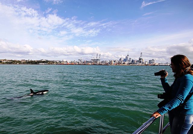
An orca swims in Waitematā Harbour, with Auckland CBD in the background.