Mount Takatsuma
Videos
Page
Mount Takatsuma (高妻山) at 2,353 m (7,720 ft) straddles the border between Nagano and Niigata prefectures, in the northwest of the city of Nagano and southwest of the city of Myōkō, and is also the boundary between the Kanto and Chubu regional offices of the Japanese forest agency.

Mount Takatsuma seen from Mount Togakushi

Late winter photo of Mount Takatsuma and the Togakushi Ridge from the summit of Mount Iizuna

Mount Takatsuma from the 9th Station, Seishi (勢至)(2,050m)

Mount Takatsuma from Kyuseishi, June 2023
Nagano (city)
Videos
Page
Nagano is the capital and largest city of Nagano Prefecture, located in the Nagano Basin in the central Chūbu region of Japan. Nagano is categorized as a core city of Japan. Nagano City is the highest prefectural capital in Japan, with an altitude of 371.4 meters (1,219 ft). The city is surrounded by mountains, the highest of which is Mount Takatsuma (2,353 m), and it is near the confluence of the Chikuma River—the longest and widest river in Japan—and the Sai River. As of 1 July 2023, the city had an estimated population of 365,296 in 160,625 households, and a population density of 438 persons per km². The total area of the city is 834.81 square kilometres (322.32 sq mi).
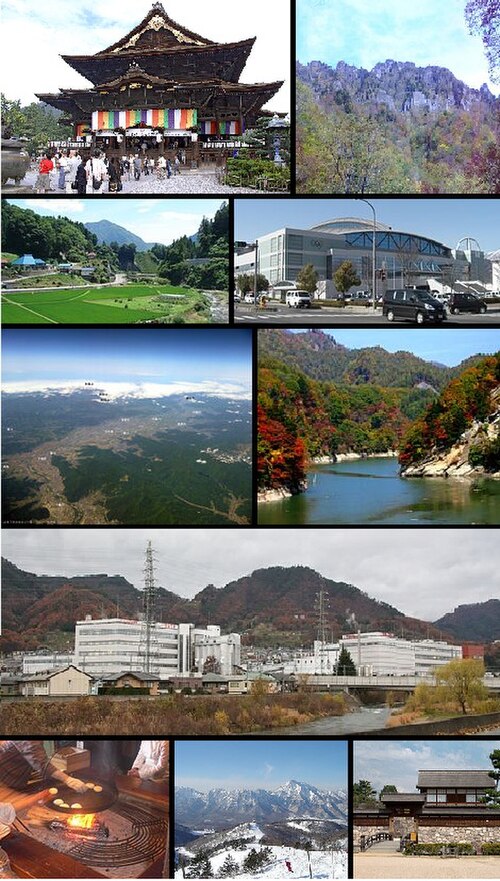
From top of left, Zenkoji, Mount Togakushi, Kinasa village, Nagano Big Hat arena, Aerial in Kawanakajima, Oku-Subana Valley, headquarters of Marukome (famous miso manufacturing company) in Nagano, Oyaki Japanese sweets, Togakushi ski resort, and Matsushiro Castle

Stylized manhole cover displaying the Nagano Olympics emblem, with tactile paving

Asagawa Loop Line to Iizuna Kogen Ski Area built in preparations for the 1998 Winter Olympics

Matsushiro Castle (2010)