Adelaide city centre
Adelaide city centre is the innermost locality of Greater Adelaide, the capital city of South Australia. It is known by locals as "The City" or "Town" to distinguish it from Greater Adelaide and from the City of Adelaide; the locality is split into two key geographical distinctions: the city "square mile", bordered by North, East and West Terraces. The locality is home to the Parliament of many key state government offices. Due to the construction of many new apartments in the city, the population has grown over ten years from 10,229 to 15,115. Before the European settlement of South Australia, the Adelaide Plains, on which Adelaide was built, were home to the Kaurna group of Indigenous Australians; the colony of South Australia was established in 1836 at Glenelg, the city itself established in 1837. The location and layout of the city is accredited to Colonel William Light, in a plan known as Light's Vision; the area where the Adelaide city centre now exists was once known as "Tarndanya", which translates as "male red kangaroo rock" in Aboriginal, an area along the south bank of what is now known as the River Torrens, which flows through Adelaide.
Kaurna numbers were reduced by at least two widespread epidemics of smallpox which preceded European settlement, having been transported downstream along the Murray River. When European settlers arrived in 1836, estimates of the Kaurna population ranged from 300 to 1000 people. British Captain Matthew Flinders, along with French Captain Nicolas Baudin, charted the southeast coast of Australia, where Adelaide is located. Flinders provided little information on Adelaide itself. Charles Sturt explored the Murray and wrote a favourable reflection on what he saw. Colonel William Light is credited with settling and laying out the Adelaide region, which included a grid plan of Adelaide's streets. Adelaide was not as badly affected by the 1860s economic depression in Australia as other gold rush cities like Sydney and Melbourne, allowing it to prosper. Historian F. W. Crowley noted that the city was full of elite upper-class citizens which provided a stark contrast to the grinding poverty of the labour areas and slums outside the inner city ring.
Due to its historic puritan wealth during the 20th century, the city retains a notable portion of Victorian architecture. Adelaide is separated from its greater metropolitan area by a ring of public parklands on all sides; the so-called "square mile" within the park lands is defined by a small area of high rise office and apartment buildings in the centre north, around King William Street, which runs north-to-south through the centre. Surrounding this central business district are a large number of medium to low density apartments and detached houses which make up the residential portion of the city centre; the layout of Adelaide, known as Light's Vision, features a cardinal direction grid pattern of wide streets and terraces and five large public squares: Victoria Square in the centre of the city, Hindmarsh, Light and Whitmore Squares in the centres of each of the four quadrants of the Adelaide city centre. These squares occupy 32 of the 700 numbered "town acre" allotments on Light's plan.
All east-west roads change their names as they cross King William Street, except for North and South terraces. They alternate between being wide and narrow, 99 and 66 feet, except for the central Grote and Wakefield which are extra-wide, 132 feet, along with the surrounding four terraces. In the south half of the city, in several places the Adelaide City Council has constructed wide footpaths and road markings to restrict traffic to a lesser number of lanes than the full width of the road could support; the street pairs, design widths, town acres in Light's Vision are illustrated in this diagram: The streets and squares were named by a committee of a number of prominent settlers after themselves, after early directors of the South Australian Company, after Commissioners appointed by the British government to oversee implementation of the acts that established the colony, after various notables involved in the establishment of the colony. The Street Naming Committee comprised: All members of the committee had one or more of the streets and squares in the Adelaide city centre and North Adelaide named after themselves.
Brown Street, named for John Brown, was subsequently subsumed as a continuation of Morphett Street in 1967. In the same year, Hanson Street, named for Richard Hanson, was subsumed as a continuation of Pulteney Street; the squares were named after: Victoria - the regent the monarch Queen Victoria Hindmarsh - Rear Admiral Sir John Hindmarsh, first Governor Hurtle - Sir James Hurtle Fisher, first Resident Commissioner Light - Colonel William Light, Surveyor General Whitmore - William Wolryche-Whitmore MP, a Colonial Commissioner in LondonThe east-west streets named on 22 December 1836 were: Rundle – John Rundle MP, Director of the South Australian Company Hindley – Charles Hindley MP, Director of South Australian Company Grenfell – Pascoe St Leger Grenfell MP, presented town acre for Holy Trinity Church and other country lands Currie – Raikes Currie MP, Director of South Australian Company Pirie – Sir John Pirie and Lord Mayor of London, Director of South Australian Company Waymouth – Henry Waymouth, Director South Australian Company Flinders – Matthew Flinders, explorer Franklin – Rear Admiral Sir John Franklin, midshipman under Flinders Wakefield – Daniel Bell Wakefield, bar
Pleistocene
The Pleistocene is the geological epoch which lasted from about 2,588,000 to 11,700 years ago, spanning the world's most recent period of repeated glaciations. The end of the Pleistocene corresponds with the end of the last glacial period and with the end of the Paleolithic age used in archaeology; the Pleistocene is the first epoch of the Quaternary Period or sixth epoch of the Cenozoic Era. In the ICS timescale, the Pleistocene is divided into four stages or ages, the Gelasian, Middle Pleistocene and Upper Pleistocene. In addition to this international subdivision, various regional subdivisions are used. Before a change confirmed in 2009 by the International Union of Geological Sciences, the time boundary between the Pleistocene and the preceding Pliocene was regarded as being at 1.806 million years Before Present, as opposed to the accepted 2.588 million years BP: publications from the preceding years may use either definition of the period. Charles Lyell introduced the term "Pleistocene" in 1839 to describe strata in Sicily that had at least 70% of their molluscan fauna still living today.
This distinguished it from the older Pliocene epoch, which Lyell had thought to be the youngest fossil rock layer. He constructed the name "Pleistocene" from the Greek πλεῖστος, pleīstos, "most", καινός, kainós, "new"; the Pleistocene has been dated from 2.588 million to 11,700 years BP with the end date expressed in radiocarbon years as 10,000 carbon-14 years BP. It covers most of the latest period of repeated glaciation, up to and including the Younger Dryas cold spell; the end of the Younger Dryas has been dated to about 9640 BC. The end of the Younger Dryas is the official start of the current Holocene Epoch. Although it is considered an epoch, the Holocene is not different from previous interglacial intervals within the Pleistocene, it was not until after the development of radiocarbon dating, that Pleistocene archaeological excavations shifted to stratified caves and rock-shelters as opposed to open-air river-terrace sites. In 2009 the International Union of Geological Sciences confirmed a change in time period for the Pleistocene, changing the start date from 1.806 to 2.588 million years BP, accepted the base of the Gelasian as the base of the Pleistocene, namely the base of the Monte San Nicola GSSP.
The IUGS has yet to approve a type section, Global Boundary Stratotype Section and Point, for the upper Pleistocene/Holocene boundary. The proposed section is the North Greenland Ice Core Project ice core 75° 06' N 42° 18' W; the lower boundary of the Pleistocene Series is formally defined magnetostratigraphically as the base of the Matuyama chronozone, isotopic stage 103. Above this point there are notable extinctions of the calcareous nanofossils: Discoaster pentaradiatus and Discoaster surculus; the Pleistocene covers the recent period of repeated glaciations. The name Plio-Pleistocene has, in the past, been used to mean the last ice age; the revised definition of the Quaternary, by pushing back the start date of the Pleistocene to 2.58 Ma, results in the inclusion of all the recent repeated glaciations within the Pleistocene. The modern continents were at their present positions during the Pleistocene, the plates upon which they sit having moved no more than 100 km relative to each other since the beginning of the period.
According to Mark Lynas, the Pleistocene's overall climate could be characterized as a continuous El Niño with trade winds in the south Pacific weakening or heading east, warm air rising near Peru, warm water spreading from the west Pacific and the Indian Ocean to the east Pacific, other El Niño markers. Pleistocene climate was marked by repeated glacial cycles in which continental glaciers pushed to the 40th parallel in some places, it is estimated. In addition, a zone of permafrost stretched southward from the edge of the glacial sheet, a few hundred kilometres in North America, several hundred in Eurasia; the mean annual temperature at the edge of the ice was −6 °C. Each glacial advance tied up huge volumes of water in continental ice sheets 1,500 to 3,000 metres thick, resulting in temporary sea-level drops of 100 metres or more over the entire surface of the Earth. During interglacial times, such as at present, drowned coastlines were common, mitigated by isostatic or other emergent motion of some regions.
The effects of glaciation were global. Antarctica was ice-bound throughout the Pleistocene as well as the preceding Pliocene; the Andes were covered in the south by the Patagonian ice cap. There were glaciers in New Tasmania; the current decaying glaciers of Mount Kenya, Mount Kilimanjaro, the Ruwenzori Range in east and central Africa were larger. Glaciers existed to the west in the Atlas mountains. In the northern hemisphere, many glaciers fused into one; the Cordilleran ice sheet covered the North American northwest. The Fenno-Scandian ice sheet rested including much of Great Britain. Scattered domes stretched across Siberi
Mount Lofty Ranges
The Mount Lofty Ranges are the range of mountains just to the east of Adelaide in the Australian state of South Australia. The Mount Lofty Ranges stretch from the southernmost point of the Fleurieu Peninsula at Cape Jervis northwards for over 300 kilometres before petering out north of Peterborough. In the vicinity of Adelaide, they separate the Adelaide Plains from the extensive plains that surround the Murray River and stretch eastwards to Victoria; the Heysen Trail traverses the entire length of the ranges, crossing westwards to the Flinders Ranges near Hallett. The mountains have a Mediterranean climate with moderate rainfall brought by south-westerly winds, hot summers and cool winters; the southern ranges are wetter than the northern ranges. The part of the ranges south of and including the Barossa Valley are known as the South Mount Lofty Ranges, the highest part of this section is the summit of Mount Lofty; the part of the ranges nearest Adelaide is called the Adelaide Hills and, further north, the Barossa Range.
The ranges encompass a wide variety of land usage, including significant residential development concentrated in the foothills, suburbs of Stirling and Bridgewater, the towns Mount Barker and Victor Harbor in particular. Several pine plantation forests exist, most around Mount Crawford and Cudlee Creek in the north and Kuitpo Forest and Second Valley in the south. Several protected areas exist near Adelaide where the hills face the city in order to preserve sought-after residential land: Black Hill Conservation Park, Cleland Conservation Park and Belair National Park are the largest; the other significant parks in the southern ranges are Deep Creek Conservation Park, on the rugged southern shores of the Fleurieu Peninsula, Para Wirra Conservation Park at the southern edge of the Barossa Valley. There are many wineries in the ranges. Two wine regions in particular are world-renowned: McLaren Vale. Grapes are grown in the Adelaide Hills and the Onkaparinga Valley. Although no major mines operate in the southern ranges today, there are several large disused ones, a myriad of small ones.
An iron sulfide mine at Brukunga, northeast of Mount Barker, operated from 1955 to 1972, proving a valuable source for the production of superphosphate fertilisers vital for the postwar development of the State's outlying agricultural areas. The runoff from the mine proved quite toxic for the local environment, efforts have been underway since to alleviate the damage. A small short-lived silver and lead mine in the foothills of the ranges at Glen Osmond was first opened just two years after the founding of the State in 1836: it is significant for being not only the first metal mine in the history of the State, but the first in all Australia. South Australia never experienced a nineteenth-century gold rush like those interstate, but gold was mined near both Echunga and Williamstown. Other mines in the southern ranges include a nineteenth-century silver-lead mine at Talisker near Cape Jervis, which features many remaining old buildings, the limestone mine at Rapid Bay, which ceased operations much more recently.
Copper was mined at Kapunda and Kanmantoo and may be again and a zinc mine is proposed near Strathalbyn. Quarries dot the most spectacular and massive of which are in the Adelaide foothills. Only one railway now crosses the ranges: the major Adelaide-Melbourne line, first constructed in the 1870s and has had only minor realignments since. Passenger services used to run from the city to Bridgewater in the heart of the hills and ranges, but now stop at Belair in the foothills. A railway approaches the ranges at Willunga; the Mount Barker to Victor Harbor line skirts the eastern edge of the ranges. North of Adelaide, there is a railway to Angaston in the east of the Barossa Valley, former railways to Truro and across the ranges near Eudunda to Morgan on the Murray River; the ranges form part of the water supply for Adelaide, there is an extensive infrastructure of reservoirs and pipelines, on the Torrens, Little Para and Gawler River catchments. Mount Bold, South Para, Kangaroo Creek, Millbrook reservoirs are the largest.
The northern ranges confused with the southern Flinders Ranges, sometimes referred to as the "Mid-North ranges" or "central hill country", stretch from hills near Kapunda in the south to arid ranges beyond Peterborough in the northeast. The highest peak in this section is Mount Bryan. Other significant peaks include New Campbell Stein Hill, which overlooks Burra; the northern ranges include Tothill Range and the Skilly Hills. Mining, although absent today, was once a major industry in the northern ranges; the copper mine at Kapunda, just north of the Barossa, operated from 1842 to 1877 and was a major boost to the infant State's economy, but was soon overshadowed by the large workings at Burra, further north. The mine here operated from 1845 to 1877 with a few minor interruptions, was superseded by larger workings on the Yorke Peninsula; as testament to the volume of copper at Burra, the mine re-opened as an open-cut in 1971, before closing
Lake Alexandrina (South Australia)
Lake Alexandrina is a freshwater lake located in the Fleurieu and Kangaroo Island and Murray Mallee regions of South Australia, adjacent to the coast of the Southern Ocean, about 100 kilometres south-east of Adelaide. The lake adjoins the smaller Lake Albert. Names reported as being used for the lake by aboriginal people having an association with the lake include Mungkuli and Kayinga; the lake was named after Princess Alexandrina and successor of King William IV of Great Britain and Ireland. When the princess ascended the throne and took the name Queen Victoria there was some talk of changing the name of the lake to Lake Victoria, but the idea was dropped. Lake Alexandrina is located north of Encounter Bay and east of Fleurieu Peninsula within the two following South Australian government regions - the Fleurieu and Kangaroo Island region and the Murray Mallee region; the Murray River is the major river to flow into Lake Alexandrina. Others include the Bremer and Finniss Rivers, all from the eastern side of the southern Mount Lofty Ranges.
The lake contains a number of islands near the southern end. Loveday Bay is an inlet located at the south-east of Lake Alexandrina, adjacent to Tauwitchere Channel; the lake empties into the sea via a channel known as the Murray Mouth south-east of the town of Goolwa, however when the river flow is low the mouth is blocked by a sand-bar. Subjected to tidal and storm inflows of seawater, the lake is now maintained as fresh water by a series of barrages known as the Goolwa Barrages which cross five channels between the mainland and three islands near the Murray Mouth. Though connected to the ocean the fresh and salt water flows mixed little, with the lake area remaining fresh over 95% of the time with normal river inflow. Salt water inflows from the ocean would result in little mixing of fresh and salt water, either vertically in the water column or laterally across the flow stream. Hindmarsh Island is reputed to be the largest island in the world with salt water on one side and fresh water on the other.
Lake Alexandrina is connected by a narrow channel to the smaller Lake Albert to the south-east. In the Australian Aboriginal Dreamtime the lake was inhabited by a monster known as the Muldjewangk. Edward Wilson, visiting the lake in the 1850s described it as follows:"Lake Alexandrina is the finest sheet of fresh water I saw. Indeed so formidable did it look, with a stiff wind blowing up quite a sufficient swell to make one seasick, that I could scarcely believe it to be fresh; such is the fact however. It is forty or fifty miles long by twelve or fifteen wide and the shores around it receded into the dim distance until they become invisible, in the way which we are accustomed only with ideas of salt water. Supplied entirely by the Murray, the whole lake retains the muddy tinge of which I have spoken, this sadly detracts from the otherwise beautiful appearances of this magnificent sheet of water."In 2008, water levels in Lake Alexandrina and Lake Albert became so low that large quantities of acid sulphate soils threatened to form.
The soils on the lake beds are rich in iron sulphides. When exposed to the air, such as may occur in a time of severe drought, the sulphides oxidise, producing sulphuric acid; the barrages now prevent seawater inflows that have prevented this phenomenon in every drought since the last ice age. A weir was proposed near Pomanda Point where the river entered the lake to protect upriver and Adelaide's water supplies should it become necessary to open the barrages, but this plan was dropped by the South Australian government after a campaign by the River and Coorong Action Group highlighted the many environmental problems such a weir would cause. Turtles live in the lake, with snakes present along the shoreline. Insect species include a range of moths and butterflies and large numbers of beetles. Freshwater fish inhabit the lake, including the introduced European carp; the soils around the lake are low in organic carbon although good barley and vegetable crops may be produced. Non-wetting soils are present along the south eastern bounds of Lake Albert and in areas around Lake Alexandrina.
The lake is a habitat for many species of waterbird, including migratory waders, or shorebirds, which breed in northern Asia and Alaska. Species supported by the lake include the critically endangered orange-bellied parrots, endangered Australasian bitterns, vulnerable fairy terns, as well as over 1% of the world populations of Cape Barren geese, Australian shelducks, great cormorants and sharp-tailed sandpipers. Lake Alexandrina is part of the wetland complex known as the Coorong and Lakes Alexandrina and Albert Wetland, listed as a Ramsar site; the wetland is appears in the non-statutory list known as A Directory of Important Wetlands in Australia. Lake Alexandrina includes the following protected areas declared under the National Parks and Wildlife Act 1972 - Currency Creek Game Reserve, Mud Islands Game Reserve, Salt Lagoon Islands Conservation Park and Tolderol Game Reserve. Lake Alexandrina is included within the boundary of the Lakes Alexandrina and Albert Important Bird Area, an area considered by BirdLife International to be a place of ‘international significance for the conservation of birds and other biodiversity.’ List of lakes of South Australia List of islands within the Murray River in South Australia
Water stagnation
Water stagnation occurs when water stops flowing. Stagnant water can be a major environmental hazard. Malaria and dengue are among the main dangers of stagnant water, which can become a breeding ground for the mosquitoes that transmit these diseases. Stagnant water can be dangerous for drinking because it provides a better incubator than running water for many kinds of bacteria and parasites. Stagnant water is contaminated with human and animal feces in deserts or other areas of low rain. Stagnant water may be classified into the following basic, although overlapping, types: Water body stagnation Surface and ground waters stagnation Trapped water stagnation; the water may be trapped in human artifacts, as well as in natural containers, such as hollow tree trunks, leaf sheath etc. To avoid ground and surface water stagnation, drainage of surface and subsoil is advised. Areas with a shallow water table are more susceptible to ground water stagnation due to the lower availability of natural soil drainage.
Some plants prefer flowing water. Various anaerobic bacteria are found in stagnant water. For this reason, pools of stagnant water have been used in processing hemp and some other fiber crops, as well as linden bark used for making bast shoes. Several weeks of soaking makes bast fibers separable due to bacterial and fermentative processes known as retting. Denitrifying bacteria Leptospira Purple bacteria Lepisosteidae. Northern snakehead fish Pygmy gourami.... Spotted barb Walking catfish Asian swamp eel Stagnant water is the favorite breeding ground for a number of insects. Dragonfly nymphs Fly maggots Mosquito larvae Nepidae Algae Biofilm A number of species of frogs prefer stagnant water; some species of turtles Mata mota Slough Wetland Residence time distribution Water pollution
Younghusband Peninsula
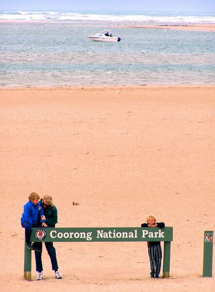
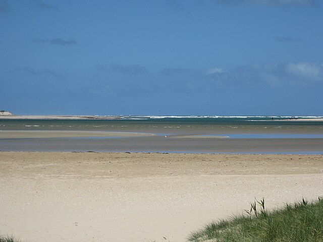
Younghusband Peninsula is a long narrow peninsula in South Australia. It separates the Coorong Channel, the Tauwitchere Channel and the Coorong which are part of the estuary of the River Murray from the Southern Ocean which including water bodies such as Encounter and Lacepede Bays, it lies within the Coorong National Park. The peninsula is less than 3 kilometres wide at its widest point, its narrowest point is less than 350 metres wide. The Younghusband Peninsula, together with the Sir Richard Peninsula on the western side of the Murray Mouth, are the coastal dune system that forms the continental coastline from near Goolwa in the north west to about 35 kilometres north of Kingston SE in the south east. Younghusband Peninsula was named after William Younghusband, M. P
Southern Ocean
The Southern Ocean known as the Antarctic Ocean or the Austral Ocean, comprises the southernmost waters of the World Ocean taken to be south of 60° S latitude and encircling Antarctica. As such, it is regarded as the fourth largest of the five principal oceanic divisions: smaller than the Pacific and Indian Oceans but larger than the Arctic Ocean; this ocean zone is where cold, northward flowing waters from the Antarctic mix with warmer subantarctic waters. By way of his voyages in the 1770s, Captain James Cook proved that waters encompassed the southern latitudes of the globe. Since geographers have disagreed on the Southern Ocean's northern boundary or existence, considering the waters as various parts of the Pacific and Indian Oceans, instead. However, according to Commodore John Leech of the International Hydrographic Organization, recent oceanographic research has discovered the importance of Southern Circulation, the term Southern Ocean has been used to define the body of water which lies south of the northern limit of that circulation.
This remains the current official policy of the IHO, since a 2000 revision of its definitions including the Southern Ocean as the waters south of the 60th parallel has not yet been adopted. Others regard the seasonally-fluctuating Antarctic Convergence as the natural boundary; the maximum depth of the Southern Ocean, using the definition that it lies south of 60th parallel, was surveyed by the Five Deeps Expedition in early February 2019. The expedition's multibeam sonar team identified the deepest point at 60° 28' 46"S, 025° 32' 32"W, with a depth of 7,434 meters; the expedition leader and chief submersible pilot Victor Vescovo, has proposed naming this deepest point in the Southern Ocean the "Factorian Deep," based on the name of the manned submersible DSV Limiting Factor, in which he visited the bottom for the first time on February 3, 2019. Borders and names for oceans and seas were internationally agreed when the International Hydrographic Bureau, the precursor to the IHO, convened the First International Conference on 24 July 1919.
The IHO published these in its Limits of Oceans and Seas, the first edition being 1928. Since the first edition, the limits of the Southern Ocean have moved progressively southwards; the IHO included the ocean and its definition as the waters south of 60°S in its year 2000 revisions, but this has not been formally adopted, due to continuing impasses over other areas of the text, such as the naming dispute over the Sea of Japan. The 2000 IHO definition, was circulated in a draft edition in 2002 and is used by some within the IHO and by some other organizations such as the US Central Intelligence Agency and Merriam-Webster. Australian authorities regard the Southern Ocean as lying south of Australia; the National Geographic Society does not recognize the ocean, depicting it in a typeface different from the other world oceans. Map publishers using the term Southern Ocean on their maps include Hema GeoNova. "Southern Ocean" is an obsolete name for the Pacific Ocean or South Pacific, coined by Vasco Núñez de Balboa, the first European to discover it, who approached it from the north.
The "South Seas" is a less archaic synonym. A 1745 British Act of Parliament established a prize for discovering a Northwest Passage to "the Western and Southern Ocean of America". Authors using "Southern Ocean" to name the waters encircling the unknown southern polar regions used varying limits. James Cook's account of his second voyage implies. Peacock's 1795 Geographical Dictionary said it lay "to the southward of America and Africa"; the Family Magazine in 1835 divided the "Great Southern Ocean" into the "Southern Ocean" and the "Antarctick Ocean" along the Antarctic Circle, with the northern limit of the Southern Ocean being lines joining Cape Horn, the Cape of Good Hope, Van Diemen's Land and the south of New Zealand. The United Kingdom's South Australia Act 1834 described the waters forming the southern limit of the new colony of South Australia as "the Southern Ocean"; the Colony of Victoria's Legislative Council Act of 1881 delimited part of the division of Bairnsdale as "along the New South Wales boundary to the Southern ocean".
In the 1928 first edition of Limits of Oceans and Seas, the Southern Ocean was delineated by land-based limits: Antarctica to the south, South America, Africa and Broughton Island, New Zealand to the north. The detailed land-limits used were from Cape Horn in Chile eastwards to Cape Agulhas in Africa further eastwards to the southern coast of mainland Australia to Cape Leeuwin, Western Australia. From Cape Leeuwin, the limit followed eastwards along the coast of mainland Australia to Cape Otway, Victoria southwards across Bass Strait to Cape Wickham, King Island, along the west coast of King Island the remainder of the way south across Bass Strait to Cape Grim, Tasmania; the limit followed the west coast of Tasmania southwards to the South East Cape and went eastwards to Broughton Island, New Zealand, before returning to Cape Horn. The northern limits of the Southern Ocean were moved southwards in the IHO's 1937 second edition of the Limits of Oceans and Seas. From this edition, much of the ocean's northern limit ceased to abut land masses.
In the second edition, the Southern Ocean extended from Antarctica northwards to latitude 40°S between Cape Agulhas