1.
State of Palestine
–
The State of Palestine claims the West Bank and Gaza Strip with East Jerusalem as the designated capital. Most of the areas claimed by the State of Palestine have been occupied by Israel since 1967 in the aftermath of the Six-Day War and its independence was declared on 15 November 1988 by the Palestine Liberation Organization in Algiers as a government-in-exile. Since the British Mandate, the term Palestine has been associated with the area that currently covers the State of Israel, the West Bank. In 1947, the UN adopted a plan for a two-state solution in the remaining territory of the mandate. The plan was accepted by the Jewish leadership but rejected by the Arab leaders, on the eve of final British withdrawal, the Jewish Agency for Israel declared the establishment of the State of Israel according to the proposed UN plan. During the war, Israel gained additional territories that were designated to be part of the Arab state under the UN plan, Egypt occupied the Gaza Strip and Transjordan occupied the West Bank. Egypt initially supported the creation of an All-Palestine Government, but disbanded it in 1959, Transjordan never recognized it and instead decided to incorporate the West Bank with its own territory to form Jordan. The annexation was ratified in 1950 but was rejected by the international community, the Six-Day War in 1967, when Egypt, Jordan, and Syria fought against Israel, ended with Israel being in occupation of the West Bank and Gaza Strip, besides other territories. In 1964, when the West Bank was controlled by Jordan, the Palestinian National Charter of the PLO defines the boundaries of Palestine as the whole remaining territory of the mandate, including Israel. Following the Six-Day War, the PLO moved to Jordan, the October 1974 Arab League summit designated the PLO as the sole legitimate representative of the Palestinian people and reaffirmed their right to establish an independent state of urgency. In November 1974, the PLO was recognized as competent on all matters concerning the question of Palestine by the UN General Assembly granting them observer status as an entity at the UN. In spite of this decision, the PLO did not participate at the UN in its capacity of the State of Palestines government, in 1979, through the Camp David Accords, Egypt signaled an end to any claim of its own over the Gaza Strip. In July 1988, Jordan ceded its claims to the West Bank—with the exception of guardianship over Haram al-Sharif—to the PLO, in November 1988, the PLO legislature, while in exile, declared the establishment of the State of Palestine. In the month following, it was recognised by many states, including Egypt. In the Palestinian Declaration of Independence, the State of Palestine is described as being established on the Palestinian territory, the UN membership application submitted by the State of Palestine also specified that it is based on the 1967 borders. During the negotiations of the Oslo Accords, the PLO recognised Israels right to exist, after Israel took control of the West Bank from Jordan and Gaza Strip from Egypt, it began to establish Israeli settlements there. These were organised into Judea and Samaria district and Hof Aza Regional Council in the Southern District, in 1980, Israel decided to freeze elections for these councils and to establish instead Village Leagues, whose officials were under Israeli influence. Later this model became ineffective for both Israel and the Palestinians, and the Village Leagues began to break up, with the last being the Hebron League, dissolved in February 1988
2.
Sebastia, Nablus
–
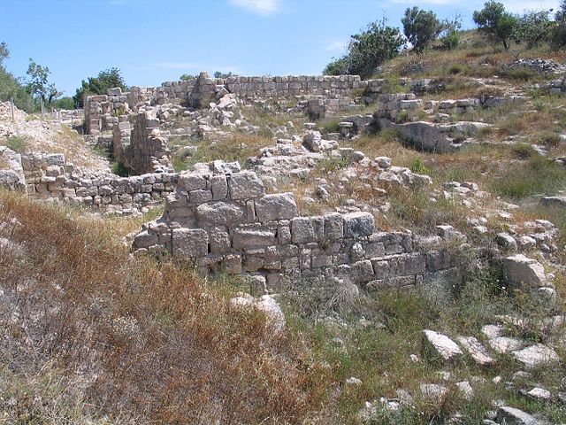
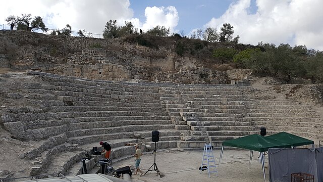
Sebastia is a Palestinian village of over 4,500 inhabitants, located in the Nablus Governorate of the West Bank some 12 kilometers northwest of the city of Nablus. The villages total area is 4,810 dunums, the built up area of which comprises 150 dunums, much of the village lands are located in Area C under the Oslo Accords. It is the home of Nabi Yahya Mosque, a former Crusader cathedral, according to Josephus, the original name of the town was Shomron, before King Herod renamed it in honor of Augustus Caeasar. The Greek sebastos, venerable, translates the Latin epithet augustus, according to the Hebrew Bible it was settled by several Israelite tribes, in ancient times. Sebastia is home to a number of important archaeological sites, the ancient site of Samaria-Sebaste is located just above the built up area of the modern day village on the eastern slope of the hill. The ruins dominate the hillside and comprise remains from six successive cultures dating back more than 10,000 years, Canaanite, Israelite, Hellenistic, Herodian, Roman and Byzantine. The city was destroyed by Alexander the Great in 331 BCE, pompey rebuilt the town in the year 63 BCE. In 27 BCE, Augustus Caesar gave it to Herod the Great, Herod expanded and renovated the city, bringing in six-thousand new inhabitants, and named it Sebaste, meaning Augustus, in the Emperors honor. Herod the Great had his sons Alexander and Aristobulus brought to Sebaste, Sebastia was the seat of a bishop in the Crusader Kingdom of Jerusalem. It is mentioned in the writings of Yaqut al-Hamawi, the Syrian geographer and he also writes, There are here the tombs of Zakariyyah and Yahya, the son of Zakariyyah, and of many other prophets and holy men. Sebastia was incorporated into the Ottoman Empire in 1517 with all of Palestine and it had a population of 20 households and 3 batchelors, all Muslim. The villagers paid taxes on wheat, barley, summer crops, olive trees, occasional revenues, the French explorer Victor Guérin visited the village in 1870 and found it to have less than a thousand inhabitants. In 1882, the Palestine Exploration Funds Survey of Western Palestine described Sebastia as A large and flourishing village, of stone and mud houses, on the hill of the ancient Samaria. There is a plateau on the top, on the east end of which the village stands. A higher knoll rises from the plateau, west of the village, the whole hill consists of soft soil, and is terraced to the very top. On the north it is bare and white, with steep slopes, and a few olives, a sort of recess exists on this side, the village itself is ill-built, and modern, with ruins of a Crusading church of Neby Yahyah, towards the northwest. A sarcophagus lies by the road on the north-east, but no rock-cut tombs have as yet been noticed on the hill, There is a large cemetery of rock-cut tombs to the north, on the other side of the valley. The neighbourhood of Samaria is well supplied with water, vegetable gardens exist below the spring
3.
Geographic coordinate system
–
A geographic coordinate system is a coordinate system used in geography that enables every location on Earth to be specified by a set of numbers, letters or symbols. The coordinates are chosen such that one of the numbers represents a vertical position. A common choice of coordinates is latitude, longitude and elevation, to specify a location on a two-dimensional map requires a map projection. The invention of a coordinate system is generally credited to Eratosthenes of Cyrene. Ptolemy credited him with the adoption of longitude and latitude. Ptolemys 2nd-century Geography used the prime meridian but measured latitude from the equator instead. Mathematical cartography resumed in Europe following Maximus Planudes recovery of Ptolemys text a little before 1300, in 1884, the United States hosted the International Meridian Conference, attended by representatives from twenty-five nations. Twenty-two of them agreed to adopt the longitude of the Royal Observatory in Greenwich, the Dominican Republic voted against the motion, while France and Brazil abstained. France adopted Greenwich Mean Time in place of local determinations by the Paris Observatory in 1911, the latitude of a point on Earths surface is the angle between the equatorial plane and the straight line that passes through that point and through the center of the Earth. Lines joining points of the same latitude trace circles on the surface of Earth called parallels, as they are parallel to the equator, the north pole is 90° N, the south pole is 90° S. The 0° parallel of latitude is designated the equator, the plane of all geographic coordinate systems. The equator divides the globe into Northern and Southern Hemispheres, the longitude of a point on Earths surface is the angle east or west of a reference meridian to another meridian that passes through that point. All meridians are halves of great ellipses, which converge at the north and south poles, the prime meridian determines the proper Eastern and Western Hemispheres, although maps often divide these hemispheres further west in order to keep the Old World on a single side. The antipodal meridian of Greenwich is both 180°W and 180°E, the combination of these two components specifies the position of any location on the surface of Earth, without consideration of altitude or depth. The grid formed by lines of latitude and longitude is known as a graticule, the origin/zero point of this system is located in the Gulf of Guinea about 625 km south of Tema, Ghana. To completely specify a location of a feature on, in, or above Earth. Earth is not a sphere, but a shape approximating a biaxial ellipsoid. It is nearly spherical, but has an equatorial bulge making the radius at the equator about 0. 3% larger than the radius measured through the poles, the shorter axis approximately coincides with the axis of rotation
4.
Islam
–
Islam is an Abrahamic monotheistic religion which professes that there is only one and incomparable God and that Muhammad is the last messenger of God. It is the worlds second-largest religion and the major religion in the world, with over 1.7 billion followers or 23% of the global population. Islam teaches that God is merciful, all-powerful, and unique, and He has guided mankind through revealed scriptures, natural signs, and a line of prophets sealed by Muhammad. The primary scriptures of Islam are the Quran, viewed by Muslims as the word of God. Muslims believe that Islam is the original, complete and universal version of a faith that was revealed many times before through prophets including Adam, Noah, Abraham, Moses. As for the Quran, Muslims consider it to be the unaltered, certain religious rites and customs are observed by the Muslims in their family and social life, while social responsibilities to parents, relatives, and neighbors have also been defined. Besides, the Quran and the sunnah of Muhammad prescribe a comprehensive body of moral guidelines for Muslims to be followed in their personal, social, political, Islam began in the early 7th century. Originating in Mecca, it spread in the Arabian Peninsula. The expansion of the Muslim world involved various caliphates and empires, traders, most Muslims are of one of two denominations, Sunni or Shia. Islam is the dominant religion in the Middle East, North Africa, sizable Muslim communities are also found in Horn of Africa, Europe, China, Russia, Mainland Southeast Asia, Philippines, Northern Borneo, Caucasus and the Americas. Converts and immigrant communities are found in almost every part of the world, Islam is a verbal noun originating from the triliteral root s-l-m which forms a large class of words mostly relating to concepts of wholeness, submission, safeness and peace. In a religious context it means voluntary submission to God, Islām is the verbal noun of Form IV of the root, and means submission or surrender. Muslim, the word for an adherent of Islam, is the active participle of the verb form. The word sometimes has connotations in its various occurrences in the Quran. In some verses, there is stress on the quality of Islam as a state, Whomsoever God desires to guide. Other verses connect Islām and dīn, Today, I have perfected your religion for you, I have completed My blessing upon you, still others describe Islam as an action of returning to God—more than just a verbal affirmation of faith. In the Hadith of Gabriel, islām is presented as one part of a triad that also includes imān, Islam was historically called Muhammadanism in Anglophone societies. This term has fallen out of use and is said to be offensive because it suggests that a human being rather than God is central to Muslims religion
5.
Nablus Governorate
–
The Nablus Governorate is an administrative district of the Palestine located in the Central Highlands of the West Bank,53 km north of Jerusalem. It covers the area around the city of Nablus which serves as the muhfaza of the governorate, the governor of the district is Mahmoud Aloul. Nablus The following localities have populations over 4,000 and municipal councils of 11-15 members, aqraba Asira ash-Shamaliya Beita Huwara Jammain Qabalan Sebastia Beit Furik The following localities have populations above 1,000 and village councils of 3 to 9 members. Askar Balata Ein Beit al-Ma Governorates of Palestine Administrative divisions in the Palestinian Territories Nablus Governorate Website
6.
West Bank
–
The West Bank shares boundaries to the west, north, and south with Israel, and to the east, across the Jordan River, with Jordan. The West Bank also contains a significant section of the western Dead Sea shore, the West Bank, including East Jerusalem, has a land area of 5,640 km2 plus a water area of 220 km2, consisting of the northwest quarter of the Dead Sea. As of July 2015 it has an population of 2,785,366 Palestinians, and approximately 371,000 Israeli settlers. The international community considers Israeli settlements in the West Bank, including East Jerusalem, illegal under international law and this annexation was recognized only by Britain, Iraq and Pakistan. The term was chosen to differentiate the west bank of the River Jordan from the east bank of this river, the neo-Latin name Cisjordan or Cis-Jordan is the usual name for the territory in the Romance languages and Hungarian. The name West Bank, however, has become the standard usage for this entity in English. The analogous Transjordan has historically used to designate the region now roughly comprising the state of Jordan. From 1517 through 1917, the now known as the West Bank was under Ottoman rule as part of the provinces of Syria. At the 1920 San Remo conference, the victorious Allied powers allocated the area to the British Mandate of Palestine, the San Remo Resolution adopted on 25 April 1920 incorporated the Balfour Declaration of 1917. It and Article 22 of the Covenant of the League of Nations were the basic documents upon which the British Mandate for Palestine was constructed. Faced with the determination of Emir Abdullah to unify Arab lands under the Hashemite banner, the West Bank area, was conquered by Jordan during the 1948 war with the new state of Israel. In 1947, it was designated as part of a proposed Arab state by the United Nations partition plan for Palestine. 1949 Armistice Agreements defined the boundary between Israel and Jordan. In 1950, Transjordan annexed the area west of the Jordan River, naming it West Bank or Cisjordan, Jordan ruled over the West Bank from 1948 until 1967. Jordans annexation was never recognized by the international community, with the exception of the United Kingdom. King Abdullah of Jordan had been crowned King of Jerusalem by the Coptic Bishop on 15 November 1948. and granted Palestinian Arabs in the West Bank, in June 1967, the West Bank and East Jerusalem were captured by Israel as a result of the Six-Day War. With the exception of East Jerusalem and the former Israeli-Jordanian no mans land, the Israeli settlements were, on the other hand, administered subsequently as Judea and Samaria Area directly by Israel. Since the 1993 Oslo Accords, the Palestinian Authority officially controls a geographically non-contiguous territory comprising approx, 11% of the West Bank which remains subject to Israeli incursions
7.
Architectural style
–
An architectural style is characterized by the features that make a building or other structure notable or historically identifiable. A style may include such elements as form, method of construction, building materials, styles therefore emerge from the history of a society. They are documented in the subject of architectural history, at any time several styles may be fashionable, and when a style changes it usually does so gradually, as architects learn and adapt to new ideas. Styles often spread to places, so that the style at its source continues to develop in new ways while other countries follow with their own twist. A style may also spread through colonialism, either by foreign colonies learning from their home country, one example is the Spanish missions in California, brought by Spanish priests in the late 18th century and built in a unique style. After a style has gone out of fashion, revivals and re-interpretations may occur, for instance, classicism has been revived many times and found new life as neoclassicism. Each time it is revived, it is different, the Spanish mission style was revived 100 years later as the Mission Revival, and that soon evolved into the Spanish Colonial Revival. Vernacular architecture works slightly differently and is listed separately and it is the native method of construction used by local people, usually using labour-intensive methods and local materials, and usually for small structures such as rural cottages. It varies from region to region even within a country, as western society has developed, vernacular styles have mostly become outmoded due to new technology and to national building standards. Paul Jacobsthal and Josef Strzygowski are among the art historians who followed Riegl in proposing grand schemes tracing the transmission of elements of styles across great ranges in time and this type of art history is also known as formalism, or the study of forms or shapes in art. Terms originated to describe architectural periods were often applied to other areas of the visual arts, and then more widely still to music, literature. In architecture stylistic change often follows, and is possible by. While many architectural styles explore harmonious ideals, Mannerism wants to take style a step further and explores the aesthetics of hyperbole, Mannerism is notable for its intellectual sophistication as well as its artificial qualities. Mannerism favours compositional tension and instability rather than balance and clarity, the definition of Mannerism, and the phases within it, continues to be the subject of debate among art historians. An example of mannerist architecture is the Villa Farnese at Caprarola. in the country side outside of Rome. The proliferation of engravers during the 16th century spread Mannerist styles more quickly than any previous styles, a center of Mannerist design was Antwerp during its 16th-century boom. Through Antwerp, Renaissance and Mannerist styles were introduced in England, Germany. During the Mannerist Renaissance period, architects experimented with using architectural forms to emphasize solid, the Renaissance ideal of harmony gave way to freer and more imaginative rhythms
8.
Ayyubid dynasty
–
The Ayyubid dynasty was a Muslim dynasty of Kurdish origin, founded by Saladin and centered in Egypt. The dynasty ruled much of the Middle East during the 12th and 13th centuries, Saladin had been the vizier of Fatimid Egypt before toppling the Fatimids in 1171. Three years later, he proclaimed himself sultan following the death of his former master, most of the Kingdom of Jerusalem fell to Saladin after his victory at the Battle of Hattin in 1187. However, the Crusaders regained control of Palestines coastline in the 1190s, by then, local Muslim dynasties had driven out the Ayyubids from Yemen, the Hejaz, and parts of Mesopotamia. After his death in 1249, as-Salih Ayyub was succeeded in Egypt by al-Muazzam Turanshah, however, the latter was soon overthrown by the Mamluk generals who had repelled a Crusader invasion of the Nile Delta. This effectively ended Ayyubid power in Egypt, attempts by the emirs of Syria, led by an-Nasir Yusuf of Aleppo, in 1260, the Mongols sacked Aleppo and conquered the Ayyubids remaining territories soon after. The Mamluks, who expelled the Mongols, maintained the Ayyubid principality of Hama until deposing its last ruler in 1341 and this period was also marked by an Ayyubid process of vigorously strengthening Sunni Muslim dominance in the region by constructing numerous madrasas in their major cities. The progenitor of the Ayyubid dynasty, Najm ad-Din Ayyub ibn Shadhi, belonged to the Kurdish Rawadiya tribe, Ayyubs ancestors settled in the town of Dvin, in northern Armenia. The Rawadiya were the dominant Kurdish group in the Dvin district, circumstances became unfavorable in Dvin when Turkish generals seized the town from its Kurdish prince. Shadhi left with his two sons Ayyub and Asad ad-Din Shirkuh and his friend Mujahid ad-Din Bihruz—the military governor of northern Mesopotamia under the Seljuks—welcomed him and appointed him governor of Tikrit. After Shadhis death, Ayyub succeeded him in governance of the city with the assistance of his brother Shirkuh, together they managed the affairs of the city well, gaining them popularity from the local inhabitants. In the meantime, Imad ad-Din Zangi, the ruler of Mosul, was defeated by the Abbasids under Caliph al-Mustarshid, in his bid to escape the battlefield to Mosul via Tikrit, Zangi took shelter with Ayyub and sought his assistance in this task. Ayyub complied and provided Zangi and his companions boats to cross the Tigris River, as a consequence for assisting Zangi, the Abbasid authorities sought punitive measures against Ayyub. Simultaneously, in an incident, Shirkuh killed a close confidant of Bihruz on charges that he had sexually assaulted a woman in Tikrit. The Abbasid court issued arrest warrants for both Ayyub and Shirkuh, but before the brothers could be arrested, they departed Tikrit for Mosul in 1138. When they arrived in Mosul, Zangi provided them all the facilities they needed. Ayyub was made commander of Baalbek and Shirkuh entered the service of Zangis son, according to historian Abdul Ali, it was under the care and patronage of Zangi that the Ayyubid family rose to prominence. In 1164, Nur al-Din dispatched Shirkuh to lead a force to prevent the Crusaders from establishing a strong presence in an increasingly anarchic Egypt
9.
Mamluk
–
Mamluk is an Arabic designation for slaves. The term is most commonly used to refer to Muslim slave soldiers and these were mostly enslaved Turkic peoples, Egyptian Copts, Circassians, Abkhazians, and Georgians. Many Mamluks were also of Balkan origin, over time, the mamluks became a powerful military knightly caste in various societies that were controlled by Muslim rulers. Particularly in Egypt, but also in the Levant, Mesopotamia, in some cases, they attained the rank of sultan, while in others they held regional power as emirs or beys. Most notably, mamluk factions seized the sultanate centered on Egypt and Syria, the Mamluk Sultanate famously defeated the Ilkhanate at the Battle of Ain Jalut. They had earlier fought the western European Christian Crusaders in 1154-1169 and 1213-1221, effectively driving them out of Egypt, in 1302 the mamluks formally expelled the last Crusaders from the Levant, ending the era of the Crusades. While mamluks were purchased as property, their status was above ordinary slaves, in a sense they were like enslaved mercenaries. In the Middle Ages, the Mamlukes took up the practice of furusiyya chivalry although Mamluk knights were slaves until their service ended, the Arabic term for a knight was fāris, The faris and the notion of furusiyya originated in pre-Muslim Persian brotherhoods. Within the Muslim world, the fursān became prized as ideal warriors and they were also trained in wrestling, and their martial skills were honed first on foot as piéton and then perfected when as mounted warriors. They were popularly used as heavy knightly cavalry by a number of different Islamic kingdoms and empires, including the Ayyubid dynasty, the origins of the mamluk system are disputed. Historians agree that a military caste such as the mamluks appeared to develop in Islamic societies beginning with the ninth-century Abbasid Caliphate of Baghdad. When in the century has not been determined. Up until the 1990s, it was believed that the earliest mamluks were known as ghilman and were bought by the Abbasid caliphs. By the end of the 9th century, such warrior slaves had become the dominant element in the military, conflict between these ghilman and the population of Baghdad prompted the caliph al-Mutasim to move his capital to the city of Samarra, but this did not succeed in calming tensions. The caliph al-Mutawakkil was assassinated by some of these slave-soldiers in 861, adult slaves and freemen both served as warriros. The mamluk system developed later, after the return of the caliphate to Baghdad in the 870s and it included the systematic training of young slaves in military and martial skills. The Mamluk system is considered to have been an experiment of al-Muwaffaq. This recent interpretation seems to have been accepted, after the fragmentation of the Abbasid Empire, military slaves, known as either mamluks or ghilman, were used throughout the Islamic world as the basis of military power
10.
Dome
–
A dome is an architectural element that resembles the hollow upper half of a sphere. The precise definition has been a matter of controversy, there are also a wide variety of forms and specialized terms to describe them. A dome can rest upon a rotunda or drum, and can be supported by columns or piers that transition to the dome through squinches or pendentives, a lantern may cover an oculus and may itself have another dome. Domes have a long architectural lineage that extends back into prehistory and they have been constructed from mud, snow, stone, wood, brick, concrete, metal, glass, and plastic over the centuries. The symbolism associated with domes includes mortuary, celestial, and governmental traditions that have developed over time. Domes have been found from early Mesopotamia, which may explain the forms spread and they are found in Persian, Hellenistic, Roman, and Chinese architecture in the Ancient world, as well as among a number of contemporary indigenous building traditions. They were popular in Byzantine and medieval Islamic architecture, and there are examples from Western Europe in the Middle Ages. The Renaissance style spread from Italy in the Early modern period, advancements in mathematics, materials, and production techniques since that time resulted in new dome types. The domes of the world can be found over religious buildings, legislative chambers, sports stadiums. The English word dome ultimately derives from the Latin domus —which, up through the Renaissance, labeled a revered house, such as a Domus Dei, or House of God, the French word dosme came to acquire the meaning of a cupola vault, specifically, by 1660. A dome is a rounded vault made of either curved segments or a shell of revolution, sometimes called false domes, corbel domes achieve their shape by extending each horizontal layer of stones inward slightly farther than the lower one until they meet at the top. A false dome may also refer to a wooden dome, true domes are said to be those whose structure is in a state of compression, with constituent elements of wedge-shaped voussoirs, the joints of which align with a central point. The validity of this is unclear, as domes built underground with corbelled stone layers are also in compression from the surrounding earth, as with arches, the springing of a dome is the level from which the dome rises. The top of a dome is the crown, the inner side of a dome is called the intrados and the outer side is called the extrados. The haunch is the part of an arch that lies halfway between the base and the top. The word cupola is another word for dome, and is used for a small dome upon a roof or turret. Cupola has also used to describe the inner side of a dome. Drums, also called tholobates, are cylindrical or polygonal walls with or without windows that support a dome, a tambour or lantern is the equivalent structure over a domes oculus, supporting a cupola
11.
Minaret
–
A minaret, from Arabic, منارة manāra, lit. lighthouse, also known as Goldaste, is a distinctive architectural structure akin to a tower and typically found adjacent to mosques. Generally a tall spire with a conical or onion-shaped crown, usually either free-standing or taller than associated support structure, the basic form of a minaret includes a base, shaft, and gallery. Styles vary regionally and by period, minarets provide a visual focal point and are traditionally used for the Muslim call to prayer. The purpose of minarets in traditional Eastern region architecture is to serve as a system for a building in very hot climates. That buildings of middle eastern origins have such outstanding features is architecturally intentional, however in modern times, with the invention of the modern air conditioners, the purpose of minarets has changed to traditional symbol. The minaret would be equipped with a speaker that would call people to prayers in Muslim countries. In addition to providing a visual cue to a Muslim community, the call to prayer is issued five times each day, dawn, noon, mid-afternoon, sunset, and night. In most modern mosques, the adhān is called from the musallah via microphone to a system on the minaret. Around 80 years after Muhammads death, the first known minarets appeared, minarets have been described as the gate from heaven and earth, and as the Arabic language letter aleph. The massive minaret of the Great Mosque of Kairouan in Tunisia is the oldest standing minaret and its construction began during the first third of the 8th century and was completed in 836 CE. The imposing square-plan tower consists of three sections of decreasing size reaching 31.5 meters, considered as the prototype for minarets of the western Islamic world, it served as a model for many later minarets. The tallest minaret, at 210 metres is located at the Hassan II Mosque in Casablanca, the tallest brick minaret is Qutub Minar located in Delhi, India. In some of the oldest mosques, such as the Great Mosque of Damascus, the basic form of minarets consists of three parts, a base, shaft, and a gallery. For the base, the ground is excavated until a foundation is reached. Gravel and other supporting materials may be used as a foundation, minarets may be conical, square, cylindrical, or polygonal. Stairs circle the shaft in a fashion, providing necessary structural support to the highly elongated shaft. The gallery is a balcony that encircles the upper sections from which the muezzin may give the call to prayer, styles and architecture can vary widely according to region and time period. Here are a few styles and the localities from which they derive, Tunisia Quadrangular, turkish 1,2,4 or 6 minarets related to the size of the mosque
12.
Arabic
–
Arabic is a Central Semitic language that was first spoken in Iron Age northwestern Arabia and is now the lingua franca of the Arab world. Arabic is also the language of 1.7 billion Muslims. It is one of six languages of the United Nations. The modern written language is derived from the language of the Quran and it is widely taught in schools and universities, and is used to varying degrees in workplaces, government, and the media. The two formal varieties are grouped together as Literary Arabic, which is the language of 26 states. Modern Standard Arabic largely follows the standards of Quranic Arabic. Much of the new vocabulary is used to denote concepts that have arisen in the post-Quranic era, Arabic has influenced many languages around the globe throughout its history. During the Middle Ages, Literary Arabic was a vehicle of culture in Europe, especially in science, mathematics. As a result, many European languages have borrowed many words from it. Many words of Arabic origin are found in ancient languages like Latin. Balkan languages, including Greek, have acquired a significant number of Arabic words through contact with Ottoman Turkish. Arabic has also borrowed words from languages including Greek and Persian in medieval times. Arabic is a Central Semitic language, closely related to the Northwest Semitic languages, the Ancient South Arabian languages, the Semitic languages changed a great deal between Proto-Semitic and the establishment of the Central Semitic languages, particularly in grammar. Innovations of the Central Semitic languages—all maintained in Arabic—include, The conversion of the suffix-conjugated stative formation into a past tense, the conversion of the prefix-conjugated preterite-tense formation into a present tense. The elimination of other prefix-conjugated mood/aspect forms in favor of new moods formed by endings attached to the prefix-conjugation forms, the development of an internal passive. These features are evidence of descent from a hypothetical ancestor. In the southwest, various Central Semitic languages both belonging to and outside of the Ancient South Arabian family were spoken and it is also believed that the ancestors of the Modern South Arabian languages were also spoken in southern Arabia at this time. To the north, in the oases of northern Hijaz, Dadanitic and Taymanitic held some prestige as inscriptional languages, in Najd and parts of western Arabia, a language known to scholars as Thamudic C is attested
13.
Mosque
–
A mosque is a place of worship for followers of Islam. There are strict and detailed requirements in Sunni jurisprudence for a place of worship to be considered a mosque, many mosques have elaborate domes, minarets, and prayer halls, in varying styles of architecture. Mosques originated on the Arabian Peninsula, but are now found in all inhabited continents, the mosque serves as a place where Muslims can come together for salat as well as a center for information, education, social welfare, and dispute settlement. The imam leads the congregation in prayer, the first mosque in the world is often considered to be the area around the Kaaba in Mecca now known as the Masjid al-Haram. Others regard the first mosque in history to be the Quba Mosque in present-day Medina since it was the first structure built by Muhammad upon his emigration from Mecca in 622. The Islamic Prophet Muhammad went on to another mosque in Medina. Built on the site of his home, Muhammad participated in the construction of the mosque himself and helped pioneer the concept of the mosque as the focal point of the Islamic city. The Masjid al-Nabawi introduced some of the still common in todays mosques, including the niche at the front of the prayer space known as the mihrab. The Masjid al-Nabawi was also constructed with a courtyard, a motif common among mosques built since then. Mosques had been built in Iraq and North Africa by the end of the 7th century, the Imam Husayn Shrine in Karbala is reportedly one of the oldest mosques in Iraq, although its present form – typical of Persian architecture – only goes back to the 11th century. The shrine, while operating as a mosque, remains one of the holiest sites for Shia Muslims, as it honors the death of the third Shia imam. The Mosque of Amr ibn al-As was reportedly the first mosque in Egypt, serving as a religious, like the Imam Husayn Shrine, though, nothing of its original structure remains. With the later Shia Fatimid Caliphate, mosques throughout Egypt evolved to include schools, hospitals and it was the first to incorporate a square minaret and includes naves akin to a basilica. Those features can also be found in Andalusian mosques, including the Grand Mosque of Cordoba, still, some elements of Visigothic architecture, like horseshoe arches, were infused into the mosque architecture of Spain and the Maghreb. The first mosque in East Asia was reportedly established in the 8th century in Xian, however, the Great Mosque of Xian, whose current building dates from the 18th century, does not replicate the features often associated with mosques elsewhere. Indeed, minarets were initially prohibited by the state, mosques in western China were more likely to incorporate elements, like domes and minarets, traditionally seen in mosques elsewhere. In turn, the Javanese style influenced the styles of mosques in Indonesias Austronesian neighbors—Malaysia, Brunei, Muslim empires were instrumental in the evolution and spread of mosques. Although mosques were first established in India during the 7th century, reflecting their Timurid origins, Mughal-style mosques included onion domes, pointed arches, and elaborate circular minarets, features common in the Persian and Central Asian styles
14.
Nablus
–
Nablus is a city in the northern West Bank, approximately 49 kilometers north of Jerusalem, with a population of 126,132. The city was named by the Roman Emperor Vespasian in 72 CE as Flavia Neapolis, since then, Nablus has been ruled by many empires over the course of its almost 2, 000-year-long history. In 636, Neapolis, along with most of Palestine, came under the rule of the Islamic Arab Caliphate of Umar ibn al-Khattab, its name Arabicized to Nablus. In 1099, the Crusaders took control of the city for less than a century, leaving its mixed Muslim, after Saladins Ayyubid forces took control of the interior of Palestine in 1187, Islamic rule was reestablished, and continued under the Mamluk and Ottoman empires to follow. Following its incorporation into the Ottoman Empire in 1517, Nablus was designated capital of the Jabal Nablus district, when Ottoman rule was firmly reestablished in 1841, Nablus prospered as a center of trade. After the city was captured by British forces during World War I, during the 1948 Arab–Israeli War, the city was captured and occupied by Transjordan, which subsequently annexed it unilaterally, until its occupation by Israel during the 1967 Six-Day War. Today, the population is predominantly Muslim, with small Christian and Samaritan minorities, since 1995, the city has been governed by the Palestinian National Authority. In the Old City, there are a number of sites of archaeological significance, culturally, the city is known for its kanafeh, a popular sweet throughout the Middle East, and its soap industry. Flavia Neapolis was named in 72 CE by the Roman emperor Vespasian and applied to an older Samaritan village, variously called Mabartha or Mamorpha. Located between Mount Ebal and Mount Gerizim, the new city lay 2 kilometers west of the Biblical city of Shechem which was destroyed by the Romans that same year during the First Jewish-Roman War, holy places at the site of the citys founding include Josephs Tomb and Jacobs Well. Due to the citys strategic position and the abundance of water from nearby springs, Neapolis prospered, accumulating extensive territory. Insofar as the topography of the site would allow, the city was built on a Roman grid plan and settled with veterans who fought in the victorious legions. In the 2nd century CE, Emperor Hadrian built a theater in Neapolis that could seat up to 7,000 people. Coins found in Nablus dating to this period depict Roman military emblems and gods and goddesses of the Greek pantheon such as Zeus, Artemis, Serapis, Neapolis was entirely pagan at this time. Justin Martyr who was born in the city c.100 CE, came into contact with Platonism, the city flourished until the civil war between Septimius Severus and Pescennius Niger in 198–9 CE. Having sided with Niger, who was defeated, the city was stripped of its legal privileges by Severus. In 244 CE, Philip the Arab transformed Flavius Neapolis into a Roman colony named Julia Neapolis and it retained this status until the rule of Trebonianus Gallus in 251 CE. The Encyclopaedia Judaica speculates that Christianity was dominant in the 2nd or 3rd century and it is known for certain that a bishop from Nablus participated in the Council of Nicaea in 325 CE
15.
Elisha
–
Elisha is a Hebrew prophet and a wonder-worker whose life is documented in the Hebrew Bible. Also mentioned in the New Testament and the Quran, Elisha is venerated as a prophet in Judaism, Christianity, amongst new religious movements, Baháí writings refer to him by name. His name is transliterated into English as Elisha via Hebrew, Eliseus via Greek and Latin, or Alyasa via Arabic. He was a disciple of Elijah and, after Elijah was taken up into the whirlwind, Elishas story is related in the Book of Kings in the Hebrew Bible. He was a prophet and a wonder-worker of the Northern Kingdom of Israel who was active during the reign of Joram, Jehu, Jehoahaz, Elisha was the son of Shaphat, a wealthy land-owner of Abel-meholah, he became the attendant and disciple of Elijah. His name first occurs in the given to Elijah to anoint him as his successor. After learning in the cave on Mount Horeb, that Elisha, on his way from Sinai to Damascus, Elijah found Elisha one of them that were ploughing with twelve yoke of oxen. Elisha delayed only long enough to kill the yoke of oxen and he went over to him, threw his mantle over Elishas shoulders, and at once adopted him as a son, investing him with the prophetic office. Elisha accepted this call about four years before the death of Israels King Ahab, for the next seven or eight years Elisha became Elijahs close attendant until Elijah was taken up into heaven. During all these years we hear nothing of Elisha except in connection with the scenes of Elijahs life. After he had shared this farewell repast with his father, mother, and friends, the chosen prophet went after Elijah. Elisha then was separated from Elijah by a chariot. Before Elijah was taken up into the whirlwind, Elisha asked to inherit a double-portion of Elijahs spirit. Some scholars see this as indicative of the property inheritance customs of the time, in this interpretation Elisha is asking that he may be seen as the rightful heir and successor to Elijah. Critics of this point out that Elisha was already appointed as Elijahs successor earlier in the narrative. In this interpretation the double-portion isnt merely an allusion to primacy in succession, before he settled in Samaria, Elisha passed some time on Mount Carmel. When the armies of Judah, Israel and Edom, then allied against Mesha and his double prediction regarding relief from drought and victory over the Moabites was fulfilled on the following morning. When a group of boys from Bethel taunted the prophet for his baldness, Elisha cursed them in the name of Yahweh and he became noted in Israel, and for six decades held the office of prophet in Israel
16.
Obadiah
–
Obadiah is a Biblical theophorical name, meaning servant of God or worshipper of Yah. The form of Obadiahs name used in the Septuagint is Obdios, the Bishops Bible has it as Abdi. The political situation implied in the points to a time after the Exile. No value can be attributed to traditions identifying this prophet with King Ahabs steward or with King Ahaziahs captain, — The Interpreters Bible According to the Talmud, Obadiah is said to have been a convert to Judaism from Edom, a descendant of Eliphaz, the friend of Job. He is identified with the Obadiah who was the servant of Ahab, moreover, having lived with two such godless persons as Ahab and Jezebel without learning to act as they did, he seemed the most suitable person to prophesy against Esau. Obadiah is supposed to have received the gift of prophecy for having hidden the hundred prophets from the persecution of Jezebel and he hid the prophets in two caves, so that if those in one cave should be discovered those in the other might yet escape. Obadiahs fear of God was one higher than that of Abraham. In some Christian traditions he is said to have born in Sychem. The date of his ministry is unclear due to certain historical ambiguities in the book bearing his name and he is regarded as a saint by several Eastern churches. His feast day is celebrated on the 15th day of the Coptic Month Tobi in the Coptic Orthodox Church, the Eastern Orthodox Church and those Eastern Catholic Churches which follow the Byzantine Rite celebrate his memory on November 19. He is celebrated on February 28 in the Syriac and Malankara Churches, According to an old tradition, Obadiah is buried in Sebastia, at the same site as Elisha and where later the body of John the Baptist was believed to have been buried by his followers. It is related to Abdeel, servant of God, which is cognate to the Arabic name Abdullah or Obaidullah. Other individuals named Obadiah in the Old Testament are listed as, According to the rabbinic tradition, the tradition of the Eastern Orthodox and Oriental Orthodox Churches, this is the same individual as the prophet. The former having the meaning of servant of god and the latter meaning slave or young slave, specifically, Obaid, also transliterated as Ubaid, is the diminutive form of abd meaning slave or servanthttp, //quranicnames. com/obaida/. The similarity of meaning is thought to be due to Arabic being the language of Hebrew. A Biographical Dictionary of the Saints, prophet Obadiah Orthodox icon and synaxarion
17.
John the Baptist
–
John the Baptist, also known as John the Baptizer, was a Jewish itinerant preacher in the early first century AD. John is revered as a religious figure in Christianity, Islam, the Baháí Faith. He is called a prophet by all of these traditions, and is honoured as a saint in many Christian traditions, John used baptism as the central symbol or sacrament of his messianic movement. Most scholars agree that John baptized Jesus, scholars generally believe Jesus was a follower or disciple of John and several New Testament accounts report that some of Jesus early followers had previously been followers of John. John the Baptist is also mentioned by the Jewish historian Josephus, according to the New Testament, John anticipated a messianic figure greater than himself. Christians commonly refer to John as the precursor or forerunner of Jesus, John is also identified with the prophet Elijah. John the Baptist is mentioned in all four canonical Gospels and the non-canonical Gospel of the Nazarenes, the Synoptic Gospels describe John baptising Jesus, in the Gospel of John it is implied in John 1, 32-34. The Gospel of Mark introduces John as a fulfilment of a prophecy from the Book of Isaiah about a messenger being sent ahead, John is described as wearing clothes of camels hair, living on locusts and wild honey. John proclaims baptism of repentance for the forgiveness of sin, and says another will come after him who will not baptize with water, Jesus comes to John, and is baptized by him in the river Jordan. The account describes how, as he emerges from the water, the heavens open, a voice from heaven then says, You are my Son, the Beloved, with you I am well pleased. Later in the gospel there is an account of Johns death and it is introduced by an incident where the Tetrarch Herod Antipas, hearing stories about Jesus, imagines that this is John the Baptist raised from the dead. It then explains that John had rebuked Herod for marrying Herodias, Herodias demands his execution, but Herod, who liked to listen to John, is reluctant to do so because he fears him, knowing he is a righteous and holy man. The account then describes how Herods daughter Herodias dances before Herod, when the girl asks her mother what she should request, she is told to demand the head of John the Baptist. Reluctantly, Herod orders the beheading of John, and his head is delivered to her, at her request, Johns disciples take the body away and bury it in a tomb. There are a number of difficulties with this passage, the Gospel wrongly identifies Antipas as King and the ex-husband of Herodias is named as Philip, but he is known to have been called Herod. Although the wording clearly implies the girl was the daughter of Herodias, many texts describe her as Herods daughter, Herodias. Since these texts are early and significant and the reading is difficult, many see this as the original version, corrected in later versions and in Matthew. Josephus says that Herodias had a daughter by the name of Salome, scholars have speculated about the origins of the story
18.
Byzantine Empire
–
It survived the fragmentation and fall of the Western Roman Empire in the 5th century AD and continued to exist for an additional thousand years until it fell to the Ottoman Turks in 1453. During most of its existence, the empire was the most powerful economic, cultural, several signal events from the 4th to 6th centuries mark the period of transition during which the Roman Empires Greek East and Latin West divided. Constantine I reorganised the empire, made Constantinople the new capital, under Theodosius I, Christianity became the Empires official state religion and other religious practices were proscribed. Finally, under the reign of Heraclius, the Empires military, the borders of the Empire evolved significantly over its existence, as it went through several cycles of decline and recovery. During the reign of Maurice, the Empires eastern frontier was expanded, in a matter of years the Empire lost its richest provinces, Egypt and Syria, to the Arabs. This battle opened the way for the Turks to settle in Anatolia, the Empire recovered again during the Komnenian restoration, such that by the 12th century Constantinople was the largest and wealthiest European city. Despite the eventual recovery of Constantinople in 1261, the Byzantine Empire remained only one of several small states in the area for the final two centuries of its existence. Its remaining territories were annexed by the Ottomans over the 15th century. The Fall of Constantinople to the Ottoman Empire in 1453 finally ended the Byzantine Empire, the term comes from Byzantium, the name of the city of Constantinople before it became Constantines capital. This older name of the city would rarely be used from this point onward except in historical or poetic contexts. The publication in 1648 of the Byzantine du Louvre, and in 1680 of Du Canges Historia Byzantina further popularised the use of Byzantine among French authors, however, it was not until the mid-19th century that the term came into general use in the Western world. The Byzantine Empire was known to its inhabitants as the Roman Empire, the Empire of the Romans, Romania, the Roman Republic, Graikia, and also as Rhōmais. The inhabitants called themselves Romaioi and Graikoi, and even as late as the 19th century Greeks typically referred to modern Greek as Romaika and Graikika. The authority of the Byzantine emperor as the legitimate Roman emperor was challenged by the coronation of Charlemagne as Imperator Augustus by Pope Leo III in the year 800. No such distinction existed in the Islamic and Slavic worlds, where the Empire was more seen as the continuation of the Roman Empire. In the Islamic world, the Roman Empire was known primarily as Rûm, the Roman army succeeded in conquering many territories covering the entire Mediterranean region and coastal regions in southwestern Europe and north Africa. These territories were home to different cultural groups, both urban populations and rural populations. The West also suffered heavily from the instability of the 3rd century AD
19.
Crusades
–
The First Crusade arose after a call to arms in a 1095 sermon by Pope Urban II. Urban urged military support for the Byzantine Empire and its Emperor, Alexios I, the response to Urbans preaching by people of many different classes across Western Europe established the precedent for later Crusades. Volunteers became Crusaders by taking a vow and receiving plenary indulgences from the church. Some were hoping for apotheosis at Jerusalem, or forgiveness from God for all their sins, others participated to satisfy feudal obligations, gain glory and honour, or find opportunities for economic and political gain. Many modern Historians have polarised opinions of the Crusaders behaviour under Papal sanction, to some it was incongruous with the stated aims and implied moral authority of the papacy and the Crusades, to the extent that on occasions that the Pope excommunicated Crusaders. Crusaders often pillaged as they travelled, while their leaders retained control of captured territory rather than returning it to the Byzantines. During the Peoples Crusade thousands of Jews were murdered in what is now called the Rhineland massacres, Constantinople was sacked during the Fourth Crusade rendering the reunification of Christendom impossible. These tales consequently galvanised medieval romance, philosophy and literature, but the Crusades also reinforced the connection between Western Christendom, feudalism, and militarism. Crusade is not a term, instead the terms iter for journey or peregrinatio for pilgrimage were used. Not until the word crucesignatus for one who was signed with the cross was adopted at the close of the century was specific terminology developed. The Middle English equivalents were derived from old French, croiserie in the 13th–15th centuries, croisade appeared in English c1575, and continued to be the leading form till c1760. By convention historians adopt the term for the Christian holy wars from 1095, the Crusades in the Holy Land are traditionally counted as nine distinct campaigns, numbered from the First Crusade of 1095–99 to the Ninth Crusade of 1271/2. Usage of the term Crusade may differ depending on the author, pluralists use the term Crusade of any campaign explicitly sanctioned by the reigning Pope. This reflects the view of the Roman Catholic Church that every military campaign given Papal sanction is equally valid as a Crusade, regardless of its cause, justification, generalists see Crusades as any and all holy wars connected with the Latin Church and fought in defence of their faith. Popularists limit the Crusades to only those that were characterised by popular groundswells of religious fervour – that is, only the First Crusade, Medieval Muslim historiographers such as Ali ibn al-Athir refer to the Crusades as the Frankish Wars. The term used in modern Arabic, ḥamalāt ṣalībiyya حملات صليبية, campaigns of the cross, is a loan translation of the term Crusade as used in Western historiography. The Islamic prophet Muhammad founded Islam in the Arabian Peninsula, the resulting unified polity in the seventh and eighth centuries led to a rapid expansion of Arab power. This influence stretched from the northwest Indian subcontinent, across Central Asia, the Middle East, North Africa, southern Italy, tolerance, trade, and political relationships between the Arabs and the Christian states of Europe waxed and waned
20.
Christian
–
A Christian is a person who follows or adheres to Christianity, an Abrahamic, monotheistic religion based on the life and teachings of Jesus Christ. Christian derives from the Koine Greek word Christós, a translation of the Biblical Hebrew term mashiach, while there are diverse interpretations of Christianity which sometimes conflict, they are united in believing that Jesus has a unique significance. The term Christian is also used as an adjective to describe anything associated with Christianity, or in a sense all that is noble, and good. According to a 2011 Pew Research Center survey, there were 2.2 billion Christians around the world in 2010, by 2050, the Christian population is expected to exceed 3 billion. According to a 2012 Pew Research Center survey Christianity will remain the worlds largest religion in 2050, about half of all Christians worldwide are Catholic, while more than a third are Protestant. Orthodox communions comprise 12% of the worlds Christians, other Christian groups make up the remainder. Christians make up the majority of the population in 158 countries and territories,280 million Christian live as a minority. In the Greek Septuagint, christos was used to translate the Hebrew מָשִׁיחַ, in other European languages, equivalent words to Christian are likewise derived from the Greek, such as Chrétien in French and Cristiano in Spanish. The second mention of the term follows in Acts 26,28, where Herod Agrippa II replied to Paul the Apostle, Then Agrippa said unto Paul, Almost thou persuadest me to be a Christian. The third and final New Testament reference to the term is in 1 Peter 4,16, which believers, Yet if as a Christian, let him not be ashamed. The city of Antioch, where someone gave them the name Christians, had a reputation for coming up with such nicknames, in the Annals he relates that by vulgar appellation commonly called Christians and identifies Christians as Neros scapegoats for the Great Fire of Rome. Another term for Christians which appears in the New Testament is Nazarenes which is used by the Jewish lawyer Tertullus in Acts 24, the Hebrew equivalent of Nazarenes, Notzrim, occurs in the Babylonian Talmud, and is still the modern Israeli Hebrew term for Christian. A wide range of beliefs and practices is found across the world among those who call themselves Christian, denominations and sects disagree on a common definition of Christianity. Most Baptists and fundamentalists, for example, would not acknowledge Mormonism or Christian Science as Christian, in fact, the nearly 77 percent of Americans who self-identify as Christian are a diverse pluribus of Christianities that are far from any collective unity. The identification of Jesus as the Messiah is not accepted by Judaism, the term for a Christian in Hebrew is נוּצְרי, a Talmudic term originally derived from the fact that Jesus came from the Galilean village of Nazareth, today in northern Israel. Adherents of Messianic Judaism are referred to in modern Hebrew as יְהוּדִים מָשִׁיחַיים, the term Nasara rose to prominence in July 2014, after the Fall of Mosul to the terrorist organization Islamic State of Iraq and the Levant. The nun or ن— the first letter of Nasara—was spray-painted on the property of Christians ejected from the city, where there is a distinction, Nasrani refers to people from a Christian culture and Masihi is used by Christians themselves for those with a religious faith in Jesus. In some countries Nasrani tends to be used generically for non-Muslim Western foreigners, another Arabic word sometimes used for Christians, particularly in a political context, is Ṣalībī from ṣalīb which refers to Crusaders and has negative connotations
21.
Muslim
–
A Muslim is someone who follows or practices Islam, a monotheistic Abrahamic religion. Muslims consider the Quran, their book, to be the verbatim word of God as revealed to the Islamic prophet. They also follow the teachings and practices of Muhammad as recorded in traditional accounts, Muslim is an Arabic word meaning one who submits. Most Muslims will accept anyone who has publicly pronounced Shahadah as a Muslim, the shahadah states, There is no god but the God and Muhammad is the last messenger of the God. The testimony authorized by God in the Quran that can found in Surah 3,18 states, There is no god except God, which in Arabic, is the exact testimony which God Himself utters, as well as the angels and those who possess knowledge utter. The word muslim is the active participle of the verb of which islām is a verbal noun, based on the triliteral S-L-M to be whole. A female adherent is a muslima, the plural form in Arabic is muslimūn or muslimīn, and its feminine equivalent is muslimāt. The Arabic form muslimun is the stem IV participle of the triliteral S-L-M, the ordinary word in English is Muslim. It is sometimes transliterated as Moslem, which is an older spelling, the word Mosalman is a common equivalent for Muslim used in Central Asia. Until at least the mid-1960s, many English-language writers used the term Mohammedans or Mahometans, although such terms were not necessarily intended to be pejorative, Muslims argue that the terms are offensive because they allegedly imply that Muslims worship Muhammad rather than God. Other obsolete terms include Muslimite and Muslimist, musulmán/Mosalmán is a synonym for Muslim and is modified from Arabic. In English it was sometimes spelled Mussulman and has become archaic in usage, the Muslim philosopher Ibn Arabi said, A Muslim is a person who has dedicated his worship exclusively to God. Islam means making ones religion and faith Gods alone. The Quran states that men were Muslims because they submitted to God, preached His message and upheld His values. Thus, in Surah 3,52 of the Quran, Jesus disciples tell him, We believe in God, and you be our witness that we are Muslims. In Muslim belief, before the Quran, God had given the Tawrat to Moses, the Zabur to David and the Injil to Jesus, who are all considered important Muslim prophets. The most populous Muslim-majority country is Indonesia, home to 12. 7% of the worlds Muslims, followed by Pakistan, Bangladesh, and Egypt. About 20% of the worlds Muslims lives in the Middle East and North Africa, Sizable minorities are found in India, China, Russia, Ethiopia. The country with the highest proportion of self-described Muslims as a proportion of its population is Morocco
22.
Josephus
–
Josephus claimed the Jewish Messianic prophecies that initiated the First Roman-Jewish War made reference to Vespasian becoming Emperor of Rome. In response Vespasian decided to keep Josephus as a slave and interpreter, after Vespasian became Emperor in 69 CE, he granted Josephus his freedom, at which time Josephus assumed the emperors family name of Flavius. Flavius Josephus fully defected to the Roman side and was granted Roman citizenship and he became an advisor and friend of Vespasians son Titus, serving as his translator when Titus led the Siege of Jerusalem. Since the siege proved ineffective at stopping the Jewish revolt, the citys destruction, Josephus recorded Jewish history, with special emphasis on the first century CE and the First Jewish–Roman War, including the Siege of Masada. His most important works were The Jewish War and Antiquities of the Jews, the Jewish War recounts the Jewish revolt against Roman occupation. Antiquities of the Jews recounts the history of the world from a Jewish perspective for an ostensibly Roman audience and these works provide valuable insight into first century Judaism and the background of Early Christianity. Josephus introduces himself in Greek as Iōsēpos, son of Matthias and he was the second-born son of Matthias. His older full-blooded brother was also called Matthias and their mother was an aristocratic woman who descended from the royal and formerly ruling Hasmonean dynasty. Josephuss paternal grandparents were Josephus and his wife—an unnamed Hebrew noblewoman, distant relatives of each other and he descended through his father from the priestly order of the Jehoiarib, which was the first of the 24 orders of priests in the Temple in Jerusalem. Josephus was a descendant of the high priest Jonathon, born and raised in Jerusalem, Josephus was educated alongside his brother. In his early twenties, he traveled to negotiate with Emperor Nero for the release of 12 Jewish priests, Josephus successfully fought the Roman army in Galilee, until he was captured by the Romans during the height of the war. After the Jewish garrison of Yodfat fell under siege, the Romans invaded, killing thousands, according to Josephus, he was trapped in a cave with 40 of his companions in July 67 CE. The Romans asked the group to surrender, but they refused, Josephus suggested a method of collective suicide, they drew lots and killed each other, one by one, counting to every third person. Two men were left, who surrendered to the Roman forces, in 69 CE, Josephus was released. According to his account, he acted as a negotiator with the defenders during the Siege of Jerusalem in 70 CE, in which his parents and first wife died. While being confined at Yodfat, Josephus claimed to have experienced a divine revelation, after the prediction came true, he was released by Vespasian, who considered his gift of prophecy to be divine. In 71 CE, he went to Rome in the entourage of Titus, becoming a Roman citizen, in addition to Roman citizenship, he was granted accommodation in conquered Judaea and a decent, if not extravagant, pension. While in Rome and under Flavian patronage, Josephus wrote all of his known works, although he uses Josephus, he appears to have taken the Roman praenomen Titus and nomen Flavius from his patrons
23.
Machaerus
–
Machaerus is a fortified hilltop palace located in Jordan 25 km southeast of the mouth of the Jordan river on the eastern side of the Dead Sea. According to Flavius Josephus, it is the location of the imprisonment, according to the chronology of the Bible, this infamous execution took place in 32 AD shortly before the Passover, following an imprisonment of two years. The fortress Machaerus was originally built by the Hasmonean king, Alexander Jannaeus in about the year 90 BC and its high, rocky vantage point was difficult to access, and invasions from the east could be easily spotted from there. It was also in line of sight of other Hasmonean citadels, nevertheless, it was destroyed by Pompeys general Gabinius in 57 BC, but later rebuilt by Herod the Great in 30 BC to be used as a military base to safeguard his territories east of the Jordan. Upon the death of Herod the Great, the fortress was passed to his son, Herod Antipas and it was during this time, at the beginning of the first century AD, that John the Baptist was imprisoned and beheaded at Machaerus. After the deposition and banishment of Herod Antipas in 39 AD, Machaerus passed to Herod Agrippa I until his death in 44 AD, Jewish rebels took control after 66 AD during the First Jewish Revolt. Shortly after defeating the Jewish garrison of Herodium, the Roman legate Lucilius Bassus advanced on Machaerus with his troops, an embankment and ramp were created in order to facilitate Roman siege engines but the Jewish rebels capitulated before the Roman attack had begun. The rebels were allowed to leave and the fortress was torn down, Josephus gives a full description of Machaerus in The Wars of the Jews 7.6.1 ff. The hilltop, which stands about 1,100 meters above Dead Sea level, is surrounded on all sides by deep ravines which provide great natural strength, the valley on the west extends 60 stadia to the Dead Sea. The valley on the east descends to a depth of a hundred cubits, Herod the Great regarded the place as deserving the strongest fortification, particularly because of its proximity to Arabia. On top of the mountain, surrounding the crest, he built a wall,100 meters long and 60 meters wide with three corner towers, each sixty cubits high. The palace was built in the center of the fortified area, numerous cisterns were provided to collect rain water. The royal courtyard is considered one of the closest and best existing archaeological parallels to the Herodian Gabbatha in the Jerusalem Praetorium, the village on the plateau to the east of the mountain is known as Muqāwir. The site was visited in 1807 by the Frisian explorer Ulrich Jasper Seetzen, in 1973, the German scholar, August Strobel, identified and studied the wall by which the Romans encircled the defenders within the fortress. In 1978-1981, excavations were carried out by Virgilio Corbo, Stanislao Loffreda and Michele Piccirillo, the ruins remain in remarkably untouched condition to this day. Within the fortified area are the ruins of the Herodian palace, including rooms, a courtyard. Farther down the slope of the hill are other walls and towers, perhaps representing the lower town. Traceable also, coming from the east, is the aqueduct brought water to the cisterns of the fortress
24.
Jordan River
–
The Jordan River is a 251-kilometre -long river in the Middle East that flows roughly north to south through the Sea of Galilee and on to the Dead Sea. Israel and the West Bank border the river to the west, while the Golan Heights, both Jordan and the West Bank take their names from the river. The Jordan River has a course and a lower one. In this sense, the Jordan Valley may be separated into upper, central, over its upper course, the river drops rapidly in a 75-kilometre run to the once large and swampy Lake Hula, which is slightly above sea level. Exiting the now much diminished lake, it goes through an even steeper drop over the 25 kilometres down to the Sea of Galilee, the Jordan deposits much of the silt it is carrying within the lake, which it leaves again near its southern tip. At that point the river is situated about 210 metres below sea level, two major tributaries enter from the east during this last section, the Yarmouk River and Zarqa River. Its section north of the Sea of Galilee is within the boundaries of Israel, south of the lake, it forms the border between the Kingdom of Jordan, and Israel. The streams coming together to create the River Jordan in its basin are, west to east, Iyyon. Hasbani, a stream flows from Mount Lebanon. Dan, a stream whose source is also at the base of Mount Hermon, Banias, a stream arising from a spring at Banias at the foot of Mount Hermon. The full text of W. F. Lynchs 1849 book Narrative of the United States Expedition to the River Jordan, in 1964, Israel began operating a pumping station that diverts water from the Sea of Galilee to the National Water Carrier. Also in 1964, Jordan constructed a channel that diverted water from the Yarmouk River, another tributary of the Jordan River to the East Ghor Canal. Syria has also built reservoirs that catch the Yarmouks waters, environmentalists blame Israel, Jordan and Syria for extensive damage to the Jordan River ecosystem. In modern times, the waters are 70% to 90% used for human purposes, because of this and the high evaporation rate of the Dead Sea, as well as industrial extraction of salts through evaporation ponds, the sea is shrinking. All the shallow waters of the end of the sea have been drained in modern times and are now salt flats. A small section of the northernmost portion of the Lower Jordan, 3-kilometre below the Sea of Galilee, has been kept pristine for baptism and local tourism. Most polluted is the 100-kilometre downstream stretch—a meandering stream from above the confluence with the Yarmouk to the Dead Sea, environmentalists say the practice of letting sewage and brackish water flow into the river has almost destroyed its ecosystem. Rescuing the Jordan could take decades, according to environmentalists, the same environmentalist organization had said in a report that the Jordan River could dry up by 2011 unless the decay is stopped
25.
Saladin
–
An-Nasir Salah ad-Din Yusuf ibn Ayyub, known as Saladin, was the first sultan of Egypt and Syria and the founder of the Ayyubid dynasty. A Sunni Muslim of Kurdish origin, Saladin led the Muslim military campaign against the Crusader states in the Levant, at the height of his power, his sultanate included Egypt, Syria, Upper Mesopotamia, the Hejaz, Yemen and other parts of North Africa. When Saladins uncle Shirkuh died in 1169, al-Adid appointed Saladin vizier, in the following years, he led forays against the Crusaders in Palestine, commissioned the successful conquest of Yemen, and staved off pro-Fatimid rebellions in Upper Egypt. Not long after Nur ad-Dins death in 1174, Saladin launched his conquest of Syria, by mid-1175, Saladin had conquered Hama and Homs, inviting the animosity of his former Zengid lords, who had been the official rulers of Syria. Soon after, he defeated the Zengid army at the Battle of the Horns of Hama and was proclaimed the Sultan of Egypt. Saladin made further conquests in northern Syria and Jazira, escaping two attempts on his life by the Assassins, before returning to Egypt in 1177 to address issues there. By 1182, Saladin completed the conquest of Muslim Syria after capturing Aleppo, although the Crusader Kingdom of Jerusalem continued to exist until the late 13th century, its defeat at Hattin marked a turning point in its conflict with the Muslim powers of the region. Saladin died in Damascus in 1193, having given away much of his wealth to his subjects. He is buried in an adjacent to the Umayyad Mosque. Saladin has become a prominent figure in Muslim, Arab, Turkish and Kurdish culture, Saladin was born in Tikrit in modern-day Iraq. His personal name was Yusuf, Salah ad-Din is a laqab and his family was of Kurdish ancestry, and had originated from the city of Dvin in medieval Armenia. The Rawadid tribe he hailed from had been assimilated into the Arabic-speaking world by this time. Ayyub provided ferries for the army and gave refuge in Tikrit. According to Baha ad-Din ibn Shaddad, Saladin was born on the night his family left Tikrit. In 1139, Ayyub and his moved to Mosul, where Imad ad-Din Zengi acknowledged his debt. After the death of Zengi in 1146, his son, Nur ad-Din, became the regent of Aleppo, Saladin, who now lived in Damascus, was reported to have a particular fondness for the city, but information on his early childhood is scarce. About education, Saladin wrote children are brought up in the way in which their elders were brought up, several sources claim that during his studies he was more interested in religion than joining the military. Another factor which may have affected his interest in religion was that, during the First Crusade, in addition to Islam, Saladin had a knowledge of the genealogies, biographies, and histories of the Arabs, as well as the bloodlines of Arabian horses
26.
Palestine (region)
–
Palestine is a geographic region in Western Asia between the Mediterranean Sea and the Jordan River. It is sometimes considered to include adjoining territories, the name was used by Ancient Greek writers, and was later used for the Roman province Syria Palaestina, the Byzantine Palaestina Prima, and the Islamic provincial district of Jund Filastin. The region comprises most of the claimed for the biblical regions known as the Land of Israel. Historically, it has known as the southern portion of wider regional designations such as Canaan, Syria, ash-Sham. The boundaries of the region have changed throughout history, today, the region comprises the State of Israel and the Palestinian territories in which the State of Palestine was declared. Modern archaeology has identified 12 ancient inscriptions from Egyptian and Assyrian records recording likely cognates of Hebrew Pelesheth, the term Peleset is found in five inscriptions referring to a neighboring people or land starting from c.1150 BCE during the Twentieth dynasty of Egypt. Neither the Egyptian nor the Assyrian sources provided clear regional boundaries for the term, approximately a century later, Aristotle used a similar definition for the region in Meteorology, in which he included the Dead Sea. The term is accepted to be a translation of the Biblical name Peleshet. The term is used in the Septuagint, who used a transliteration Land of Phylistieim different from the contemporary Greek place name Palaistínē. Following the Muslim conquest, place names that were in use by the Byzantine administration generally continued to be used in Arabic, Modern archaeologists and historians of the region refer to their field of study as Levantine archaeology. The region was among the earliest in the world to see human habitation, agricultural communities, during the Bronze Age, independent Canaanite city-states were established, and were influenced by the surrounding civilizations of ancient Egypt, Mesopotamia, Phoenicia, Minoan Crete, and Syria. Between 1550–1400 BCE, the Canaanite cities became vassals to the Egyptian New Kingdom who held power until the 1178 BCE Battle of Djahy during the wider Bronze Age collapse. The region became part of the Neo-Assyrian Empire from c.740 BCE, in 539 BCE, the Babylonian empire was replaced by the Achaemenid Empire. In the 330s BCE, Macedonian ruler Alexander the Great conquered the region and it ultimately fell to the Seleucid Empire between 219–200 BCE. In 116 BCE, a Seleucid civil war resulted in the independence of certain regions including the Hasmonean principality in the Judaean Mountains, from 110 BCE, the Hasmoneans extended their authority over much of Palestine, creating a Judaean–Samaritan–Idumaean–Ituraean–Galilean alliance. The Judaean control over the region resulted in it also becoming known as Judaea. Between 73–63 BCE, the Roman Republic extended its influence into the region in the Third Mithridatic War, conquering Judea in 63 BCE, and splitting the former Hasmonean Kingdom into five districts. The three-year Ministry of Jesus, culminating in his crucifixion, is estimated to have occurred from 28–30 CE, in 70 CE, Titus sacked Jerusalem, resulting in the dispersal of the citys Jews and Christians to Yavne and Pella
27.
Ottoman Empire
–
After 1354, the Ottomans crossed into Europe, and with the conquest of the Balkans the Ottoman Beylik was transformed into a transcontinental empire. The Ottomans ended the Byzantine Empire with the 1453 conquest of Constantinople by Mehmed the Conqueror, at the beginning of the 17th century the empire contained 32 provinces and numerous vassal states. Some of these were later absorbed into the Ottoman Empire, while others were granted various types of autonomy during the course of centuries. With Constantinople as its capital and control of lands around the Mediterranean basin, while the empire was once thought to have entered a period of decline following the death of Suleiman the Magnificent, this view is no longer supported by the majority of academic historians. The empire continued to maintain a flexible and strong economy, society, however, during a long period of peace from 1740 to 1768, the Ottoman military system fell behind that of their European rivals, the Habsburg and Russian Empires. While the Empire was able to hold its own during the conflict, it was struggling with internal dissent. Starting before World War I, but growing increasingly common and violent during it, major atrocities were committed by the Ottoman government against the Armenians, Assyrians and Pontic Greeks. The word Ottoman is an anglicisation of the name of Osman I. Osmans name in turn was the Turkish form of the Arabic name ʿUthmān, in Ottoman Turkish, the empire was referred to as Devlet-i ʿAlīye-yi ʿOsmānīye, or alternatively ʿOsmānlı Devleti. In Modern Turkish, it is known as Osmanlı İmparatorluğu or Osmanlı Devleti, the Turkish word for Ottoman originally referred to the tribal followers of Osman in the fourteenth century, and subsequently came to be used to refer to the empires military-administrative elite. In contrast, the term Turk was used to refer to the Anatolian peasant and tribal population, the term Rūmī was also used to refer to Turkish-speakers by the other Muslim peoples of the empire and beyond. In Western Europe, the two names Ottoman Empire and Turkey were often used interchangeably, with Turkey being increasingly favored both in formal and informal situations and this dichotomy was officially ended in 1920–23, when the newly established Ankara-based Turkish government chose Turkey as the sole official name. Most scholarly historians avoid the terms Turkey, Turks, and Turkish when referring to the Ottomans, as the power of the Seljuk Sultanate of Rum declined in the 13th century, Anatolia was divided into a patchwork of independent Turkish principalities known as the Anatolian Beyliks. One of these beyliks, in the region of Bithynia on the frontier of the Byzantine Empire, was led by the Turkish tribal leader Osman, osmans early followers consisted both of Turkish tribal groups and Byzantine renegades, many but not all converts to Islam. Osman extended the control of his principality by conquering Byzantine towns along the Sakarya River and it is not well understood how the early Ottomans came to dominate their neighbours, due to the scarcity of the sources which survive from this period. One school of thought which was popular during the twentieth century argued that the Ottomans achieved success by rallying religious warriors to fight for them in the name of Islam, in the century after the death of Osman I, Ottoman rule began to extend over Anatolia and the Balkans. Osmans son, Orhan, captured the northwestern Anatolian city of Bursa in 1326 and this conquest meant the loss of Byzantine control over northwestern Anatolia. The important city of Thessaloniki was captured from the Venetians in 1387, the Ottoman victory at Kosovo in 1389 effectively marked the end of Serbian power in the region, paving the way for Ottoman expansion into Europe
28.
Cupola
–
In architecture, a cupola /ˈkjuːpələ/ is a small, most often dome-like, structure on top of a building. Often used to provide a lookout or to light and air. The word derives, via Italian, from the lower Latin cupula small cup indicating a vault resembling an upside down cup. The cupola is a development during the Renaissance of the oculus, an ancient device found in Roman architecture, the chhatri, seen in Indian architecture, fits the definition of a cupola when it is used atop a larger structure. Cupolas often appear as small buildings in their own right and they often serve as a belfry, belvedere, or roof lantern above a main roof. In other cases they may crown a spire, tower, or turret, barns often have cupolas for ventilation. The square, dome-like segment of a North American railroad train caboose that contains the second-level or angel seats is called a cupola. Some armored fighting vehicles have cupolas, called commanders cupola, which is a dome or cylinder with armored glass to provide 360-degree vision around the vehicle
29.
Crypt
–
A crypt is a stone chamber beneath the floor of a church or other building. It typically contains coffins, sarcophagi, or religious relics, originally, crypts were typically found below the main apse of a church, such as at the Abbey of Saint-Germain en Auxerre, but were later located beneath chancel, naves and transepts as well. Occasionally churches were raised high to accommodate a crypt at the level, such as St Michaels Church in Hildesheim. Crypt developed as a form of the Latin vault as it was carried over into Late Latin. It also served as a vault for storing important and/or sacred items, crypta, however, is also the female form of crypto hidden. The earliest known origin of both is in the Ancient Greek κρύπτω, the first person singular indicative of the verb to conceal, first known in the early Christian period, in particular North Africa at Chlef and Djemila in Algeria, and Byzantium at Saint John Studio in Constantinople. Where Christian churches have been built over mithraea, the mithraeum has often been adapted to serve as a crypt, crypts were introduced into Frankish church building in the mid-8th century, as a feature of its Romanization. Their popularity then spread widely in western Europe under Charlemagne. Examples from this period are most common in the early medieval West, for example in Burgundy at Dijon, after the 10th century the early medieval requirements of a crypt faded, as church officials permitted relics to be held in the main level of the church. By the Gothic period crypts were built, however burial vaults continued to be constructed beneath churches. In more modern terms, a crypt is most often a stone chambered burial vault used to store the deceased, crypts are usually found in cemeteries and under public religious buildings, such as churches or cathedrals, but are also occasionally found beneath mausolea or chapels on personal estates. Wealthy or prestigious families will often have a family crypt or vault in which all members of the family are interred, many royal families, for example, have vast crypts containing the bodies of dozens of former royalty. In some localities an above ground crypt is more commonly called a mausoleum, there was a trend in the 19th century of building crypts on medium to large size family estates, usually subtly placed on the edge of the grounds or more commonly incorporated into the cellar. After a change of owner these are often blocked up and the house deeds will not allow this area to be re-developed, catacomb Mausoleum Tumulus Ossuary Tomb Cemetery Media related to Crypt at Wikimedia Commons Chisholm, Hugh, ed. Crypt
30.
Basilica
–
The Latin word basilica has three distinct applications in modern English. The word was used to describe an ancient Roman public building where courts were held, as well as serving other official. To a large extent these were the halls of ancient Roman life. The basilica was centrally located in every Roman town, usually adjacent to the main forum, later, the term came to refer specifically to a large and important Roman Catholic church that has been given special ceremonial rights by the Pope. Roman Catholic basilicas are Catholic pilgrimage sites, receiving tens of millions of visitors per year. In December 2009 the Basilica of Our Lady of Guadalupe in Mexico City set a new record with 6.1 million pilgrims during Friday and Saturday for the anniversary of Our Lady of Guadalupe. The Roman basilica was a public building where business or legal matters could be transacted. The first basilicas had no function at all. The central aisle tended to be wide and was higher than the flanking aisles, the oldest known basilica, the Basilica Porcia, was built in Rome in 184 BC by Cato the Elder during the time he was Censor. Other early examples include the basilica at Pompeii, probably the most splendid Roman basilica is the one begun for traditional purposes during the reign of the pagan emperor Maxentius and finished by Constantine I after 313 AD. In the 3rd century AD, the elite appeared less frequently in the forums. They now tended to dominate their cities from opulent palaces and country villas, rather than retreats from public life, however, these residences were the forum made private. Seated in the tribune of his basilica, the man would meet his dependent clientes early every morning. A private basilica excavated at Bulla Regia, in the House of the Hunt and its reception or audience hall is a long rectangular nave-like space, flanked by dependent rooms that mostly also open into one another, ending in a semi-circular apse, with matching transept spaces. Clustered columns emphasised the crossing of the two axes, the remains of a large subterranean Neopythagorean basilica dating from the 1st century AD were found near the Porta Maggiore in Rome in 1915. The ground-plan of Christian basilicas in the 4th century was similar to that of this Neopythagorean basilica, the usable model at hand, when Constantine wanted to memorialise his imperial piety, was the familiar conventional architecture of the basilicas. In, and often also in front of, the apse was a platform, where the altar was placed. Constantine built a basilica of this type in his complex at Trier, later very easily adopted for use as a church
31.
Marble
–
Marble is a metamorphic rock composed of recrystallized carbonate minerals, most commonly calcite or dolomite. Geologists use the marble to refer to metamorphosed limestone, however. Marble is commonly used for sculpture and as a building material and this stem is also the basis for the English word marmoreal, meaning marble-like. In Hungarian it is called márvány, Marble is a rock resulting from metamorphism of sedimentary carbonate rocks, most commonly limestone or dolomite rock. Metamorphism causes variable recrystallization of the carbonate mineral grains. The resulting marble rock is composed of an interlocking mosaic of carbonate crystals. Primary sedimentary textures and structures of the carbonate rock have typically been modified or destroyed. Pure white marble is the result of metamorphism of a very pure limestone or dolomite protolith, green coloration is often due to serpentine resulting from originally magnesium-rich limestone or dolostone with silica impurities. These various impurities have been mobilized and recrystallized by the intense pressure, examples of historically notable marble varieties and locations, White marble has been prized for its use in sculptures since classical times. This preference has to do with its softness, which made it easier to carve, relative isotropy and homogeneity, construction marble is a stone which is composed of calcite, dolomite or serpentine which is capable of taking a polish. More generally in construction, specifically the dimension stone trade, the marble is used for any crystalline calcitic rock useful as building stone. For example, Tennessee marble is really a dense granular fossiliferous gray to pink to maroon Ordovician limestone that geologists call the Holston Formation. Ashgabat, the city of Turkmenistan, was recorded in the 2013 Guinness Book of Records as having the worlds highest concentration of white marble buildings. According to the United States Geological Survey, U. S. domestic marble production in 2006 was 46,400 tons valued at about $18.1 million, compared to 72,300 tons valued at $18.9 million in 2005. Crushed marble production in 2006 was 11.8 million tons valued at $116 million, of which 6.5 million tons was finely ground calcium carbonate and the rest was construction aggregate. For comparison,2005 crushed marble production was 7.76 million tons valued at $58.7 million, of which 4.8 million tons was finely ground calcium carbonate, U. S. dimension marble demand is about 1.3 million tons. The DSAN World Demand for Marble Index has shown a growth of 12% annually for the 2000–2006 period, the largest dimension marble application is tile. In 1998, marble production was dominated by 4 countries that accounted for almost half of production of marble
32.
Loculus (architecture)
–
Loculus, plural loculi, is an architectural compartment or niche that houses a body, as in a catacomb, hypogeum, mausoleum or other place of entombment. In classical antiquity, the mouth of the loculus might be closed with a slab, plain, as in the Catacombs of Rome, or sculptural, a Dictionary of Architecture and Landscape Architecture
33.
Palestine Exploration Fund
–
The Palestine Exploration Fund is a British society based in London. It was founded in 1865 and is the oldest known organization in the world created specifically for the study of the Levant region, today now known as Palestine. Consequently, it had a relationship with Corps of Royal Engineers. The beginnings of the Palestine Exploration Fund are rooted in a society founded by British Consul James Finn. Many photographs of Palestine have survived from this period, on 22 June 1865, a group of Biblical archaeologists and clergymen financed the fund, with initial funding of £300. The most notable of the founders were Arthur P. Stanley, the Dean of Westminster, and George Grove and its founders established the fund for the purpose of investigating the Archaeology, Geography, manners, customs and culture, Geology and Natural History of the Holy Land. It is interesting to note that the General Committee of the Palestine Exploration Fund recognized a connection with the earlier Society. The preliminary meeting of the Society of the Palestine Exploration Fund took place in the Jerusalem Chamber of Westminster Abbey, William Thomson, the Archbishop of York, read out the original prospectus at the first organisational meeting, ur object is strictly an inductive inquiry. No country should be of so much interest to us as that in which the documents of our Faith were written, at the same time no country more urgently requires illustration. Even to a traveller in the Holy Land the Bible becomes, in its form, and therefore to some extent in its substance. Much would be gained by. bringing to light the remains of so many races and generations which must lie concealed under the accumulation of rubbish and ruins on which those villages stand. The PEF conducted many early excavations of biblical and post biblical sites around the Levant, as well as studies involving natural history, anthropology, history, in 1867, Charles Warren led PEFs biggest expedition. Warren and his team improved the topography of Jerusalem and discovered the ancient water systems that lay beneath the city of Jerusalem, the water system was later named Warrens Shaft, after Charles Warren, due to the discovery. Scattered over the world, a people without a country and it was one of the earliest usages by a prominent politician of a phrase which was to become widely used by advocates of Jewish settlement in Palestine. In 1878, the Treasurers statement listed over 130 local associations in the United Kingdom, there were also branches in Canada and Australia as well as Gaza City and Jerusalem. Expenditure in 1877 amounted to £2,959 14s 11d, regarding the latter, great emphasis was placed upon the nomenclature Holy Land, so the notion of religion could never have been far away. Also stress was laid upon the fact that The Society numbers among its supporters Christians, originally the survey was led by a Captain Stewart but he was forced home due to ill health. He was replaced by Major Wilson with Lieutenant Conder, following the death of Tyrwhitt Drake from malaria Lieutenant Kitchener joined the group
34.
Aisle
–
An aisle is, in general, a space for walking with rows of seats on both sides or with rows of seats on one side and a wall on the other. Aisles can also be seen in shops, warehouses, and factories, in warehouses and factories, aisles may consist of storage pallets, and in factories, aisles may separate work areas. In health clubs, exercise equipment is arranged in aisles. Aisles are distinguished from corridors, hallways, walkways, footpaths/pavements, trails, paths, aisles have certain general physical characteristics, They are virtually always straight, not curved. An open space that had three rows of chairs to the right of it and three to the left generally would not be considered an aisle. Theatres, meeting halls, shops, etc. usually have aisles wide enough for 2-3 strangers to walk past each other without feeling uncomfortably close. In such facilities, anything that could accommodate more than 4 people side-by-side would generally be considered an open area. Factory work area aisles are wide enough for workers to comfortably sit or stand at their work area, while allowing safe and efficient movement of persons. Passage aisles usually are quite enough for a large person to carry a suitcase in each hand. Usually, even without luggage one person must turn sideways in order for the one to pass. Warehouse aisles normally are at least 8–10 feet wide, to use of mechanical loading equipment. Wedding aisles are wide enough to allow two people to walk comfortably beside each other and still have space, the width of these aisles varies and is up to those who design the layout of the wedding. Vehicle aisles are wide enough to allow a type of vehicle to pass one or two way. Width generally varies for vehicle type and other variables like no of parking accessibility etc. Note that spaces between buildings, e. g. rows of storage sheds, would not be considered aisles, in architecture, an aisle is more specifically the wing of a house, or a lateral division of a large building. The earliest examples of aisles date back to the Roman times and can be found in the Basilica Ulpia, the church of St. Peters in Rome has the same number. In cathedral architecture, an aisle is more specifically a passageway to either side of the nave that is separated from the nave by colonnades or arcades, occasionally aisles stop at the transepts, but often aisles can be continued around the apse. Aisles are thus categorized as nave-aisles, transept-aisles or choir-aisles, a semi-circular choir with aisles continued around it, providing access to a series of chapels, is a chevet
35.
Bay (architecture)
–
In architecture, a bay is the space between architectural elements, or a recess or compartment. Bay comes from Old French baee, meaning an opening or hole, the spaces between posts, columns, or buttresses in the length of a building, the division in the widths being called aisles. This meaning also applies to overhead vaults, in a building using a vaulted structural system, for example, the Gothic architecture periods Chartres Cathedral has a nave that is seven bays long. Similarly in timber framing a bay is the space between posts in the direction of the building and aisles run longitudinally. The openings for windows in a wall, for example, in Georgian style, at Mulberry Fields, the building is described as a 5 bay by 2 bay facade, meaning a 5 windows by 2 windows exterior. A recess in a wall, such as a bay window, a division of space such as an animal stall, sick bay, or bay platform. The space between joists or rafters, a joist bay or rafter bay
36.
Apse
–
In architecture, an apse is a semicircular recess covered with a hemispherical vault or semi-dome, also known as an Exedra. Smaller apses may also be in other locations, especially shrines, an apse is a semicircular recess covered with a hemispherical vault. Commonly, the apse of a church, cathedral or basilica is the semicircular or polygonal termination to the choir or sanctuary, in relation to church architecture it is generally the name given to where the altar is placed or where the clergy are seated. An apse is occasionally found in a synagogue, e. g. Maoz Haim Synagogue, the apse is separated from the main part of the church by the transept. Smaller apses are sometimes built in other than the east end. The domed apse became a part of the church plan in the early Christian era. In the Eastern Orthodox tradition, the apse is known as diaconicon. Various ecclesiastical features of which the apse may form part are drawn here, The chancel, directly to the east beyond the choir contains the High Altar. This area is reserved for the clergy, and was formerly called the presbytery. Hemi-cyclic choirs, first developed in the East, came to use in France in 470, famous northern French examples of chevets are in the Gothic cathedrals of Amiens, Beauvais and Reims. The word ambulatory refers to an aisle in the apse that passes behind the altar and choir. An ambulatory may refer to the passages that enclose a cloister in a monastery, or to other types of aisles round the edge of a church building
37.
Nave
–
The nave /ˈneɪv/ is the central aisle of a basilica church, or the main body of a church between its western wall and its chancel. It is the zone of a church accessible by the laity, the nave extends from the entry — which may have a separate vestibule — to the chancel and may be flanked by lower side-aisles separated from the nave by an arcade. If the aisles are high and of a width comparable to the central nave and it provides the central approach to the high altar. The term nave is from medieval Latin navis, a ship was an early Christian symbol. The term may also have suggested by the keel shape of the vaulting of a church. The earliest churches were built when builders were familiar with the form of the Roman basilica and it had a wide central area, with aisles separated by columns, and with windows near the ceiling. Old St. Peters Basilica in Rome is a church which had this form. It was built in the 4th century on the orders of Roman emperor Constantine I, the nave, the main body of the building, is the section set apart for the laity, while the chancel is reserved for the clergy. In medieval churches the nave was separated from the chancel by the rood screen, medieval naves were divided into bays, the repetition of form giving an effect of great length, and the vertical element of the nave was emphasized. During the Renaissance, in place of dramatic effects there were more balanced proportions, longest nave in Denmark, Aarhus Cathedral,93 metres. Longest nave in England, St Albans Cathedral, St Albans,84 metres, longest nave in Ireland, St Patricks Cathedral, Dublin,91 metres. Longest nave in France, Bourges Cathedral,91 metres, including choir where a crossing would be if there were transepts, longest nave in Germany, Cologne cathedral,58 metres, including two bays between the towers. Longest nave in Italy, St Peters Basilica in Rome,91 metres, longest nave in Spain, Seville,60 metres, in five bays. Longest nave in the United States, Cathedral of Saint John the Divine, New York City, highest vaulted nave, Beauvais Cathedral, France,48 metres high but only one bay of the nave was actually built but choir and transepts were completed to the same height. Highest completed nave, Rome, St. Peters, Italy,46 metres high, abbey, with architectural discussion and groundplans Cathedral architecture Cathedral diagram List of highest church naves
38.
Column
–
A column or pillar in architecture and structural engineering is a structural element that transmits, through compression, the weight of the structure above to other structural elements below. In other words, a column is a compression member, the term column applies especially to a large round support with a capital and a base or pedestal and made of stone, or appearing to be so. A small wooden or metal support is called a post. For the purpose of wind or earthquake engineering, columns may be designed to resist lateral forces, other compression members are often termed columns because of the similar stress conditions. Columns are frequently used to support beams or arches on which the parts of walls or ceilings rest. In architecture, column refers to such an element that also has certain proportional. A column might also be an element not needed for structural purposes, many columns are engaged. All significant Iron Age civilizations of the Near East and Mediterranean made some use of columns, egyptian columns are famously present in the Great Hypostyle Hall of Karnak, where 134 columns are lined up in 16 rows, with some columns reaching heights of 24 metres. Some of the most elaborate columns in the ancient world were those of the Persians and they included double-bull structures in their capitals. The Hall of Hundred Columns at Persepolis, measuring 70 ×70 metres, was built by the Achaemenid king Darius I, many of the ancient Persian columns are standing, some being more than 30 metres tall. The Minoans used whole tree-trunks, usually turned upside down in order to prevent re-growth, stood on a set in the stylobate. These were then painted as in the most famous Minoan palace of Knossos, the Minoans employed columns to create large open-plan spaces, light-wells and as a focal point for religious rituals. These traditions were continued by the later Mycenaean civilization, particularly in the megaron or hall at the heart of their palaces. Being made of wood these early columns have not survived, but their bases have and through these we may see their use. The Greeks developed the classical orders of architecture, which are most easily distinguished by the form of the column and their Doric, Ionic, and Corinthian orders were expanded by the Romans to include the Tuscan and Composite orders. Columns, or at least large structural exterior ones, became less significant in the architecture of the Middle Ages. Early columns were constructed of stone, some out of a piece of stone. Monolithic columns are among the heaviest stones used in architecture, other stone columns are created out of multiple sections of stone, mortared or dry-fit together
39.
Google Maps
–
Google Maps is a web mapping service developed by Google. It offers satellite imagery, street maps, 360° panoramic views of streets, real-time traffic conditions, Google maps began as a C++ desktop program designed by Lars and Jens Eilstrup Rasmussen at Where 2 Technologies. In October 2004, the company was acquired by Google, which converted it into a web application, after additional acquisitions of a geospatial data visualization company and a realtime traffic analyzer, Google Maps was launched in February 2005. The services front end utilizes JavaScript, XML, and Ajax, Google Maps offers an API that allows maps to be embedded on third-party websites, and offers a locator for urban businesses and other organizations in numerous countries around the world. Google Map Maker allows users to expand and update the services mapping worldwide. Much of the satellite imagery is no more than three years old and is updated on a regular basis. Google Maps uses a variant of the Mercator projection. The current redesigned version of the application was made available in 2013. Google Maps for mobile was released in September 2008 and features GPS turn-by-turn navigation, in August 2013, it was determined to be the worlds most popular app for smartphones, with over 54% of global smartphone owners using it at least once. In 2012, Google reported having over 7,100 employees, Google Maps provides a route planner under Get Directions. Up to four modes of transportation are available depending on the area, driving, public transit, walking, in combination with Google Street View, issues such as parking, turning lanes, and one-way streets can be viewed before traveling. China mainland, Hong Kong, Macau, Jordan, Lebanon, only public transit directions are provided for South Korea. All countries of mainland North and Central America are covered contiguously, all countries of mainland South America are covered. All countries including Trinidad and Tobago* are treated contiguously, all inhabited countries and territories in the Caribbean are covered, though in general there are no connections between islands. Like many other Google web applications, Google Maps uses JavaScript extensively, as the user drags the map, the grid squares are downloaded from the server and inserted into the page. When a user searches for a business, the results are downloaded in the background for insertion into the panel and map. Locations are drawn dynamically by positioning a red pin on top of the map images, a hidden IFrame with form submission is used because it preserves browser history. The site also uses JSON for data rather than XML
40.
Claude Reignier Conder
–
Claude Reignier Conder was an English soldier, explorer and antiquarian. He was a great-great-grandson of Louis-François Roubiliac, Conder was educated at University College London and the Royal Military Academy, Woolwich. He became a lieutenant in the Corps of Royal Engineers in 1870 and he retired with the rank of colonel in 1904. Conder joined the expedition to Egypt in 1882, under Sir Garnet Wolseley and he was appointed a deputy assistant adjutant and quartermaster-general on the staff of the intelligence department. In Egypt his perfect knowledge of Arabic and of Eastern people proved most useful and he was present at the action of Kassassin, the Battle of Tel el-Kebir, and the advance to Cairo, but then, seized with typhoid fever, he was invalided home. For his services he received the war medal with clasp for Tel el-Kebir, the Khedives bronze star, the work of surveying the country of Palestine commenced again only in late February 1877, without Conder. Conder was first proposed as a candidate for the Jack the Ripper murders by the author Tom Slemen. H, Kitchener, The Survey of Western Palestine, memoirs of the topography, orography, hydrography, and archaeology. London, Committee of the Palestine Exploration Fund, vol 1 The full text, archive. org, Can download PDF. Conder, Claude Reignier and H. H. Kitchener, The Survey of Western Palestine, memoirs of the topography, orography, hydrography, London, Committee of the Palestine Exploration Fund. Vol 2 The full text, archive. org, Can download PDF, Conder, Claude Reignier and H. H. Kitchener, The Survey of Western Palestine, memoirs of the topography, orography, hydrography, and archaeology. London, Committee of the Palestine Exploration Fund, vol 3 The full text, archive. org, Can download PDF. Measuring Jerusalem, the Palestine Exploration Fund and British interests in the Holy Land, la fortaleza de Herodes y el último bastión de los Zelotes
41.
Herbert Kitchener, 1st Earl Kitchener
–
His term as Commander-in-Chief of the Army in India saw him quarrel with another eminent proconsul, the Viceroy Lord Curzon, who eventually resigned. Kitchener then returned to Egypt as British Agent and Consul-General, in 1914, at the start of the First World War, Kitchener became Secretary of State for War, a Cabinet Minister. Kitchener died on 5 June 1916 when HMS Hampshire sank west of the Orkney Islands and he was making his way to Russia in order to attend negotiations when the ship struck a German mine. He was one of more than 600 killed on board the ship, Kitchener was born in Ballylongford near Listowel, County Kerry, in Ireland, son of army officer Henry Horatio Kitchener and Frances Anne Chevallier. His father had recently bought land in Ireland under a scheme to encourage the purchase of land after selling his commission. They then moved to Switzerland where the young Kitchener was educated at Montreux, then at the Royal Military Academy, pro-French and eager to see action, he joined a French field ambulance unit in the Franco-Prussian War. His father took him back to England after he caught pneumonia after ascending in a balloon to see the French Army of the Loire in action. Commissioned into the Royal Engineers on 4 January 1871, his service in France had violated British neutrality, and he was reprimanded by the Duke of Cambridge, the commander-in-chief. He served in Palestine, Egypt, and Cyprus as a surveyor, learned Arabic, Sir Walter Kitchener, had also entered the army, and was Governor of Bermuda from 1908 to 1912. In 1874, at age 24, Kitchener was assigned by the Palestine Exploration Fund to a mapping-survey of the Holy Land, replacing Charles Tyrwhitt-Drake, who had died of malaria. Conder and Kitchener’s expedition became known as the Survey of Western Palestine because it was confined to the area west of the Jordan River. The survey collected data on the topography and toponymy of the area, as well as local flora, the results of the survey were published in an eight-volume series, with Kitchener’s contribution in the first three tomes. This survey has had an effect on the Middle East for several reasons, The ordnance survey serves as the basis for the grid system used in the modern maps of Israel. The collection of data compiled by Conder and Kitchener are still consulted by archaeologists, the survey itself effectively delineated and defined the political borders of the southern Levant. For instance, the border between Israel and Lebanon is established at the point in upper Galilee where Conder and Kitchener’s survey stopped. In 1878 having completed the survey of Western Palestine, Kitchener was sent to Cyprus to undertake a survey of newly acquired British protectorate. Then in 1879 he became vice-consul in Anatolia, in 1883 Kitchener became a Freemason. On 4 January 1883 Kitchener was promoted to captain, given the Turkish rank bimbashi, Egypt had recently become a British puppet state, its army led by British officers, although still nominally under the sovereignty of the Khedive and his nominal overlord the Sultan of Turkey
42.
International Standard Book Number
–
The International Standard Book Number is a unique numeric commercial book identifier. An ISBN is assigned to each edition and variation of a book, for example, an e-book, a paperback and a hardcover edition of the same book would each have a different ISBN. The ISBN is 13 digits long if assigned on or after 1 January 2007, the method of assigning an ISBN is nation-based and varies from country to country, often depending on how large the publishing industry is within a country. The initial ISBN configuration of recognition was generated in 1967 based upon the 9-digit Standard Book Numbering created in 1966, the 10-digit ISBN format was developed by the International Organization for Standardization and was published in 1970 as international standard ISO2108. Occasionally, a book may appear without a printed ISBN if it is printed privately or the author does not follow the usual ISBN procedure, however, this can be rectified later. Another identifier, the International Standard Serial Number, identifies periodical publications such as magazines, the ISBN configuration of recognition was generated in 1967 in the United Kingdom by David Whitaker and in 1968 in the US by Emery Koltay. The 10-digit ISBN format was developed by the International Organization for Standardization and was published in 1970 as international standard ISO2108, the United Kingdom continued to use the 9-digit SBN code until 1974. The ISO on-line facility only refers back to 1978, an SBN may be converted to an ISBN by prefixing the digit 0. For example, the edition of Mr. J. G. Reeder Returns, published by Hodder in 1965, has SBN340013818 -340 indicating the publisher,01381 their serial number. This can be converted to ISBN 0-340-01381-8, the check digit does not need to be re-calculated, since 1 January 2007, ISBNs have contained 13 digits, a format that is compatible with Bookland European Article Number EAN-13s. An ISBN is assigned to each edition and variation of a book, for example, an ebook, a paperback, and a hardcover edition of the same book would each have a different ISBN. The ISBN is 13 digits long if assigned on or after 1 January 2007, a 13-digit ISBN can be separated into its parts, and when this is done it is customary to separate the parts with hyphens or spaces. Separating the parts of a 10-digit ISBN is also done with either hyphens or spaces, figuring out how to correctly separate a given ISBN number is complicated, because most of the parts do not use a fixed number of digits. ISBN issuance is country-specific, in that ISBNs are issued by the ISBN registration agency that is responsible for country or territory regardless of the publication language. Some ISBN registration agencies are based in national libraries or within ministries of culture, in other cases, the ISBN registration service is provided by organisations such as bibliographic data providers that are not government funded. In Canada, ISBNs are issued at no cost with the purpose of encouraging Canadian culture. In the United Kingdom, United States, and some countries, where the service is provided by non-government-funded organisations. Australia, ISBNs are issued by the library services agency Thorpe-Bowker
43.
Rachel's Tomb
–
Rachels Tomb is the site revered as the burial place of the Hebrew matriarch Rachel. The tomb, located at the entrance of Bethlehem, is considered holy to Jews, Christians. Since the mid-1990s the site has been referred to by Palestinians as the Bilal bin Rabah mosque, the burial place of the matriarch Rachel as mentioned in the Jewish Tanakh and Christian Old Testament, and in Muslim literature is contested between this site and several others to the north. Although this site is considered unlikely to be the site of the grave. The earliest extra-biblical records describing this tomb as Rachels burial place date to the first decades of the 4th century CE, the structure in its current form dates from the Ottoman period, and is situated in an Ottoman-period Muslim cemetery. When Sir Moses Montefiore renovated the site in 1841 and obtained the keys for the Jewish community, he added an antechamber, including a mihrab for Muslim prayer. Following the Israeli occupation of the West Bank in 1967, though not initially falling within Area C, Rachels tomb is the third holiest site in Judaism and has become one of the cornerstones of Jewish-Israeli identity. According to Genesis 35,20, a mazzebah was erected at the site of Rachels grave in ancient Israel, according to Martin Gilbert, Jews have made pilgrimage to the tomb since ancient times. The first historically recorded pilgrimages to the site were by early Christians, throughout history, the site was rarely considered a shrine exclusive to one religion and is described as being held in esteem equally by Jews, Muslims, and Christians. In 2005, following Israeli approval on 11 September 2002, the Israeli West Bank barrier was built around the tomb, effectively annexing it to Jerusalem. A2005 report from OHCHR Special Rapporteur John Dugard noted that, Although Rachel’s Tomb is a site holy to Jews, Muslims and Christians, it has effectively closed to Muslims. On October 21,2015, UNESCO adopted a resolution reaffirming a 2010 statement that Rachels Tomb was. On 22 October 2015, the tomb was separated from the rest of Bethlehem with a series of concrete barriers, in rabbinical tradition the duality is resolved by using two different terms in Hebrew to designate these different localities. In the Hebrew version given in Genesis, Rachel and Jacob journey from Shechem to Hebron, a distance from Ephrath. She dies on the way giving birth to Benjamin, And Rachel died, and was buried on the way to Ephrath, and Jacob set a pillar upon her grave, that is the pillar of Rachels grave unto this day. The Judean scribal gloss which is Bethlehem was added to distinguish it from a similar toponym Ephrathah in the Bethlehem region, at 1 Samuel 10,2, Rachels tomb is located in the territory of Benjamin at Zelzah. In the period of the monarchy down to the exile, it would follow, the indications for this are based on 1 Sam 10,2 and Jer. 31,15, which give a location north of Jerusalem, in the vicinity of ar-Ram, biblical Ramah
44.
Fatima Khatun Mosque
–
The Fatima Khatun Mosque is the main mosque of the Palestinian city of Jenin in the northern West Bank. Adjacent to the mosque is the still-active Fatima Khatun Girls School, a ruined mosque dating back to 636 CE stood on the site of the modern-day mosque. It was renovated during the Mamluk era in the 14th-century, the existing structure was founded in 1566 by Fatima Khatun, the wife of Lala Kara Mustafa Pasha, the Bosnian governor of Damascus during the reign of Ottoman sultan Suleiman the Magnificent. Fatima Khatun paid regular visits to the area, but took a liking to Jenin while traveling towards Jerusalem for pilgrimage. In the center of Jenin, she decided to have the building established atop the remains of the old mosque, numerous religious trusts including a local public bath and many of the nearby shops were designated to fund the Fatima Khatun Mosque thereafter. Today, it serves as Jenins largest mosque
45.
Great Mosque of Nablus
–
Great Mosque of Nablus is the oldest and largest mosque in the Palestinian city of Nablus. It was originally built as a Byzantine church and was converted into a mosque during the early Islamic era, the Crusaders transformed it into a church in the 11th century, but it was reconsecrated as a mosque by the Ayyubids in the 12th century. The mosque is located at the intersection of the streets of the Old City. It has a long, narrow, rectangular plan and a silver dome. Local legend in Nablus claims that mosque was the site where Jacobs sons handed Jacob the blood-stained coat of their brother Joseph as evidence that his son was dead. This tradition is associated with the nearby al-Khadra Mosque, however. The site of the Great Mosque was originally a basilica built during the reign of Philip the Arab in 244-249 CE, the Byzantines later constructed a cathedral on the basilicas ruins and this cathedral is depicted in the mosaic Map of Madaba in 600 CE. It was likely damaged or destroyed by the Samaritans during their raids in 484 and 529, the cathedral was transformed into the Great Mosque of Nablus in the early period of Islamic Arab rule in Palestine, in the 10th-century. Arab geographer al-Muqaddasi wrote that the Great Mosque was in the “midst” of Nablus, and “is very finely paved. ”The Crusaders converted the mosque into a church, in 1187, the Ayyubids led by Saladin reconsecrated the building as a mosque. The Knights Templar of the Crusaders burnt it in a raid in 1242. ”In 1335, Western traveler James of Verona recorded that the mosque had been “a church of the Christians but now is a mosque of the Saracens. ”Twenty years later, Ibn Batuta visited it and noted that in the middle of the mosque was a “tank of sweet water. The mosques dome and minaret were destroyed as a result, but were restored in 1935
46.
Hanbali Mosque
–
The Hanbali Mosque is a major mosque in central Nablus off Jamaa Kabir Street south of Martyrs Square and west of the Great Mosque of Nablus. The Hanbali Mosque was founded by the family of Nablus in the early 16th-century. Ancient stone pillars with carved capitals were used during the mosques construction, according to local Muslim tradition, the wooden box in the mosque preserves three hairs of Muhammad, the prophet of Islam. The box is brought out annually on the 27th day of Ramadan for worshipers to view, the minaret of the Hanbali Mosque was rebuilt in 1913. In the 1930s the imam of the mosque, Sheikh Muhammad Radi al-Hanbali maintained connections with the rebel leader Izz al-Din al-Qassam, the Hanbali family administers the mosques affairs until the present day