Nagorno-Karabakh
Videos
Nagorno-Karabakh is a region located within the territory of present-day Azerbaijan, covering the southeastern stretch of the Lesser Caucasus mountain range. Part of the greater region of Karabakh, it
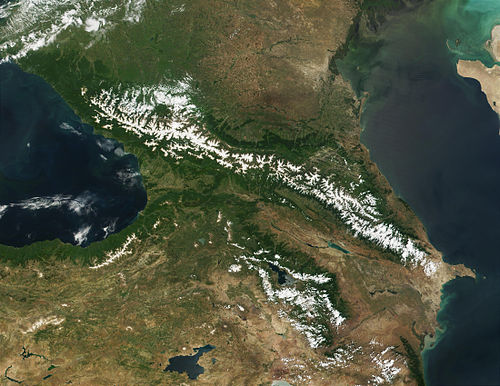
June 2001 NASA photograph of the snow-covered Lesser Caucasus to the south of the Greater Caucasus. Around the year 1800, the Karabakh Khanate was based in the southeast corner of the Lesser Caucasus. It extended east into the lowlands, hence the name Nagorno- or "Highland-" Karabakh for the western part.

The Amaras Monastery, founded in the 4th century by St Gregory the Illuminator. In the 5th century, Mesrop Mashtots, inventor of the Armenian alphabet, established at Amaras the first school to use his script.

The monastery at Gandzasar was commissioned by the House of Khachen and completed in 1238
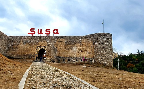
The Shusha fortress, built by the Karabakh Khanate ruler Panah Ali Khan in the 18th century
Second Nagorno-Karabakh War
Videos
The Second Nagorno-Karabakh War was an armed conflict in 2020 that took place in the disputed region of Nagorno-Karabakh and the surrounding occupied territories. It was a major escalation of an unres
Nagorno-Karabakh
…comprising 4,400 km2 (1,700 sq mi); however, the region's historical extent encompasses approximately 8,223 km2 (3,175 sq mi). On 27 September 2020, the Second Nagorno-Karabakh War broke out with an Azerbaijani offensive in Nagorno-Karabakh and the surrounding territories. Azerbaijan made significant gains during the war, regaining…

A pro-military billboard in Republic Square, Yerevan, on 7 October 2020.

Azerbaijani flag in Jafar Jabbarly Square near the 28 May station in Baku on 10 October 2020.

The wall with images of fallen Armenian soldiers. According to Artsakhian President, mainly 18–20 year old soldiers fought in hostilities.

Wounded Azerbaijani servicemen attending the victory parade on 10 December.