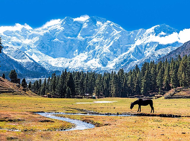
Nanga Parbat, known locally as Diamer, is the ninth-highest mountain on Earth and its summit is at 8,126 m (26,660 ft) above sea level. Lying immediately southeast of the northernmost bend of the Indus River in the Gilgit-Baltistan region of Pakistan-administered Kashmir, Nanga Parbat is the westernmost major peak of the Himalayas, and thus in the traditional view of the Himalayas as bounded by the Indus and Yarlung Tsangpo/Brahmaputra rivers, it is the western anchor of the entire mountain range.
Nanga Parbat, view from Fairy Meadows
Nanga Parbat & river
Nanga Parbat Rupal Base camp, Gilgit Baltistan
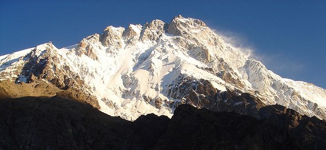
Southwest aspect of the Rupal Face
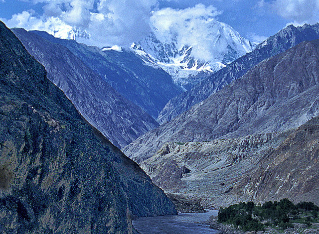
The Indus is a transboundary river of Asia and a trans-Himalayan river of South and Central Asia. The 3,120 km (1,940 mi) river rises in mountain springs northeast of Mount Kailash in Western Tibet, flows northwest through the disputed region of Kashmir, bends sharply to the left after the Nanga Parbat massif, and flows south-by-southwest through Pakistan, before emptying into the Arabian Sea near the port city of Karachi.
The Indus Gorge is formed as the Indus River bends around the Nanga Parbat massif, shown towering behind, defining the western anchor of the Himalayan mountain range.
The course and major tributaries of the Indus river
The course of the Indus in the heavily disputed Kashmir region; the river flows through Ladakh and Gilgit-Baltistan, administered respectively by India and Pakistan
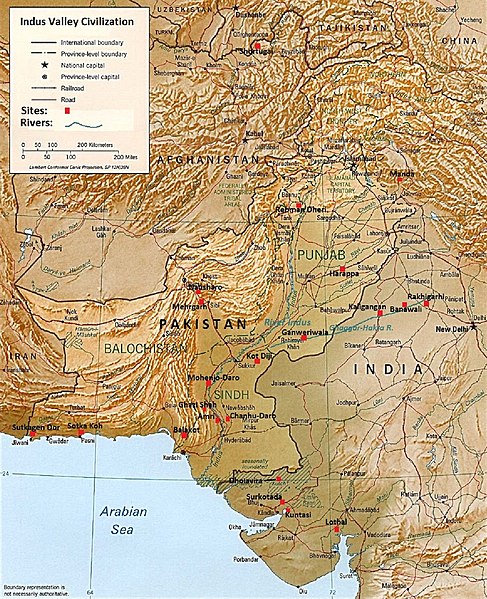
The major sites of the Indus Valley Civilization c. 2600–1900 BC in Pakistan, India and Afghanistan