Nathan Road is the main thoroughfare in Kowloon, Hong Kong, aligned south–north from Tsim Sha Tsui to Sham Shui Po. It is lined with shops and restaurants and throngs with visitors, and was known in the post–World War II years as the Golden Mile, a name that is now rarely used. It starts on the southern part of Kowloon at its junction with Salisbury Road, a few metres north of Victoria Harbour, and ends at its intersection with Boundary Street in the north. Portions of the Kwun Tong and Tsuen Wan lines run underneath Nathan Road. The total length of Nathan Road is about 3.6 km (2.2 mi).
Jordan section of Nathan Road, at its intersection with Austin Road
Nathan Road in the 1920s (Cameron Road on right)
Saint Andrew's Church
Chungking Mansions
Tsim Sha Tsui, often abbreviated as TST, is an urban area in southern Kowloon, Hong Kong. The area is administratively part of the Yau Tsim Mong District. Tsim Sha Tsui East is a piece of land reclaimed from the Hung Hom Bay now east of Tsim Sha Tsui. The area is bounded north by Austin Road and in the east by Hong Chong Road and Cheong Wan Road.
Tsim Sha Tsui waterfront, Victoria Harbour from Sky100
Aerial view of Tsim Sha Tsui in early 20th century. The Kowloon station (low left corner), the former Marine Police Headquarters (on the hill inland behind the station), and the Peninsula Hotel (centre)
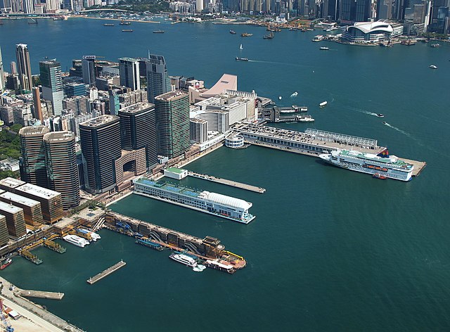
The southern tip of Tsim Sha Tsui, with the Hong Kong China Ferry Terminal and Harbour City.
The Peninsula Hong Kong and its office towers.


