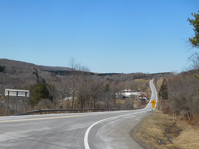
New York State Route 174 (NY 174) is a state highway in Onondaga County, located in Central New York, in the United States. The highway is 16.7 miles (26.9 km) long and passes through mostly rural regions. Route 174 begins at an intersection with NY 41 in Borodino, a hamlet of Spafford. It heads generally northward for most of its length, except for short distances in the villages of Marcellus and Camillus. The route ends at a junction with NY 5 west of Camillus, at the west end of the Route 5 Camillus bypass. Route 174 is located along a large mapped sedimentary bedrock unit, known as the Marcellus Formation. The formation is named for an outcrop found near the town of Marcellus, New York, during a geological survey in 1839.
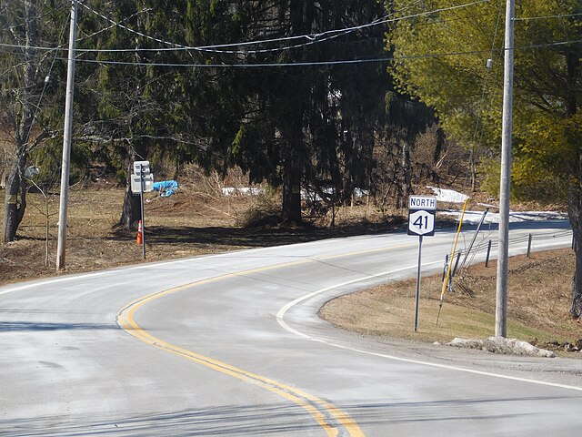
NY 174's southern terminus at NY 41
NY 174 with Otisco Lake in view
NY 174 in Marcellus, approaching NY 175
NY 174 southbound (south of US 20)
New York State Route 41 (NY 41) is a north–south state highway in Central New York in the United States. The southern terminus of the route is at an interchange with NY 17 in the town of Sanford in Broome County, New York. Its northern terminus is at an intersection with U.S. Route 20 (US 20) in the village of Skaneateles. The route is almost 100 miles (161 km) long and passes through Broome, Chenango, Cortland, and Onondaga counties. NY 41 was assigned as part of the 1930 renumbering of state highways in New York, replacing New York State Route 70 from Homer to Skaneateles. The route initially extended as far north as Jordan; however, NY 41 was cut back to its current northern terminus c. 1933.
NY 41 in Willets, north of NY 26
NY 41 in Smithville Flats