New York State Route 210
Videos
Page
New York State Route 210 (NY 210) is a state highway in Orange County, New York, in the United States. It runs north from the New Jersey state line—where it continues south as Passaic County Route 511 (CR 511)—along the west shore of Greenwood Lake to the eponymous village of Greenwood Lake, where it ends at a junction with NY 17A. It was once much longer, as it originally extended east along NY 17A and CR 106 in Orange and Rockland counties to Stony Point when it was assigned as part of the 1930 renumbering of state highways in New York. The route was truncated to its current length in 1982. Prior to becoming NY 210 in 1930, the road alongside Greenwood Lake was part of NY 55, a route connecting New Jersey to Goshen, in the 1920s.

NY 210 northbound past its southern terminus at CR 511 at the New Jersey border in Warwick
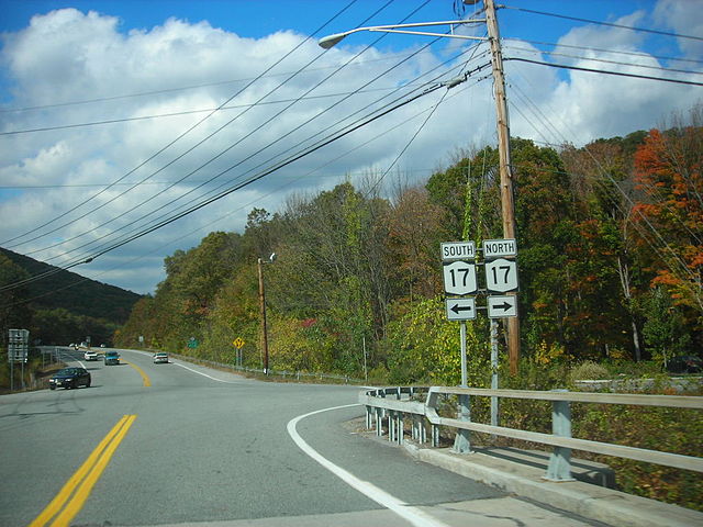
Junction of NY 17 and NY 17A in Southfields. From 1930 to 1982, NY 210 entered this intersection from the background on NY 17A and left in the foreground on modern CR 106.

Sign assembly for NY 210 at CR 106 (former NY 210) in Rockland County
County Route 511 (New Jersey)
Videos
Page
County Route 511 is a county highway in the U.S. state of New Jersey. The highway extends 37.44 miles (60.25 km) from Columbia Avenue in Morris Township to the New York state line in West Milford where the road continues as New York State Route 210.

US 202/CR 511 northbound on Intervale Road past I-287 in Parsippany-Troy Hills

View northbound along CR 511 from Route 24 in Morris Township
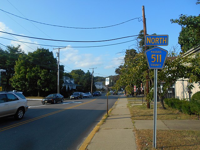
CR 511 northbound leaving downtown Bloomingdale

View north along CR 511 crossing the Monksville Reservoir in West Milford