New York State Route 266 (NY 266) is a state highway in Erie County, New York, in the United States. It runs along the Niagara River from the city of Buffalo to the city of Tonawanda. The southern terminus of the route is at the ramps leading to Interstate 190 (I-190) exit 8 in Buffalo. Its northern terminus is at an intersection with NY 265 just south of North Tonawanda in Tonawanda.
Southern terminus of NY 266 at I-190 in Buffalo
NY 266 as seen from the South Grand Island Bridge heading through Tonawanda
The Niagara River flows north from Lake Erie to Lake Ontario, forming part of the border between Ontario, Canada, to the west, and New York, United States, to the east. The origin of the river's name is debated. Iroquoian scholar Bruce Trigger suggests it is derived from a branch of the local Neutral Confederacy, referred to as the Niagagarega people on several late-17th-century French maps. George R. Stewart posits that it comes from an Iroquois town named Ongniaahra, meaning "point of land cut in two."
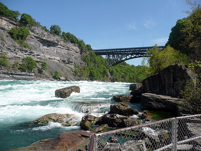
The Niagara River at Niagara Gorge in May 2008
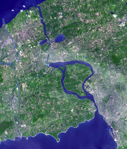
Satellite image of Niagara River flowing north from Lake Erie (bottom) to Lake Ontario (top). The river flows around Grand Island, and then flows over Niagara Falls. It narrows in the Niagara Gorge, where two hydropower reservoirs are visible, and then widens after exiting the gorge. The Welland Canal is visible on the far left.
American Falls with Goat Island to its right
Niagara River at Queenston, Ontario, then known as Queenstown, Upper Canada, c. 1805 watercolour