The Niger Delta is the delta of the Niger River sitting directly on the Gulf of Guinea on the Atlantic Ocean in Nigeria. It is located within nine coastal southern Nigerian states, which include: all six states from the South South geopolitical zone, one state (Ondo) from South West geopolitical zone and two states from South East geopolitical zone.
View of the Niger Delta from space (north/land at top).
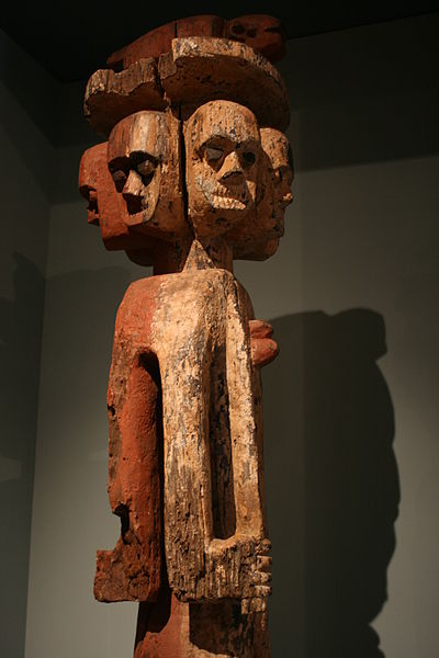
A statue of the Ijaw people
The Niger River is the main river of West Africa, extending about 4,180 kilometres. Its drainage basin is 2,117,700 km2 (817,600 sq mi) in area. Its source is in the Guinea Highlands in south-eastern Guinea near the Sierra Leone border. It runs in a crescent shape through Mali, Niger, on the border with Benin and then through Nigeria, discharging through a massive delta, known as the Niger Delta, into the Gulf of Guinea in the Atlantic Ocean. The Niger is the third-longest river in Africa, exceeded by the Nile and the Congo River. Its main tributary is the Benue River.
The Pont Kennedy across the Niger at Niamey, early 2019
Commercial activity along the river front at Boubon, in Niger
The great bend of the Niger River, seen from space, creates a green arc through the brown of the Sahel and Savanna. The green mass on the left is the Inner Niger Delta, and on the far left are tributaries of the Senegal River.
Mud houses on the center island at Lake Debo, a wide section of the Niger River


