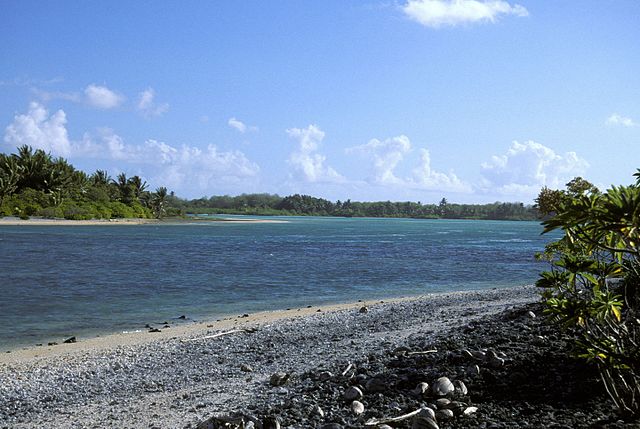
Nikumaroro, previously known as Kemins Island or Gardner Island, is a part of the Phoenix Islands, Kiribati, in the western Pacific Ocean. It is a remote, elongated, triangular coral atoll with profuse vegetation and a large central marine lagoon. Nikumaroro is about 7.5 km (4.7 mi) long by 2.5 km (1.6 mi) wide. The rim has two narrow entrances, both of which are blocked by a wide reef, which is dry at low tide. The ocean beyond the reef is very deep, and the only anchorage is at the island's west end, across the reef from the ruins of a mid-20th-century British colonial village, but this is safe only with the southeast trade winds. Landing has always been difficult and is most often done south of the anchorage. Although occupied at various times during the past, the island is uninhabited today.
Western entrance to Nikumaroro's lagoon as seen from near the village ruins
Large Pandanus sp. trees, viewed from underneath: Note the typical prop roots of the trees, enabling them to live along the coast, enduring violent seas and winds. They may have been planted as a food plant for the Phoenix Islands Settlement Scheme, 1938–1962.
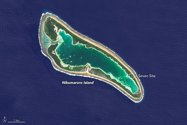
Nikumaroro Island in 2014.
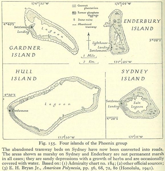
Gardner and other islands of the Phoenix Group, from a geographical handbook compiled by the British Admiralty in 1943-45
The Phoenix Islands, or Rawaki, are a group of eight atolls and two submerged coral reefs that lie east of the Gilbert Islands and west of the Line Islands in the central Pacific Ocean, north of Samoa. They are part of the Republic of Kiribati. Their combined land area is 28 square kilometres (11 sq mi). The only island of any commercial importance is Canton Island. The other islands are Enderbury, Rawaki, Manra, Birnie, McKean, Nikumaroro, and Orona.
Entrance to Canton Island's Lagoon. Village site is to the left.
Islands of the Settlement Scheme and Enderbury Island