The Noachis quadrangle is one of a series of 30 quadrangle maps of Mars used by the United States Geological Survey (USGS) Astrogeology Research Program. The Noachis quadrangle is also referred to as MC-27.
Image of the Noachis Quadrangle (MC-27). The northeast includes the western half of Hellas basin. The southeastern region contains Peneus Patera and part of the Amphitrites volcano.
Scalloped Terrain at Peneus Patera, as seen by HiRISE. Scalloped terrain is quite common in some areas of Mars.
Scalloped topography, as seen by HiRISE
Close view of scalloped topography, as seen by HiRISE
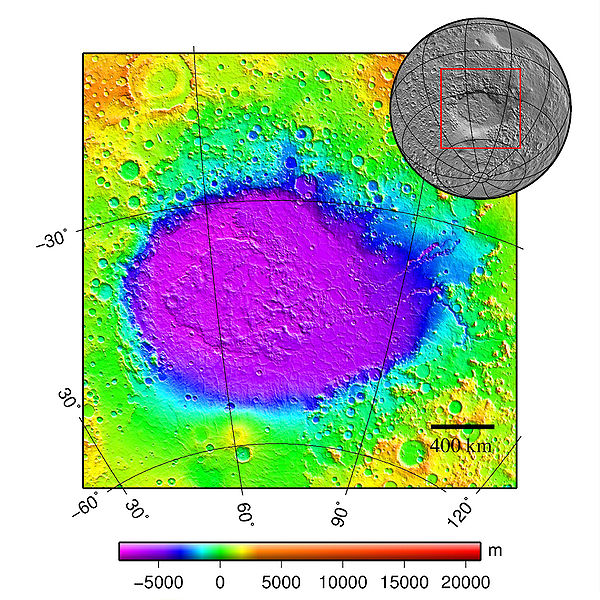
Hellas Planitia is a plain located within the huge, roughly circular impact basin Hellas located in the southern hemisphere of the planet Mars. Hellas is the third- or fourth-largest known impact crater in the Solar System. The basin floor is about 7,152 m (23,465 ft) deep, 3,000 m (9,800 ft) deeper than the Moon's South Pole-Aitken basin, and extends about 2,300 km (1,400 mi) east to west. It is centered at 42.4°S 70.5°E. Hellas Planitia spans the boundary between the Hellas quadrangle and the Noachis quadrangle.
Viking orbiter image mosaic of Hellas Planitia
Geographic context of Hellas
Apparent viscous flow features on the floor of Hellas, as seen by HiRISE.
Twisted terrain in Hellas Planitia (actually located in Noachis quadrangle).