Normandale, New Zealand
Videos
Normandale is a semi-rural suburb of Lower Hutt City, New Zealand, on the western hills of the Hutt Valley. It consists of two main roads – Normandale Road and Miromiro Road – and the hills between, a

View toward Wellington from the top of Normandale Road

Minoh Friendship House

Normandale Road railway crossing c. 1880s. This crossing survived until the erection of the overbridge which provides access from Lower Hutt to Normandale. The photograph long predates the construction of the Western Hutt Road from Melling to Petone in 1938 – nowadays the State Highway 2 motorway.

Panorama of Lower Hutt from upper Normandale
Hutt Valley
Videos
The Hutt Valley is the large area of fairly flat land in the Hutt River valley in the Wellington Region of New Zealand. Like the river that flows through it, it takes its name from Sir William Hutt, a
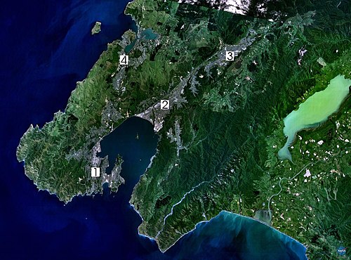
Lower and Upper Hutt cities are marked as 2 and 3 in this satellite image of the Wellington area (composite landsat-7 image)