North Carolina Highway 12
North Carolina Highway 12 (NC 12) is a 148.0-mile-long (238.2 km) primary state highway in the U.S. state of North Carolina, linking the peninsulas and islands of the northern Outer Banks. Most sections of NC 12 are two lanes wide, and there are also two North Carolina Ferry System routes which maintain continuity of the route as it traverses the Outer Banks region. NC 12 is part of the Outer Banks Scenic Byway, a National Scenic Byway. The first NC 12 appeared on the 1924 North Carolina Official Map and at its greatest length ran from NC 30 in Pollocksville to NC 48 near Murfreesboro. Over time it was replaced by both U.S. Route 258 (US 258) and NC 58 and ceased to exist in 1958. The current NC 12 first appeared on the 1964 state highway map running from US 158 in Nags Head to Ocracoke. In 1976 NC 12 was extended to US 70 on the mainland and in 1987 was extended north to Corolla.
NC 12 crossing a temporary bridge that was built after Hurricane Irene
North Carolina Highway 12 is routed along the Outer Banks. Yellow indicates roadbed while blue indicates the ferry routes
Rebuilding of dunes and placement of sandbags along a breached section of NC 12, March 2013
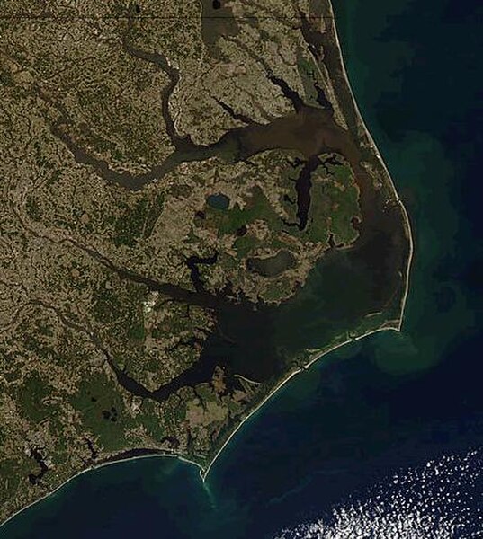
The Outer Banks are a 200 mi (320 km) string of barrier islands and spits off the coast of North Carolina and southeastern Virginia, on the east coast of the United States. They line most of the North Carolina coastline, separating Currituck Sound, Albemarle Sound, and Pamlico Sound from the Atlantic Ocean. A major tourist destination, the Outer Banks are known for their wide expanse of open beachfront and the Cape Hatteras National Seashore. The seashore and surrounding ecosystem are important biodiversity zones, including beach grasses and shrubland that help maintain the form of the land.
The Outer Banks, separating the Atlantic Ocean (east) from Currituck and Albemarle Sounds (north) and Pamlico Sound (south)
View from the International Space Station in 2019 (north is in the lower left of the photo)
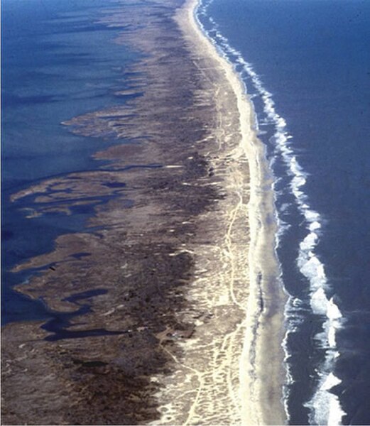
Aerial view of Outer banks (looking north), with sound on the left and ocean on the right
Graveyard of the Atlantic Museum, Hatteras, North Carolina, June 2007