North West Coastal Highway
North West Coastal Highway is a generally north-south Western Australian highway which links the coastal city of Geraldton with the town of Port Hedland. The 1,300-kilometre-long (808 mi) road, constructed as a sealed two-lane single carriageway, travels through remote and largely arid landscapes. Carnarvon is the only large settlement on the highway, and is an oasis within the harsh surrounding environment. The entire highway is allocated National Route 1, part of Australia's Highway 1, and parts of the highway are included in tourist routes Batavia Coast Tourist Way and Cossack Tourist Way. Economically, North West Coastal Highway is an important link to the Mid West, Gascoyne and Pilbara regions, supporting the agricultural, pastoral, fishing, and tourism industries, as well as mining and offshore oil and gas production.
View south along North West Coastal Highway, about 27 km (17 mi) south of the Wooramel Roadhouse
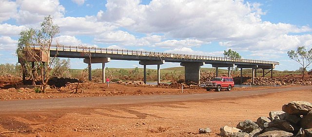
Crossing the Ashburton River
The flooded Gascoyne River in Carnarvon, 1942, with water rushing over the deck of the bridge. During such floods, roads could become bogs or be completely washed away.
Maitland River bridge following Cyclone Monty, 2004
Australia's Highway 1 is a network of highways that circumnavigate the country, joining all mainland capital cities except the national capital of Canberra. At a total length of approximately 14,500 km (9,000 mi) it is the longest national highway in the world, surpassing the Trans-Siberian Highway and the Trans-Canada Highway. Over a million people traverse some part of the highway network every day. It is the longest continuing highway in the world as the Pan-American Highway is separated by the Darién Gap and AH1 is separated by the Sea of Japan.
Princes Highway, which is part of the Highway 1 network, at Moruya, New South Wales


