Novarupta
Videos
Novarupta is a volcano located on the Alaska Peninsula on a slope of Trident Volcano in Katmai National Park and Preserve, about 290 miles southwest of Anchorage. Novarupta was formed in 1912, during

Novarupta's lava dome in June 2011

The 1912 eruption resulted in Mount Katmai losing a cubic mile of its summit. This photo shows Mount Katmai in 1913.

Colorful ash in the Valley of Ten Thousand Smokes
The 1991 eruption of Mount Pinatubo in the Philippines' Luzon Volcanic Arc was the second-largest volcanic eruption of the 20th century, behind only the 1912 eruption of Novarupta in Alaska. Eruptive
Novarupta
…4.1 cubic miles (17 km3) of air fall tuff and approximately 2.6 cubic miles (11 km3) of pyroclastic ash-flow tuff. During the 20th century, only the 1991 eruption of Mount Pinatubo in the Philippines and the 1902 eruption of Santa María in Guatemala were of comparable magnitude; Mount Pinatubo ejected 2.6 cubic miles (11 km3) of…
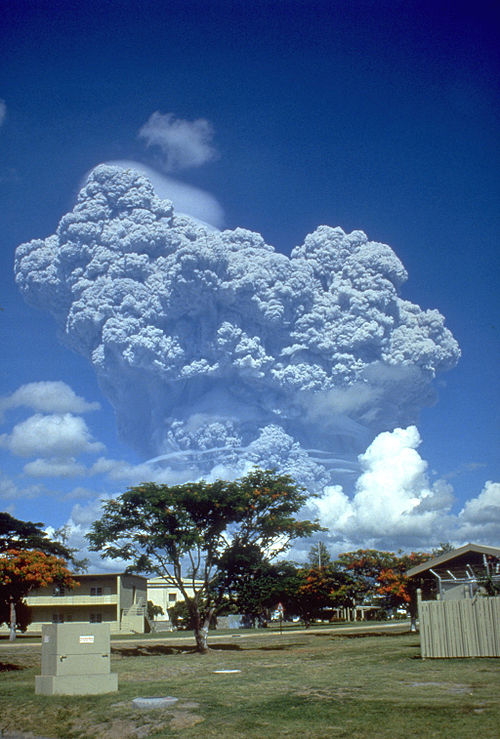
Eruption column on June 12, of 1991

Aerial view of Mount Pinatubo in June 22, 1991 a ashfall was still there before it was formation of Lake Pinatubo

Pinatubo as viewed from the north in late April 1991. Grayish-tan ash and several craters from the April 2 phreatic explosions are visible at the left.

A view to the west from Clark Air Base of the major eruption of Pinatubo on June 15, 1991. The June 15–16 climactic phase lasted more than fifteen hours, sent tephra about 35 km (22 mi) into the atmosphere, generated voluminous pyroclastic flows, and left a caldera in the former summit region. Later dubbed Black Saturday, the day of darkness stretched for 36 hours.