Nyanga National Park lies in the north of Zimbabwe's Eastern Highlands. One of the first national parks to be declared in the country, it contains the highest land in Zimbabwe, with green hills and perennial rivers. Most of its terrain consists of rolling downland, sometimes lightly wooded, lying at altitudes between 1,800–2,593 metres. Mount Nyangani, the highest point in Zimbabwe, lies in the centre of the park and Mutarazi Falls, Zimbabwe's highest waterfall, is in the south of the park. Nyanga National Park incorporates the former Mutarazi Falls National Park on its southern boundary.
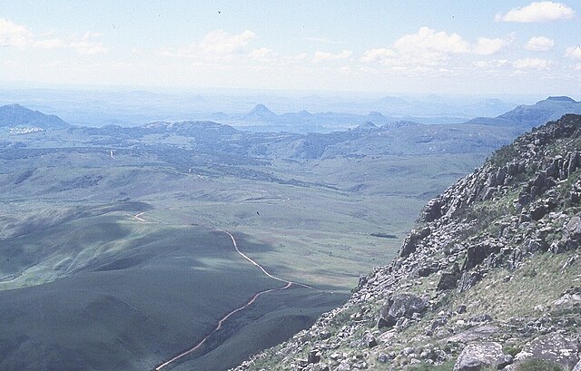
View across central Nyanga National Park from Mount Nyangani. The Pungwe River rises in the moorland on the left. The prominent hill at Ziwa can be seen in the distance and the Troutbeck Plateau on the far right.
Stormclouds over the Kwaraguza area, acquired by Nyanga National Park in the late 1990s.
Nyanga landscape: Afromontane forest and moorland.
Male waterbuck in the Udu area.
Zimbabwe, officially the Republic of Zimbabwe, is a landlocked country in Southern Africa, between the Zambezi and Limpopo Rivers, bordered by South Africa to the south, Botswana to the southwest, Zambia to the north, and Mozambique to the east. The capital and largest city is Harare, and the second largest is Bulawayo.
Towers of Great Zimbabwe
The Battle of the Shangani on 25 October 1893
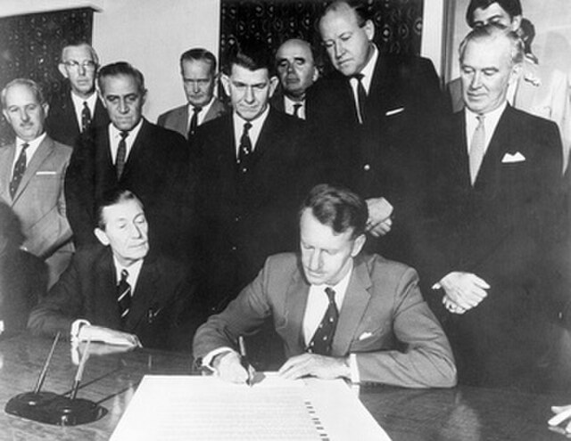
Ian Smith signing the Unilateral Declaration of Independence on 11 November 1965 with his cabinet in audience
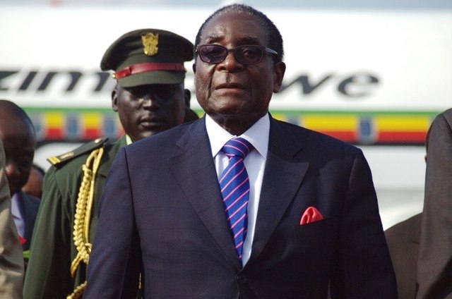
Zimbabwean President Robert Mugabe attending the Independence Day celebrations in South Sudan in July 2011.