Old River Control Structure
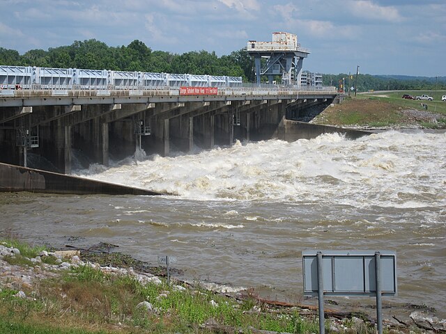
The Old River Control Structure is a floodgate system in a branch of the Mississippi River in central Louisiana. It regulates the flow of water from the Mississippi into the Atchafalaya River, thereby preventing the Mississippi River from changing course. Completed in 1963, the complex was built by the U.S. Army Corps of Engineers in a side channel of the Mississippi known as "Old River", between the Mississippi's current channel and the Atchafalaya Basin, a former channel of the Mississippi.
The Old River Control Structure complex. View is to the east-southeast, looking downriver on the Mississippi, with the three dams across channels leading to the Atchafalaya River to the right of the Mississippi. Concordia Parish, Louisiana is in the foreground, on the right, and Wilkinson County, Mississippi, is in the background, across the Mississippi on the left.
Old River low-sill control structure discharging water into the Atchafalaya, May 2011
Formation of the Atchafalaya River and construction of the Old River Control Structure.
The Mississippi River is the primary river, and second-longest river, of the largest drainage basin in the United States. From its traditional source of Lake Itasca in northern Minnesota, it flows generally south for 2,340 miles (3,766 km) to the Mississippi River Delta in the Gulf of Mexico. With its many tributaries, the Mississippi's watershed drains all or parts of 32 U.S. states and two Canadian provinces between the Rocky and Appalachian mountains. The main stem is entirely within the United States; the total drainage basin is 1,151,000 sq mi (2,980,000 km2), of which only about one percent is in Canada. The Mississippi ranks as the thirteenth-largest river by discharge in the world. The river either borders or passes through the states of Minnesota, Wisconsin, Iowa, Illinois, Missouri, Kentucky, Tennessee, Arkansas, Mississippi, and Louisiana.
The Mississippi River in Iowa
The source of the Mississippi River at Lake Itasca
The first bridge (and only log bridge) over the Mississippi, about 25 feet south of its source at Lake Itasca
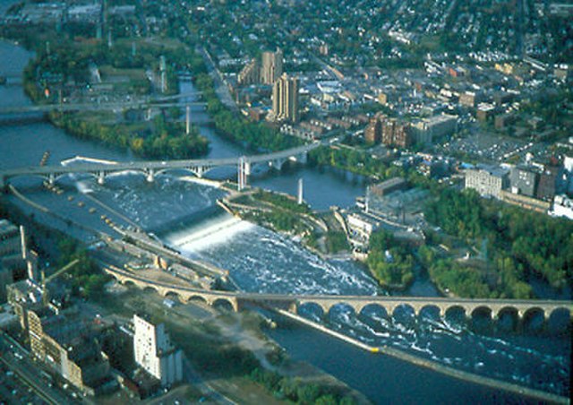
Former head of navigation, St. Anthony Falls, Minneapolis, Minnesota