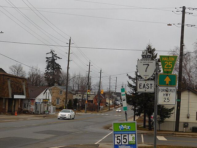
King's Highway 25, commonly referred to as Highway 25, was a highway in the Canadian province of Ontario. The north–south route connected several towns on its route northward from Burlington. The first section of Highway 25, designated in 1925, travelled north from Highway 5 to Milton. In 1928, the route was extended south into Burlington, following portions of Lower Middle Road to Highway 2. The highway was extended north to Highway 7 in 1937. That same year, a portion of Highway 25 was made concurrent with The Middle Road, which would be renamed as the Queen Elizabeth Way (QEW) two years later. The route remained relatively unchanged for two decades, save for the southern end being truncated at the QEW in 1946. In 1963 it was extended north to Ospringe to meet Highway 24. Another extension was added in 1974 to bring the route to Highway 89 near Shelburne. The entire route was decommissioned in 1997 and 1998 as part of a province-wide downloading of highways deemed to be of regional importance.

Signage on Halton 25 denoting its former designation
Milton is a town in Southern Ontario, Canada, and part of the Halton Region in the Greater Toronto Area. Between 2001 and 2011, Milton was the fastest growing municipality in Canada, with a 71.4% increase in population from 2001 to 2006 and another 56.5% increase from 2006 to 2011. In 2016, Milton's census population was 110,128 with an estimated growth to 228,000 by 2031. It remained the fastest growing community in Ontario but was deemed to be the sixth fastest growing in Canada at that time.
Downtown Milton
Milton, seen from the International Space Station, in late winter. This photograph was taken by astronaut Chris Hadfield, who grew up in Milton and is the namesake of Chris Hadfield Public School.
The historic Milton town hall in Victoria Park
Grace Anglican Church, Milton


