The Ordos Plateau, also known as the Ordos Basin or simply the Ordos, is a highland sedimentary basin in parts of most Northern China with an elevation of 1,000–1,600 m (3,300–5,200 ft), and consisting mostly of land enclosed by the Ordos Loop, a large northerly rectangular bend of the Yellow River. It is China's second largest sedimentary basin with a total area of 370,000 km2 (140,000 sq mi), and includes territories from five provinces, namely Shaanxi, Gansu, Ningxia, Inner Mongolia and a thin fringe of Shanxi, but is demographically dominated by the former three, hence is also called the Shaan-Gan-Ning Basin. The basin is bounded in the east by the Lüliang Mountains, north by the Yin Mountains, west by the Helan Mountains, and south by the Huanglong Mountains, Meridian Ridge and Liupan Mountains.
Approximate area of Chinese civilization during the Spring and Autumn period. Note the extension up the Wei valley
Bronze statuette of a man, Ordos, 3-1st century BC. British Museum. Otto J. Maenchen-Helfen notes that the statuette displays clear Europoid features.
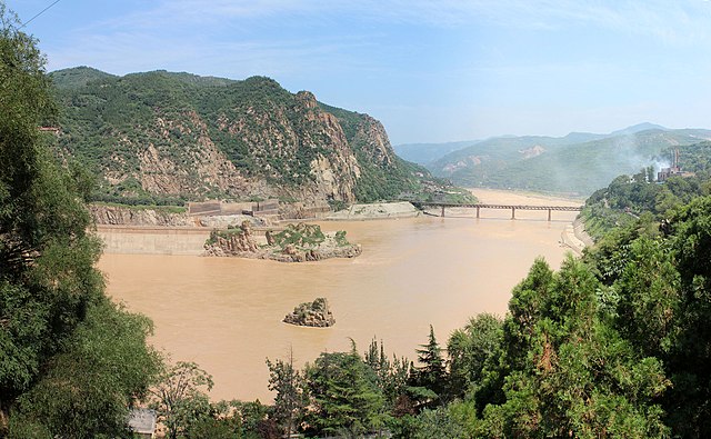
The Yellow River is the second-longest river in China, after the Yangtze River, and the sixth-longest river system on Earth at the estimated length of 5,464 km (3,395 mi). Originating at an elevation above 15,000 feet in the Bayan Har Mountains, it empties into the Bohai Sea. The Yellow River basin was the birthplace of ancient Chinese civilization. Its yellow sediments are carried downstream from the Loess Plateau. The river experiences frequent devastating floods and course changes produced by the continual elevation of the river bed, sometimes above the level of its surrounding farm fields.
The Yellow River in Sanmenxia, Henan
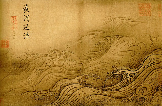
The Yellow River Breaches its Course by Ma Yuan (1160–1225, Song dynasty). Flooding of the river has been the cause of millions of deaths.
Zoigê County, Sichuan.
Guide County, Qinghai in the Tibetan Plateau, upstream from the Loess Plateau.