Parambikulam Tiger Reserve
Parambikulam Tiger Reserve, which also includes the erstwhile Parambikulam Wildlife Sanctuary, is a 643.66 square kilometres (248.5 sq mi) protected area lying in Palakkad district and Thrissur district of Kerala state, South India. The Wildlife Sanctuary, which had an area of 285 square kilometres (110 sq mi) was established in part in 1973 and 1984. It is in the Sungam range of hills between the Anaimalai Hills and Nelliampathy Hills. Parambikulam Wildlife Sanctuary was declared as part of the Parambikulam Tiger Reserve on 19 February 2010. Including the buffer zone, the tiger reserve has a span of 643.66 km2. The Western Ghats, Anamalai Sub-Cluster, including all of Parambikulam Wildlife Sanctuary, has been declared by the UNESCO World Heritage Committee as a World Heritage Site. The Tiger Reserve is the home of four different tribes of indigenous peoples including the Kadar, Malasar tribe, Muduvar and Mala Malasar settled in six colonies. Parambikulam Tiger Reserve implements the Project Tiger scheme along with various other programs of the Government of India and the Government of Kerala. The operational aspects of administering a tiger reserve is as per the scheme laid down by the National Tiger Conservation Authority. People from tribal colonies inside the reserve are engaged as guides for treks and safaris, and are provided employment through various eco-tourism initiatives. Parambikulam Tiger Reserve is among the top-ten best managed Tiger Reserve in India. The tiger reserve hosts many capacity building training programmes conducted by Parambikulam Tiger Conservation Foundation in association with various organisations.
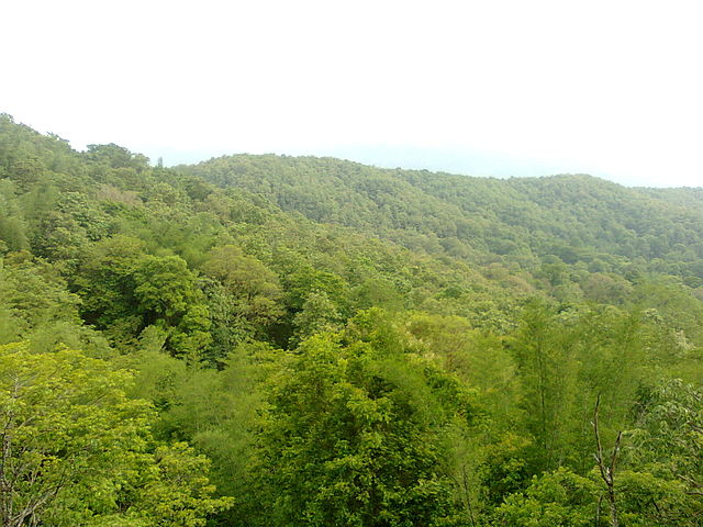
Parambikulam Tiger Reserve
Indian gaur (Bos gaurus) at Prarambikulam.
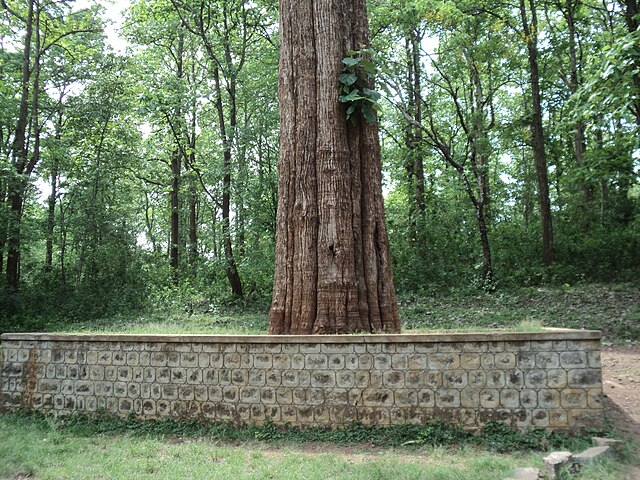
Kannimara Teak
Do-Not-Feed-Animals Signage at Parambikulam Tiger Reserve
Palakkad is one of the 14 districts in the Indian state of Kerala. It was carved out of the southeastern region of the former Malabar District on 1 January 1957. It is located at the central region of Kerala and is the second largest district in the state after Idukki. The city of Palakkad is the district headquarters. Palakkad is bordered on the northwest by the Malappuram district, on the southwest by the Thrissur district, on the northeast by Nilgiris district, and on the east by Coimbatore district of Tamil Nadu. The district is nicknamed "The granary of Kerala". Palakkad is the gateway to Kerala due to the presence of the Palakkad Gap, in the Western Ghats. The 2,383 m high Anginda peak, which is situated in the border of Palakkad district, Nilgiris district, and Malappuram district, in Silent Valley National Park, is the highest point of elevation in Palakkad district. Palakkad city is about 347 kilometres (216 mi) northeast of the state capital, Thiruvananthapuram.
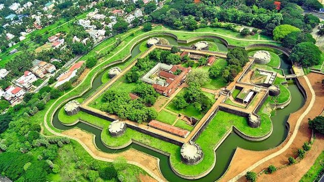
Image: Palakkad Fort 5
Image: Palakkad City, Kunnathurmedu
Image: Ottpalam town 3
Image: Pattambi Town 1