The Philippine Sea is a marginal sea of the Western Pacific Ocean east of the Philippine Archipelago and the largest sea in the world, occupying an estimated surface area of 5 million square kilometers. The Philippine Sea Plate forms the floor of the sea. Its western border is the first island chain to the west, comprising the Ryukyu Islands in the northwest and Taiwan in the west. Its southwestern border comprises the Philippine islands of Luzon, Catanduanes, Samar, Leyte, and Mindanao. Its northern border comprises the Japanese islands of Honshu, Shikoku and Kyūshū. Its eastern border is the second island chain to the east, comprising the Bonin Islands and Iwo Jima in the northeast, the Mariana Islands in the due east, and Halmahera, Palau, Yap and Ulithi in the southeast. Its southern border is Indonesia's Morotai Island.
An image captured from the ISS while flying over the Philippine Sea
Philippine Sea plate
View of the beach, rocky coastline and the Philippine Sea in Pingtung County, Taiwan
Japanese Carrier Division Three under attack by United States Navy aircraft from Task Force 58, late afternoon, 20 June 1944. The heavy cruiser circling at right, nearest to the camera, is either Maya or Chōkai. Beyond that, is the small aircraft carrier Chiyoda.
The Pacific Ocean is the largest and deepest of Earth's five oceanic divisions. It extends from the Arctic Ocean in the north to the Southern Ocean in the south, and is bounded by the continents of Asia and Australia in the west and the Americas in the east.
The Pacific Ocean, photograph taken from space by the GOES-18 spacecraft in September 2023
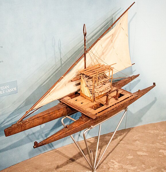
Model of a Fijian drua, an example of an Austronesian vessel with a double-canoe (catamaran) hull and a crab claw sail
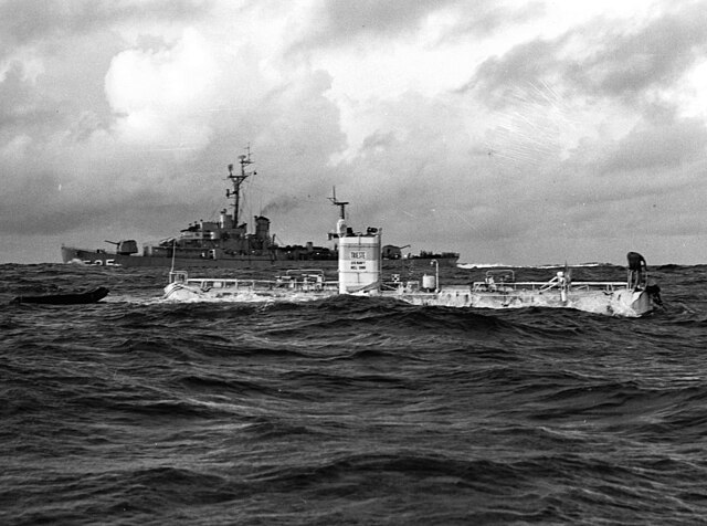
The bathyscaphe Trieste before her record dive to the bottom of the Mariana Trench, 23 January 1960
Abel Aubert du Petit-Thouars taking over Tahiti on 9 September 1842


