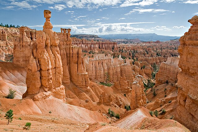
The Pink Cliffs are a series of highly dissected cliffs on the Colorado Plateau in Garfield, Iron, and Kane counties in southwestern Utah, United States. Contrary to the implication of the name, the cliffs are not a single set of rock formations, but actually a geological formation that manifests itself in multiple sets of rock formations.
One of the many hoodoo formations in the section of the Pink Cliffs that are located within Bryce Canyon National Park, July 2007
The Colorado Plateau, also known as the Colorado Plateau Province, is a physiographic and desert region of the Intermontane Plateaus, roughly centered on the Four Corners region of the southwestern United States. This province covers an area of 336,700 km2 (130,000 mi2) within western Colorado, northwestern New Mexico, southern and eastern Utah, northern Arizona, and a tiny fraction in the extreme southeast of Nevada. About 90% of the area is drained by the Colorado River and its main tributaries: the Green, San Juan, and Little Colorado. Most of the remainder of the plateau is drained by the Rio Grande and its tributaries.
The Four Corners region and the Colorado Plateau.
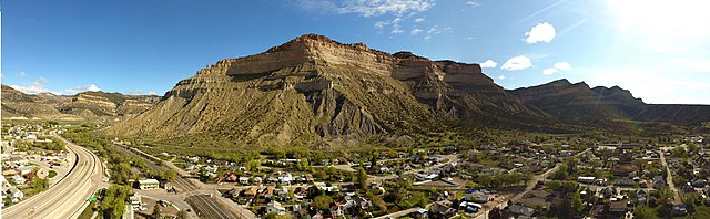
The Book Cliffs of Utah
The Green River runs north to south from Wyoming, briefly through Colorado, and converges with the Colorado River in southeastern Utah.
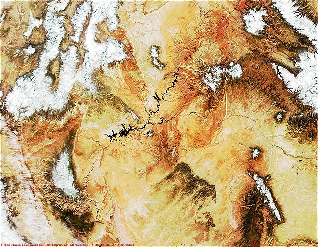
MODIS satellite image of Grand Canyon (lower left), Lake Powell (black, left of center) and the Colorado Plateau. White areas are snow-capped.