The Poor Knights Islands are a group of islands off the east coast of the Northland Region of the North Island of New Zealand. They lie 50 kilometres (31 mi) to the northeast of Whangārei, and 22 kilometres (14 mi) offshore halfway between Bream Head and Cape Brett. Uninhabited since the 1820s, they are a nature reserve and popular underwater diving spot, with boat tours typically departing from Tutukaka. The Poor Knights Islands Marine Reserve surrounds the island.
Poor Knights lily (Xeronema callistemon) plants growing in situ
Flowering Poor Knights lily in cultivation
Large numbers of Buller's shearwaters breed on the islands
The waters off the Poor Knights are a marine reserve with subtropical species
The Northland Region is the northernmost of New Zealand's 16 local government regions. New Zealanders sometimes refer to it as the Winterless North because of its mild climate all throughout the year. The main population centre is the city of Whangārei, and the largest town is Kerikeri. At the 2018 New Zealand census, Northland recorded a population growth spurt of 18.1% since the previous 2013 census, placing it as the fastest growing region in New Zealand, ahead of other strong growth regions such as the Bay of Plenty Region and Waikato.
Northland landscape at Parua Bay
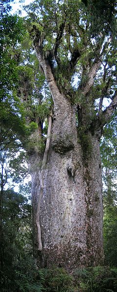
Mature kauri tree (Agathis australis)
Kerikeri, Bay of Islands. Stone Store (left), St James (rear), and the country's oldest surviving building, Mission House (right).
Fence on a sheep farm