1.
Northern Hemisphere
–
The Northern Hemisphere is the half of Earth that is north of the equator. For other planets in the Solar System, north is defined as being in the celestial hemisphere relative to the invariable plane of the solar system as Earths North pole. Due to the Earths axial tilt, winter in the Northern Hemisphere lasts from the December solstice to the March Equinox, the dates vary each year due to the difference between the calendar year and the astronomical year. Its surface is 60. 7% water, compared with 80. 9% water in the case of the Southern Hemisphere, the Arctic is the region north of the Arctic Circle. Its climate is characterized by cold winters and cool summers, precipitation mostly comes in the form of snow. The Arctic experiences some days in summer when the Sun never sets, the duration of these phases varies from one day for locations right on the Arctic Circle to several months near the North Pole, which is the middle of the Northern Hemisphere. Between the Arctic Circle and the Tropic of Cancer lies the Northern Temperate Zone, the changes in these regions between summer and winter are generally mild, rather than extreme hot or cold. However, a temperate climate can have very unpredictable weather, tropical regions are generally hot all year round and tend to experience a rainy season during the summer months, and a dry season during the winter months. In the Northern Hemisphere, objects moving across or above the surface of the Earth tend to turn to the right because of the coriolis effect, as a result, large-scale horizontal flows of air or water tend to form clockwise-turning gyres. These are best seen in circulation patterns in the North Atlantic. For the same reason, flows of air down toward the surface of the Earth tend to spread across the surface in a clockwise pattern. Thus, clockwise air circulation is characteristic of high pressure weather cells in the Northern Hemisphere, conversely, air rising from the northern surface of the Earth tends to draw air toward it in a counterclockwise pattern. Hurricanes and tropical storms spin counter-clockwise in the Northern Hemisphere, the shadow of a sundial moves clockwise in the Northern Hemisphere. When viewed from the Northern Hemisphere, the Moon appears inverted compared to a view from the Southern Hemisphere, the North Pole faces away from the galactic center of the Milky Way. The Northern Hemisphere is home to approximately 6.57 billion people which is around 90% of the total human population of 7.3 billion people
2.
Agriculture
–
Agriculture is the cultivation and breeding of animals, plants and fungi for food, fiber, biofuel, medicinal plants and other products used to sustain and enhance human life. Agriculture was the key development in the rise of human civilization. The study of agriculture is known as agricultural science, the history of agriculture dates back thousands of years, and its development has been driven and defined by greatly different climates, cultures, and technologies. Industrial agriculture based on large-scale monoculture farming has become the dominant agricultural methodology, genetically modified organisms are an increasing component of agriculture, although they are banned in several countries. Agricultural food production and water management are increasingly becoming global issues that are fostering debate on a number of fronts, the major agricultural products can be broadly grouped into foods, fibers, fuels, and raw materials. Specific foods include cereals, vegetables, fruits, oils, meats, fibers include cotton, wool, hemp, silk and flax. Raw materials include lumber and bamboo, other useful materials are also produced by plants, such as resins, dyes, drugs, perfumes, biofuels and ornamental products such as cut flowers and nursery plants. The word agriculture is a late Middle English adaptation of Latin agricultūra, from ager, field, Agriculture usually refers to human activities, although it is also observed in certain species of ant, termite and ambrosia beetle. To practice agriculture means to use resources to produce commodities which maintain life, including food, fiber, forest products, horticultural crops. This definition includes arable farming or agronomy, and horticulture, all terms for the growing of plants, even then, it is acknowledged that there is a large amount of knowledge transfer and overlap between silviculture and agriculture. In traditional farming, the two are often combined even on small landholdings, leading to the term agroforestry, Agriculture began independently in different parts of the globe, and included a diverse range of taxa. At least 11 separate regions of the Old and New World were involved as independent centers of origin, wild grains were collected and eaten from at least 105,000 years ago. Pigs were domesticated in Mesopotamia around 15,000 years ago, rice was domesticated in China between 13,500 and 8,200 years ago, followed by mung, soy and azuki beans. Sheep were domesticated in Mesopotamia between 13,000 and 11,000 years ago. From around 11,500 years ago, the eight Neolithic founder crops, emmer and einkorn wheat, hulled barley, peas, lentils, bitter vetch, chick peas and flax were cultivated in the Levant. Cattle were domesticated from the aurochs in the areas of modern Turkey. In the Andes of South America, the potato was domesticated between 10,000 and 7,000 years ago, along with beans, coca, llamas, alpacas, sugarcane and some root vegetables were domesticated in New Guinea around 9,000 years ago. Sorghum was domesticated in the Sahel region of Africa by 7,000 years ago, cotton was domesticated in Peru by 5,600 years ago, and was independently domesticated in Eurasia at an unknown time
3.
Population
–
A population is the number of all the organisms of the same group or species, which live in a particular geographical area, and have the capability of interbreeding. In sociology, population refers to a collection of humans, Demography is a social science which entails the statistical study of human populations. This article refers mainly to human population, in population genetics a sexual population is a set of organisms in which any pair of members can breed together. This means that they can regularly exchange gametes to produce normally-fertile offspring and this also implies that all members belong to the same species. If the gamodeme is very large, and all gene alleles are uniformly distributed by the gametes within it, however, there may be low frequencies of exchange with these neighbours. This may be viewed as the breaking up of a sexual population into smaller overlapping sexual populations. The overall rise in homozygosity is quantified by the inbreeding coefficient, note that all homozygotes are increased in frequency – both the deleterious and the desirable. The mean phenotype of the collection is lower than that of the panmictic original – which is known as inbreeding depression. It is most important to note, however, that some lines will be superior to the panmictic original, while some will be about the same. The probabilities of each can be estimated from those binomial equations, in plant and animal breeding, procedures have been developed which deliberately utilise the effects of dispersion. It can be shown that dispersion-assisted selection leads to the greatest genetic advance and this is so for both allogamous and autogamous gamodemes. In ecology, the population of a species in a certain area can be estimated using the Lincoln Index. As of todays date, the population is estimated by the United States Census Bureau to be 7.496 billion. The US Census Bureau estimates the 7 billion number was surpassed on 12 March 2012, according to papers published by the United States Census Bureau, the world population hit 6.5 billion on 24 February 2006. The United Nations Population Fund designated 12 October 1999 as the day on which world population reached 6 billion. This was about 12 years after world population reached 5 billion in 1987, the population of countries such as Nigeria, is not even known to the nearest million, so there is a considerable margin of error in such estimates. Researcher Carl Haub calculated that a total of over 100 billion people have probably been born in the last 2000 years, Population growth increased significantly as the Industrial Revolution gathered pace from 1700 onwards. In 2007 the United Nations Population Division projected that the population will likely surpass 10 billion in 2055
4.
Organism
–
In biology, an organism is any contiguous living system, such as an animal, plant, fungus, protist, archaeon, or bacterium. All known types of organisms are capable of some degree of response to stimuli, reproduction, growth and development and homeostasis. An organism consists of one or more cells, when it has one cell it is known as an organism. Most unicellular organisms are of microscopic scale and are thus described as microorganisms. Humans are multicellular organisms composed of trillions of cells grouped into specialized tissues. An organism may be either a prokaryote or a eukaryote, prokaryotes are represented by two separate domains—bacteria and archaea. Eukaryotic organisms are characterized by the presence of a cell nucleus. Fungi, animals and plants are examples of kingdoms of organisms within the eukaryotes, estimates on the number of Earths current species range from 10 million to 14 million, of which only about 1.2 million have been documented. More than 99% of all species, amounting to five billion species. In 2016, a set of 355 genes from the last universal ancestor of all living organisms living was identified. The term organism first appeared in the English language in 1703 and it is directly related to the term organization. There is a tradition of defining organisms as self-organizing beings. An organism may be defined as an assembly of molecules functioning as a more or less stable whole that exhibits the properties of life. Dictionary definitions can be broad, using such as any living structure, such as a plant, animal, fungus or bacterium, capable of growth. Many definitions exclude viruses and possible man-made non-organic life forms, as viruses are dependent on the machinery of a host cell for reproduction. A superorganism is an organism consisting of individuals working together as a single functional or social unit. There has been controversy about the best way to define the organism, several contributions are responses to the suggestion that the category of organism may well not be adequate in biology. Viruses are not typically considered to be organisms because they are incapable of autonomous reproduction and this controversy is problematic because some cellular organisms are also incapable of independent survival and live as obligatory intracellular parasites
5.
Human
–
Modern humans are the only extant members of Hominina tribe, a branch of the tribe Hominini belonging to the family of great apes. Several of these hominins used fire, occupied much of Eurasia and they began to exhibit evidence of behavioral modernity around 50,000 years ago. In several waves of migration, anatomically modern humans ventured out of Africa, the spread of humans and their large and increasing population has had a profound impact on large areas of the environment and millions of native species worldwide. Humans are uniquely adept at utilizing systems of communication for self-expression and the exchange of ideas. Humans create complex structures composed of many cooperating and competing groups, from families. Social interactions between humans have established a wide variety of values, social norms, and rituals. These human societies subsequently expanded in size, establishing various forms of government, religion, today the global human population is estimated by the United Nations to be near 7.5 billion. In common usage, the word generally refers to the only extant species of the genus Homo—anatomically and behaviorally modern Homo sapiens. In scientific terms, the meanings of hominid and hominin have changed during the recent decades with advances in the discovery, there is also a distinction between anatomically modern humans and Archaic Homo sapiens, the earliest fossil members of the species. The English adjective human is a Middle English loanword from Old French humain, ultimately from Latin hūmānus, the words use as a noun dates to the 16th century. The native English term man can refer to the species generally, the species binomial Homo sapiens was coined by Carl Linnaeus in his 18th century work Systema Naturae. The generic name Homo is a learned 18th century derivation from Latin homō man, the species-name sapiens means wise or sapient. Note that the Latin word homo refers to humans of either gender, the genus Homo evolved and diverged from other hominins in Africa, after the human clade split from the chimpanzee lineage of the hominids branch of the primates. The closest living relatives of humans are chimpanzees and gorillas, with the sequencing of both the human and chimpanzee genome, current estimates of similarity between human and chimpanzee DNA sequences range between 95% and 99%. The gibbons and orangutans were the first groups to split from the leading to the humans. The splitting date between human and chimpanzee lineages is placed around 4–8 million years ago during the late Miocene epoch, during this split, chromosome 2 was formed from two other chromosomes, leaving humans with only 23 pairs of chromosomes, compared to 24 for the other apes. There is little evidence for the divergence of the gorilla, chimpanzee. Each of these species has been argued to be an ancestor of later hominins
6.
Extinction vortex
–
Extinction vortices are a class of models through which conservation biologists, geneticists and ecologists can understand the dynamics of and categorize extinctions in the context of their causes. Developed by M. E. Gilpin and M. E. Soulé in their famous 1986 paper Minimum viable populations, Processes of species extinction, there are currently four classes of extinction vortices. The first two deal with factors that have an effect on the ecosystem or community level, such as disturbance, pollution. This event can make populations vulnerable to additional disturbances which will lead to decreases in population size. A prime example of this would be the disruption of sex ratios in an away from the species optimum. Within these fragments, local extinction rates increase which, through positive feedback and this vortex can result from biological invasion, resulting in large scale hybridization and outbreeding depression. Mutational meltdown Small population size Mullers ratchet
7.
Allee effect
–
The Allee effect is a phenomenon in biology characterized by a correlation between population size or density and the mean individual fitness of a population or species. Although the concept of Allee effect had no title at the time, it was first described in the 1930s by its namesake, through experimental studies, Allee was able to demonstrate that goldfish grow more rapidly when there are more individuals within the tank. This led him to conclude that aggregation can improve the rate of individuals. The term Allee principle was introduced in the 1950s, a time when the field of ecology was heavily focused on the role of competition among and within species. In other words, individuals in a population would be better off there are fewer individuals around due to a limited amount of resources. However, the concept of the Allee effect introduced the idea that the reverse holds true when the density is low. Individuals within a species often require the assistance of another individual for more than simple reproductive reasons in order to persist, the most obvious example of this is observed in animals that hunt for prey or defend against predators as a group. The generally accepted definition of Allee effect is positive density dependence and it is sometimes referred to as undercrowding and it is analogous to depensation in the field of fishery sciences. Listed below are a few significant subcategories of the Allee effect used in the ecology literature, the component Allee effect is the positive relationship between any measurable component of individual fitness and population density. The demographic Allee effect is the relationship between the overall individual fitness and population density. For example, cooperative hunting and the ability to easily find mates. At low population density, these component Allee effects would add up to produce an overall demographic Allee effect, when population density reaches a high number, negative density dependence often offsets the component Allee effects through resource competition, thus erasing the demographic Allee effect. It is important to note that Allee effects might occur even at high density for some species. The strong Allee effect is a demographic Allee effect with a population size or density. The weak Allee effect is a demographic Allee effect without a population size or density. The distinction between the two terms is based on whether or not the population in question exhibits a critical size or density. A population exhibiting a weak Allee effect will possess a reduced per capita growth rate at lower density or size. However, even at low population size or density, the population will always exhibit a positive per capita growth rate
8.
Monaco
–
Monaco, officially the Principality of Monaco, is a sovereign city-state and microstate, located on the French Riviera in Western Europe. France borders the country on three sides while the other side borders the Mediterranean Sea, Monaco has an area of 2.02 km2 and a population of about 38,400 according to the last census of 2015. With 19,009 inhabitants per km², it is the second smallest, Monaco has a land border of 5.47 km, a coastline of 3.83 km, and a width that varies between 1,700 and 349 m. The highest point in the country is a pathway named Chemin des Révoires on the slopes of Mont Agel, in the Les Révoires Ward. Monacos most populous Quartier is Monte Carlo and the most populous Ward is Larvotto/Bas Moulins, through land reclamation, Monacos land mass has expanded by twenty percent, in 2005, it had an area of only 1.974 km2. Monaco is known as a playground for the rich and famous, in 2014, it was noted about 30% of the population was made up of millionaires, more than in Zürich or Geneva. Monaco is a principality governed under a form of constitutional monarchy, although Prince Albert II is a constitutional monarch, he wields immense political power. The House of Grimaldi have ruled Monaco, with brief interruptions, the official language is French, but Monégasque, Italian, and English are widely spoken and understood. The states sovereignty was recognized by the Franco-Monegasque Treaty of 1861. Despite Monacos independence and separate foreign policy, its defense is the responsibility of France, however, Monaco does maintain two small military units. Economic development was spurred in the late 19th century with the opening of the countrys first casino, Monte Carlo, since then, Monacos mild climate, scenery, and gambling facilities have contributed to the principalitys status as a tourist destination and recreation center for the rich. In more recent years, Monaco has become a major banking center and has sought to diversify its economy into services and small, high-value-added, the state has no income tax, low business taxes, and is well known for being a tax haven. It is also the host of the street circuit motor race Monaco Grand Prix. Monaco is not formally a part of the European Union, but it participates in certain EU policies, including customs, through its relationship with France, Monaco uses the euro as its sole currency. Monaco joined the Council of Europe in 2004 and it is a member of the Organisation Internationale de la Francophonie. Monacos name comes from the nearby 6th-century BC Phocaean Greek colony, according to an ancient myth, Hercules passed through the Monaco area and turned away the previous gods. As a result, a temple was constructed there, the temple of Hercules Monoikos, because the only temple of this area was the House of Hercules, the city was called Monoikos. It ended up in the hands of the Holy Roman Empire, an ousted branch of a Genoese family, the Grimaldi, contested it for a hundred years before actually gaining control
9.
Southern Europe
–
Southern Europe is the southern region of the European continent. Most definitions of Southern Europe, also known as Mediterranean Europe, include the countries of the Iberian peninsula, different methods can be used to define Southern Europe, including its political, economic, and cultural attributes. Southern Europe can also be defined by its natural features — its geography, climate, geographically, Southern Europe is the southern half of the landmass of Europe. This definition is relative, with no clear limits and those areas of Mediterranean climate present similar vegetations and landscapes throughout, including dry hills, small plains, pine forests and olive trees. Cooler climates can be found in parts of Southern European countries, for example within the mountain ranges of Spain. Additionally, the north coast of Spain experiences a wetter Atlantic climate, Southern Europes flora is that of the Mediterranean Region, one of the phytochoria recognized by Armen Takhtajan. The period known as classical antiquity began with the rise of the city-states of Ancient Greece, Greek influence reached its zenith under the expansive empire of Alexander the Great, spreading throughout Asia. The Roman Empire came to dominate the entire Mediterranean basin in a vast empire based on Roman law and it promoted trade, tolerance, and Greek culture. By 300 AD the Roman Empire was divided into the Western Roman Empire based in Rome, during the Middle Ages, the Eastern Roman Empire survived, though modern historians refer to this state as the Byzantine Empire. In Western Europe, Germanic peoples moved into positions of power in the remnants of the former Western Roman Empire and established kingdoms, the period known as the Crusades, a series of religiously motivated military expeditions originally intended to bring the Levant back into Christian rule, began. Several Crusader states were founded in the eastern Mediterranean, the Crusaders would have a profound impact on many parts of Europe. Their Sack of Constantinople in 1204 brought an end to the Byzantine Empire. Though it would later be re-established, it would never recover its former glory, the Crusaders would establish trade routes that would develop into the Silk Road and open the way for the merchant republics of Genoa and Venice to become major economic powers. The Reconquista, a movement, worked to reconquer Iberia for Christendom. The Late Middle Ages represented a period of upheaval in Europe, the epidemic known as the Black Death and an associated famine caused demographic catastrophe in Europe as the population plummeted. Dynastic struggles and wars of conquest kept many of the states of Europe at war for much of the period, in the Balkans, the Ottoman Empire, a Turkish state originating in Anatolia, encroached steadily on former Byzantine lands, culminating in the Fall of Constantinople in 1453. An unprecedented series of wars and political revolutions took place around Europe. Observers at the time, and many historians since, have argued that wars caused the revolutions, galileo Galilei, invented the telescope and the thermometer which allowed him to observe and describe the solar system
10.
Mongolia
–
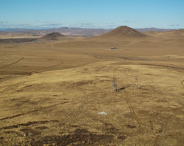
Mongolia /mɒŋˈɡoʊliə/ is a landlocked unitary sovereign state in East Asia. Its area is equivalent with the historical territory of Outer Mongolia. It is sandwiched between China to the south and Russia to the north, while it does not share a border with Kazakhstan, Mongolia is separated from it by only 36.76 kilometers. At 1,564,116 square kilometers, Mongolia is the 18th largest and it is also the worlds second-largest landlocked country behind Kazakhstan and the largest landlocked country that does not border a closed sea. The country contains very little land, as much of its area is covered by grassy steppe, with mountains to the north and west. Ulaanbaatar, the capital and largest city, is home to about 45% of the countrys population, approximately 30% of the population is nomadic or semi-nomadic, horse culture is still integral. The majority of its population are Buddhists, the non-religious population is the second largest group. Islam is the dominant religion among ethnic Kazakhs, the majority of the states citizens are of Mongol ethnicity, although Kazakhs, Tuvans, and other minorities also live in the country, especially in the west. Mongolia joined the World Trade Organization in 1997 and seeks to expand its participation in regional economic, the area of what is now Mongolia has been ruled by various nomadic empires, including the Xiongnu, the Xianbei, the Rouran, the Turkic Khaganate, and others. In 1206, Genghis Khan founded the Mongol Empire, which became the largest contiguous empire in history. His grandson Kublai Khan conquered China to establish the Yuan dynasty, after the collapse of the Yuan, the Mongols retreated to Mongolia and resumed their earlier pattern of factional conflict, except during the era of Dayan Khan and Tumen Zasagt Khan. In the 16th century, Tibetan Buddhism began to spread in Mongolia, being led by the Manchu-founded Qing dynasty. By the early 1900s, almost one-third of the male population were Buddhist monks. After the collapse of the Qing dynasty in 1911, Mongolia declared independence from the Qing dynasty, shortly thereafter, the country came under the control of the Soviet Union, which had aided its independence from China. In 1924, the Mongolian Peoples Republic was declared as a Soviet satellite state, after the anti-Communist revolutions of 1989, Mongolia conducted its own peaceful democratic revolution in early 1990. This led to a multi-party system, a new constitution of 1992, homo erectus inhabited Mongolia from 850,000 years ago. Modern humans reached Mongolia approximately 40,000 years ago during the Upper Paleolithic, the Khoit Tsenkher Cave in Khovd Province shows lively pink, brown, and red ochre paintings of mammoths, lynx, bactrian camels, and ostriches, earning it the nickname the Lascaux of Mongolia. The venus figurines of Malta testify to the level of Upper Paleolithic art in northern Mongolia, the wheeled vehicles found in the burials of the Afanasevans have been dated to before 2200 BC
11.
Cartogram
–
A cartogram is a map in which some thematic mapping variable – such as travel time, population, or Gross National Product – is substituted for land area or distance. The geometry or space of the map is distorted in order to convey the information of this alternate variable and they are primarily used to display emphasis and for analysis as nomographs. Two common types of cartograms, area and distance cartograms, Cartograms have a fairly long history, with examples from the mid-1800s. Other synonyms in use are anamorphic map, density-equalizing map and Gastner map, area cartograms may be contiguous or noncontiguous. The area cartograms shown on this page are all contiguous, while an example of a noncontiguous cartogram was published in The New York Times. This method of creation is sometimes referred to as the projector method or scaled-down regions. Cartograms may be classified also by the properties of shape and topology preservation, classical area cartograms are typically distorting the shape of spatial units to some degree, but they are strict at preserving correct neighborhood relationships between them. Another branch of cartograms introduced by Dorling, replaces actual shapes with circles scaled according to the mapped feature, circles are distributed to resemble the original topology. Demers cartogram is a variation of Dorling cartogram, but it uses rectangles instead of circles, schematic maps based on quad trees can be seen as non shape-preserving cartograms with some degree of neighborhood preservation. A collection of about 700 contiguous area cartograms is available at Worldmapper, one of the first cartographers to generate cartograms with the aid of computer visualization was Waldo Tobler of UC Santa Barbara in the 1960s. Prior to Toblers work, cartograms were created by hand, the National Center for Geographic Information and Analysis located on the UCSB campus maintains an online Cartogram Central with resources regarding cartograms. A number of software packages generate cartograms, examples of cartogram software include ScapeToad, Cart, and the Cartogram Processing Tool, which all use the Gastner-Newman algorithm. An alternative algorithm, Carto3F, is implemented as an independent program for non-commercial use on Windows platforms. This program also provides an optimization to the original Dougenik rubber-sheet algorithm, choropleth map Contour map Thematic map Campbell, John. Area cartograms, Their use and creation, concepts and Techniques in Modern Geography series no.59. Norwich, University of East Anglia,1996, Gastner, Michael T. and Mark E. J. Newman, Diffusion-based method for producing density-equalizing maps. Proceedings of the National Academy of Sciences 2004,101, 7499–7504, places in the News, The Use of Cartograms in Introductory Geography Courses. Hennig, Benjamin D. Rediscovering the World, Map Transformations of Human, house, Donald H. and Christopher Kocmoud, Continuous Cartogram Construction
12.
County
–
A county is a geographical region of a country used for administrative or other purposes, in certain modern nations. The term is derived from the Old French conté or cunté denoting a jurisdiction under the sovereignty of a count or a viscount. The modern French is comté, and its equivalents in other languages are contea, contado, comtat, condado, Grafschaft, graafschap, Gau, when the Normans conquered England, they brought the term with them. The Saxons had already established the districts became the historic counties of England. The Vikings introduced the term earl to the British Isles, thus, the Anglo-Saxons earl and earldom were taken as equivalent to the continental use of count and county under the conquering Normans, and over time the two blended and became equivalent terms. Further, the term became a synonym for the native English word scir or, in Modern English. Since a shire was a division of the kingdom, the term county evolved to designate an administrative division of states or of a national government in most other modern uses. A county may be subdivided into districts, hundreds, townships or other administrative jurisdictions within the county. A county usually, but not always, contains cities, towns, townships, villages, or other municipal corporations, Provinces in Argentina are divided into departments, except in the Buenos Aires Province, where they are called partidos. The Autonomous City of Buenos Aires is divided into communes, in the eastern states of Australia, counties are used in the administration of land titles. They do not generally correspond to a level of government, but are used in the identification of parcels of land, canadas five oldest provinces – New Brunswick, Nova Scotia, Ontario, Quebec and Prince Edward Island – are divided into counties. In addition to counties, Ontario is also subdivided into districts, district municipalities, metropolitan municipalities. British Columbia, Manitoba, Newfoundland and Labrador, Northwest Territories, Nunavut, Saskatchewan, the word county is used to translate the Chinese term xiàn. In Mainland China, governed by the Peoples Republic of China, counties are the level of local government. There are 1,464 counties in the PRC out of a total of 2,862 county-level divisions, the number of counties has remained more or less constant since the Han dynasty. The county remains one of the oldest levels of government in China, the county government was particularly important in imperial China because this was the lowest layer at which the imperial government functioned. The head of a county during imperial times was the magistrate, in older context, prefecture and district are alternative terms to refer to xiàn before the establishment of the Republic of China. The English nomenclature county was adopted following the establishment of the ROC, contrary to the typical rural location of a county in Western countries, a city in China may enclose several counties
13.
Country
–
A country is a region that is identified as a distinct national entity in political geography. Sometimes the word countries is used to both to sovereign states and to other political entities, while other times it refers only to states. The word country comes from Old French contrée, itself derived from Vulgar Latin contrata and it most likely entered the English language after the Franco-Norman invasion during the 11th century. Areas much smaller than a state may be called by names such as the West Country in England, the Black Country, Constable Country. In many European countries the words are used for sub-divisions of the territory, as in the German Bundesländer. The modern Italian contrada is a word with its meaning varying locally, the term country is frequently used to refer to sovereign states. There is no agreement on the number of countries in the world. There are 206 sovereign states, of which 193 states are members of the United Nations, all are defined as states by declarative theory of statehood and constitutive theory of statehood. The latest proclaimed state is South Sudan in 2011, the Kingdom of Denmark, a sovereign state, comprises Metropolitan Denmark and two nominally separate countries—the Faroe Islands, and Greenland—which are almost fully internally self-governing. The Kingdom of the Netherlands, a state, comprises four separate countries, Netherlands, Aruba, Curaçao. The degree of autonomy of non-sovereign countries varies widely, some are possessions of sovereign states, as several states have overseas territories, with citizenry at times identical and at times distinct from their own
14.
Earth
–
Earth, otherwise known as the World, or the Globe, is the third planet from the Sun and the only object in the Universe known to harbor life. It is the densest planet in the Solar System and the largest of the four terrestrial planets, according to radiometric dating and other sources of evidence, Earth formed about 4.54 billion years ago. Earths gravity interacts with objects in space, especially the Sun. During one orbit around the Sun, Earth rotates about its axis over 365 times, thus, Earths axis of rotation is tilted, producing seasonal variations on the planets surface. The gravitational interaction between the Earth and Moon causes ocean tides, stabilizes the Earths orientation on its axis, Earths lithosphere is divided into several rigid tectonic plates that migrate across the surface over periods of many millions of years. About 71% of Earths surface is covered with water, mostly by its oceans, the remaining 29% is land consisting of continents and islands that together have many lakes, rivers and other sources of water that contribute to the hydrosphere. The majority of Earths polar regions are covered in ice, including the Antarctic ice sheet, Earths interior remains active with a solid iron inner core, a liquid outer core that generates the Earths magnetic field, and a convecting mantle that drives plate tectonics. Within the first billion years of Earths history, life appeared in the oceans and began to affect the Earths atmosphere and surface, some geological evidence indicates that life may have arisen as much as 4.1 billion years ago. Since then, the combination of Earths distance from the Sun, physical properties, in the history of the Earth, biodiversity has gone through long periods of expansion, occasionally punctuated by mass extinction events. Over 99% of all species that lived on Earth are extinct. Estimates of the number of species on Earth today vary widely, over 7.4 billion humans live on Earth and depend on its biosphere and minerals for their survival. Humans have developed diverse societies and cultures, politically, the world has about 200 sovereign states, the modern English word Earth developed from a wide variety of Middle English forms, which derived from an Old English noun most often spelled eorðe. It has cognates in every Germanic language, and their proto-Germanic root has been reconstructed as *erþō, originally, earth was written in lowercase, and from early Middle English, its definite sense as the globe was expressed as the earth. By early Modern English, many nouns were capitalized, and the became the Earth. More recently, the name is simply given as Earth. House styles now vary, Oxford spelling recognizes the lowercase form as the most common, another convention capitalizes Earth when appearing as a name but writes it in lowercase when preceded by the. It almost always appears in lowercase in colloquial expressions such as what on earth are you doing, the oldest material found in the Solar System is dated to 4. 5672±0.0006 billion years ago. By 4. 54±0.04 Gya the primordial Earth had formed, the formation and evolution of Solar System bodies occurred along with the Sun
15.
World population
–
In demographics, the world population is the total number of humans currently living. As of March 2017, it was estimated at 7.49 billion, the United Nations estimates it will further increase to 11.2 billion in the year 2100. World population has experienced growth since the end of the Great Famine of 1315–17 and the Black Death in 1350. The highest population growth rates – global population increases above 1. 8% per year – occurred between 1955-1975 peaking to 2. 06% between 1965-1970, the growth rate has declined to 1. 18% between 2010-2015 and is projected to decline to 0. 13% by the year 2100. World population reached 7 billion on October 31,2011 according to the United Nations Population Fund, and on March 12,2012 according to the United States Census Bureau. The median age of the population was estimated to be 30.1 years in 2016, with the male median age estimated to be 29.4 years. 2003 UN Population Division population projections for the year 2150 range between 3.2 and 24.8 billion. One of many independent mathematical models supports the estimate, while a 2014 estimate forecasts between 9.3 and 12.6 billion in 2100, and continued growth thereafter. Some analysts have questioned the sustainability of further population growth, highlighting the growing pressures on the environment, global food supplies. Estimates on the number of humans who have ever lived range in the order of 106 to 108 billion. Six of the Earths seven continents are permanently inhabited on a large scale, Asia is the most populous continent, with its 4.3 billion inhabitants accounting for 60% of the world population. The worlds two most populated countries alone, China and India, together constitute about 37% of the worlds population, Africa is the second most populated continent, with around 1 billion people, or 15% of the worlds population. Europes 733 million people make up 12% of the population as of 2012. Northern America, primarily consisting of the United States, Mexico, and Canada, has a population of around 352 million, and Oceania, the least-populated region, has about 35 million inhabitants. Though it is not permanently inhabited by any fixed population, Antarctica has a small, fluctuating international population and this population tends to rise in the summer months and decrease significantly in winter, as visiting researchers return to their home countries. Estimates of world population by their nature are an aspect of modernity, more refined estimates, broken down by continents, were published in the first half of the 19th century, at 600 to 1000 million in the early 1800s and at 800 to 1000 million in the 1840s. Estimates of the population of the world at the time agriculture emerged in around 10,000 BCE have ranged between 1 million and 15 million. Even earlier, genetic evidence suggests humans may have gone through a bottleneck of between 1,000 and 10,000 people about 70,000 BCE, according to the Toba catastrophe theory
16.
Antarctica
–
It contains the geographic South Pole and is situated in the Antarctic region of the Southern Hemisphere, almost entirely south of the Antarctic Circle, and is surrounded by the Southern Ocean. At 14,000,000 square kilometres, it is the fifth-largest continent, for comparison, Antarctica is nearly twice the size of Australia. About 98% of Antarctica is covered by ice that averages 1.9 km in thickness, Antarctica, on average, is the coldest, driest, and windiest continent, and has the highest average elevation of all the continents. Antarctica is a desert, with precipitation of only 200 mm along the coast. The temperature in Antarctica has reached −89.2 °C, though the average for the quarter is −63 °C. Anywhere from 1,000 to 5,000 people reside throughout the year at the research stations scattered across the continent. Organisms native to Antarctica include many types of algae, bacteria, fungi, plants, protista, vegetation, where it occurs, is tundra. The continent, however, remained neglected for the rest of the 19th century because of its hostile environment, lack of easily accessible resources. In 1895, the first confirmed landing was conducted by a team of Norwegians, Antarctica is a de facto condominium, governed by parties to the Antarctic Treaty System that have consulting status. Twelve countries signed the Antarctic Treaty in 1959, and thirty-eight have signed it since then, the treaty prohibits military activities and mineral mining, prohibits nuclear explosions and nuclear waste disposal, supports scientific research, and protects the continents ecozone. Ongoing experiments are conducted by more than 4,000 scientists from many nations, the name Antarctica is the romanised version of the Greek compound word ἀνταρκτική, feminine of ἀνταρκτικός, meaning opposite to the Arctic, opposite to the north. Aristotle wrote in his book Meteorology about an Antarctic region in c.350 B. C, marinus of Tyre reportedly used the name in his unpreserved world map from the 2nd century A. D. Before acquiring its present geographical connotations, the term was used for locations that could be defined as opposite to the north. For example, the short-lived French colony established in Brazil in the 16th century was called France Antarctique, the first formal use of the name Antarctica as a continental name in the 1890s is attributed to the Scottish cartographer John George Bartholomew. Antarctica has no population and there is no evidence that it was seen by humans until the 19th century. Explorer Matthew Flinders, in particular, has credited with popularising the transfer of the name Terra Australis to Australia. Cook came within about 120 km of the Antarctic coast before retreating in the face of ice in January 1773. The first confirmed sighting of Antarctica can be narrowed down to the crews of ships captained by three individuals, according to various organisations, ships captained by three men sighted Antarctica or its ice shelf in 1820, von Bellingshausen, Edward Bransfield, and Nathaniel Palmer
17.
City-state
–
A city-state is a sovereign state that consists of a city and its dependent territories. A great deal of consensus exists that the term applies to Singapore, Monaco. A number of small states share similar characteristics, and therefore are sometimes also cited as modern city-states. Occasionally, other states with high population densities, such as San Marino, are also cited. Several non-sovereign cities enjoy a degree of autonomy, and are sometimes considered city-states. Hong Kong and Macau, along with independent members of the United Arab Emirates, most notably Dubai, scholars have classed the Viking colonial cities in medieval Ireland, most importantly Dublin, as city-states. In Cyprus, the Phoenician settlement of Kition was a city-state that existed from around 800 BC until the end of the 4th century BC. The success of regional units coexisting as autonomous actors in loose geographical and cultural unity, as in Italy and Greece. However, such small political entities often survived only for short periods because they lacked the resources to defend themselves against incursions by larger states, thus they inevitably gave way to larger organisations of society, including the empire and the nation-state. In the history of Mainland Southeast Asia, aristocratic groups, Buddhist leaders, the system existed until the 19th century when colonization by European powers, and Thailands resulted in the adoption of the modern concept of statehood. In the Holy Roman Empire the Free Imperial Cities enjoyed a considerable autonomy, some, like the three Hanseatic cities of Bremen, Hamburg and Lübeck, pooled their economic relations with foreign powers and were able to wield considerable diplomatic clout. Under Habsburg rule the city of Fiume had the status of a Corpus separatum, a later city-state, though lacking sovereignty, was West Berlin, being a state legally not belonging to any other state, but ruled by the Western Allies. They allowed – notwithstanding their overlordship as occupant powers – its internal organisation as one state simultaneously being a city, though West Berlin maintained close ties to the West German Federal Republic of Germany, it was legally never part of it. But the idea of leaving the United States proved too radical even in the turmoil of 1861 and was poorly received, the war, and especially conscription, was nevertheless often unpopular in the city, sparking the deadly New York Draft Riots. The neighboring City of Brooklyn, in contrast, was staunchly Unionist, the Free City of Danzig was a semi-autonomous city-state that existed between 1920 and 1939, consisting of the Baltic Sea port of Danzig and nearly 200 towns in the surrounding areas. It was created on 15 November 1920 under the terms of Article 100 of the 1919 Treaty of Versailles after the end of World War I. Its territory of 28 km2 comprised the city of Fiume and rural areas to its north, with a corridor to its west connecting it to Italy, the Shanghai International Settlement was an international zone with its own legal system, postal service, and currency. The Klaipėda Region or Memel Territory was defined by the Treaty of Versailles in 1920 when it was put under the administration of the Council of Ambassadors
18.
Ministate
–
A microstate or ministate is a sovereign state having a very small population or very small land area, and usually both. According to a definition, microstates are, modern protected states. In line with this and most other definitions the examples of microstates include, Liechtenstein, Monaco, San Marino, Andorra, the smallest political unit recognized as a sovereign state is Vatican City, with 842 citizens as of July 2013 and an area of only 44 hectares. Microstates are distinct from micronations, which are not recognized as sovereign states, most scholars identify microstates by using a quantitative threshold and applying it to either one variable or a composite of different variables. With the exceptions of Singapore and Bahrain, all the above have fewer than 500,000 people, with the exceptions of Samoa, Vanuatu, Iceland, Bahamas, Belize, and Brunei, all the above have a non-sea area less than 1,000 km2. While employing simple quantitative criteria may seem straightforward, it can also be perceived as potentially problematic, newer approaches have proposed looking at the behaviour or capacity to operate in the international arena in order to determine which states should deserve the microstate label. Yet, it has argued that such approaches could lead to either confusing microstates with weak states or relying too much on subjective perceptions. Examples of microstates understood as modern protected states include such states as, Liechtenstein, San Marino, Monaco, Niue, Andorra, a small number of tiny sovereign political units are founded on historical anomalies or eccentric interpretations of law. One example is the Republic of Indian Stream, now the town of Pittsburg, revolutionary War, and claimed by both the U. S. and Canada. Between 1832 and 1835, the residents refused to acknowledge either claimant. Another example is the Cospaia Republic, which became independent through a treaty error and its independence made it important in the introduction of tobacco cultivation to Italy
19.
Urbanization
–
Urbanization refers to the population shift from rural to urban areas, the gradual increase in the proportion of people living in urban areas, and the ways in which each society adapts to the change. It is predominantly the process by which towns and cities are formed, the United Nations projected that half of the worlds population would live in urban areas at the end of 2008. It is predicted that by 2050 about 64% of the developing world and that is equivalent to approximately 3 billion urbanites by 2050, much of which will occur in Africa and Asia. Notably, the United Nations has also projected that nearly all global population growth from 2017 to 2030 will be absorbed by cities. Urbanization is relevant to a range of disciplines, including geography, sociology, economics, urban planning, the phenomenon has been closely linked to modernization, industrialization, and the sociological process of rationalization. Urbanization can be seen as a condition at a set time or as an increase in that condition over time. The first major change in settlement patterns was the accumulation of hunter-gatherers into villages many years ago. This unprecedented movement of people is forecast to continue and intensify during the few decades. Outside Asia, Mexico City, São Paulo, London, New York City, Lagos, in England the proportion of the population living in cities jumped from 17% in 1801 to 72% in 1891. Growing trade around the world also allowed cereals to be imported from North America and refrigerated meat from Australasia, spatially, cities also expanded due to the development of public transport systems, which facilitated commutes of longer distances to the city centre for the working class. Urbanization rapidly spread across the Western world and, since the 1950s, at the turn of the 20th century, just 15% of the world population lived in cities. According to the UN the year 2007 witnessed the turning point when more than 50% of the population were living in cities. Living in a city can provide opportunities of proximity, diversity, as against this, there may be alienation issues, stress, increased cost of living, and negative social aspects that result from mass marginalization. In cities, money, services, wealth and opportunities are centralized, many rural inhabitants come to the city to seek their fortune and alter their social position. Businesses, which provide jobs and exchange capital, are concentrated in urban areas. Whether the source is trade or tourism, it is also through the ports or banking systems, commonly located in cities, many people move into cities for the economic opportunities, but this does not fully explain the very high recent urbanization rates in places like China and India. Rural flight is a factor to urbanization. Farm living has always been susceptible to environmental conditions, and in times of drought, flood or pestilence
20.
City
–
A city is a large and permanent human settlement. Cities generally have complex systems for sanitation, utilities, land usage, housing, a big city or metropolis usually has associated suburbs and exurbs. Such cities are associated with metropolitan areas and urban areas. Once a city expands far enough to another city, this region can be deemed a conurbation or megalopolis. Damascus is arguably the oldest city in the world, in terms of population, the largest city proper is Shanghai, while the fastest-growing is Dubai. There is not enough evidence to assert what conditions gave rise to the first cities, some theorists have speculated on what they consider suitable pre-conditions and basic mechanisms that might have been important driving forces. The conventional view holds that cities first formed after the Neolithic revolution, the Neolithic revolution brought agriculture, which made denser human populations possible, thereby supporting city development. The advent of farming encouraged hunter-gatherers to abandon nomadic lifestyles and to settle near others who lived by agricultural production, the increased population density encouraged by farming and the increased output of food per unit of land created conditions that seem more suitable for city-like activities. In his book, Cities and Economic Development, Paul Bairoch takes up position in his argument that agricultural activity appears necessary before true cities can form. According to Vere Gordon Childe, for a settlement to qualify as a city, it must have enough surplus of raw materials to support trade and a relatively large population. To illustrate this point, Bairoch offers an example, Western Europe during the pre-Neolithic, when the cost of transport is taken into account, the figure rises to 200,000 square kilometres. Bairoch noted that this is roughly the size of Great Britain, the urban theorist Jane Jacobs suggests that city formation preceded the birth of agriculture, but this view is not widely accepted. In his book City Economics, Brendan OFlaherty asserts Cities could persist—as they have for thousands of years—only if their advantages offset the disadvantages, OFlaherty illustrates two similar attracting advantages known as increasing returns to scale and economies of scale, which are concepts usually associated with businesses. Their applications are seen in more basic economic systems as well, increasing returns to scale occurs when doubling all inputs more than doubles the output an activity has economies of scale if doubling output less than doubles cost. To offer an example of these concepts, OFlaherty makes use of one of the oldest reasons why cities were built, in this example, the inputs are anything that would be used for protection and the output is the area protected and everything of value contained in it. OFlaherty then asks that we suppose the protected area is square, the advantage is expressed as, O = s 2, where O is the output and s stands for the length of a side. This equation shows that output is proportional to the square of the length of a side, the inputs depend on the length of the perimeter, I =4 s, where I stands for the quantity of inputs. So there are increasing returns to scale, O = I2 /16 and this equation shows that with twice the inputs, you produce quadruple the output
21.
Human overpopulation
–
Human overpopulation occurs when the ecological footprint of a human population in a specific geographical location exceeds the carrying capacity of the place occupied by that group. The term human overpopulation refers to the relationship between the human population and its environment, the Earth, or to smaller geographical areas such as countries. Overpopulation can result from an increase in births, a decline in mortality rates and it is possible for very sparsely populated areas to be overpopulated if the area has a meagre or non-existent capability to sustain life. The rate of growth has been declining since the 1980s. The United Nations has expressed concerns on continued population growth in sub-Saharan Africa, recent research has demonstrated that those concerns are well grounded. As of April 7,2017 the worlds population is estimated to be 7.496 billion by the United States Census Bureau. Most contemporary estimates for the capacity of the Earth under existing conditions are between 4 billion and 16 billion. Depending on which estimate is used, human overpopulation may or may not have already occurred, nevertheless, the rapid recent increase in human population is causing some concern. The population is expected to reach between 8 and 10.5 billion between the years 2040 and 2050, in May 2011, the United Nations increased the medium variant projections to 9.3 billion for 2050 and 10.1 billion for 2100. The recent rapid increase in population over the past three centuries has raised concerns that the planet may not be able to sustain present or future numbers of inhabitants. Wealthy but highly populated territories like Britain rely on imports from overseas. This was severely felt during the World Wars when, despite food efficiency initiatives like dig for victory and food rationing, however, many believe that waste and over-consumption, especially by wealthy nations, is putting more strain on the environment than overpopulation. Most countries have no policy of limiting their birth rates. Only China had imposed restrictions on having more than one child. Extraterrestrial settlement and other solutions have been proposed as ways to mitigate overpopulation in the future. Concern about overpopulation is an ancient topic, tertullian was a resident of the city of Carthage in the second century CE, when the population of the world was about 190 million. He notably said, What most frequently meets our view is our teeming population and our numbers are burdensome to the world, which can hardly support us. In very deed, pestilence, and famine, and wars, before that, Plato, Aristotle and others broached the topic as well
22.
Southeast Asia
–
Southeast Asia or Southeastern Asia is a subregion of Asia, consisting of the countries that are geographically south of China, east of India, west of New Guinea and north of Australia. The region lies near the intersection of geological plates, with seismic and volcanic activity. Southeast Asia consists of two regions, Mainland Southeast Asia, also known historically as Indochina, comprising Vietnam, Laos, Cambodia, Thailand, Myanmar. Maritime Southeast Asia, comprising Indonesia, East Malaysia, Singapore, Philippines, East Timor, Brunei, Cocos Islands, definitions of Southeast Asia vary, but most definitions include the area represented by the countries listed below. All of the states are members of the Association of Southeast Asian Nations, the area, together with part of South Asia, was widely known as the East Indies or simply the Indies until the 20th century. Sovereignty issues exist over some territories in the South China Sea, Papua New Guinea has stated that it might join ASEAN, and is currently an observer. Southeast Asia is geographically divided into two subregions, namely Mainland Southeast Asia and Maritime Southeast Asia, Mainland Southeast Asia includes, Maritime Southeast Asia includes, The Andaman and Nicobar Islands of India are geographically considered part of Southeast Asia. Eastern Bangladesh and the Seven Sister States of India are culturally part of Southeast Asia, the eastern half of Indonesia and East Timor are considered to be biogeographically part of Oceania. Homo sapiens reached the region by around 45,000 years ago, homo floresiensis also lived in the area up until 12,000 years ago, when they became extinct. Austronesian people, who form the majority of the population in Indonesia, Malaysia, Brunei, East Timor. Solheim and others have shown evidence for a Nusantao maritime trading network ranging from Vietnam to the rest of the archipelago as early as 5000 BC to 1 AD. The peoples of Southeast Asia, especially those of Austronesian descent, have been seafarers for thousands of years and their vessels, such as the vinta, were ocean-worthy. Magellans voyage records how much more manoeuvrable their vessels were, as compared to the European ships, Passage through the Indian Ocean aided the colonisation of Madagascar by the Austronesian people, as well as commerce between West Asia and Southeast Asia. Gold from Sumatra is thought to have reached as far west as Rome and this was later replaced by Hinduism. Theravada Buddhism soon followed in 525, in the 15th century, Islamic influences began to enter. This forced the last Hindu court in Indonesia to retreat to Bali, in Mainland Southeast Asia, Burma, Cambodia and Thailand retained the Theravada form of Buddhism, brought to them from Sri Lanka. This type of Buddhism was fused with the Hindu-influenced Khmer culture, very little is known about Southeast Asian religious beliefs and practices before the advent of Indian merchants and religious influences from the 2nd century BCE onwards. Prior to the 13th century CE, Hinduism and Buddhism were the religions in Southeast Asia
23.
Cairo
–
Cairo is the capital and largest city of Egypt. Cairo has long been a center of the political and cultural life. Cairo has the oldest and largest film and music industries in the Arab world, as well as the worlds second-oldest institution of higher learning, Al-Azhar University. Many international media, businesses, and organizations have regional headquarters in the city, with a population of 6.76 million spread over 453 square kilometers, Cairo is by far the largest city in Egypt. An additional 9.5 million inhabitants live in proximity to the city. Cairo, like many other mega-cities, suffers from high levels of pollution, Cairos metro, one of only two in Africa, ranks among the fifteen busiest in the world, with over 1 billion annual passenger rides. The economy of Cairo was ranked first in the Middle East in 2005, Egyptians often refer to Cairo as Maṣr, the Egyptian Arabic name for Egypt itself, emphasizing the citys importance for the country. In Coptic the city is known as Kahire, meaning Place of the Sun, possibly referring to the ancient city of Heliopolis, the location of the ancient city is the suburb of Ain Shams. The ancient Egyptian name for the area is thought to be Khere-Ohe, The Place of Combat, sometimes the city is informally referred to as Kayro. The area around present-day Cairo, especially Memphis, had long been a point of Ancient Egypt due to its strategic location just upstream from the Nile Delta. However, the origins of the city are generally traced back to a series of settlements in the first millennium. Around the turn of the 4th century, as Memphis was continuing to decline in importance and this fortress, known as Babylon, remained the nucleus of the Roman, and, later, the Byzantine, city and is the oldest structure in the city today. It is also situated at the nucleus of the Coptic Orthodox community, many of Cairos oldest Coptic churches, including the Hanging Church, are located along the fortress walls in a section of the city known as Coptic Cairo. Following the Muslim conquest in 640 AD the conqueror Amr ibn As settled to the north of the Babylon in an area became known as al-Fustat. Originally a tented camp Fustat became a permanent settlement and the first capital of Islamic Egypt, in 750, following the overthrow of the Ummayad caliphate by the Abbasids, the new rulers created their own settlement to the northeast of Fustat which became their capital. This was known as al-Askar as it was laid out like a military camp, a rebellion in 869 by Ahmad ibn Tulun led to the abandonment of Al Askar and the building of another settlement, which became the seat of government. This was al-Qattai, to the north of Fustat and closer to the river, Al Qattai was centred around a palace and ceremonial mosque, now known as the Mosque of ibn Tulun. In 905 the Abbasids re-asserted control of the country and their returned to Fustat
24.
Lagos
–
Lagos /ˈleɪɡɒs/ is a city in the Nigerian state of Lagos. The city, with its conurbation, is the largest in Nigeria. It is one of the fastest growing in the world, Lagos is a major financial centre in Africa, the megacity has the highest GDP, and also houses one of the largest and busiest ports on the continent. Due to rapid urbanization, the city expanded to the west of the lagoon to include areas in the present day Lagos Mainland, Ajeromi-Ifelodun and Surulere. This led to the classification of Lagos into two main areas - the Island, which was the city of Lagos, before it expanded into the area known as the Mainland. Lagos, the capital of Nigeria since its amalgamation in 1914, however, the state capital was later moved to Ikeja in 1976, while the federal capital also moved to Abuja in 1991. This conurbation makes up 37% of Lagos States total land area, the exact population of Metropolitan Lagos is disputed, In the 2006 federal census data, the conurbation had a population of about 8 million people. However, the figure was disputed by the Lagos State Government, Lagos was originally inhabited by the Awori subgroup of the Yoruba people in the 15th century, who called it Oko. Under the leadership of the Oloye Olofin, the Awori moved to an island now called Iddo and then to the larger Lagos Island. In the 16th century, the Awori settlement was conquered by the Benin Empire and the became a Benin war-camp called Eko under Oba Orhogba. Eko is still the name for Lagos. Lagos, which means lakes, was a given to the settlement by the Portuguese. The present-day Lagos state has a percentage of Awori, who migrated to the area from Isheri along the Ogun river. Throughout history, it was home to a number of warring ethnic groups who had settled in the area. Following its early settlement by the Awori nobility, and its conquest by the Bini warlords of Benin, Portuguese explorer Rui de Sequeira visited the area in 1472, naming the area around the city Lago de Curamo. Another explanation is that Lagos was named for Lagos, Portugal—a maritime town which, in 1849, Britain appointed John Beecroft Consul of the Bights of Benin and Biafra, a position he held until his death in 1854. John Duncan was appointed Vice Consul and was located at Wydah, at the time of Beecrofts appointment, the Kingdom of Lagos was in the western part of the Consulate of the Bights of Benin and Biafra and was a key slave trading port. Oba Akitoye then signed the Treaty between Great Britain and Lagos abolishing slavery, the signing of the 1852 treaty ushered in the Consular Period in Lagos history wherein Britain provided military protection to Lagos
25.
Africa
–
Africa is the worlds second-largest and second-most-populous continent. At about 30.3 million km² including adjacent islands, it covers 6% of Earths total surface area and 20.4 % of its land area. With 1.2 billion people as of 2016, it accounts for about 16% of the human population. The continent includes Madagascar and various archipelagos and it contains 54 fully recognized sovereign states, nine territories and two de facto independent states with limited or no recognition. Africas population is the youngest amongst all the continents, the age in 2012 was 19.7. Algeria is Africas largest country by area, and Nigeria by population, afarensis, Homo erectus, H. habilis and H. ergaster – with the earliest Homo sapiens found in Ethiopia being dated to circa 200,000 years ago. Africa straddles the equator and encompasses numerous climate areas, it is the continent to stretch from the northern temperate to southern temperate zones. Africa hosts a diversity of ethnicities, cultures and languages. In the late 19th century European countries colonized most of Africa, Africa also varies greatly with regard to environments, economics, historical ties and government systems. However, most present states in Africa originate from a process of decolonization in the 20th century, afri was a Latin name used to refer to the inhabitants of Africa, which in its widest sense referred to all lands south of the Mediterranean. This name seems to have referred to a native Libyan tribe. The name is connected with Hebrew or Phoenician ʿafar dust. The same word may be found in the name of the Banu Ifran from Algeria and Tripolitania, under Roman rule, Carthage became the capital of the province of Africa Proconsularis, which also included the coastal part of modern Libya. The Latin suffix -ica can sometimes be used to denote a land, the later Muslim kingdom of Ifriqiya, modern-day Tunisia, also preserved a form of the name. According to the Romans, Africa lay to the west of Egypt, while Asia was used to refer to Anatolia, as Europeans came to understand the real extent of the continent, the idea of Africa expanded with their knowledge. 25,4, whose descendants, he claimed, had invaded Libya, isidore of Seville in Etymologiae XIV.5.2. Suggests Africa comes from the Latin aprica, meaning sunny, massey, in 1881, stated that Africa is derived from the Egyptian af-rui-ka, meaning to turn toward the opening of the Ka. The Ka is the double of every person and the opening of the Ka refers to a womb or birthplace
26.
Metropolitan area
–
As social, economic and political institutions have changed, metropolitan areas have become key economic and political regions. The Greater São Paulo is a term for one of the multiple definitions the large metropolitan area located in the São Paulo state in Brazil. A metropolitan area combines an urban agglomeration with zones not necessarily urban in character and these outlying zones are sometimes known as a commuter belt, and may extend well beyond the urban zone, to other political entities. For example, El Monte, California is considered part of the Los Angeles metro area in the United States, in practice, the parameters of metropolitan areas, in both official and unofficial usage, are not consistent. Population figures given for one area can vary by millions. A polycentric metropolitan area is one not connected by continuous development or conurbation, in defining a metropolitan area, it is sufficient that a city or cities form a nucleus that other areas have a high degree of integration with. The Australian Bureau of Statistics defines statistical divisions as areas under the influence of one or more major towns or a major city. However, this definition has become obsolete with the conurbation of several statistical divisions into a larger metropolitan areas. In Brazil, metropolitan areas are called metropolitan regions, each State defines its own legislation for the creation, definition and organization of a metropolitan region. The creation of a region is not intended for any statistical purpose, although the Brazilian Institute of Geography. Their main purpose is to allow for a management of public policies of common interest to all cities involved. They dont have political, electoral or jurisdictional power whatsoever, so living in a metropolitan region do not elect representatives for them. Statistics Canada defines a metropolitan area as an area consisting of one or more adjacent municipalities situated around a major urban core. To form a CMA, the area must have a population of at least 100,000. To be included in the CMA, adjacent municipalities must have a degree of integration with the core. As of the Canada 2011 Census, there were 33 CMAs in Canada, including six with a population over one million—Toronto, Montreal, Vancouver, Ottawa, Calgary and Edmonton. In Denmark the only area is Greater Copenhagen, consisting of the Capital Region of Denmark along with the neighboring regions Region Zealand. Greater Copenhagen has an population of 1.25 million people
27.
Milwaukee
–
Milwaukee is the largest city in the state of Wisconsin and the fifth-largest city in the Midwestern United States. The county seat of Milwaukee County, it is on Lake Michigans western shore, Milwaukees estimated population in 2015 was 600,155. Milwaukee is the cultural and economic center of the Milwaukee–Racine–Waukesha Metropolitan Area with an estimated population of 2,046,692 as of 2015. Ranked by estimated 2014 population, Milwaukee is the 31st largest city in the United States, the first Europeans to pass through the area were French Catholic missionaries and fur traders. In 1818, the French Canadian explorer Solomon Juneau settled in the area, large numbers of German immigrants helped increase the citys population during the 1840s, with Poles and other immigrants arriving in the following decades. Known for its traditions, Milwaukee is currently experiencing its largest construction boom since the 1960s. In addition, many new skyscrapers, condos, lofts and apartments have been built in neighborhoods on and near the lakefront, the word Milwaukee may come from the Potawatomi language minwaking, or Ojibwe language ominowakiing, Gathering place. The first recorded inhabitants of the Milwaukee area are the Menominee, Fox, Mascouten, Sauk, Potawatomi, Ojibwe, many of these people had lived around Green Bay before migrating to the Milwaukee area around the time of European contact. In the second half of the 18th century, the Indians at Milwaukee played a role in all the wars on the American continent. During the French and Indian War, a group of Ojibwas, in the American Revolutionary War, the Indians around Milwaukee were some of the few Indians who remained loyal to the American cause throughout the Revolution. After American independence, the Indians fought the United States in the Northwest Indian War as part of the Council of Three Fires, during the War of 1812, Indians held a council in Milwaukee in June 1812, which resulted in their decision to attack Chicago. This resulted in the Battle of Fort Dearborn on August 15,1812, the War of 1812 did not end well for the Indians, and after the Black Hawk War in 1832, the Indians in Milwaukee signed their final treaty with the United States in Chicago in 1833. This paved the way for American settlement, Europeans had arrived in the Milwaukee area prior to the 1833 Treaty of Chicago. French missionaries and traders first passed through the area in the late 17th and 18th centuries, alexis Laframboise, in 1785, coming from Michilimackinac settled a trading post, therefore, he is the first European descent resident of the Milwaukee region. Early explorers called the Milwaukee River and surrounding lands various names, Melleorki, Milwacky, Mahn-a-waukie, Milwarck, for many years, printed records gave the name as Milwaukie. One story of Milwaukees name says, ne day during the thirties of the last century a newspaper calmly changed the name to Milwaukee, the spelling Milwaukie lives on in Milwaukie, Oregon, named after the Wisconsin city in 1847, before the current spelling was universally accepted. Milwaukee has three founding fathers, Solomon Juneau, Byron Kilbourn, and George H. Walker, Solomon Juneau was the first of the three to come to the area, in 1818. He was not the first European settler but founded a town called Juneaus Side, or Juneautown, in competition with Juneau, Byron Kilbourn established Kilbourntown west of the Milwaukee River and made sure the streets running toward the river did not join with those on the east side
28.
Delaware
–
Delaware is a state located in the Mid-Atlantic and/or Northeastern regions of the United States. It is bordered to the south and west by Maryland, to the northeast by New Jersey, the state takes its name from Thomas West, 3rd Baron De La Warr, an English nobleman and Virginias first colonial governor. Delaware occupies the portion of the Delmarva Peninsula and is the second smallest, the sixth least populous. Delaware is divided into three counties, the lowest number of counties of any state, from north to south, the three counties are New Castle, Kent, and Sussex. While the southern two counties have historically been agricultural, New Castle County has been more industrialized. Before its coastline was explored by Europeans in the 16th century, Delaware was inhabited by groups of Native Americans, including the Lenape in the north. It was initially colonized by Dutch traders at Zwaanendael, near the present town of Lewes, Delaware was one of the 13 colonies participating in the American Revolution. On December 7,1787, Delaware became the first state to ratify the Constitution of the United States, the Delaware Indians, a name used by Europeans for Lenape people indigenous to the Delaware Valley, also derive their name from the same source. The surname de La Warr comes from Sussex and is of Anglo-Norman origin and it came probably from a Norman lieu-dit La Guerre. This toponymic could derive from the Latin word ager, from the Breton gwern or from the Late Latin varectum, the toponyms Gara, Gare, Gaire also appear in old texts cited by Lucien Musset, where the word gara means gore. It could also be linked with a patronymic from the Old Norse verr, Delaware is 96 miles long and ranges from 9 miles to 35 miles across, totaling 1,954 square miles, making it the second-smallest state in the United States after Rhode Island. Delaware is bounded to the north by Pennsylvania, to the east by the Delaware River, Delaware Bay, New Jersey and the Atlantic Ocean, small portions of Delaware are also situated on the eastern side of the Delaware River sharing land boundaries with New Jersey. The state of Delaware, together with the Eastern Shore counties of Maryland, the definition of the northern boundary of the state is unusual. Most of the boundary between Delaware and Pennsylvania was originally defined by an arc extending 12 miles from the cupola of the courthouse in the city of New Castle and this boundary is often referred to as the Twelve-Mile Circle. This is the only nominally circular state boundary in the United States, to the west, a portion of the arc extends past the easternmost edge of Maryland. The remaining western border runs slightly east of due south from its intersection with the arc, the Wedge of land between the northwest part of the arc and the Maryland border was claimed by both Delaware and Pennsylvania until 1921, when Delawares claim was confirmed. Delaware is on a plain, with the lowest mean elevation of any state in the nation. Its highest elevation, located at Ebright Azimuth, near Concord High School, the northernmost part of the state is part of the Piedmont Plateau with hills and rolling surfaces
29.
Singapore
–
Singapore, officially the Republic of Singapore, sometimes referred to as the Lion City or the Little Red Dot, is a sovereign city-state in Southeast Asia. It lies one degree north of the equator, at the tip of peninsular Malaysia. Singapores territory consists of one island along with 62 other islets. Since independence, extensive land reclamation has increased its size by 23%. During the Second World War, Singapore was occupied by Japan, after early years of turbulence, and despite lacking natural resources and a hinterland, the nation developed rapidly as an Asian Tiger economy, based on external trade and its workforce. Singapore is a global commerce, finance and transport hub, the country has also been identified as a tax haven. Singapore ranks 5th internationally and first in Asia on the UN Human Development Index and it is ranked highly in education, healthcare, life expectancy, quality of life, personal safety, and housing, but does not fare well on the Democracy index. Although income inequality is high, 90% of homes are owner-occupied, 38% of Singapores 5.6 million residents are permanent residents and other foreign nationals. There are four languages on the island, Malay, Mandarin, Tamil. English is its language, most Singaporeans are bilingual. Singapore is a multiparty parliamentary republic, with a Westminster system of unicameral parliamentary government. The Peoples Action Party has won every election since self-government in 1959, however, it is unlikely that lions ever lived on the island, Sang Nila Utama, the Srivijayan prince said to have founded and named the island Singapura, perhaps saw a Malayan tiger. There are however other suggestions for the origin of the name, the central island has also been called Pulau Ujong as far back as the third century CE, literally island at the end in Malay. In 1299, according to the Malay Annals, the Kingdom of Singapura was founded on the island by Sang Nila Utama and these Indianized Kingdoms, a term coined by George Cœdès were characterized by surprising resilience, political integrity and administrative stability. In 1613, Portuguese raiders burned down the settlement, which by then was part of the Johor Sultanate. The wider maritime region and much trade was under Dutch control for the following period, in 1824 the entire island, as well as the Temenggong, became a British possession after a further treaty with the Sultan. In 1826, Singapore became part of the Straits Settlements, under the jurisdiction of British India, prior to Raffles arrival, there were only about a thousand people living on the island, mostly indigenous Malays along with a handful of Chinese. By 1860 the population had swelled to over 80,000, many of these early immigrants came to work on the pepper and gambier plantations
30.
Hong Kong
–
Hong Kong, officially the Hong Kong Special Administrative Region of the Peoples Republic of China, is an autonomous territory on the Pearl River Delta of East Asia. Macau lies across the delta to the west, and the Chinese province of Guangdong borders the territory to the north. With a total area of 1,106 square kilometres. Hong Kong was later occupied by Japan during World War II until British control resumed in 1945, under the principle of one country, two systems, Hong Kong maintains a separate political and economic system from China. Except in military defence and foreign affairs, Hong Kong maintains its independent executive, legislative, in addition, Hong Kong develops relations directly with foreign states and international organisations in a broad range of appropriate fields. Hong Kong is one of the worlds most significant financial centres, with the highest Financial Development Index score and consistently ranks as the worlds most competitive and freest economic entity. As the worlds 8th largest trading entity, its legal tender, Hong Kongs tertiary sector dominated economy is characterised by simple taxation with a competitive level of corporate tax and supported by its independent judiciary system. However, while Hong Kong has one of the highest per capita incomes in the world and it has a very high Human Development Index ranking and the worlds longest life expectancy. Over 90% of the population use of well-developed public transportation. Seasonal air pollution with origins from neighbouring areas of Mainland China. Hong Kong was officially recorded in the 1842 Treaty of Nanking to encompass the entirety of the island, before 1842, the name referred to a small inlet—now Aberdeen Harbour, literally means Little Hong Kong)—between Aberdeen Island and the southern coast of Hong Kong Island. Aberdeen was a point of contact between British sailors and local fishermen. Detailed and accurate romanisation systems for Cantonese were available and in use at the time, fragrance may refer to the sweet taste of the harbours fresh water estuarine influx of the Pearl River or to the incense from factories lining the coast of northern Kowloon. The incense was stored near Aberdeen Harbour for export before Hong Kong developed Victoria Harbour, the name had often been written as the single word Hongkong until the government adopted the current form in 1926. Nevertheless, a number of century-old institutions still retain the form, such as the Hongkong Post, Hongkong Electric. As of 1997, its name is the Hong Kong Special Administrative Region of the Peoples Republic of China. This is the title as mentioned in the Hong Kong Basic Law. Hong Kong has carried many nicknames, the most famous among those is the Pearl of the Orient, which reflected the impressive nightscape of the citys light decorations on the skyscrapers along both sides of the Victoria Harbour
31.
Gaza Strip
–
Gaza, together with the West Bank, comprise the Palestinian territories claimed by the Palestinians as the State of Palestine. The territories of Gaza and the West Bank are separated from each other by Israeli territory, both fall under the jurisdiction of the Palestinian Authority, but Gaza has since June 2007 been governed by Hamas, a Palestinian Islamic organization which came to power in free elections in 2006. It has been placed under an Israeli and U. S. -led international economic, the territory is 41 kilometers long, and from 6 to 12 kilometers wide, with a total area of 365 square kilometers. With around 1.85 million Palestinians on some 362 square kilometers, an extensive Israeli buffer zone within the Strip renders much land off-limits to Gazas Palestinians. Gaza has a population growth rate of 2. 91%, the 13th highest in the world. The population is expected to increase to 2.1 million in 2020, by that time, Gaza may be rendered unliveable, if present trends continue. Due to the Israeli and Egyptian border closures and the Israeli sea and air blockade, Sunni Muslims make up the predominant part of the Palestinian population in the Gaza Strip. Israel maintains direct control over Gaza and indirect control over life within Gaza, it controls Gazas air and maritime space. It reserves the right to enter Gaza at will with its military, Gaza is dependent on Israel for its water, electricity, telecommunications, and other utilities. When Hamas won the Palestinian legislative election,2006, Fatah refused to join the proposed coalition, when this collapsed under joint Israeli and United States pressure, the Palestinian Authority instituted a non-Hamas government in the West Bank while Hamas formed a government on its own in Gaza. Further economic sanctions were imposed by Israel and the European Quartet against Hamas, a brief civil war between the two groups had broken out in Gaza when, apparently under a U. S. -backed plan, Fatah contested Hamas’s administration. Hamas emerged the victor and expelled Fatah-allied officials and members of the PAs security apparatus from the Strip, since 2007, the Gaza Strip has been de facto governed by Hamas, which claims to represent the Palestinian National Authority and the Palestinian people. Israel maintains direct control over Gaza and indirect control over life within Gaza, it controls Gazas air and maritime space. It reserves the right to enter Gaza at will with its military, Gaza is dependent on Israel for its water, electricity, telecommunications, and other utilities. The Gaza Strip acquired its current northern and eastern boundaries at the cessation of fighting in the 1948 war, article V of the Agreement declared that the demarcation line was not to be an international border. At first the Gaza Strip was officially administered by the All-Palestine Government, All-Palestine in the Gaza Strip was managed under the military authority of Egypt, functioning as a puppet state, until it officially merged into the United Arab Republic and dissolved in 1959. From the time of the dissolution of the All-Palestine Government until 1967, Israel captured the Gaza Strip from Egypt in the Six-Day War in 1967. In 2005, Israel withdrew from the Gaza Strip under their unilateral disengagement plan, in July 2007, after winning the 2006 Palestinian legislative election, Hamas became the elected government
32.
Bahrain
–
Bahrain, officially the Kingdom of Bahrain, is a small Arab monarchy in the Persian Gulf. Bahrains population is 1,234,567, including 666,172 non-nationals and it is 780 km2 in size, making it the third smallest nation in Asia after the Maldives and Singapore. Bahrain is the site of the ancient Dilmun civilisation and it has been famed since antiquity for its pearl fisheries, which were considered the best in the world into the 19th century. Bahrain was one of the earliest areas to convert to Islam, following a period of Arab rule, Bahrain was occupied by the Portuguese in 1521, who in turn were expelled in 1602 by Shah Abbas I of the Safavid dynasty under the Persian Empire. In 1783, the Bani Utbah clan captured Bahrain from Nasr Al-Madhkur and it has since been ruled by the Al Khalifa royal family, in the late 1800s, following successive treaties with the British, Bahrain became a protectorate of the United Kingdom. Formerly a state, Bahrain was declared a Kingdom in 2002, in 2011, the country experienced protests inspired by the regional Arab Spring. Bahrain had the first post-oil economy in the Persian Gulf, since the late 20th century, Bahrain has invested in the banking and tourism sectors. Many large financial institutions have a presence in Manama, the countrys capital, Bahrain has a high Human Development Index and was recognised by the World Bank as a high income economy. In Arabic, Bahrayn is the form of bahr, so al-Bahrayn means the two seas, although which two seas were originally intended remains in dispute. The term appears five times in the Quran, but does not refer to the modern island—originally known to the Arabs as Awal— but rather to all of Eastern Arabia. Today, Bahrains two seas are generally taken to be the bay east and west of the island. In addition to wells, there are areas of the sea north of Bahrain where fresh water bubbles up in the middle of the water as noted by visitors since antiquity. An alternate theory with regard to Bahrains toponymy is offered by the al-Ahsa region, another supposition by al-Jawahari suggests that the more formal name Bahri would have been misunderstood and so was opted against. Until the late Middle Ages, Bahrain referred to the region of Eastern Arabia that included Southern Iraq, Kuwait, Al-Hasa, Qatif, the region stretched from Basra in Iraq to the Strait of Hormuz in Oman. This was Iqlīm al-Bahrayns Bahrayn Province, the exact date at which the term Bahrain began to refer solely to the Awal archipelago is unknown. The entire coastal strip of Eastern Arabia was known as Bahrain for a millennium, the island and kingdom were also commonly spelled Bahrein into the 1950s. Bahrain was home to the Dilmun civilization, an important Bronze Age trade centre linking Mesopotamia, Bahrain was later ruled by the Assyrians and Babylonians. From the 6th to 3rd century BC, Bahrain was part of the Persian Empire ruled by the Achaemenian dynasty, by about 250 BC, Parthia brought the Persian Gulf under its control and extended its influence as far as Oman
33.
Bangladesh
–
Bangladesh, officially the Peoples Republic of Bangladesh, is a country in South Asia. It shares land borders with India and Myanmar, Nepal, Bhutan and China are located near Bangladesh but do not share a border with it. The countrys maritime territory in the Bay of Bengal is roughly equal to the size of its land area, Bangladesh is the worlds eighth most populous country. Dhaka is its capital and largest city, followed by Chittagong which has the countrys largest port, Bangladesh forms the largest and eastern part of the Bengal region. Bangladeshis include people of different ethnic groups and religions, Bengalis, who speak the official Bengali, make up 98% of the population. The politically dominant Bengali Muslims make the nation the worlds third largest Muslim-majority country, most of Bangladesh is covered by the Bengal delta, the largest delta on Earth. The country has 700 rivers and 8,046 km of inland waterways, highlands with evergreen forests are found in the northeastern and southeastern regions of the country. Bangladesh has many islands and a coral reef and it is home to the Sundarbans, the largest mangrove forest in the world. The countrys biodiversity includes a vast array of plant and wildlife, including critically endangered Bengal tigers, the Greeks and Romans identified the region as Gangaridai, a powerful kingdom of the historical subcontinent, in the 3rd century BCE. Archaeological research has unearthed several ancient cities in Bangladesh, which had trade links for millennia. The Bengal Sultanate and Mughal Bengal transformed the region into a cosmopolitan Islamic imperial power between the 14th and 18th centuries, the region was home to many principalities which had inland naval prowess. It was also a center of the worldwide muslin and silk trade. As part of British India, the region was influenced by the Bengali renaissance, the Partition of British India made East Bengal a part of the Dominion of Pakistan, and was renamed as East Pakistan. The region witnessed the Bengali Language Movement in 1952 and the Bangladesh Liberation War in 1971, after independence, a parliamentary republic was established. A presidential government was in place between 1975 and 1990, followed by a return to parliamentary democracy, the country has also been affected by poverty, natural disasters, hunger, dominant party systems and military coups. Bangladesh is a power and a major developing nation. Listed as one of the Next Eleven, it has the 46th largest economy and it is one of the largest textile exporters in the world. Its major trading partners are the European Union, the United States, China, India, Japan, Malaysia, with its strategically vital location between Southern, Eastern and Southeast Asia, Bangladesh is an important promoter of regional connectivity and cooperation
34.
Taiwan
–
Taiwan, officially the Republic of China, is a state in East Asia. Neighbours include China to the west, Japan to the northeast, Taiwan is the most populous state that is not a member of the United Nations, and the one with the largest economy. The island of Taiwan, also known as Formosa, was inhabited by Taiwanese aborigines before the 17th century. After a brief rule by the Kingdom of Tungning, the island was annexed by the Qing dynasty, the Qing ceded Taiwan to Japan in 1895 after the Sino-Japanese War. While Taiwan was under Japanese rule, the Republic of China was established on the mainland in 1912 after the fall of the Qing dynasty, following the Japanese surrender to the Allies in 1945, the ROC took control of Taiwan. However, the resumption of the Chinese Civil War led to the ROCs loss of the mainland to the Communists, and the flight of the ROC government to Taiwan in 1949. As a founding member of the United Nations, the ROC continued to represent China at the United Nations until 1971, in the early 1960s, Taiwan entered a period of rapid economic growth and industrialization, creating a stable industrial economy. In the 1980s and early 1990s, it changed from a one-party military dictatorship dominated by the Kuomintang to a multi-party democracy with universal suffrage, Taiwan is the 22nd-largest economy in the world, and its high-tech industry plays a key role in the global economy. It is ranked highly in terms of freedom of the press, health care, public education, economic freedom, the PRC has consistently claimed sovereignty over Taiwan and asserted the ROC is no longer in legitimate existence. Under its One-China Policy the PRC refused diplomatic relations with any country that recognizes the ROC, the PRC has threatened the use of military force in response to any formal declaration of independence by Taiwan or if PRC leaders decide that peaceful unification is no longer possible. There are various names for the island of Taiwan in use today, the former name Formosa dates from 1542, when Portuguese sailors sighted the main island of Taiwan and named it Ilha Formosa, which means beautiful island. The name Formosa eventually replaced all others in European literature and was in use in English in the early 20th century. This name was adopted into the Chinese vernacular as the name of the sandbar. The modern word Taiwan is derived from this usage, which is seen in forms in Chinese historical records. Use of the current Chinese name was formalized as early as 1684 with the establishment of Taiwan Prefecture, through its rapid development, the entire Formosan mainland eventually became known as Taiwan. The official name of the state is the Republic of China and it was a member of the United Nations representing China until 1971, when it lost its seat to the Peoples Republic of China. Over subsequent decades, the Republic of China has become known as Taiwan. In some contexts, especially ones from the ROC government
35.
Mauritius
–
Mauritius, officially the Republic of Mauritius, is an island nation in the Indian Ocean about 2,000 kilometres off the southeast coast of the African continent. The country includes the islands of Mauritius and Rodrigues, and the outer islands, the islands of Mauritius and Rodrigues form part of the Mascarene Islands, along with nearby Réunion, a French overseas department. The area of the country is 2,040 km², the capital and largest city is Port Louis. Mauritius was a British colonial possession from 1810 to 1968, the year of its independence, the government uses English as the main language. The sovereignty over the Chagos Archipelago is disputed between Mauritius and the United Kingdom, the UK excised the archipelago from Mauritian territory in 1965, three years prior to Mauritian independence. The UK gradually depopulated the archipelagos indigenous population and leased its biggest island, Diego Garcia, access to the archipelago is prohibited to casual tourists, the media, and its former inhabitants. Mauritius also claims sovereignty over Tromelin Island from France, the people of Mauritius are multiethnic, multi-religious, multicultural and multilingual. The islands government is modelled on the Westminster parliamentary system. Along with the other Mascarene Islands, Mauritius is known for its flora and fauna. The island is known as the only known home of the dodo. Mauritius is the country in Africa where Hinduism is the largest religion. The first historical evidence of the existence of an island now known as Mauritius is on a map produced by the Italian cartographer Alberto Cantino in 1502. From this, it appears that Mauritius was first named Dina Arobi around 975 by Arab sailors, in 1507 Portuguese sailors visited the uninhabited island. The island appears with a Portuguese name Cirne on early Portuguese maps, another Portuguese sailor, Dom Pedro Mascarenhas, gave the name Mascarenes to the Archipelago. In 1598 a Dutch squadron under Admiral Wybrand van Warwyck landed at Grand Port and named the island Mauritius, in honour of Prince Maurice van Nassau, later the island became a French colony and was renamed Isle de France. On 3 December 1810 the French surrendered the island to Great Britain during the Napoleonic Wars, under British rule, the islands name reverted to Mauritius /məˈrɪʃəs/. Mauritius is also known as Maurice and Île Maurice in French. The island of Mauritius was uninhabited before its first recorded visit during the Middle Ages by Arab sailors, in 1507 Portuguese sailors came to the uninhabited island and established a visiting base
36.
Lebanon
–
Lebanon, officially known as the Lebanese Republic, is a sovereign state in Western Asia. It is bordered by Syria to the north and east and Israel to the south, Lebanons location at the crossroads of the Mediterranean Basin and the Arabian hinterland facilitated its rich history and shaped a cultural identity of religious and ethnic diversity. At just 10,452 km2, it is the smallest recognized country on the entire mainland Asian continent, the earliest evidence of civilization in Lebanon dates back more than seven thousand years, predating recorded history. Lebanon was the home of the Canaanites/Phoenicians and their kingdoms, a culture that flourished for over a thousand years. In 64 BC, the region came under the rule of the Roman Empire, in the Mount Lebanon range a monastic tradition known as the Maronite Church was established. As the Arab Muslims conquered the region, the Maronites held onto their religion, however, a new religious group, the Druze, established themselves in Mount Lebanon as well, generating a religious divide that has lasted for centuries. During the Crusades, the Maronites re-established contact with the Roman Catholic Church, the ties they established with the Latins have influenced the region into the modern era. The region eventually was ruled by the Ottoman Empire from 1516 to 1918, following the collapse of the empire after World War I, the five provinces that constitute modern Lebanon came under the French Mandate of Lebanon. The French expanded the borders of the Mount Lebanon Governorate, which was populated by Maronites and Druze. Lebanon gained independence in 1943, establishing confessionalism, a unique, foreign troops withdrew completely from Lebanon on 31 December 1946. Lebanon has been a member of the Organisation internationale de la francophonie since 1973, despite its small size, the country has developed a well-known culture and has been highly influential in the Arab world. Before the Lebanese Civil War, the experienced a period of relative calm and renowned prosperity, driven by tourism, agriculture, commerce. At the end of the war, there were efforts to revive the economy. In spite of troubles, Lebanon has the highest Human Development Index and GDP per capita in the Arab world. The name of Mount Lebanon originates from the Phoenician root lbn meaning white, occurrences of the name have been found in different Middle Bronze Age texts from the library of Ebla, and three of the twelve tablets of the Epic of Gilgamesh. The name is recorded in Ancient Egyptian as Rmnn, where R stood for Canaanite L, the name occurs nearly 70 times in the Hebrew Bible, as לְבָנוֹן. The borders of contemporary Lebanon are a product of the Treaty of Sèvres of 1920 and its territory was the core of the Bronze Age Phoenician city-states. After the 7th-century Muslim conquest of the Levant, it was part of the Rashidun, Umyayad, Abbasid Seljuk, with the dissolution of the Ottoman Empire, Greater Lebanon fell under French mandate in 1920, and gained independence under president Bechara El Khoury in 1943
37.
South Korea
–
South Korea, officially the Republic of Korea, is a sovereign state in East Asia, constituting the southern part of the Korean Peninsula. The earliest Korean pottery dates to 8000 BC, with three kingdoms flourishing in the 1st century BC and its rich and vibrant culture left 19 UNESCO Intangible Cultural Heritages of Humanity, the third largest in the world, along with 12 World Heritage Sites. Annexed into Imperial Japan in 1910, Korea was divided after its surrender in 1945, peace has since mostly continued with the two agreeing to work peacefully for reunification and the South solidifying peace as a regional power with the worlds 10th largest defence budget. South Koreas tiger economy soared at an average of 10% for over 30 years in a period of rapid transformation called the Miracle on the Han River. A long legacy of openness and focus on innovation made it successful, today, it is the worlds fifth largest exporter with the G20s largest budget surplus and highest credit rating of any country in East Asia. It has free trade agreements with 75% of the economy and is the only G20 nation trading freely with China, the US. Since 1988, its constitution guarantees a liberal democracy with high government transparency, high personal freedoms led to the rise of a globally influential pop culture such as K-pop and K-drama, a phenomenon called the Korean Wave, known for its distinctive fashionable and trendy style. Home of the UN Green Climate Fund and GGGI, South Korea is a leader in low carbon growth, committed to helping developing countries as a major DAC. It is the third least ignorant country in the Index of Ignorance, ranking eighth highest for peaceful tolerance. It is the worlds largest spender on R&D per GDP, leading the OECD in graduates in science, the name Korea derives from the name Goryeo. The name Goryeo itself was first used by the ancient kingdom of Goguryeo in the 5th century as a form of its name. The 10th-century kingdom of Goryeo succeeded Goguryeo, and thus inherited its name, the modern spelling of Korea first appeared in the late 17th century in the travel writings of the Dutch East India Companys Hendrick Hamel. After Goryeo was replaced by Joseon in 1392, Joseon became the name for the entire territory. The new official name has its origin in the ancient country of Gojoseon, in 1897, the Joseon dynasty changed the official name of the country from Joseon to Daehan Jeguk. The name Daehan, which means great Han literally, derives from Samhan, however, the name Joseon was still widely used by Koreans to refer to their country, though it was no longer the official name. Under Japanese rule, the two names Han and Joseon coexisted, there were several groups who fought for independence, the most notable being the Provisional Government of the Republic of Korea. Following the surrender of Japan, in 1945, the Republic of Korea was adopted as the name for the new country. Since the government only controlled the part of the Korean Peninsula
38.
Rwanda
–
Rwanda, officially the Republic of Rwanda, is a sovereign state in central and east Africa and one of the smallest countries on the African mainland. Located a few south of the Equator, Rwanda is bordered by Uganda, Tanzania, Burundi. Rwanda is in the African Great Lakes region and is elevated, its geography is dominated by mountains in the west and savanna to the east. The climate is temperate to subtropical, with two seasons and two dry seasons each year. The population is young and predominantly rural, with a density among the highest in Africa, Rwandans are drawn from just one cultural and linguistic group, the Banyarwanda, although within this group there are three subgroups, the Hutu, Tutsi and Twa. The Twa are a pygmy people descended from Rwandas earliest inhabitants. Christianity is the largest religion in the country, the language is Kinyarwanda, spoken by most Rwandans, with English. Rwanda has a system of government. The president is Paul Kagame of the Rwandan Patriotic Front, who took office in 2000, Rwanda today has low corruption compared with neighbouring countries, although human rights organisations report suppression of opposition groups, intimidation and restrictions on freedom of speech. The country has been governed by an administrative hierarchy since pre-colonial times. Rwanda is one of two countries with a female majority in the national parliament. Hunter gatherers settled the territory in the stone and iron ages, the population coalesced first into clans and then into kingdoms. The Kingdom of Rwanda dominated from the century, with the Tutsi kings conquering others militarily, centralising power. Germany colonised Rwanda in 1884 as part of German East Africa, followed by Belgium, both European nations ruled through the kings and perpetuated a pro-Tutsi policy. The Hutu population revolted in 1959 and they massacred numerous Tutsi and ultimately established an independent, Hutu-dominated state in 1962. The Tutsi-led Rwandan Patriotic Front launched a war in 1990. Social tensions erupted in the 1994 genocide, in which Hutu extremists killed an estimated 500,000 to 1.3 million Tutsi, the RPF ended the genocide with a military victory. Rwandas economy suffered heavily during the 1994 Rwandan Genocide, but has since strengthened, the economy is based mostly on subsistence agriculture
39.
Netherlands
–
The Netherlands, also informally known as Holland is the main constituent country of the Kingdom of the Netherlands. It is a densely populated country located in Western Europe with three territories in the Caribbean. The European part of the Netherlands borders Germany to the east, Belgium to the south, and the North Sea to the northwest, sharing borders with Belgium, the United Kingdom. The three largest cities in the Netherlands are Amsterdam, Rotterdam and The Hague, Amsterdam is the countrys capital, while The Hague holds the Dutch seat of parliament and government. The port of Rotterdam is the worlds largest port outside East-Asia, the name Holland is used informally to refer to the whole of the country of the Netherlands. Netherlands literally means lower countries, influenced by its low land and flat geography, most of the areas below sea level are artificial. Since the late 16th century, large areas have been reclaimed from the sea and lakes, with a population density of 412 people per km2 –507 if water is excluded – the Netherlands is classified as a very densely populated country. Only Bangladesh, South Korea, and Taiwan have both a population and higher population density. Nevertheless, the Netherlands is the worlds second-largest exporter of food and agricultural products and this is partly due to the fertility of the soil and the mild climate. In 2001, it became the worlds first country to legalise same-sex marriage, the Netherlands is a founding member of the EU, Eurozone, G-10, NATO, OECD and WTO, as well as being a part of the Schengen Area and the trilateral Benelux Union. The first four are situated in The Hague, as is the EUs criminal intelligence agency Europol and this has led to the city being dubbed the worlds legal capital. The country also ranks second highest in the worlds 2016 Press Freedom Index, the Netherlands has a market-based mixed economy, ranking 17th of 177 countries according to the Index of Economic Freedom. It had the thirteenth-highest per capita income in the world in 2013 according to the International Monetary Fund, in 2013, the United Nations World Happiness Report ranked the Netherlands as the seventh-happiest country in the world, reflecting its high quality of life. The Netherlands also ranks joint second highest in the Inequality-adjusted Human Development Index, the region called Low Countries and the country of the Netherlands have the same toponymy. Place names with Neder, Nieder, Nether and Nedre and Bas or Inferior are in use in all over Europe. They are sometimes used in a relation to a higher ground that consecutively is indicated as Upper, Boven, Oben. In the case of the Low Countries / the Netherlands the geographical location of the region has been more or less downstream. The geographical location of the region, however, changed over time tremendously
40.
India
–
India, officially the Republic of India, is a country in South Asia. It is the seventh-largest country by area, the second-most populous country, and it is bounded by the Indian Ocean on the south, the Arabian Sea on the southwest, and the Bay of Bengal on the southeast. It shares land borders with Pakistan to the west, China, Nepal, and Bhutan to the northeast, in the Indian Ocean, India is in the vicinity of Sri Lanka and the Maldives. Indias Andaman and Nicobar Islands share a border with Thailand. The Indian subcontinent was home to the urban Indus Valley Civilisation of the 3rd millennium BCE, in the following millennium, the oldest scriptures associated with Hinduism began to be composed. Social stratification, based on caste, emerged in the first millennium BCE, early political consolidations took place under the Maurya and Gupta empires, the later peninsular Middle Kingdoms influenced cultures as far as southeast Asia. In the medieval era, Judaism, Zoroastrianism, Christianity, and Islam arrived, much of the north fell to the Delhi sultanate, the south was united under the Vijayanagara Empire. The economy expanded in the 17th century in the Mughal empire, in the mid-18th century, the subcontinent came under British East India Company rule, and in the mid-19th under British crown rule. A nationalist movement emerged in the late 19th century, which later, under Mahatma Gandhi, was noted for nonviolent resistance, in 2015, the Indian economy was the worlds seventh largest by nominal GDP and third largest by purchasing power parity. Following market-based economic reforms in 1991, India became one of the major economies and is considered a newly industrialised country. However, it continues to face the challenges of poverty, corruption, malnutrition, a nuclear weapons state and regional power, it has the third largest standing army in the world and ranks sixth in military expenditure among nations. India is a constitutional republic governed under a parliamentary system. It is a pluralistic, multilingual and multi-ethnic society and is home to a diversity of wildlife in a variety of protected habitats. The name India is derived from Indus, which originates from the Old Persian word Hindu, the latter term stems from the Sanskrit word Sindhu, which was the historical local appellation for the Indus River. The ancient Greeks referred to the Indians as Indoi, which translates as The people of the Indus, the geographical term Bharat, which is recognised by the Constitution of India as an official name for the country, is used by many Indian languages in its variations. Scholars believe it to be named after the Vedic tribe of Bharatas in the second millennium B. C. E and it is also traditionally associated with the rule of the legendary emperor Bharata. Gaṇarājya is the Sanskrit/Hindi term for republic dating back to the ancient times, hindustan is a Persian name for India dating back to the 3rd century B. C. E. It was introduced into India by the Mughals and widely used since then and its meaning varied, referring to a region that encompassed northern India and Pakistan or India in its entirety
41.
Haiti
–
Haiti, officially the Republic of Haiti and formerly called Hayti, is a country located on the island of Hispaniola in the Greater Antilles archipelago of the Caribbean Sea. It occupies the western three-eighths of the island, which it shares with the Dominican Republic, the region was originally inhabited by the indigenous Taíno people. Spain discovered the island on 5 December 1492 during the first voyage of Christopher Columbus across the Atlantic, when Columbus initially landed in Haiti, he had thought he had found India or Asia. On Christmas Day 1492, Columbus flagship the Santa Maria ran aground north of what is now Limonade, the island was named La Española and claimed by Spain, which ruled until the early 17th century. Competing claims and settlements by the French led to the portion of the island being ceded to France. The development of plantations, worked by slaves brought from Africa. Upon his death in a prison in France, he was succeeded by his lieutenant, Jean-Jacques Dessalines, the Haitian Revolution lasted just over a dozen years, and apart from Alexandre Pétion, the first President of the Republic, all the first leaders of government were former slaves. The Citadelle Laferrière is the largest fortress in the Americas, Henri Christophe – former slave and first king of Haiti, Henri I – built it to withstand a possible foreign attack. It has the lowest Human Development Index in the Americas, most recently, in February 2004, a coup détat originating in the north of the country forced the resignation and exile of President Jean-Bertrand Aristide. A provisional government took control with security provided by the United Nations Stabilization Mission in Haiti, the name Haïti comes from the indigenous Taíno language which was the native name given to the entire island of Hispaniola to mean, land of high mountains. The h is silent in French and the ï in Haïti, is a mark used to show that the second vowel is pronounced separately. In English, this rule for the pronunciation is often disregarded, the name Haïti was restored by Haitian revolutionary Jean-Jacques Dessalines as the official name of independent Saint-Domingue, as a tribute to the Amerindian predecessors. The Taíno name for the island was Haiti. The people had migrated over centuries into the Caribbean islands from South America, genetic studies show they were related to the Yanomami of the Amazon Basin. They also originated in Central and South America, after migrating to Caribbean islands, in the 15th century, the Taíno were pushed into the northeast Caribbean islands by the Caribs. In the Taíno societies of the Caribbean islands, the largest unit of organization was led by a cacique, or chief. The caciquedoms were tributary kingdoms, with payment consisting of harvests, Taíno cultural artifacts include cave paintings in several locations in the country. These have become symbols of Haiti and tourist attractions
42.
Belgium
–
Belgium, officially the Kingdom of Belgium, is a sovereign state in Western Europe bordered by France, the Netherlands, Germany, Luxembourg, and the North Sea. It is a small, densely populated country which covers an area of 30,528 square kilometres and has a population of about 11 million people. Additionally, there is a group of German-speakers who live in the East Cantons located around the High Fens area. Historically, Belgium, the Netherlands and Luxembourg were known as the Low Countries, the region was called Belgica in Latin, after the Roman province of Gallia Belgica. From the end of the Middle Ages until the 17th century, today, Belgium is a federal constitutional monarchy with a parliamentary system of governance. It is divided into three regions and three communities, that exist next to each other and its two largest regions are the Dutch-speaking region of Flanders in the north and the French-speaking southern region of Wallonia. The Brussels-Capital Region is a bilingual enclave within the Flemish Region. A German-speaking Community exists in eastern Wallonia, Belgiums linguistic diversity and related political conflicts are reflected in its political history and complex system of governance, made up of six different governments. Upon its independence, declared in 1830, Belgium participated in the Industrial Revolution and, during the course of the 20th century, possessed a number of colonies in Africa. This continuing antagonism has led to several far-reaching reforms, resulting in a transition from a unitary to a federal arrangement during the period from 1970 to 1993. Belgium is also a member of the Eurozone, NATO, OECD and WTO. Its capital, Brussels, hosts several of the EUs official seats as well as the headquarters of major international organizations such as NATO. Belgium is also a part of the Schengen Area, Belgium is a developed country, with an advanced high-income economy and is categorized as very high in the Human Development Index. A gradual immigration by Germanic Frankish tribes during the 5th century brought the area under the rule of the Merovingian kings, a gradual shift of power during the 8th century led the kingdom of the Franks to evolve into the Carolingian Empire. Many of these fiefdoms were united in the Burgundian Netherlands of the 14th and 15th centuries, the Eighty Years War divided the Low Countries into the northern United Provinces and the Southern Netherlands. The latter were ruled successively by the Spanish and the Austrian Habsburgs and this was the theatre of most Franco-Spanish and Franco-Austrian wars during the 17th and 18th centuries. The reunification of the Low Countries as the United Kingdom of the Netherlands occurred at the dissolution of the First French Empire in 1815, although the franchise was initially restricted, universal suffrage for men was introduced after the general strike of 1893 and for women in 1949. The main political parties of the 19th century were the Catholic Party, French was originally the single official language adopted by the nobility and the bourgeoisie