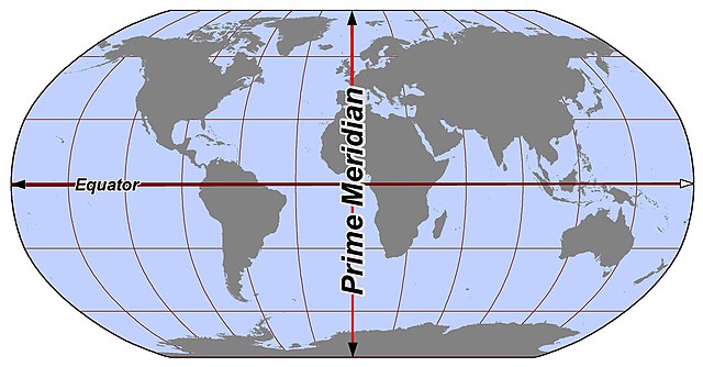
A prime meridian is an arbitrarily-chosen meridian in a geographic coordinate system at which longitude is defined to be 0°. Together, a prime meridian and its anti-meridian form a great circle. This great circle divides a spheroid, like Earth, into two hemispheres: the Eastern Hemisphere and the Western Hemisphere. For Earth's prime meridian, various conventions have been used or advocated in different regions throughout history. Earth's current international standard prime meridian is the IERS Reference Meridian. It is derived, but differs slightly, from the Greenwich Meridian, the previous standard.
Gerardus Mercator in his Atlas Cosmographicae (1595) used a prime meridian somewhere close to 25°W, passing just to the west of Santa Maria Island in the Azores in the Atlantic Ocean. His 180th meridian runs along the Strait of Anián (Bering Strait)
The line of the Greenwich meridian at the Royal Observatory, Greenwich
In geography and geodesy, a meridian is the locus connecting points of equal longitude, which is the angle east or west of a given prime meridian. In other words, it is a line of longitude. The position of a point along the meridian is given by that longitude and its latitude, measured in angular degrees north or south of the Equator. On a Mercator projection or on a Gall-Peters projection, each meridian is perpendicular to all circles of latitude. A meridian is half of a great circle on Earth's surface. The length of a meridian on a modern ellipsoid model of Earth has been estimated as 20,003.93 km (12,429.87 mi).
Meridians run between the North and South poles.
The astronomic prime meridian at Greenwich, England. The geodetic prime meridian is actually 102.478 meters east of this point since the adoption of WGS84.


