Protected areas of Nicaragua
The protected areas of Nicaragua are areas that have natural beauty or significance and are protected by Nicaragua. Nicaragua has 78 protected areas that cover 22,422 km2, about 17.3% of the nations landmass. The National System of Protected Areas (SINAP) is administered by the Ministry of the Environment and Natural Resources (MARENA).
Mombacho Volcano Natural Reserve
Vista of Tiscapa Lagoon and the capital city, Managua
Salto Eatanzuela (Estanzuela waterfall), located in the Tisey Estanzuela Natural Reserve in Estelí
A river along the Los Guatuzos Wildlife Refuge
Nicaragua, officially the Republic of Nicaragua, is the geographically largest country in Central America, comprising 130,370 km2 (50,340 sq mi). With a population of 6,850,540 as of 2021, it is the third-most populous country in Central America after Guatemala and Honduras. Nicaragua is bordered by Honduras to the north, the Caribbean Sea to the east, Costa Rica to the south, and the Pacific Ocean and a shared maritime border with El Salvador to the west. The country's largest city and national capital is Managua, the fourth-largest city in Central America with a population of 1,055,247 as of 2020. Nicaragua's multiethnic population includes people of mestizo, indigenous, European, and African heritage. The country's most spoken language is Spanish, though indigenous tribes on the Mosquito Coast speak their own languages and English.
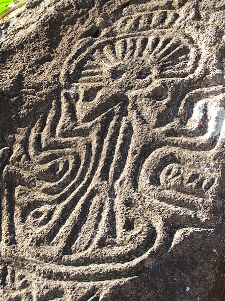
An ancient petroglyph on Ometepe Island
The Colonial city of León
The colonial city of Granada near Lake Nicaragua, one of the most visited sites in Central America
A portrait of the Battle of San Jacinto during the Filibuster War