Radcliffe, Greater Manchester
Videos
Page
Radcliffe is a market town in the Metropolitan Borough of Bury, Greater Manchester, England. It lies in the Irwell Valley 7 miles (11 km) northwest of Manchester and 3 miles (5 km) southwest of Bury and is contiguous with Whitefield to the south. The disused Manchester Bolton & Bury Canal bisects the town.

A prominent landmark, St Thomas and St John with St Philip Church
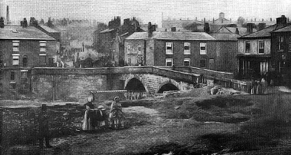
The earliest known photograph of Radcliffe Bridge district, taken by William Smith in 1854. The belfry of the original St Thomas' Church is visible on the horizon.
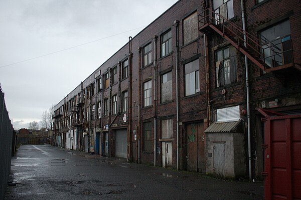
Pioneer Mill, at the end of Milltown Street in Radcliffe. The building was the last in the town to use cotton.

Following the Industrial Revolution the River Irwell was badly polluted by industry, such as that pictured in this photograph of Radcliffe taken in 1902.
Metropolitan Borough of Bury
Videos
Page
The Metropolitan Borough of Bury is a metropolitan borough of Greater Manchester in England. It is north of Manchester, to the east of Bolton and west of Rochdale. The borough is centred around the town of Bury but also includes other towns such as Ramsbottom, Tottington, Radcliffe, Whitefield and Prestwich. Bury bounds the Lancashire districts of Rossendale and Blackburn with Darwen to the north. With a population of 194,606 in 2022, it is the smallest borough in Greater Manchester.
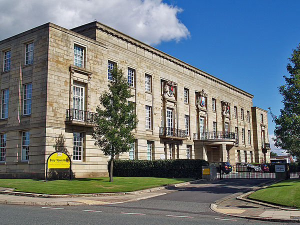
Bury Town Hall, the seat of Bury Council

Ruckriem's "Standing Stones" sculpture at Outwood

Parish Church of St. Mary the Virgin, Prestwich