Radius of maximum wind
Videos
Page
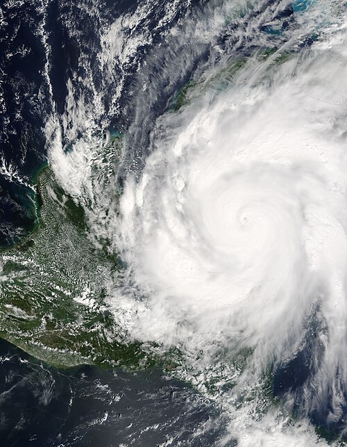
The radius of maximum wind (RMW) is the distance between the center of a cyclone and its band of strongest winds. It is a parameter in atmospheric dynamics and tropical cyclone forecasting. The highest rainfall rates occur near the RMW of tropical cyclones. The extent of a cyclone's storm surge and its maximum potential intensity can be determined using the RMW. As maximum sustained winds increase, the RMW decreases. Recently, RMW has been used in descriptions of tornadoes. When designing buildings to prevent against failure from atmospheric pressure change, RMW can be used in the calculations.

The radius of maximum wind of a tropical cyclone lies just within the eyewall of an intense tropical cyclone, such as Hurricane Isabel from 2003
Eye (cyclone)
Videos
Page
The eye is a region of mostly calm weather at the center of a tropical cyclone. The eye of a storm is a roughly circular area, typically 30–65 kilometers in diameter. It is surrounded by the eyewall, a ring of towering thunderstorms where the most severe weather and highest winds of the cyclone occur. The cyclone's lowest barometric pressure occurs in the eye and can be as much as 15 percent lower than the pressure outside the storm.

Hurricane Florence, seen from the International Space Station, showing a well-defined eye at the center of the storm
Hurricane Wilma with a pinhole eye

Detail of Hurricane Isabel's eye, as viewed from the International Space Station

The eye of Hurricane Katrina viewed from a hurricane hunter aircraft