The Rangitoto Channel is an area of the Hauraki Gulf in the Auckland Region of New Zealand's North Island. The channel is north-east of the Waitematā Harbour, and is located between the North Shore and Rangitoto Island. The channel's traditional Ngāi Tai name is Te Awanui o Peretū, and is an important deep water shipping channel to reach the Ports of Auckland.
The Rangitoto Channel, looking west towards the North Shore from Rangitoto Island.
The Rangitoto Lighthouse is located along the Rangitoto Channel
Satellite view of Rangitoto Channel
View of Rangitoto Island from Milford Beach
The Hauraki Gulf / Tīkapa Moana is a coastal feature of the North Island of New Zealand. It has an area of 4000 km2, and lies between, in anticlockwise order, the Auckland Region, the Hauraki Plains, the Coromandel Peninsula, and Great Barrier Island. Most of the gulf is part of the Hauraki Gulf Marine Park.
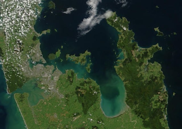
True-colour image showing the Hauraki Gulf / Tīkapa Moana, with Auckland (left) and the Coromandel Peninsula (right), by NASA's Terra satellite, 2002.
Sunset view of The Noises viewed from Waiheke Island
Farmland and native bush on Ponui Island
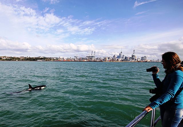
An orca swims in Waitematā Harbour, with Auckland CBD in the background.