Rangpo
Videos
Page
Rangpo is a Municipal town in Pakyong district in the Indian state of Sikkim. The town borders West Bengal's Kalimpong district and is situated along the Teesta river and Rangpo River. It is the first town of Sikkim lying on National Highway 10 that links Siliguri to Gangtok. It is about 300 m above sea level with a sub-tropical climate. It is the 'Gateway to Sikkim' and all vehicles entering Sikkim have to stop at the Rangpo Police check-post. Foreign tourists require documents to enter Sikkim state and have to show them at the police check post.
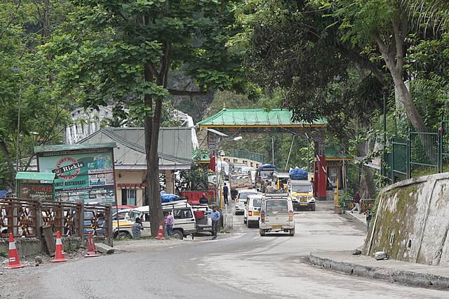
Rangpo Police Checkpoint, Sikkim

Indian Oil Petrol Pump at Rangpo, Pakyong District Sikkim
Pakyong district
Videos
Page
Pakyong district is a district in the Indian state of Sikkim, administered from Pakyong. The district was formed in 2021 from three former subdivisions of the East Sikkim district, viz., Pakyong Subdivision, Rangpo Subdivision and Rongli Subdivision. The remaining Gangtok Subdivision of the former district was named as the Gangtok district, which now bounds the Pakyong district in the northwest. In addition, the district is now bounded by the Kalimpong district of West Bengal, Bhutan, China and the Namchi district of Sikkim.

Mt. Kangchenjunga view from Thambi View Point, Dzuluk, Pakyong District Sikkim.

Nathang Valley Pakyong District Sikkim

Snow on Sikkim Silk Route, Pakyong District Sikkim

National Highway 717B (India) switchbacks at Zuluk, Pakyong District Sikkim