Rapid intensification (RI) is any process wherein a tropical cyclone strengthens dramatically in a short period of time. Tropical cyclone forecasting agencies utilize differing thresholds for designating rapid intensification events, though the most widely used definition stipulates an increase in the maximum sustained winds of a tropical cyclone of at least 30 knots in a 24-hour period. However, periods of rapid intensification often last longer than a day. About 20–30% of all tropical cyclones undergo rapid intensification, including a majority of tropical cyclones with peak wind speeds exceeding 51 m/s.
Cyclone Marcus was an instance in which operational intensity forecasts successfully predicted rapid intensification with the aid of RI forecast aids.
A tropical cyclone is a rapidly rotating storm system with a low-pressure center, a closed low-level atmospheric circulation, strong winds, and a spiral arrangement of thunderstorms that produce heavy rain and squalls. Depending on its location and strength, a tropical cyclone is called a hurricane, typhoon, tropical storm, cyclonic storm, tropical depression, or simply cyclone. A hurricane is a strong tropical cyclone that occurs in the Atlantic Ocean or northeastern Pacific Ocean, and a typhoon occurs in the northwestern Pacific Ocean. In the Indian Ocean and South Pacific, comparable storms are referred to as "tropical cyclones". In modern times, on average around 80 to 90 named tropical cyclones form each year around the world, over half of which develop hurricane-force winds of 65 kn or more. Tropical cyclones carry heat away from the tropics and transport it towards temperate latitudes. This plays an important role in regulating global climate. Tropical cyclones can be very harmful for people.
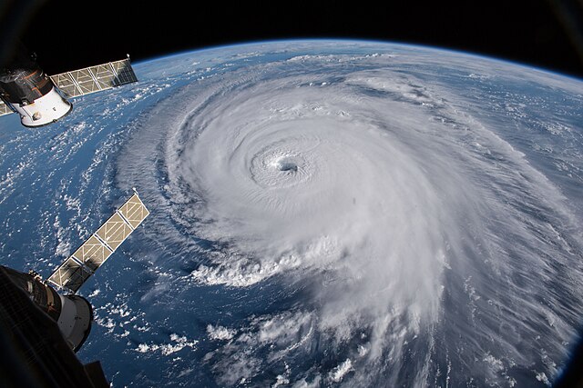
Example of tropical cyclone Hurricane Florence in 2018 as viewed from space: The eye, eyewall, and surrounding rainbands are characteristics of tropical cyclones.
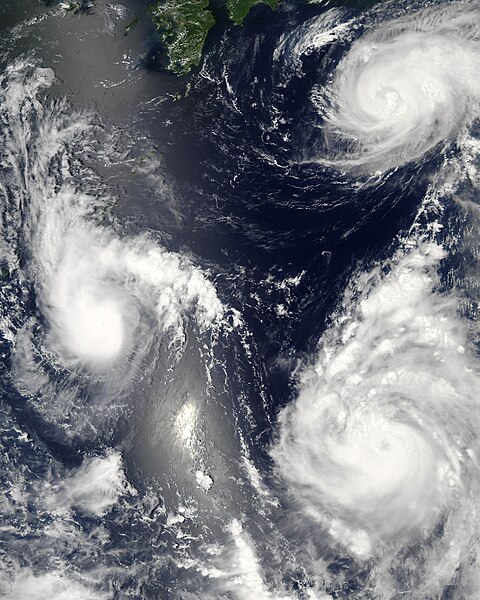
Three tropical cyclones of the 2006 Pacific typhoon season at different stages of development. The weakest (left) demonstrates only the most basic circular shape. A stronger storm (top right) demonstrates spiral banding and increased centralization, while the strongest (lower right) has developed an eye.
The eye and surrounding clouds of 2018 Hurricane Florence as seen from the International Space Station
Aftermath of Hurricane Ike in Bolivar Peninsula, Texas