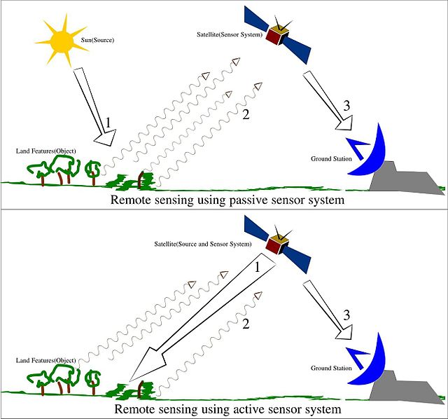
Remote sensing is the acquisition of information about an object or phenomenon without making physical contact with the object, in contrast to in situ or on-site observation. The term is applied especially to acquiring information about Earth and other planets. Remote sensing is used in numerous fields, including geophysics, geography, land surveying and most Earth science disciplines. It also has military, intelligence, commercial, economic, planning, and humanitarian applications, among others.
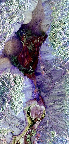
Synthetic aperture radar image of Death Valley colored using polarimetry
Illustration of remote sensing
The TR-1 reconnaissance/surveillance aircraft
The 2001 Mars Odyssey used spectrometers and imagers to hunt for evidence of past or present water and volcanic activity on Mars.
In situ is a Latin phrase that translates literally to "on site" or "in position." It can mean "locally", "on site", "on the premises", or "in place" to describe where an event takes place and is used in many different contexts. For example, in fields such as physics, geology, chemistry, or biology, in situ may describe the way a measurement is taken, that is, in the same place the phenomenon is occurring without isolating it from other systems or altering the original conditions of the test. The opposite of in situ is ex situ.
Ancient Hohokam arrowhead in situ.
Live sea snail, species Nataea, photographed in situ