Ridgewood Park (baseball ground)
Ridgewood Park, also known as Wallace's Ridgewood Park or the Wallace Grounds, and frequently confused with Grauer's Ridgewood Park, was a baseball ground in Ridgewood, Queens, New York. Both Wallace's and Grauer's are shown in Belcher Hyde's Map of Newtown in 1915. The baseball field was part of a larger entertainment area bounded Wyckoff Avenue, Covert Street, Halsey Street, and Irving Avenue. The baseball field was southwest of the Long Island Rail Road's Montauk Branch tracks. Eldert Street, although depicted on the map as running through the baseball grounds, was not cut through southwest of the railroad tracks and the road remains interrupted there today. Originally the park was in Queens County, before its incorporation into New York City in 1899. This facilitated Sunday baseball playing, including the charging of admission, beyond the reach of Sabbath enforcers from the then-city of Brooklyn.
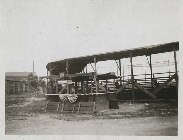
Ridgewood Park Grandstand, 1922
Ridgewood is a neighborhood in the New York City borough of Queens. It borders the Queens neighborhoods of Maspeth to the north, Middle Village to the east, and Glendale to the southeast, as well as the Brooklyn neighborhoods of Bushwick to the southwest and East Williamsburg to the west. Historically, the neighborhood straddled the Queens-Brooklyn boundary.
Myrtle Avenue's Business Improvement District runs from Wyckoff Avenue to Fresh Pond Road in Ridgewood where the elevated Bay Ridge Branch of the LIRR crosses over Myrtle Avenue and serves as a border between Ridgewood and the neighboring "lower" portion of Glendale.
One of the rowhouse developments in Ridgewood, preserved as part of the Stockholm–DeKalb–Hart Historic District
Our Lady of the Miraculous Medal Church
A typical block in Ridgewood