A rift valley is a linear shaped lowland between several highlands or mountain ranges produced by the action of a geologic rift. Rifts are formed as a result of the pulling apart of the lithosphere due to extensional tectonics. The linear depression may subsequently be further deepened by the forces of erosion. More generally the valley is likely to be filled with sedimentary deposits derived from the rift flanks and the surrounding areas. In many cases rift lakes are formed. One of the best known examples of this process is the East African Rift. On Earth, rifts can occur at all elevations, from the sea floor to plateaus and mountain ranges in continental crust or in oceanic crust. They are often associated with a number of adjoining subsidiary or co-extensive valleys, which are typically considered part of the principal rift valley geologically.
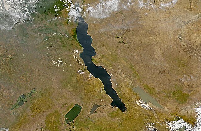
African Rift Valley. From left to right: Lake Upemba, Lake Mweru, Lake Tanganyika (largest), and Lake Rukwa.
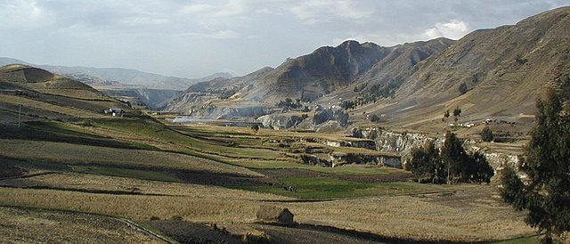
A rift valley near Quilotoa, Ecuador.
Þingvallavatn
In geology, a rift is a linear zone where the lithosphere is being pulled apart and is an example of extensional tectonics. Typical rift features are a central linear downfaulted depression, called a graben, or more commonly a half-graben with normal faulting and rift-flank uplifts mainly on one side. Where rifts remain above sea level they form a rift valley, which may be filled by water forming a rift lake. The axis of the rift area may contain volcanic rocks, and active volcanism is a part of many, but not all, active rift systems.
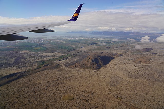
Volcano-tectonic landforms connected to rifting on Reykjanes Peninsula, Iceland: faults, fissures, elongated volcanoes of subglacial origin, postglacial lava fields