1.
Monnow Bridge
–
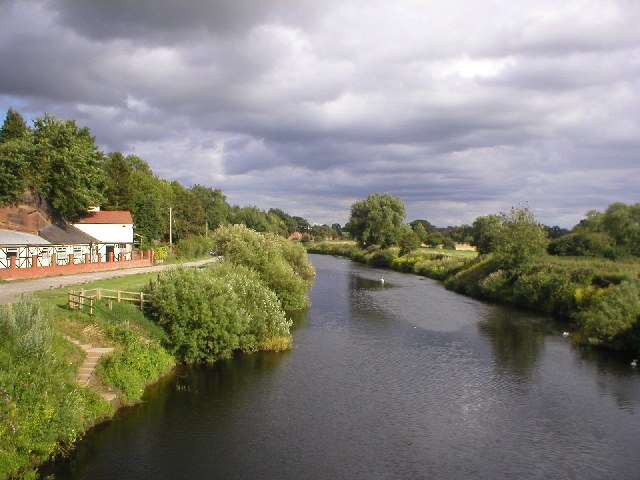
Monnow Bridge in Monmouth, Wales, crosses the River Monnow some 500m above its confluence with the River Wye. It is the remaining fortified river bridge in Great Britain with its gate tower standing on the bridge. The historical and architectural importance of the bridge, and its rarity, are reflected in its status as a Scheduled Monument, begun, according to tradition, in 1272, the stone bridge replaced a 12th-century Norman timber bridge. From its construction, it played a significant, if ineffectual, role in the defence of Monmouth, in the era, in the English Civil War. It also served as a gaol, a store, a lodge, an advertising hoarding. Much of the development of the town of Monmouth was funded by the taxes. The tolls were collected through control of the points of entry to the town, built predominantly of Old Red Sandstone, the bridge was the subject of significant reconstruction and rebuilding in the 18th and 19th centuries. In those centuries, it became a popular subject for artists, amongst others, Turner, Gastineau and Cotman produced sketches of the bridge. In the 20th century, it suffered increasing damage as higher volumes of traffic, in the 21st century, the construction of a new road crossing to the south enabled the pedestrianisation of the bridge. The existing bridge was completed in the late 13th century, traditionally in 1272 though this date has no supporting documentary evidence, heath drew directly from the earlier guide to The Antiquities of England and Wales written by Francis Grose and published in 1773. However, this is unlikely as the gatehouse did not come into the possession of the Somersets until the 19th century, the stone bridge replaced an earlier wooden structure. In 1297 Edward I provided a grant in favour of Monmouth. A murage was a tax, granted specifically to allow for the raising of funds to construct, or repair. The grant allowed the townspeople to build the walls and gates. By 1315, this work was incomplete or required repair. At that time, the bridge would have much narrower than now, with all traffic passing beneath a portcullis – the grooves for the lowering of which are still visible –. The prominent arched machicolations were added at a date in the mediaeval period. The gate formed part of the circuit of walls/urban defences encircling Monmouth, kissack contends that the gate house was ineffective in defensive terms, as the Monnow could easily be crossed on foot just upstream
2.
Monmouth
–
Monmouth is a traditional county town in Monmouthshire, Wales. It is situated where the River Monnow meets the River Wye, the town is 30 miles northeast of Cardiff, and 113 miles west of London. It is within the Monmouthshire local authority, and the constituency of Monmouth. According to the 2001 census, its population was 8,877, the town was the site of a small Roman fort, Blestium, and became established after the Normans built a castle here after 1067. Its mediaeval stone gated bridge is the one of its type remaining in Britain. The castle later came into the possession of the House of Lancaster, in 1536, it became the county town of Monmouthshire. Monmouth later became a tourist centre at the heart of the Wye Valley and it now acts as a shopping and service centre, and as a focus of educational and cultural activities for its surrounding rural area. The name Monmouth is an English contraction of Monnow-mouth, the Welsh name for the river, Mynwy, which may originally have meant fast-flowing, was anglicised as Monnow. The town was known in Welsh as Abermynwy, replaced by Trefynwy by the 1600s. Excavations undertaken by the Monmouth Archaeological Society on sites along Monnow Street have uncovered a wealth of information about the history of the town. Indeed, the Council for British Archaeology have designated Monmouth as one of the top ten towns in Britain for archaeology, the excavations later revealed the remains of a Neolithic crannog. The dwelling was constructed on stilts on an island away from the lake shore in water up to 10 feet deep. Timbers from the structure were dated to 4867 years before present. The first recorded settlement at Monmouth was the small Roman fort of Blestium and this was connected by road to the larger Roman towns at Glevum and Isca Augusta. Archaeologists have found Roman pottery and coins within the town centre. After the end of Roman rule in Britain, the area was at the edge of the Welsh kingdom of Ergyng. The only evidence of continuing settlement at Monmouth is a record of a 7th-century church, at a location within the town. Initially it would have been a motte and bailey castle, later rebuilt in stone, and refortified and developed over time
3.
Wales
–
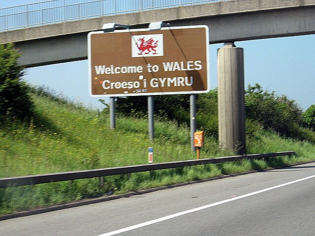
Wales is a country that is part of the United Kingdom and the island of Great Britain. It is bordered by England to the east, the Irish Sea to the north and west, and it had a population in 2011 of 3,063,456 and has a total area of 20,779 km2. Wales has over 1,680 miles of coastline and is mountainous, with its higher peaks in the north and central areas, including Snowdon. The country lies within the temperate zone and has a changeable. Welsh national identity emerged among the Celtic Britons after the Roman withdrawal from Britain in the 5th century, Llywelyn ap Gruffudds death in 1282 marked the completion of Edward I of Englands conquest of Wales, though Owain Glyndŵr briefly restored independence to Wales in the early 15th century. The whole of Wales was annexed by England and incorporated within the English legal system under the Laws in Wales Acts 1535–1542, distinctive Welsh politics developed in the 19th century. Welsh Liberalism, exemplified in the early 20th century by Lloyd George, was displaced by the growth of socialism, Welsh national feeling grew over the century, Plaid Cymru was formed in 1925 and the Welsh Language Society in 1962. Established under the Government of Wales Act 1998, the National Assembly for Wales holds responsibility for a range of devolved policy matters, two-thirds of the population live in south Wales, mainly in and around Cardiff, Swansea and Newport, and in the nearby valleys. Now that the countrys traditional extractive and heavy industries have gone or are in decline, Wales economy depends on the sector, light and service industries. Wales 2010 gross value added was £45.5 billion, over 560,000 Welsh language speakers live in Wales, and the language is spoken by a majority of the population in parts of the north and west. From the late 19th century onwards, Wales acquired its popular image as the land of song, Rugby union is seen as a symbol of Welsh identity and an expression of national consciousness. The Old English-speaking Anglo-Saxons came to use the term Wælisc when referring to the Celtic Britons in particular, the modern names for some Continental European lands and peoples have a similar etymology. The modern Welsh name for themselves is Cymry, and Cymru is the Welsh name for Wales and these words are descended from the Brythonic word combrogi, meaning fellow-countrymen. The use of the word Cymry as a self-designation derives from the location in the post-Roman Era of the Welsh people in modern Wales as well as in northern England and southern Scotland. It emphasised that the Welsh in modern Wales and in the Hen Ogledd were one people, in particular, the term was not applied to the Cornish or the Breton peoples, who are of similar heritage, culture, and language to the Welsh. The word came into use as a self-description probably before the 7th century and it is attested in a praise poem to Cadwallon ap Cadfan c. 633. Thereafter Cymry prevailed as a reference to the Welsh, until c.1560 the word was spelt Kymry or Cymry, regardless of whether it referred to the people or their homeland. The Latinised forms of names, Cambrian, Cambric and Cambria, survive as lesser-used alternative names for Wales, Welsh
4.
England
–
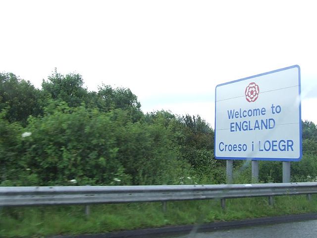
England is a country that is part of the United Kingdom. It shares land borders with Scotland to the north and Wales to the west, the Irish Sea lies northwest of England and the Celtic Sea lies to the southwest. England is separated from continental Europe by the North Sea to the east, the country covers five-eighths of the island of Great Britain in its centre and south, and includes over 100 smaller islands such as the Isles of Scilly, and the Isle of Wight. England became a state in the 10th century, and since the Age of Discovery. The Industrial Revolution began in 18th-century England, transforming its society into the worlds first industrialised nation, Englands terrain mostly comprises low hills and plains, especially in central and southern England. However, there are uplands in the north and in the southwest, the capital is London, which is the largest metropolitan area in both the United Kingdom and the European Union. In 1801, Great Britain was united with the Kingdom of Ireland through another Act of Union to become the United Kingdom of Great Britain and Ireland. In 1922 the Irish Free State seceded from the United Kingdom, leading to the latter being renamed the United Kingdom of Great Britain, the name England is derived from the Old English name Englaland, which means land of the Angles. The Angles were one of the Germanic tribes that settled in Great Britain during the Early Middle Ages, the Angles came from the Angeln peninsula in the Bay of Kiel area of the Baltic Sea. The earliest recorded use of the term, as Engla londe, is in the ninth century translation into Old English of Bedes Ecclesiastical History of the English People. According to the Oxford English Dictionary, its spelling was first used in 1538. The earliest attested reference to the Angles occurs in the 1st-century work by Tacitus, Germania, the etymology of the tribal name itself is disputed by scholars, it has been suggested that it derives from the shape of the Angeln peninsula, an angular shape. An alternative name for England is Albion, the name Albion originally referred to the entire island of Great Britain. The nominally earliest record of the name appears in the Aristotelian Corpus, specifically the 4th century BC De Mundo, in it are two very large islands called Britannia, these are Albion and Ierne. But modern scholarly consensus ascribes De Mundo not to Aristotle but to Pseudo-Aristotle, the word Albion or insula Albionum has two possible origins. Albion is now applied to England in a poetic capacity. Another romantic name for England is Loegria, related to the Welsh word for England, Lloegr, the earliest known evidence of human presence in the area now known as England was that of Homo antecessor, dating to approximately 780,000 years ago. The oldest proto-human bones discovered in England date from 500,000 years ago, Modern humans are known to have inhabited the area during the Upper Paleolithic period, though permanent settlements were only established within the last 6,000 years
5.
Herefordshire
–
Herefordshire is a historic English county in the West Midlands. It is a county and a unitary non-metropolitan county and district, also named in legislation as the County of Herefordshire. The Welsh unitary county covering the part of Gwent next to Herefordshire is Monmouthshire, Hereford is a cathedral city and is the county town, with a population of approximately 55,800 inhabitants it is also the largest settlement. The county is one of the most rural and sparsely populated in England, the land use is predominantly agricultural and the county is well known for its fruit and cider production, and the Hereford cattle breed. From 1974 to 1998, Herefordshire was part of the former county of Hereford. Herefordshire was reconstituted both as a new district and as a new county by Statutory Instrument as defined in The Hereford and this Order established Herefordshire as a unitary authority on 1 April 1998, combining county and district functions into a single council. Herefordshire is also called a unitary district, but this is not official nomenclature. Herefordshire is officially known as an authority for local government purposes. The Lieutenancies Act 1997 made Herefordshire a ceremonial county, covering the area of the unitary district. For Eurostat purposes it is a NUTS3 region and is one of three counties that comprise the Herefordshire, Worcestershire and Warwickshire NUTS2 region. The River Wye, which at 135 miles is the fifth-longest in the United Kingdom and it flows through both Hereford and Ross-on-Wye before returning to Wales. Leominster is situated on the River Lugg, a tributary of the Wye, there are two Areas of Outstanding Natural Beauty in the county. The Wye Valley is located in the valleys south of Hereford, while the Malvern Hills are in the east of the county. Herefordshire is one of the 39 historic counties of England, in 1974 it was merged with neighbouring Worcestershire to form the Hereford and Worcester administrative county. Within this, Herefordshire was covered by the government districts of South Herefordshire, Hereford. However, the county was dissolved in 1998, resulting in the return of Herefordshire and Worcestershire as counties, the current ceremonial county and unitary district have broadly the same borders as the pre-1974 historic county. However this has been from a base, with only Northumberland. The population is White 98. 2%, Asian 0. 8%, Mixed 0. 7%, Black 0. 2%, gypsies and Travellers have historically been Herefordshires largest minority ethnic group
6.
Confluence
–
In geography, a confluence is the meeting of two or more bodies of water. The term is used to describe the meeting of tidal or other non-riverine bodies of water. A one-mile portion of the Industrial Canal in New Orleans accommodates the Gulf Intracoastal Waterway, niagara-on-the-Lake, Ontario, Canada is at the confluence of the Niagara River and Lake Ontario. The junction of the Green River and Colorado River forms the heart of Canyonlands National Park in Utahs Canyon Country, the Sangam, near Allahabad, India, where the sacred rivers Ganges and Yamuna meet to create one of the holiest places in Hinduism. The Ohio River is formed by the confluence of the Monongahela and Allegheny rivers, located in Pittsburgh, the Madison, Jefferson and Gallatin Rivers in Three Forks, Montana form the confluence of the Missouri River, one of the longest rivers in the United States. Kuala Lumpur, the capital of Malaysia, is at the confluence of the Gombak River and the Klang River. Passau known also as the Dreiflüssestadt, because the Danube River is joined there by the Inn River from the South, manaus, Brazil is on the Rio Negro near its confluence with the Amazon. It is the port and a hub for the regions extensive river system. Osijek, Croatia, is on the bank of the river Drava 25 km upstream of its confluence with the Danube. Belgrade, the capital of Serbia lies at the confluence of the Sava, the Hochelaga Archipelago, including the island and city of Montreal, is located at the confluence of the St. Lawrence River and Ottawa River in Quebec, Canada. Winnipeg, Canada, is at the confluence of the Red River, the area is referred to as The Forks by locals, and has been an important trade location for over 6000 years. The confluence of the rivers Danube and Morava in Devín on the border between Slovakia and Austria, triangle of Three Emperors, former tripoint in Europe. Cairo, Illinois, in the United States, where the Ohio River flows into the Mississippi River, St. Louis, Missouri, is built just south of the confluence of the Mississippi River and the Missouri River. Lyon, France is located on the confluence of the Saône and Rhone rivers, lytton, British Columbia, Canada, is located at the confluence of the muddy Fraser River and the clearer Thompson River. The confluence between the Franklin River and Gordon River in south-western Tasmania The confluence of the Snake and Columbia River at the Tri-Cities of Washington, the confluence of the rivers Pivka and Rak is one of the largest subterranean confluences in Europe. The confluence at Lokoja, Nigeria, where the Niger and Benue rivers merge, the Sudanese capital of Khartoum, located at the confluence of the White Nile and the Blue Nile. This merging point is the beginning of the Nile, columbus, Ohio, in the United States is at the confluence of the Scioto and Olentangy rivers. Luang Prabang in Laos is at the confluence of the Mekong, River Kabul and River Swat at Attock, in Pakistan
7.
River Wye
–
The River Wye is the fifth-longest river in the UK, stretching some 215 kilometres from its source on Plynlimon in mid Wales to the Severn estuary. For much of its length the river forms part of the border between England and Wales, the Wye Valley is an Area of Outstanding Natural Beauty. The Wye is important for conservation and recreation. The Wyes Latin name is Vaga, an adjective meaning wandering, the Tithe map references a Vagas Field in both Whitchurch and Chepstow. The modern Welsh name Gwy may be derived from old Welsh Gwybiol or Gwyr, the source of the Wye is in the Welsh mountains at Plynlimon. Its total length is 134 miles, the lower 16 miles of the river from Redbrook to Chepstow forms the border between England and Wales. The River Wye forms two Sites of Special Scientific Interest, one covering the Upper Wye above Hay-on-Wye, and one covering the Lower Wye downstream to Chepstow. The criteria for inclusion of the river as an SSSI include geology, topography, flora, mammals, invertebrates, fish and birdlife, as the river, the Wye abuts a range of other SSSIs in England and Wales, including the Upper Wye Gorge and Lower Wye Gorge. It is also a Special Area of Conservation and one of the most important rivers in the UK for nature conservation and it is an important migration route and wildlife corridor, as well as a key breeding area for many nationally and internationally important species. The river supports a range of species and habitats covered by European Directives, in Powys the river lies within the Radnorshire Environmentally Sensitive Area. Much of the valley is an Area of Outstanding Natural Beauty. The Lower Wye has been designated as a salmonid fishery under the EC Freshwater Fish Directive, the Wye is largely unpolluted and used to be considered one of the best rivers for salmon fishing in the United Kingdom, outside Scotland. In the 1980s and 1990s salmon in the Wye declined dramatically, in 1967 the Wye rod catch was 7,864, and as recently as 1988 it was 6,401, but by 2002 it was only 357. It is now recovering from this low in response to the extensive habitat improvement work carried out by the Wye and Usk Foundation, set up to restore the spring salmon runs. In 2015 the five-year average once again climbed above 1,000 and it is now the third best salmon river in England and Wales, surpassed only by the Tyne and Wear. The Wye was particularly famous for its large spring salmon that had spent three or more years at sea returning to spawn. The last recorded 50 lb rod-caught salmon from the Wye was taken in 1963 by Donald Parrish, since the early 2000s the spring catch has been steadily recovering and salmon of over 35 lb have been reported every year since 2011. The Romans constructed a bridge of wood and stone just upstream of present-day Chepstow, the River Wye was and still is navigable up to Monmouth at least since the early 14th century
8.
Black Mountains, Wales
–
The Black Mountains are a group of hills spread across parts of Powys and Monmouthshire in southeast Wales, and extending across the England–Wales border into Herefordshire. They are the easternmost of the four ranges of hills that comprise the Brecon Beacons National Park, and are confused with the westernmost. Other gateway towns to the Black Mountains include Talgarth and Crickhowell, the range of hills is well known to walkers and ramblers for the ease of access and views from the many ridge trails, such as that on the Black Hill at the eastern edge of the massif. The latter is now recognised in Pen y Gader-fawr and Gader Fawr, cadair, mutated to gadair and anglicised as gader, means seat or chair in Welsh. The highest mountain in the group is Waun Fach whose heavily eroded peat summit plateau attains a height of 811 metres, outlying summits, all of which are classed as Marilyns, include the Sugar Loaf, Mynydd Troed and Mynydd Llangorse. The lower and separate hills of Allt yr Esgair, Myarth, Bryn Arw, in his work People of the Black Mountains, Raymond Williams described the Black Mountains thus, See this layered sandstone in the short mountain grass. Place your right hand on it, palm downward, See where the summer sun rises and where it stands at noon. Direct your index finger midway between them and you now hold this place in your hand. The six rivers rise in the plateau towards your wrist, the first river, now called Mynwy, flows at the outside edge of your thumb. The second river, now called Olchon, flows between your thumb and the first finger, to join the Mynwy at the top of your thumb, the third river, now called Honddu, flows between your first and second fingers and then curves to join the Mynwy. The sixth river, now called Rhiangoll, flows at the edge of your outside finger and this is the hand of the Black Mountains, the shape first learned. Your thumb is Crib y Gath and your first finger is Curum and Hateral. Your second finger is Ffawyddog, with Tal y Cefn and Bal Mawr at its knuckles and your third finger is Gadair Fawr. Your outside finger is Allt Mawr, from Llysiau to Cerrig Calch, on the high plateau of the back of your hand are Twyn y Llech and Twmpa, Rhos Dirion, Waun Fach and Y Das. You hold their shapes and their names, the Black Mountains are composed almost exclusively of rocks assigned to the Old Red Sandstone and dating from the Devonian period. This thick sedimentary sequence comprises sandstones, mudstones, siltstones and numerous thin limestones, the exception is the summit area of Pen Cerrig-calch where a thin sequence of Carboniferous rocks occur, an outlier of the more extensive outcrop to the south of the Usk valley. The lower slopes of hills are formed from the mudstone-rich St Maughans beds at the top of which lies a calcrete - a discontinuous limestone band known as the Ffynnon Limestone. Above this are the sandstone-dominated Senni Beds which form the upper reaches of much of the range, higher again are the Brownstones which form the summit areas of the central and southern parts of the range
9.
Tributary
–
A tributary or affluent is a stream or river that flows into a larger stream or main stem river or a lake. A tributary does not flow directly into a sea or ocean, tributaries and the main stem river drain the surrounding drainage basin of its surface water and groundwater, leading the water out into an ocean. A confluence, where two or more bodies of water together, usually refers to the joining of tributaries. The opposite to a tributary is a distributary, a river or stream that branches off from, distributaries are most often found in river deltas. Right tributary and left tributary are terms stating the orientation of the relative to the flow of the main stem river. These terms are defined from the perspective of looking downstream, where tributaries have the same name as the river into which they feed, they are called forks. These are typically designated by compass direction, for example, the American River receives flow from its North, Middle, and South forks. The Chicago Rivers North Branch has the East, West, and Middle Fork, the South Branch has its South Fork, forks are sometimes designated as right or left. Here, the handedness is from the point of view of an observer facing upstream, for instance, Steer Creek has a left tributary which is called Right Fork Steer Creek. Tributaries are sometimes listed starting with those nearest to the source of the river, the Strahler Stream Order examines the arrangement of tributaries in a hierarchy of first, second, third, and higher orders, with the first-order tributary being typically the least in size. For example, a second-order tributary would be the result of two or more first-order tributaries combining to form the second-order tributary, another method is to list tributaries from mouth to source, in the form of a tree structure, stored as a tree data structure
10.
Middle Ages
–
In the history of Europe, the Middle Ages or Medieval Period lasted from the 5th to the 15th century. It began with the fall of the Western Roman Empire and merged into the Renaissance, the Middle Ages is the middle period of the three traditional divisions of Western history, classical antiquity, the medieval period, and the modern period. The medieval period is subdivided into the Early, High. Population decline, counterurbanisation, invasion, and movement of peoples, the large-scale movements of the Migration Period, including various Germanic peoples, formed new kingdoms in what remained of the Western Roman Empire. In the seventh century, North Africa and the Middle East—once part of the Byzantine Empire—came under the rule of the Umayyad Caliphate, although there were substantial changes in society and political structures, the break with classical antiquity was not complete. The still-sizeable Byzantine Empire survived in the east and remained a major power, the empires law code, the Corpus Juris Civilis or Code of Justinian, was rediscovered in Northern Italy in 1070 and became widely admired later in the Middle Ages. In the West, most kingdoms incorporated the few extant Roman institutions, monasteries were founded as campaigns to Christianise pagan Europe continued. The Franks, under the Carolingian dynasty, briefly established the Carolingian Empire during the later 8th, the Crusades, first preached in 1095, were military attempts by Western European Christians to regain control of the Holy Land from Muslims. Kings became the heads of centralised nation states, reducing crime and violence, intellectual life was marked by scholasticism, a philosophy that emphasised joining faith to reason, and by the founding of universities. Controversy, heresy, and the Western Schism within the Catholic Church paralleled the conflict, civil strife. Cultural and technological developments transformed European society, concluding the Late Middle Ages, the Middle Ages is one of the three major periods in the most enduring scheme for analysing European history, classical civilisation, or Antiquity, the Middle Ages, and the Modern Period. Medieval writers divided history into periods such as the Six Ages or the Four Empires, when referring to their own times, they spoke of them as being modern. In the 1330s, the humanist and poet Petrarch referred to pre-Christian times as antiqua, leonardo Bruni was the first historian to use tripartite periodisation in his History of the Florentine People. Bruni and later argued that Italy had recovered since Petrarchs time. The Middle Ages first appears in Latin in 1469 as media tempestas or middle season, in early usage, there were many variants, including medium aevum, or middle age, first recorded in 1604, and media saecula, or middle ages, first recorded in 1625. The alternative term medieval derives from medium aevum, tripartite periodisation became standard after the German 17th-century historian Christoph Cellarius divided history into three periods, Ancient, Medieval, and Modern. The most commonly given starting point for the Middle Ages is 476, for Europe as a whole,1500 is often considered to be the end of the Middle Ages, but there is no universally agreed upon end date. English historians often use the Battle of Bosworth Field in 1485 to mark the end of the period
11.
Medieval fortification
–
During this millennium, fortifications changed warfare, and in turn were modified to suit new tactics, weapons and siege techniques. Towers of medieval castles were usually made of stone or sometimes wood, often toward the later part of the era they included battlements and arrow loops. The tower had a staircase to make it hard for the attackers to fight upward. An exact nature of the walls of a town or city would depend on the resources available for building them, the nature of the terrain. In northern Europe, early in the period, walls were likely to have constructed of wood. Especially where stone was available for building, the wood will have been replaced by stone to a higher or lower standard of security. This would have been the pattern of events in the Five Boroughs of the Danelaw in England, in many cases, the wall would have had an internal and an external pomoerium. This was a strip of ground immediately adjacent the wall. The word is from the medieval, derived from the classical Latin post murum. An external pomoerium, stripped of bushes and building, gave defenders a clear view of what was happening outside, an internal pomoerium gave ready access to the rear of the curtain wall to facilitate movement of the garrison to a point of need. By the end of the century, the word had developed further in common use. By that time too, the walls were no longer secure against a serious threat from an army as they were not designed for resisting cannon shot. They were sometimes rebuilt, as at Berwick on Tweed, or retained for use against thieves, very elaborate and complex schemes for town defences were developed in the Netherlands and France but these belong mainly to the post-medieval periods. However, a few, such as those of Carcassonne and Dubrovnik, Medieval walls that were no longer adequate for defending were succeeded by the star fort. After the invention of the shell, star forts became obsolete as well. Harbours or some sort of access was often essential to the construction of medieval fortification. It was a route for trading and fortification. The concept of rivers or harbours coming directly up to the walls of fortifications was used by the English as they constructed castles throughout Wales