Ross Sea
Videos
Photos
The Ross Sea is a deep bay of the Southern Ocean in Antarctica, between Victoria Land and Marie Byrd Land and within the Ross Embayment, and is the southernmost sea on Earth. It derives its name from the British explorer James Clark Ross who visited this area in 1841. To the west of the sea lies Ross Island and Victoria Land, to the east Roosevelt Island and Edward VII Peninsula in Marie Byrd Land, while the southernmost part is covered by the Ross Ice Shelf, and is about 200 miles (320 km) from the South Pole. Its boundaries and area have been defined by the New Zealand National Institute of Water and Atmospheric Research as having an area of 637,000 square kilometres (246,000 sq mi).

Sea ice in the Ross Sea

Bloom in the Ross Sea, January 2011
Southern Ocean
Videos
Photos
The Southern Ocean, also known as the Antarctic Ocean, comprises the southernmost waters of the world ocean, generally taken to be south of 60° S latitude and encircling Antarctica. With a size of 20,327,000 km2 (7,848,000 sq mi), it is regarded as the second-smallest of the five principal oceanic divisions: smaller than the Pacific, Atlantic, and Indian oceans but larger than the Arctic Ocean.

1928 delineation

1937 delineation

James Weddell's second expedition in 1823, depicting the brig Jane and the cutter Beaufroy
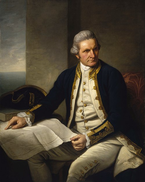
Famous official portrait of Captain James Cook who proved that waters encompassed the southern latitudes of the globe. "He holds his own chart of the Southern Ocean on the table and his right hand points to the east coast of Australia on it."