Roxas Boulevard
Videos
Roxas Boulevard is a popular waterfront promenade in Metro Manila in the Philippines. The boulevard, which runs along the shores of Manila Bay, is well known for its sunsets and stretch of coconut trees. The divided roadway has become a trademark of Philippine tourism, famed for its yacht club, hotels, restaurants, commercial buildings and parks.

The boulevard in 2021
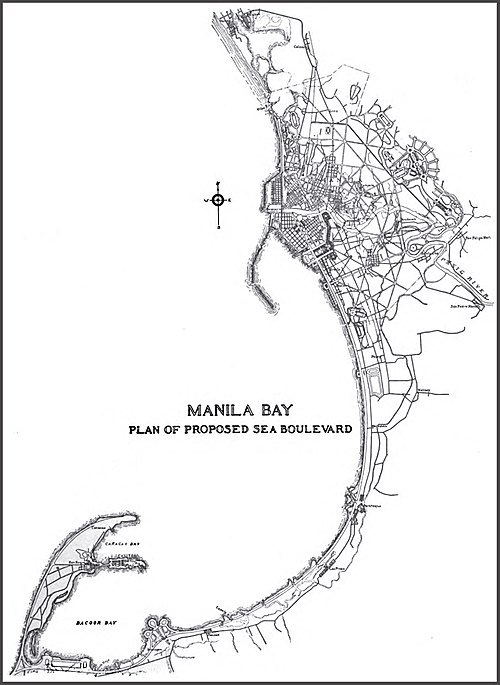
Daniel Burnham's plan of the sea boulevard from Manila to Cavite

Construction of Cavite Boulevard, 1912

Aerial view of Dewey Boulevard, 1931
Manila Bay
Videos
Manila Bay is a natural harbor that serves the Port of Manila, in the Philippines. Strategically located around the capital city of the Philippines, Manila Bay facilitated commerce and trade between the Philippines and its neighboring countries, becoming the gateway for socio-economic development even prior to Spanish occupation. With an area of 1,994 km2 (769.9 sq mi), and a coastline of 190 km (118.1 mi), Manila Bay is situated in the western part of Luzon and is bounded by Cavite and Metro Manila on the east, Bulacan and Pampanga on the north, and Bataan on the west and northwest. Manila Bay drains approximately 17,000 km2 (6,563.7 sq mi) of watershed area, with the Pampanga River contributing about 49% of the freshwater influx. With an average depth of 17 m (55.8 ft), it is estimated to have a total volume of 28.9 billion cubic meters. Entrance to the bay is 19 km (11.8 mi) wide and expands to a width of 48 km (29.8 mi). However, width of the bay varies from 22 km (13.7 mi) at its mouth and expanding to 60 km (37.3 mi) at its widest point.


Sunset at Manila Bay

An egret in a mangrove area along Manila Bay.

Mangrove trees along Manila Bay.