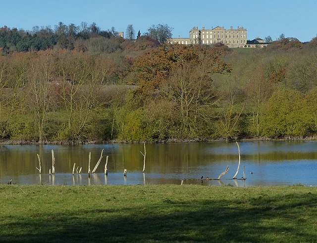
1.
Kingdom of Great Britain
–
The Kingdom of Great Britain, officially Great Britain, was a sovereign state in western Europe from 1 May 1707 to 31 December 1800. It did not include Ireland, which remained a separate realm, the unitary state was governed by a single parliament and government that was based in Westminster. Also after the accession of George I to the throne of Great Britain in 1714, the early years of the unified kingdom were marked by Jacobite risings which ended in defeat for the Stuart cause at Culloden in 1746. On 1 January 1801, the kingdoms of Great Britain and Ireland were merged to form the United Kingdom of Great Britain and Ireland. In 1922, five-sixths of Ireland seceded from the United Kingdom, the name Britain descends from the Latin name for the island of Great Britain, Britannia or Brittānia, the land of the Britons via the Old French Bretaigne and Middle English Bretayne, Breteyne. The term Great Britain was first used officially in 1474, in the instrument drawing up the proposal for a marriage between Edward IV of Englands daughter Cecily and James III of Scotlands son James. The Treaty of Union and the subsequent Acts of Union state that England and Scotland were to be United into one Kingdom by the Name of Great Britain. However, both the Acts and the Treaty also refer numerous times to the United Kingdom and the longer form, other publications refer to the country as the United Kingdom after 1707 as well. The websites of the UK parliament, the Scottish Parliament, the BBC, additionally, the term United Kingdom was found in informal use during the 18th century to describe the state. The new state created in 1707 included the island of Great Britain, the kingdoms of England and Scotland, both in existence from the 9th century, were separate states until 1707. However, they had come into a union in 1603. Each of the three kingdoms maintained its own parliament and laws and this disposition changed dramatically when the Acts of Union 1707 came into force, with a single unified Crown of Great Britain and a single unified parliament. Ireland remained formally separate, with its own parliament, until the Acts of Union 1800, legislative power was vested in the Parliament of Great Britain, which replaced both the Parliament of England and the Parliament of Scotland. In practice it was a continuation of the English parliament, sitting at the location in Westminster. Newly created peers in the Peerage of Great Britain were given the right to sit in the Lords. Despite the end of a parliament for Scotland, it retained its own laws. As a result of Poynings Law of 1495, the Parliament of Ireland was subordinate to the Parliament of England, the Act was repealed by the Repeal of Act for Securing Dependence of Ireland Act 1782. The same year, the Irish constitution of 1782 produced a period of legislative freedom, the 18th century saw England, and after 1707 Great Britain, rise to become the worlds dominant colonial power, with France its main rival on the imperial stage
2.
United Kingdom
–
The United Kingdom of Great Britain and Northern Ireland, commonly known as the United Kingdom or Britain, is a sovereign country in western Europe. Lying off the north-western coast of the European mainland, the United Kingdom includes the island of Great Britain, Northern Ireland is the only part of the United Kingdom that shares a land border with another sovereign state—the Republic of Ireland. The Irish Sea lies between Great Britain and Ireland, with an area of 242,500 square kilometres, the United Kingdom is the 78th-largest sovereign state in the world and the 11th-largest in Europe. It is also the 21st-most populous country, with an estimated 65.1 million inhabitants, together, this makes it the fourth-most densely populated country in the European Union. The United Kingdom is a monarchy with a parliamentary system of governance. The monarch is Queen Elizabeth II, who has reigned since 6 February 1952, other major urban areas in the United Kingdom include the regions of Birmingham, Leeds, Glasgow, Liverpool and Manchester. The United Kingdom consists of four countries—England, Scotland, Wales, the last three have devolved administrations, each with varying powers, based in their capitals, Edinburgh, Cardiff and Belfast, respectively. The relationships among the countries of the UK have changed over time, Wales was annexed by the Kingdom of England under the Laws in Wales Acts 1535 and 1542. A treaty between England and Scotland resulted in 1707 in a unified Kingdom of Great Britain, which merged in 1801 with the Kingdom of Ireland to form the United Kingdom of Great Britain and Ireland. Five-sixths of Ireland seceded from the UK in 1922, leaving the present formulation of the United Kingdom of Great Britain, there are fourteen British Overseas Territories. These are the remnants of the British Empire which, at its height in the 1920s, British influence can be observed in the language, culture and legal systems of many of its former colonies. The United Kingdom is a country and has the worlds fifth-largest economy by nominal GDP. The UK is considered to have an economy and is categorised as very high in the Human Development Index. It was the worlds first industrialised country and the worlds foremost power during the 19th, the UK remains a great power with considerable economic, cultural, military, scientific and political influence internationally. It is a nuclear weapons state and its military expenditure ranks fourth or fifth in the world. The UK has been a permanent member of the United Nations Security Council since its first session in 1946 and it has been a leading member state of the EU and its predecessor, the European Economic Community, since 1973. However, on 23 June 2016, a referendum on the UKs membership of the EU resulted in a decision to leave. The Acts of Union 1800 united the Kingdom of Great Britain, Scotland, Wales and Northern Ireland have devolved self-government
3.
British Army
–
The British Army is the principal land warfare force of the United Kingdom. As of 2017 the British Army comprises just over 80,000 trained Regular, or full-time, personnel and just over 26,500 trained Reserve, or part-time personnel. Therefore, the UK Parliament approves the continued existence of the Army by passing an Armed Forces Act at least once every five years, day to day the Army comes under administration of the Ministry of Defence and is commanded by the Chief of the General Staff. Repeatedly emerging victorious from these decisive wars allowed Britain to influence world events with its policies and establish itself as one of the leading military. In 1660 the English, Scottish and Irish monarchies were restored under Charles II, Charles favoured the foundation of a new army under royal control and began work towards its establishment by August 1660. The Royal Scots Army and the Irish Army were financed by the Parliament of Scotland, the order of seniority of the most senior line regiments in the British Army is based on the order of seniority in the English army. At that time there was only one English regiment of dragoons, after William and Marys accession to the throne, England involved itself in the War of the Grand Alliance, primarily to prevent a French invasion restoring Marys father, James II. Spain, in the two centuries, had been the dominant global power, and the chief threat to Englands early transatlantic ambitions. The territorial ambitions of the French, however, led to the War of the Spanish Succession and the Napoleonic Wars. From the time of the end of the Seven Years War in 1763, Great Britain was the naval power. As had its predecessor, the English Army, the British Army fought the Kingdoms of Spain, France, and the Netherlands for supremacy in North America and the West Indies. With native and provincial assistance, the Army conquered New France in the North American theatre of the Seven Years War, the British Army suffered defeat in the American War of Independence, losing the Thirteen Colonies but holding on to Canada. The British Army was heavily involved in the Napoleonic Wars and served in campaigns across Europe. The war between the British and the First French Empire of Napoleon Bonaparte stretched around the world and at its peak, in 1813, the regular army contained over 250,000 men. A Coalition of Anglo-Dutch and Prussian Armies under the Duke of Wellington, the English had been involved, both politically and militarily, in Ireland since being given the Lordship of Ireland by the Pope in 1171. The campaign of the English republican Protector, Oliver Cromwell, involved uncompromising treatment of the Irish towns that had supported the Royalists during the English Civil War, the English Army stayed in Ireland primarily to suppress numerous Irish revolts and campaigns for independence. Having learnt from their experience in America, the British government sought a political solution, the British Army found itself fighting Irish rebels, both Protestant and Catholic, primarily in Ulster and Leinster in the 1798 rebellion. The Haldane Reforms of 1907 formally created the Territorial Force as the Armys volunteer reserve component by merging and reorganising the Volunteer Force, Militia, Great Britains dominance of the world had been challenged by numerous other powers, in the 20th century, most notably Germany
4.
Yeomanry
–
Yeomanry is a designation used by a number of units or sub-units of the British Army Reserve, descended from volunteer cavalry regiments. Today, Yeomanry units serve in a variety of different military roles, in the 1790s, the threat of invasion of the Kingdom of Great Britain was high, after the French Revolution and the rise of Napoleon Bonaparte. To improve the defences, volunteer regiments were raised in many counties from yeomen. These regiments became known collectively as the Yeomanry, members of the yeomanry were not obliged to serve overseas without their individual consent. In 1827 it was decided for reasons to reduce the number of yeomanry regiments. A number of independent troops were also dissolved, following these reductions the yeomanry establishment was fixed at 22 corps receiving allowances and a further 16 serving without pay. During the 1830s the number of yeomanry units fluctuated, reflecting the level of civil unrest in any region at any particular time. The Irish Yeomanry, which had played a role in suppressing the rebellion of 1798, was completely disbanded in 1838. For the next thirty years the Yeomanry Force was retained as a line of support for the regular cavalry within Britain. Recruiting difficulties led to serious consideration being given to the disbandment of the force in 1870. These included requirements that individual yeomanry troopers attend a number of drills per year in return for a permanent duty allowance. While these reforms improved the professionalism of the Yeomanry Force, numbers remained low, in 1876 the role of the Yeomanry Force was fixed as that of light cavalry. These supernumerary units were now abolished, during the Second Boer War companies of Imperial Yeomanry were formed to serve overseas from volunteers from the Yeomanry. In 1901 all yeomanry regiments were redesignated as Imperial Yeomanry, in 1908 the Imperial Yeomanry was merged with the Volunteer Force to form the Territorial Force, of which it became the cavalry arm. The Imperial title was dropped at the same time, on the eve of World War I in 1914 there were 55 Yeomanry regiments, each of four squadrons instead of the three of the regular cavalry. Upon embodiment these regiments were brought together to form mounted brigades or allocated as divisional cavalry. For purposes of recruitment and administration the Yeomanry were linked to counties or regions. Some of the still in existence in 1914 dated back to those created in the 1790s while others had been created during a period of expansion following on the Boer War
5.
Infantry
–
Infantry is the general branch of an army that engages in military combat on foot. As the troops who engage with the enemy in close-ranged combat, infantry units bear the largest brunt of warfare, Infantry can enter and maneuver in terrain that is inaccessible to military vehicles and employ crew-served infantry weapons that provide greater and more sustained firepower. In English, the 16th-century term Infantry describes soldiers who walk to the battlefield, and there engage, fight, the term arose in Sixteenth-Century Spain, which boasted one of the first professional standing armies seen in Europe since the days of Rome. It was common to appoint royal princes to military commands, and the men under them became known as Infanteria. in the Canadian Army, the role of the infantry is to close with, and destroy the enemy. In the U. S. Army, the closes with the enemy, by means of fire and maneuver, in order to destroy or capture him, or to repel his assault by fire, close combat. In the U. S. Marine Corps, the role of the infantry is to locate, close with, and destroy the enemy fire and maneuver. Beginning with the Napoleonic Wars of the early 19th century, artillery has become a dominant force on the battlefield. Since World War I, combat aircraft and armoured vehicles have become dominant. In 20th and 21st century warfare, infantry functions most effectively as part of a combined arms team including artillery, armour, Infantry relies on organized formations to be employed in battle. These have evolved over time, but remain a key element to effective infantry development and deployment, until the end of the 19th century, infantry units were for the most part employed in close formations up until contact with the enemy. This allowed commanders to control of the unit, especially while maneuvering. The development of guns and other weapons with increased firepower forced infantry units to disperse in order to make them less vulnerable to such weapons. This decentralization of command was made possible by improved communications equipment, among the various subtypes of infantry is Medium infantry. This refers to infantry which are heavily armed and armored than heavy infantry. In the early period, medium infantry were largely eliminated due to discontinued use of body armour up until the 20th century. In the United States Army, Stryker Infantry is considered Medium Infantry, since they are heavier than light infantry, Infantry doctrine is the concise expression of how infantry forces contribute to campaigns, major operations, battles, and engagements. It is a guide to action, not a set of hard, doctrine provides a very common frame of reference across the military forces, allowing the infantry to function cooperatively in what are now called combined arms operations. Doctrine helps standardise operations, facilitating readiness by establishing common ways of accomplishing infantry tasks, doctrine links theory, history, experimentation, and practice
6.
Canterbury
–
Canterbury is a historic English cathedral city and UNESCO World Heritage Site, which lies at the heart of the City of Canterbury, a local government district of Kent, England. It lies on the River Stour, a journey of pilgrims to Beckets shrine served as the frame for Geoffrey Chaucers 14th century classic The Canterbury Tales. Canterbury is a popular tourist destination, consistently one of the cities in the United Kingdom. The city has been occupied since Paleolithic times and served as the capital of the Celtic Cantiaci, modern additions include the Marlowe Theatre and the St Lawrence Ground, home of the Kent County Cricket Club. Canterbury remains, however, a city in terms of geographical size and population. In Sub-Roman Britain, it was known in Old Welsh as Cair Ceint, occupied by the Jutes, it became known in Old English as Cantwareburh, which developed into its present name. The Canterbury area has been inhabited since prehistoric times, lower Paleolithic axes, and Neolithic and Bronze Age pots have been found in the area. Canterbury was first recorded as the settlement of the Celtic tribe of the Cantiaci. In the 1st century AD, the Romans captured the settlement, the Romans rebuilt the city, with new streets in a grid pattern, a theatre, a temple, a forum, and public baths. In the late 3rd century, to defend against attack from barbarians, the Romans built an earth bank around the city and a wall with seven gates, which enclosed an area of 130 acres. Over the next 100 years, an Anglo-Saxon community formed within the city walls, as Jutish refugees arrived, in 597, Pope Gregory the Great sent Augustine to convert its King Æthelberht to Christianity. After the conversion, Canterbury, being a Roman town, was chosen by Augustine as the centre for his see in Kent. Augustine thus became the first Archbishop of Canterbury, the towns new importance led to its revival, and trades developed in pottery, textiles, and leather. By 630, gold coins were being struck at the Canterbury mint, in 672, the Synod of Hertford gave the see of Canterbury authority over the entire English Church. In 842 and 851, Canterbury suffered great loss of life during Danish raids, in 978, Archbishop Dunstan refounded the abbey built by Augustine, and named it St Augustines Abbey. A second wave of Danish attacks began in 991, and in 1011 the cathedral was burnt, remembering the destruction caused by the Danes, the inhabitants of Canterbury did not resist William the Conquerors invasion in 1066. William immediately ordered a wooden motte-and-bailey castle to be built by the Roman city wall, in the early 12th century, the castle was rebuilt with stone. After the murder of Archbishop Thomas Becket at the cathedral in 1170, Canterbury became one of the most notable towns in Europe and this pilgrimage provided the framework for Geoffrey Chaucers 14th-century collection of stories, The Canterbury Tales
7.
Second Boer War
–
The Second Boer War, usually known as the Boer War and also at the time as the South African War, started on 11 October 1899 and ended on 31 May 1902. Great Britain defeated two Boer states in South Africa, the South African Republic and the Orange Free State, Britain was aided by its Cape Colony, Colony of Natal and some native African allies. The British war effort was supported by volunteers from the British Empire, including Southern Africa, the Australian colonies, Canada, India. All other nations were neutral, but public opinion in them was largely hostile to Britain, inside Britain and its Empire there also was significant opposition to the Second Boer War. The British were overconfident and under-prepared, the Boers were very well armed and struck first, besieging Ladysmith, Kimberley, and Mafeking in early 1900, and winning important battles at Colenso, Magersfontein and Stormberg. Staggered, the British brought in numbers of soldiers and fought back. General Redvers Buller was replaced by Lord Roberts and Lord Kitchener and they relieved the three besieged cities, and invaded the two Boer republics in late 1900. The onward marches of the British Army were so overwhelming that the Boers did not fight staged battles in defense of their homeland, the British quickly seized control of all of the Orange Free State and Transvaal, as the civilian leadership went into hiding or exile. In conventional terms, the war was over, Britain officially annexed the two countries in 1900, and called a khaki election to give the government another six years of power in London. However, the Boers refused to surrender and they reverted to guerrilla warfare under new generals Louis Botha, Jan Smuts, Christiaan de Wet and Koos de la Rey. Two more years of attacks and quick escapes followed. As guerrillas without uniforms, the Boer fighters easily blended into the farmlands, which provided hiding places, supplies, the British solution was to set up complex nets of block houses, strong points, and barbed wire fences, partitioning off the entire conquered territory. The civilian farmers were relocated into concentration camps, where very large proportions died of disease, especially the children, then the British mounted infantry units systematically tracked down the highly mobile Boer guerrilla units. The battles at this stage were small operations with few combat casualties The war ended in surrender, the British successfully won over the Boer leaders, who now gave full support to the new political system. Both former republics were incorporated into the Union of South Africa in 1910, the conflict is commonly referred to as simply the Boer War, since the First Boer War is much less well known. Boer was the term for Afrikaans-speaking white South Africans descended from the Dutch East India Companys original settlers at the Cape of Good Hope. It is officially called the South African War and it is known as the Anglo-Boer War among some South Africans. In Afrikaans it may be called the Anglo-Boereoorlog, Tweede Boereoorlog, in South Africa it is officially called the South African War
8.
World War I
–
World War I, also known as the First World War, the Great War, or the War to End All Wars, was a global war originating in Europe that lasted from 28 July 1914 to 11 November 1918. More than 70 million military personnel, including 60 million Europeans, were mobilised in one of the largest wars in history and it was one of the deadliest conflicts in history, and paved the way for major political changes, including revolutions in many of the nations involved. The war drew in all the worlds great powers, assembled in two opposing alliances, the Allies versus the Central Powers of Germany and Austria-Hungary. These alliances were reorganised and expanded as more nations entered the war, Italy, Japan, the trigger for the war was the assassination of Archduke Franz Ferdinand of Austria, heir to the throne of Austria-Hungary, by Yugoslav nationalist Gavrilo Princip in Sarajevo on 28 June 1914. This set off a crisis when Austria-Hungary delivered an ultimatum to the Kingdom of Serbia. Within weeks, the powers were at war and the conflict soon spread around the world. On 25 July Russia began mobilisation and on 28 July, the Austro-Hungarians declared war on Serbia, Germany presented an ultimatum to Russia to demobilise, and when this was refused, declared war on Russia on 1 August. Germany then invaded neutral Belgium and Luxembourg before moving towards France, after the German march on Paris was halted, what became known as the Western Front settled into a battle of attrition, with a trench line that changed little until 1917. On the Eastern Front, the Russian army was successful against the Austro-Hungarians, in November 1914, the Ottoman Empire joined the Central Powers, opening fronts in the Caucasus, Mesopotamia and the Sinai. In 1915, Italy joined the Allies and Bulgaria joined the Central Powers, Romania joined the Allies in 1916, after a stunning German offensive along the Western Front in the spring of 1918, the Allies rallied and drove back the Germans in a series of successful offensives. By the end of the war or soon after, the German Empire, Russian Empire, Austro-Hungarian Empire, national borders were redrawn, with several independent nations restored or created, and Germanys colonies were parceled out among the victors. During the Paris Peace Conference of 1919, the Big Four imposed their terms in a series of treaties, the League of Nations was formed with the aim of preventing any repetition of such a conflict. This effort failed, and economic depression, renewed nationalism, weakened successor states, and feelings of humiliation eventually contributed to World War II. From the time of its start until the approach of World War II, at the time, it was also sometimes called the war to end war or the war to end all wars due to its then-unparalleled scale and devastation. In Canada, Macleans magazine in October 1914 wrote, Some wars name themselves, during the interwar period, the war was most often called the World War and the Great War in English-speaking countries. Will become the first world war in the sense of the word. These began in 1815, with the Holy Alliance between Prussia, Russia, and Austria, when Germany was united in 1871, Prussia became part of the new German nation. Soon after, in October 1873, German Chancellor Otto von Bismarck negotiated the League of the Three Emperors between the monarchs of Austria-Hungary, Russia and Germany
9.
Gallipoli Campaign
–
The peninsula forms the northern bank of the Dardanelles, a strait that provided a sea route to the Russian Empire, one of the Allied powers during the war. Intending to secure it, Russias allies Britain and France launched an attack followed by an amphibious landing on the peninsula. The naval attack was repelled and after eight months fighting, with casualties on both sides, the land campaign was abandoned and the invasion force was withdrawn to Egypt. The campaign was one of the greatest Ottoman victories during the war, in Turkey, it is regarded as a defining moment in the nations history, a final surge in the defence of the motherland as the Ottoman Empire crumbled. In 1908, a group of officers, known as the Young Turks. The new régime implemented a program of reform to modernise the political and economic system. An enthusiastic supporter, Germany provided significant investment, German diplomats subsequently found increasing influence, despite Britain previously being the predominant power in the region, while German officers assisted in training and re-equipping the army. Despite this support, the resources of the Ottoman Empire were depleted by the cost of the Balkan Wars of 1912 and 1913. In December 1913, the Germans sent a mission to Constantinople. The geographical position of the Ottoman Empire meant that Russia and her allies France, during the Sarajevo Crisis in 1914, German diplomats offered Turkey an anti-Russian alliance and territorial gains in Caucasia, north-west Iran and Trans-Caspia. The pro-British faction in the Cabinet was isolated due to the British ambassador taking leave until 18 August, as the crisis deepened in Europe, Ottoman policy was to obtain a guarantee of territorial integrity and potential advantages, unaware that the British might enter a European war. This action strained diplomatic relations between the two empires and the German government offered SMS Goeben and SMS Breslau to the Ottoman navy as replacements, by allowing the German ships to enter the Dardanelles, the Ottomans confirmed their links to Germany. In September, the British naval mission to the Ottomans, which had established in 1912 under Admiral Arthur Limpus, was recalled due to increasing concern that Turkey would soon enter the war. Rear Admiral Wilhelm Souchon of the Imperial German Navy took over command of the Ottoman navy, the German naval presence and the success of German armies on all fronts, gave the pro-German faction in the Ottoman government enough influence to declare war on Russia. On 27 October, Goeben and Breslau, having been renamed Yavûz Sultân Selîm and Midilli, sortied into the Black Sea, bombarded the Russian port of Odessa and sank several Russian ships. The Ottomans refused an Allied demand that they expel the German missions and on 31 October 1914, Russia declared war on Turkey on 2 November. The next day, the British ambassador left Constantinople and a British naval squadron off the Dardanelles bombarded the outer defensive forts at Kum Kale, a shell hit a magazine, knocked the guns off their mounts and killed 86 soldiers. Fighting also began in Mesopotamia, following a British landing to occupy the oil facilities in the Persian Gulf, the Ottomans prepared to attack Egypt in early 1915, aiming to occupy the Suez Canal and cut the Mediterranean route to India and the Far East
10.
Sinai and Palestine Campaign
–
The Sinai and Palestine Campaign of the Middle Eastern theatre of World War I was fought between the British Empire and the Ottoman Empire, supported by the German Empire. It started with an Ottoman attempt at raiding the Suez Canal in 1915, fighting began in January 1915, when a German-led Ottoman force invaded the Sinai Peninsula, then part of the British Protectorate of Egypt, to unsuccessfully raid the Suez Canal. After the Gallipoli Campaign, veterans from each side formed the Egyptian Expeditionary Force, after a period of stalemate in Southern Palestine from April to October 1917, General Edmund Allenby captured Beersheba from the III Corps. Serious losses on the Western Front in March 1918, during Erich Ludendorffs German Spring Offensive, Damascus and Aleppo were captured during the subsequent pursuit, before the Ottoman Empire agreed to the Armistice of Mudros on 30 October 1918, ending the Sinai and Palestine Campaign. The British Mandate of Palestine and the French Mandate for Syria, the campaign was generally not well known or understood during the war. Australia did not have a war correspondent in the area until Captain Frank Hurley, Henry Gullett, the first Official War Correspondent, arrived in November 1917. The Republic of Turkey came into existence in 1923 after the Turkish War of Independence ended the Ottoman Empire, the Suez Canal was of vital strategic importance to the British, reducing the sailing time from India, New Zealand and Australia to Europe. As a result Egypt became a base during the war. To Germany and the Ottoman Empire the canal was the closest and weakest link in British communications, Defence of the canal posed a number of problems, with its sheer size alone making it hard to control. There was no road from Cairo, while only one railway track crossed the 30 miles of desert from Cairo to Ismaïlia on the Canal before branching north to Port Said and south to Suez. At the beginning of hostilities between Britain and the Ottoman Empire in November 1914 the 30,000 strong British defence force evacuated the Sinai Peninsula, instead they concentrated their defences on the western side of the canal. These were supported by the guns of Allied ships in the canal, opposing them were around 25,000 men, including the 25th Division. The Ottoman Empire demonstrated its interest in being reinstated in Egypt in 1915 when Ottoman forces attacked British forces in Egypt, the Germans also helped to foment unrest among the Senussi in what is now Libya, when they attacked western Egypt and threatened the Sudan during the Senussi Campaign. Egypt was neither an independent ally nor a member of the British Empire, the recently appointed High Commissioner Sir Reginald Wingate and Murray agreed that Egypts contributions would be restricted to the use of the countrys railway and Egyptian personnel. However, Maxwell had proclaimed on 6 November 1914 that Egypt would not be required to aid Britains war effort, martial law allowed the British administration to control foreign European residents, monitor foreign agents and intern dangerous persons who were the subjects of hostile nations. The powers were used to police prostitution and the sale of alcohol. The Capitulations, however provided some protection to the Europeans who controlled both these industries, in the autumn of 1917 GHQ was transferred from Cairo to the front leaving garrison battalions. This move took the commander in chief of the EEF, who was responsible for law, out of touch with the civil authorities
11.
Western Front (World War I)
–
The Western Front or Western Theater was the main theatre of war during World War I. Following the outbreak of war in August 1914, the German Army opened the Western Front by invading Luxembourg and Belgium, the tide of the advance was dramatically turned with the Battle of the Marne. Following the Race to the Sea, both sides dug in along a line of fortified trenches, stretching from the North Sea to the Swiss frontier with France. This line remained unchanged for most of the war. Between 1915 and 1917 there were several major offensives along this front, the attacks employed massive artillery bombardments and massed infantry advances. However, a combination of entrenchments, machine gun emplacements, barbed wire, as a result, no significant advances were made. In an effort to break the deadlock, this front saw the introduction of new technology, including poison gas, aircraft. But it was only after the adoption of improved tactics that some degree of mobility was restored, the German Armys Spring Offensive of 1918 was made possible by the Treaty of Brest-Litovsk that marked the end of the conflict on the Eastern Front. In spite of the stagnant nature of this front, this theatre would prove decisive. The terms of peace were agreed upon with the signing of the Treaty of Versailles in 1919, belgiums neutrality was guaranteed by Britain under the 1839 Treaty of London, this caused Britain to join the war at the expiration of its ultimatum at 11 pm GMT on 4 August. Armies under German generals Alexander von Kluck and Karl von Bülow attacked Belgium on 4 August 1914, Luxembourg had been occupied without opposition on 2 August. The first battle in Belgium was the Siege of Liège, which lasted from 5–16 August, Liège was well fortified and surprised the German Army under von Bülow with its level of resistance. German heavy artillery was able to demolish the main forts within a few days. Following the fall of Liège, most of the Belgian field army retreated to Antwerp, leaving the garrison of Namur isolated, with the Belgian capital, Brussels, although the German army bypassed Antwerp, it remained a threat to their flank. Another siege followed at Namur, lasting from about 20–23 August, for their part, the French had five armies deployed on their borders. The pre-war French offensive plan, Plan XVII, was intended to capture Alsace-Lorraine following the outbreak of hostilities, on 7 August the VII Corps attacked Alsace with its objectives being to capture Mulhouse and Colmar. The main offensive was launched on 14 August with 1st and 2nd Armies attacking toward Sarrebourg-Morhange in Lorraine, in keeping with the Schlieffen Plan, the Germans withdrew slowly while inflicting severe losses upon the French. The French advanced the 3rd and 4th Armies toward the Saar River and attempted to capture Saarburg, attacking Briey and Neufchateau, before being driven back
12.
Kent
–
Kent /ˈkɛnt/ is a county in South East England and one of the home counties. It borders Greater London to the north west, Surrey to the west and East Sussex to the south west, the county also shares borders with Essex via the Dartford Crossing and the French department of Pas-de-Calais through the Channel Tunnel. France can be clearly in fine weather from Folkestone and the White Cliffs of Dover. Hills in the form of the North Downs and the Greensand Ridge span the length of the county, because of its relative abundance of fruit-growing and hop gardens, Kent is known as The Garden of England. The title was defended in 2006 when a survey of counties by the UKTV Style Gardens channel put Kent in fifth place, behind North Yorkshire, Devon. Haulage, logistics, and tourism are industries, major industries in north-west Kent include aggregate building materials, printing. Coal mining has played its part in Kents industrial heritage. Large parts of Kent are within the London commuter belt and its transport connections to the capital. Twenty-eight per cent of the county forms part of two Areas of Outstanding Natural Beauty, the North Downs and The High Weald, the area has been occupied since the Palaeolithic era, as attested by finds from the quarries at Swanscombe. The Medway megaliths were built during the Neolithic era, There is a rich sequence of Bronze Age, Iron Age, and Roman era occupation, as indicated by finds and features such as the Ringlemere gold cup and the Roman villas of the Darent valley. The modern name of Kent is derived from the Brythonic word Cantus meaning rim or border and this describes the eastern part of the current county area as a border land or coastal district. Julius Caesar had described the area as Cantium, or home of the Cantiaci in 51 BC, the extreme west of the modern county was by the time of Roman Britain occupied by Iron Age tribes, known as the Regnenses. East Kent became a kingdom of the Jutes during the 5th century and was known as Cantia from about 730, the early medieval inhabitants of the county were known as the Cantwara, or Kent people. These people regarded the city of Canterbury as their capital, in 597, Pope Gregory I appointed the religious missionary as the first Archbishop of Canterbury. In the previous year, Augustine successfully converted the pagan King Æthelberht of Kent to Christianity, the Diocese of Canterbury became Britains first Episcopal See with first cathedral and has since remained Englands centre of Christianity. The second designated English cathedral was in Kent at Rochester Cathedral, in the 11th century, the people of Kent adopted the motto Invicta, meaning undefeated. This naming followed the invasion of Britain by William of Normandy, the Kent peoples continued resistance against the Normans led to Kents designation as a semi-autonomous county palatine in 1067. Under the nominal rule of Williams half-brother Odo of Bayeux, the county was granted powers to those granted in the areas bordering Wales
13.
French Revolutionary Wars
–
The French Revolutionary Wars were a series of sweeping military conflicts, lasting from 1792 until 1802, resulting from the French Revolution. They pitted the French First Republic against Britain, Austria and several other monarchies and they are divided in two periods, the War of the First Coalition and the War of the Second Coalition. Initially confined to Europe, the fighting gradually assumed a global dimension as the political ambitions of the Revolution expanded, French success in these conflicts ensured the spread of revolutionary principles over much of Europe. The Revolutionary Wars began from increasing political pressure on King Louis XVI of France to prove his loyalty to the new direction France was taking. In the spring of 1792, France declared war on Prussia and Austria, the victory rejuvenated the French nation and emboldened the National Convention to abolish the monarchy. A series of victories by the new French armies abruptly ended with defeat at Neerwinden in the spring of 1793, by 1795, the French had captured the Austrian Netherlands and knocked Spain and Prussia out of the war with the Peace of Basel. A hitherto unknown general called Napoleon Bonaparte began his first campaign in Italy in April 1796, in less than a year, French armies under Napoleon decimated the Habsburg forces and evicted them from the Italian peninsula, winning almost every battle and capturing 150,000 prisoners. With French forces marching towards Vienna, the Austrians sued for peace and agreed to the Treaty of Campo Formio, the War of the Second Coalition began with the French invasion of Egypt, headed by Napoleon, in 1798. The Allies took the opportunity presented by the French strategic effort in the Middle East to regain territories lost from the First Coalition. The war began well for the Allies in Europe, where they pushed the French out of Italy and invaded Switzerland—racking up victories at Magnano, Cassano. However, their efforts largely unraveled with the French victory at Zurich in September 1799, meanwhile, Napoleons forces annihilated a series of Egyptian and Ottoman armies at the battles of the Pyramids, Mount Tabor, and Abukir. These victories and the conquest of Egypt further enhanced Napoleons popularity back in France, however, the Royal Navy had managed to inflict a humiliating defeat on the French fleet at the Battle of the Nile in 1798, further strengthening British control of the Mediterranean. Napoleons arrival from Egypt led to the fall of the Directory in the Coup of 18 Brumaire, Napoleon then reorganized the French army and launched a new assault against the Austrians in Italy during the spring of 1800. This latest effort culminated in a decisive French victory at the Battle of Marengo in June 1800, another crushing French triumph at Hohenlinden in Bavaria forced the Austrians to seek peace for a second time, leading to the Treaty of Lunéville in 1801. With Austria and Russia out of the war, the United Kingdom found itself increasingly isolated and agreed to the Treaty of Amiens with Napoleons government in 1802, concluding the Revolutionary Wars. The lingering tensions proved too difficult to contain, however, in 1789–1792, the entire governmental structure of France was transformed to fall into line with the Revolutionary principles of Liberty, Equality and Fraternity. As a result, one of the first major elements of the French state to be restructured was the army, the transformation of the army was best seen in the officer corps. Before the revolution 90% had been nobility, compared to only 3% in 1794, Revolutionary fervour was high, and was closely monitored by the Committee of Public Safety, which assigned Representatives on Mission to keep watch on generals
14.
Imperial Yeomanry
–
The Imperial Yeomanry was a volunteer cavalry regiment of the British Army that mainly saw action during the Second Boer War. Officially created on 24 December 1899, the regiment was based on members of standing Yeomanry regiments, in Ireland 120 men were recruited in February 1900. It was officially disbanded in 1908, on 13 December 1899, the decision to allow volunteer forces serve in the Second Boer War was made. This warrant officially created the Imperial Yeomanry, in February 1900 the Yeomanrys commander was Major-General J. P. Brabazon, being in South Africa at the time, followed shortly by Lord Chesham who was appointed as its brigadier-general. The Royal Warrant asked standing Yeomanry regiments to provide companies of approximately 115 men each. In addition to this, many British citizens volunteered to join the new regiment, although there were strict requirements, many volunteers were accepted with substandard horsemanship/marksmanship, however, they had significant time to train while awaiting transport. The first contingent of recruits contained 550 officers,10,371 men in 20 battalions of four companies each, upon arrival, the regiment was sent throughout the zone of operations. The Imperial Yeomanry’s first action was on 5 April 1900, when members of 3rd, after a series of tactical errors, the Boers were subsequently surrounded. The Count was killed, and the Imperial Yeomanry was victorious, the next action took place in Lindley, a Boer held town. On 27 May 1900, due to a miscommunication, the 13th battalion arrived at Lindley where they were ambushed by a group of Boers, rather than retreat, Spragge decided to fight until aid arrived. Although a message for help did arrive, it did not describe the urgency of the situation, under artillery fire, one officer and 16 men were killed, about 59 were wounded and 400 were captured. With the rate of disease and death rising, morale was falling, during the later part of 1900 they had a few small victories, but still nothing major. Finally, in September,1900, the City Imperial Volunteers were returned to England and this affected morale, and a high number of Yeomanry personnel volunteered to join police forces to escape the monotony of regular duty. Due to this outflow of IY plus casualties, only one-third of the force was still serving by the end of 1900. Eventually, in June or July 1901, all of the first contingent recruits were returned to England, due to the lack of numbers for the Imperial Yeomanry, the War Office expanded recruiting during the early months of 1901. The recruits for the contingent were usually working class, as opposed to the first contingent. They received extremely poor training and were shipped to South Africa, in total,16,597 men were recruited, including 655 who re-enlisted. The second contingents first battle was at Vlakfontein in May 1901, brigadier General Dixon led a force of 230 men from the 7th battalion, as well as artillery, some Scottish Horse, and some men of the Derbyshires
15.
Officer (armed forces)
–
An officer is a member of an armed force or uniformed service who holds a position of authority. In this sense, officers are not enlisted, but hold appointments from their government that typically remain in force indefinitely unless resigned, the proportion of officers varies greatly. Officers typically make up between an eighth and a fifth of modern armed forces personnel, in 2013, officers were the senior 17% of the British armed forces, and the senior 13. 7% of the French armed forces. In 2012, officers made up about 18% of the German armed forces, historically, however, armed forces have generally had much lower proportions of officers. During the First World War, fewer than 5% of British soldiers were officers, in the early twentieth century, the Spanish army had the highest proportion of officers of any European army, at 12. 5%. Within a nations armed forces, armies tend to have a proportion of officers. For example,13. 9% of British army personnel and 22. 2% of the RAF personnel were officers in 2013, having officers is one requirement for combatant status under the laws of war, though these officers need not have obtained an official commission or warrant. Commissioned officers are typically the only persons, in an armed forces environment, a superior officer is an officer with a higher rank than another officer, who is a subordinate officer relative to the superior. Non-commissioned officers in positions of authority can be said to have control or charge rather than command per se, many advanced militaries require university degrees as a prerequisite for commissioning, even from the enlisted ranks. In the Israel Defense Forces, a university degree is a requirement for an officer to advance to the rank of lieutenant colonel, the IDF often sponsors the studies for its majors, while aircrew and naval officers obtain academic degrees as a part of their training programmes. In the United Kingdom, there are three routes of entry for British Armed Forces officers, the first, and primary route are those who receive their commission directly into the officer grades following completion at their relevant military academy. The third route is similar to the second, in that they convert from an enlisted to a commission, but these are taken from the highest ranks of SNCOs. LE officers, whilst holding the same Queens Commission, generally work in different roles from the DE officers, in the infantry, a number of Warrant Officer Class 1s are commissioned as LE officers. For Royal Navy and Royal Air Force officer candidates, a 30-week period at Britannia Royal Naval College or a 30-week period at RAF College Cranwell, Royal Marines officers receive their training in the Command Wing of the Commando Training Centre Royal Marines during a grueling 15-month course. The courses consist of not only tactical and combat training, but also leadership, management, etiquette, until the Cardwell Reforms of 1871, commissions in the British Army were purchased by officers. The Royal Navy, however, operated on a more meritocratic, or at least socially mobile, AOCS also also included the embedded Aviation Reserve Officer Candidate and Naval Aviation Cadet programs. NAVCADs were personnel who held associates degrees, but lacked bachelors degrees, nAVCADs would complete the entire AOCS program, but would not be commissioned until completion of flight training and receiving their wings. After their initial tour, they would be assigned to a college or university full-time for no more than two years in order to complete their bachelors degree
16.
Battalion
–
A battalion is a military unit. The use of the term varies by nationality and branch of service. Typically a battalion consists of 300 to 800 soldiers and is divided into a number of companies, a battalion is typically commanded by a lieutenant colonel. In some countries the word battalion is associated with the infantry, the term was first used in Italian as battaglione no later than the 16th century. It derived from the Italian word for battle, battaglia, the first use of battalion in English was in the 1580s, and the first use to mean part of a regiment is from 1708. The battalion must, of course, have a source of re-supply to enable it to sustain operations for more than a few days, the battalion is usually part of a regiment, brigade, or group, depending on the organizational model used by that service. The bulk of a battalions companies are often homogeneous with respect to type, a battalion includes a headquarters company and some sort of combat service support, typically organized within a combat support company. The term battalion is used in the British Army Infantry and some including the Royal Electrical and Mechanical Engineers. It was formerly used in the Royal Engineers, and was used in the now defunct Royal Army Ordnance Corps. Other corps usually use the term regiment instead, an infantry battalion is numbered ordinarily within its regiment. It normally has a company, support company, and three rifle companies. Each company is commanded by a major, the officer commanding, the HQ company contains signals, quartermaster, catering, intelligence, administration, pay, training, operations and medical elements. The support company usually contains anti-tank, machine gun, mortar, pioneer, mechanised units usually have an attached light aid detachment of the Royal Electrical and Mechanical Engineers to perform field repairs on vehicles and equipment. A British battalion in theatre during World War II had around 845 men in it, and, as of 2012, with successive rounds of cutbacks after the war, many infantry regiments were reduced to a single battalion. A battalion group or battlegroup consists of a battalion or armoured regiment with sub-units detached from other military units acting under the command of the battalion commander. In the Canadian Forces, most battalions are reserve units of between 100–200 soldiers that include an operationally ready, field-deployable component of approximately a half-company apiece, the nine regular force infantry battalions each contain three or four rifle companies and one or two support companies. Canadian battalions are generally commanded by lieutenant-colonels, though smaller reserve battalions may be commanded by majors, with the Dutch artillery units, the equivalent of a battalion is called an afdeling. Combat companies consist of infantry, combat engineers, or tanks, in the latter case, the unit is called an eskadron, which translates roughly to squadron
17.
Company (military unit)
–
A company is a military unit, typically consisting of 80–250 soldiers and usually commanded by a major or a captain. Most companies are formed of three to six platoons, although the number may vary by country, unit type. Usually several companies are grouped as a battalion or regiment, the latter of which is formed by several battalions. Occasionally, independent or separate companies are organized for special purposes and these companies are not organic to a battalion or regiment, but rather report directly to a higher level organization such as a Marine Expeditionary Force headquarters. The modern military company became popularized during the reorganization of the Swedish Army in 1631 under King Gustav II Adolph, for administrative purposes, the infantry was divided into companies consisting of 150 men, grouped into regiments of eight companies. Tactically, the companies were organized into battalions and grouped with cavalry troops. From ancient times, some armies have used a base administrative. Furthermore, recent studies have indicated that humans are best able to maintain stable relationships in a group numbering between 100-250 members, with 150 members being the common number. The advent of accurate, long-range rifle fire, repeating rifles and this, coupled with the advent of radio communication, permitted relatively small numbers of men to have much greater firepower and combat effectiveness than previously possible. Companies, however, continue to remain within the range of 100-250 members, perhaps validating the premise that men fight best in organizations of around 150 members. These companies were not organic to any intermediate headquarters, but rather reported directly to the division headquarters, rifle companies consist of three platoons and a company headquarters. Until after the Second World War, the Royal Engineers and Royal Signals had both squadrons and companies depending on whether the units were supporting mounted or foot formations. The British Army infantry normally identifies its rifle companies by letter within a battalion, usually with the addition of a headquarters company and a support/heavy weapons company. Some units name their companies after regimental battle honours, this is commonly the case for composite units, for example the London Regiment with its Somme, Messines and Cambrai companies. The foot guards regiments use traditional names for some of their companies, for example Queens Company, Left Flank, Royal Marines companies are designated by a letter that is unique across the corps, not just within their command. The Intelligence Corps, Royal Army Medical Corps, Royal Military Police, the defunct Royal Army Service Corps, Royal Pioneer Corps and Royal Army Ordnance Corps had companies, the Royal Corps of Transport had squadrons. British companies are commanded by a major, the officer commanding. The Honourable Artillery Company is in fact a regiment, not a company, in terms of organisation, canadian Army organisation is modelled after the British
18.
South Africa
–
South Africa, officially the Republic of South Africa, is the southernmost country in Africa. South Africa is the 25th-largest country in the world by land area and it is the southernmost country on the mainland of the Old World or the Eastern Hemisphere. About 80 percent of South Africans are of Sub-Saharan African ancestry, divided among a variety of ethnic groups speaking different Bantu languages, the remaining population consists of Africas largest communities of European, Asian, and multiracial ancestry. South Africa is a multiethnic society encompassing a variety of cultures, languages. Its pluralistic makeup is reflected in the recognition of 11 official languages. The country is one of the few in Africa never to have had a coup détat, however, the vast majority of black South Africans were not enfranchised until 1994. During the 20th century, the black majority sought to recover its rights from the dominant white minority, with this struggle playing a role in the countrys recent history. The National Party imposed apartheid in 1948, institutionalising previous racial segregation, since 1994, all ethnic and linguistic groups have held political representation in the countrys democracy, which comprises a parliamentary republic and nine provinces. South Africa is often referred to as the Rainbow Nation to describe the multicultural diversity. The World Bank classifies South Africa as an economy. Its economy is the second-largest in Africa, and the 34th-largest in the world, in terms of purchasing power parity, South Africa has the seventh-highest per capita income in Africa. However, poverty and inequality remain widespread, with about a quarter of the population unemployed, nevertheless, South Africa has been identified as a middle power in international affairs, and maintains significant regional influence. The name South Africa is derived from the geographic location at the southern tip of Africa. Upon formation the country was named the Union of South Africa in English, since 1961 the long form name in English has been the Republic of South Africa. In Dutch the country was named Republiek van Zuid-Afrika, replaced in 1983 by the Afrikaans Republiek van Suid-Afrika, since 1994 the Republic has had an official name in each of its 11 official languages. Mzansi, derived from the Xhosa noun umzantsi meaning south, is a name for South Africa. South Africa contains some of the oldest archaeological and human fossil sites in the world, extensive fossil remains have been recovered from a series of caves in Gauteng Province. The area is a UNESCO World Heritage site and has termed the Cradle of Humankind
19.
Westgate Hall, Canterbury
–
The building is now leased by Curzon Cinemas. In 1874 on the site of the present hall there was Welby Square and it was called Masters’ Exotic Nursery, an exotic garden with two springs giving chalybeate and mineral water and a very tall Lombardy poplar 16 ft in girth at base. It can be seen on the 1874 map below, the nursery, which stretched northward from Welby Square, belonged to the Masters family and occupied 30 acres of land. The gardens were dismantled and sold in 1896, and the last owner of the nursery was George Mount, the square was replaced by Westgate Lane, West Gate Hall and a car park are now on the site of the garden. 1899 maps do not yet show the hall in Welby Square and it is not known for what purpose it was built, but St Peters Mission Hall is mentioned as being in Welby square in the early days of the hall. It was used as a hall for the Territorials during World War I. It appears in a photograph taken in 1900. The hall was originally built expensively with a tiled roof and large windows at each end. The Victorian building next door was later knocked through between the wars and the foyer given Art Deco fittings and this building is now in a Conservation area, and a project exists to record all drill halls before they are lost to redevelopment. It was probably the local Rifle Volunteers meeting place before its winding-up, the hall was 4th Battalion, the Buffs drill hall from its inception as a Territorial battalion in 1908, and they were still there in 1913. An old photo shows army recruits marching outside the hall in 1915, in 1915 the Drill Hall was the base for the 4th and 5th Battalions of the Buffs and the REK Mounted Rifles. In 1937 The Territorial Drill Hall was still the base for the 4th Battalion of the Buffs and the Duke of Connaughts Own Yeomanry RA385, residents would see battalions marching through the building from one end to the other. The hall was used as a hospital during World War II, a photograph exists of Field Marshal Montgomery visiting the hall in 1948, after which the Buffs moved to the Leros. At some point after 1937 it was called the Territorial Drill Hall and it was called the Drill Hall between World War II and the 1970s. The hall was taken over by the Council in the early 1970s and it may have been called St Peters Mission Hall as early as 1903, as there was a hall of that name in Welby Square, but no drill hall is mentioned in trade directories. It was one of the halls used by the Mothers’ Union in 1927. Probably during its early years until 1914, and since the early 1970s, along with the Beehive, the hall was the background to the beginning of the current Canterbury music scene. The first regular music group to play here was the Wilde Flowers and it is now a dance hall with sprung floor used by the people of Canterbury and by students from the University of Kent and Canterbury Christ Church University
20.
Russell Square
–
Russell Square is a large garden square in Bloomsbury, in the London Borough of Camden, built predominantly by James Burton. It is near the University of Londons main buildings and the British Museum, to the north is Woburn Place and to the south-east is Southampton Row. Russell Square tube station is nearby to the north-east and it is named after the surname of the Earls and Dukes of Bedford, the freehold remains with the Bedford Estate, though the square is managed by Camden Council. The square is named after the surname of the Earls and Dukes of Bedford, Russell Square was formed when new streets were laid out by the 5th Duke on the site of the gardens of his former home Bedford House, their London house. William Russell, 1st Baron Russell of Thornhaugh is interred at St. Andrews Church Thornhaugh in Cambridgeshire, the street lamps around this area carry the Bedford Arms. The square contained large terraced houses aimed mainly at upper class families. A number of the houses survive, especially on the southern and western sides. Thomas Lawrence had a studio at number 65, on the eastern side the Hotel Russell, built in 1898 to a design by Charles Fitzroy Doll, dominates, alongside the Imperial Hotel, London, built in 1966. Other past residents include the famous 19th century architectural partnership of father and son, since 2004, the two buildings on the southern side, at numbers 46 and 47, have been occupied by the Huron University USA in London. In 1998, the London Mathematical Society moved from rooms in Burlington House to De Morgan House, at 57–58 Russell Square, a near neighbour, at 52-53 Russell Square, is the Chartered Institute of Public Relations, which moved there in 2009. In 2002, the square was re-landscaped in a style based on the original early 19th-century layout by Humphry Repton, in addition, the café in the square was redeveloped and a new ornamental fountain installed. Although it is managed by the London Borough of Camden, the freehold of the remains with the Bedford Estate. On 7 July 2005, two terrorist bombings occurred near the square, the square was also the site of a mass stabbing in 2016. The Cabmens Shelter Fund was established in London in 1875 to run shelters for the drivers of hansom cabs, the Russell Square shelter is one of thirteen such shelters that still exist. All are now Grade II listed buildings, to commemorate the victims, many flowers were laid at a spot on Russell Square just south of the café. The location is now marked by a plaque and a young oak tree. In the early chapters of Thackerays Vanity Fair, set c,1812, Russell Square is evoked as the residence of the John Sedley, Esquire, of Russell Square, and the Stock Exchange. 21 Russell Square is the street address in the novel The Murderer Lives at Number 21 by the Belgian writer Stanislas-André Steeman
21.
London
–
London /ˈlʌndən/ is the capital and most populous city of England and the United Kingdom. Standing on the River Thames in the south east of the island of Great Britain and it was founded by the Romans, who named it Londinium. Londons ancient core, the City of London, largely retains its 1. 12-square-mile medieval boundaries. London is a global city in the arts, commerce, education, entertainment, fashion, finance, healthcare, media, professional services, research and development, tourism. It is crowned as the worlds largest financial centre and has the fifth- or sixth-largest metropolitan area GDP in the world, London is a world cultural capital. It is the worlds most-visited city as measured by international arrivals and has the worlds largest city airport system measured by passenger traffic, London is the worlds leading investment destination, hosting more international retailers and ultra high-net-worth individuals than any other city. Londons universities form the largest concentration of education institutes in Europe. In 2012, London became the first city to have hosted the modern Summer Olympic Games three times, London has a diverse range of people and cultures, and more than 300 languages are spoken in the region. Its estimated mid-2015 municipal population was 8,673,713, the largest of any city in the European Union, Londons urban area is the second most populous in the EU, after Paris, with 9,787,426 inhabitants at the 2011 census. The citys metropolitan area is the most populous in the EU with 13,879,757 inhabitants, the city-region therefore has a similar land area and population to that of the New York metropolitan area. London was the worlds most populous city from around 1831 to 1925, Other famous landmarks include Buckingham Palace, the London Eye, Piccadilly Circus, St Pauls Cathedral, Tower Bridge, Trafalgar Square, and The Shard. The London Underground is the oldest underground railway network in the world, the etymology of London is uncertain. It is an ancient name, found in sources from the 2nd century and it is recorded c.121 as Londinium, which points to Romano-British origin, and hand-written Roman tablets recovered in the city originating from AD 65/70-80 include the word Londinio. The earliest attempted explanation, now disregarded, is attributed to Geoffrey of Monmouth in Historia Regum Britanniae and this had it that the name originated from a supposed King Lud, who had allegedly taken over the city and named it Kaerlud. From 1898, it was accepted that the name was of Celtic origin and meant place belonging to a man called *Londinos. The ultimate difficulty lies in reconciling the Latin form Londinium with the modern Welsh Llundain, which should demand a form *lōndinion, from earlier *loundiniom. The possibility cannot be ruled out that the Welsh name was borrowed back in from English at a later date, and thus cannot be used as a basis from which to reconstruct the original name. Until 1889, the name London officially applied only to the City of London, two recent discoveries indicate probable very early settlements near the Thames in the London area
22.
Chatham, Kent
–
Chatham is one of the Medway towns located within the Medway unitary authority, in North Kent, in South East England. Chatham Dockyard closed in 1984, but major naval buildings remain as the focus for a flourishing tourist industry, Chatham also has military connections, several Army barracks were located here, together with 19th-century forts which provided a defensive shield for the dockyard. Brompton Barracks, located in the town, remains the headquarters of the Corps of Royal Engineers, the town has important road links and the railway and bus stations are the main interchanges for the area. It is the headquarters of Medway unitary authority, as well as its principal shopping centre. The name Chatham was first recorded as Cetham in 880, the Domesday Book records the place as Ceteham. Most books explain this name as a British root ceto plus Old English ham, however, the river-valley situation of Chatham is more consistent with cet being an Old English survival of the element catu that was common in Roman-era names and meant basin or valley. Chatham stands on the A2 road along the line of the ancient Celtic route, which was paved by the Romans, among finds have been the remains of a Roman cemetery. It was established as a Royal Dockyard by Queen Elizabeth I in 1568, initially a refitting base, it became a shipbuilding yard, from then until the late 19th century, further expansion of the yard took place. In its time, many thousands of men were employed at the dockyard, after World War I many submarines were also built in Chatham Dockyard. In addition to the dockyard itself, defensive fortifications were built to protect it from attack, upnor Castle had been built in 1567, but had proved ineffectual, the Dutch Raid on the Medway in 1667 showed that more was required. The threat of a attack from the south during the 19th century led to the construction of even more forts. The second phase of fort-building included Fort Pitt, the 1859 Royal Commission on the Defence of the United Kingdom ordered, inter alia, a third outer ring of forts, these included Fort Luton, Fort Bridgewood, and Fort Borstal. These fortifications all required military personnel to man them and Army barracks to house those men and these included Kitchener Barracks, the Royal Marine Barracks, Brompton Artillery Barracks and Melville Barracks. In response to the manpower needs, the village of Chatham and other nearby villages. Trams, and later buses, linked those places to bring in the workforce, the area between the High Street and Luton village illustrates part of that growth, with its many streets of Victorian terraces. The importance of Chatham dockyard gradually declined as Britains naval resources were reduced or moved to other locations, the dockyard buildings were preserved as the historic site Chatham Historic Dockyard, which was under consideration as a World Heritage Site the site is being used for other purposes. Part of the St Marys Island section is now used as a marina, under the most recent change, in 1998, and with the addition of the Borough of Gillingham, the Borough of Medway became a unitary authority area, administratively separate from Kent. It remains part of the county of Kent for ceremonial purposes, Medway Council has recently relocated its main administration building to Gun Wharf, the site of the earliest part of the Dockyard, a former Lloyds office building
23.
Faversham
–
Faversham /ˈfævərʃəm/ is a market town and civil parish in the Swale district of Kent, England. The town is 48 miles from London and 10 miles from Canterbury and lies next to the Swale and it is close to the A2, which follows an ancient British trackway which was used by the Romans and the Anglo-Saxons, and known as Watling Street. The Faversham name is of Latin via Old English origin, meaning the metal-workers village, there has been a settlement at Faversham since pre-Roman times, next to the ancient sea port on Faversham Creek, and archaeological evidence has shown a Roman theatre was based in the town. It was inhabited by the Saxons and mentioned in the Domesday book as Favreshant, the town was favoured by King Stephen who established Faversham Abbey, which survived until the Dissolution of the Monasteries in 1538. Subsequently, the became an important seaport and established itself as a centre for brewing. The town was also the centre of the industry between the 17th and early 20th century, before a decline following an accident in 1916 which killed over 100 workers. This coincided with a revival of the industry in the town. Faversham has a number of landmarks, with several churches including St Mary of Charity, Faversham Parish Church. Faversham Market has been established for over 900 years and is based in the town centre. There are good road and rail links, including a Southeastern service to the High Speed 1 line at Ebbsfleet International, Faversham was established as a settlement before the Roman conquest. The town was less than 10 miles from Canterbury, and consequently Faversham had become established on this road network by 50 AD following the initial conquest by Claudius in 43 AD. In 2013, the remains of a 2, 000-year-old Roman theatre, the cockpit-style outdoor auditorium, the first of its kind found in Britain, was a style the Romans used elsewhere in their empire on the Continent. There is archaeological evidence to suggest that Faversham was a capital for the Saxon kings of Kent. It was held in royal demesne in 811, and is cited in a charter granted by Coenwulf. Coenwulf described the town as the Kings little town of Fefresham, the name has been documented as meaning the metal-workers village, which may derive from the Old English fæfere, which in turn comes from the Latin faber meaning craftsman or forger. The town had established itself as a seaport by the Middle Ages, the Gough Map of Britain, printed in 1360, shows the Swale as an important shipping channel for trade. The manor was recorded as Terra Regis, meaning it was part of the ancient royal estates. King Stephen gave it to his lieutenant, William of Ypres
24.
Dover
–
Dover is a town and major ferry port in the home county of Kent, in South East England. The town is the centre of the Dover District and home of the Dover Calais ferry through the Port of Dover. The surrounding chalk cliffs are known as the White Cliffs of Dover and its strategic position has been evident throughout its history, archaeological finds have revealed that the area has always been a focus for peoples entering and leaving Britain. The name of the town derives from the name of the river flows through it. There was a barracks in Dover, which was closed in 2007. Although many of the ferry services have declined, services related to the Port of Dover provide a great deal of the town’s employment. Local residents had clubbed together to propose buying it for the community, first recorded in its Latinised form of Portus Dubris, the name derives from the Brythonic word for waters. The same element is present in the towns French and Modern Welsh forms, subsequent name forms included Doverre, The current name was in use at least by the time of Shakespeares King Lear, in which the town and its cliffs play a prominent role. The sight of the cliffs when approaching Dover may have given the island of Britain its ancient name of Albion. Dover’s history, because of its proximity to France, has always been of strategic importance to Britain. Archaeological finds have shown there were Stone Age people in the area. Some Iron Age finds exist also, but the coming of the Romans made Dover part of their communications network, like Lemanis and Rutupiae Dover was connected by road to Canterbury and Watling Street, and it became Portus Dubris, a fortified port. Forts were built above the port, lighthouses were constructed to guide passing ships, Dover figured largely in the Domesday Book as an important borough. It also served as a bastion against various attackers, notably the French during the Napoleonic Wars and it was one of the Cinque Ports during medieval times. Dover is near the extreme south-east corner of Britain between Deal and Folkestone and this led to the silting up of the river mouth by the action of longshore drift, the town was then forced into making artificial breakwaters to keep the port in being. These breakwaters have been extended and adapted so that the port lies almost entirely on reclaimed land. The higher land on either side of the valley – the Western Heights, the town has gradually extended up the river valley, encompassing several villages in doing so. Little growth is possible along the coast, since the cliffs are on the sea’s edge, the railway, being tunnelled and embanked, skirts the foot of the cliffs
25.
Ashford, Kent
–
Ashford is a town in the county of Kent, England. It lies on the River Great Stour at the edge of the North Downs. In the 2011 census, it had a population of 74,204, the name comes from the Old English æscet, indicating a ford near a clump of ash trees. It has been a town since the 13th century. Ashford has been a hub and has stood at the centre of five railway lines since the 19th century. The arrival of the railways became a source of employment and contributed to the towns growth, with the opening of the international passenger station it is now a European communications centre, with new lines running between London and the Channel Tunnel. The M20 motorway also links Ashford to those two destinations for road traffic, the town has been marked as a place for expansion since the 1960s and appeared on several Government plans for growth. Changes have included the County Square shopping centre, the redevelopment of the Templer Barracks at Repton Park, and the award-winning Ashford Designer Outlet. In the 1970s, a ring road scheme and construction of the multi storey Charter House building destroyed significant parts of the old town. St Marys Church in Ashford has been a landmark since the 13th century. Today, the functions in a dual role as a centre for worship. Ashford has two schools, the Norton Knatchbull School and Highworth Grammar School. There has been evidence of habitation around Ashford since the Iron Age. Two axes from the Lower Paleolithic period have been found near Ashford, during the construction of the Park Farm estate in the late 1990s, excavation in the area revealed tools from the Upper Palaeolithic and Mesolithic period dating back to the 7th century BC. A number of other Mesolithic tools were discovered during construction of the Channel Tunnel Rail Link through Ashford, during Roman Britain, iron ore was mined in the Weald and transported to Ashford where two ironworks processed the ore into a workable metal. Archaeological studies have revealed the existence of a Roman town to the north of the current centre, roughly at the junction of Albert Road and Wall Road. The present town originates from a settlement established in 893 AD by inhabitants escaping a Danish Viking raid. The name comes from the Old English æscet, indicating a ford near a clump of ash trees, at the time of the Domesday Book of 1086 it was still known by its original Saxon name of Essetesford
26.
Queen's Own West Kent Yeomanry
–
The Queens Own West Kent Yeomanry can trace its origins to 1794 when local volunteer troops were raised to assist the civil powers. Each troop was about 50 strong with three officers, they were required to provide their own uniforms and mounts while the government would supply their arms, in 1827 the government disbanded the Yeomanry Regiments in those districts where they had not been mobilised in the previous 10 years. The Kent Regiment was stood down and their equipment returned to the regular army, in 1830 the West Kent Yeomanry was reformed and in 1864 the West Kent Yeomanry was awarded the title Queens Own and became known as the Queens Own West Kent Yeomany. On December 13,1899, the decision to allow volunteer forces serve in the Second Boer War was made and this warrant officially created the Imperial Yeomanry. The Royal Warrant asked standing Yeomanry regiments to provide companies of approximately 115 men each. In addition to this, many British citizens volunteered to join the new regiment, although there were strict requirements, many volunteers were accepted with substandard horsemanship/marksmanship, however they had significant time to train while awaiting transport. The first contingent of recruits contained 550 officers,10,371 men with 20 battalions and four companies, upon arrival, the regiment was sent throughout the zone of operations. The Queens Own West Kent Yeomanry provided troops for the 36th Company, however, on the outbreak of war on 4 August 1914, many members volunteered for Imperial Service. Therefore, TF units were split in August and September 1914 into 1st Line, later, a 3rd Line was formed to act as a reserve, providing trained replacements for the 1st and 2nd Line regiments. The 1st Line regiment was mobilised on 4 August 1914 at the outbreak of the First World War and was in the Canterbury area until September 1915 and it was dismounted and left Kent for Liverpool, on 24 September it boarded RMS Olympic and sailed the next day. It arrived at Lemnos on 1 October, the regiment landed in Gallipoli on 8 October and was attached to the 42nd Division. On 30 December it was evacuated to Mudros with 42nd Division, the brigade, with the regiment, was withdrawn to Egypt in February 1916 and formed part of the Suez Canal Defences. On 22 February, South Eastern Mounted Brigade was absorbed into the 3rd Dismounted Brigade, the brigade served as part of the Suez Canal Defences from 14 March to 26 July attached to 42nd Division, it then joined the Western Frontier Force. By the end of the year, it was back on the Suez, the brigade units were reorganized in January and February 1917. As a result, the 1/1st Queens Own West Kent Yeomanry was amalgamated with 1/1st Royal East Kent Yeomanry at Sollum on 1 February 1917 and redesignated 10th Battalion, Buffs. On 23 February, the GOC EEF sought permission from the War Office to form the 229th, 230th, the War Office granted permission and the new 74th Division started to form. The 230th Brigade joined the division at Deir el Balah between 9 and 13 April, the battalion remained with 230th Brigade in 74th Division for the rest of the war. With the 74th Division, the took part in the invasion of Palestine in 1917 and 1918
27.
Maidstone
–
Maidstone is the county town of Kent, England,32 miles south-east of London. The River Medway runs through the centre of the town, linking it with Rochester, historically, the river was a source and route for much of the towns trade as the centre of the agricultural county of Kent, known as the Garden of England. There is evidence of a settlement in the area dating back to before the Stone Age, the town is in the borough of Maidstone. In 2011, the town had a population of 113,137, maidstones economy has changed over the years from being involved in heavy industry, to more light industry and service industries. Saxon charters show the first recorded instances of the name, de maeides stana and maegdan stane. The latter meaning may refer to the nearby megalith around which took place. The name evolved through medestan/meddestane in the Domesday Book with possible variation Mayndenstan, the modern name appeared by 1610. It has been suggested that the name derives from stones set into the river to allow clothes to be rinsed in the water away from the banks. Neolithic finds have revealed the earliest occupation of the area, the Normans set up a shire moot, and religious organisations established an abbey at Boxley, hospitals and a college for priests. Today’s suburb of Penenden Heath was a place of execution in medieval times, maidstones charter as a town was granted in 1549, although briefly revoked, a new charter in 1551 created the town as a borough. The charter was ratified in 1619 under James I, and the coat of arms was designed, bearing a golden lion, recently to these arms were added the head of a white horse, a golden lion and an iguanodon. The iguanodon relates to the discovery in the 19th century of the remains of that dinosaur. Maidstone has had the right to a town gaol since 1604, during the English Civil War, the Battle of Maidstone took place in 1648, resulting in a victory for the Parliamentarians. Paper mills, stone quarrying, brewing and the industry have all flourished here. The paper maker James Whatman and his son invented wove paper at Turkey Mill from 1740, a permanent military presence was established in the town with the completion of cavalry barracks in 1798. Invicta Park Barracks is now home to the 36 Engineer Regiment, Maidstone Prison is north of the town centre and was completed in 1819. Modern Maidstone incorporates a number of outlying villages and settlements, the county council offices to the north of the town centre were built of Portland stone between 1910 and 1913. On 29 September 1975 a local pub serving Invicta Park Barracks, The Hare, Maidstone General Hospital opened on the outskirts of the town in 1983, replacing West Kent General Hospital, which opened 150 years earlier in Marsham Street
28.
Bromley
–
Bromley is a large suburban town, the administrative headquarters of the London Borough of Bromley in Greater London, England, United Kingdom. It was historically a market town chartered since 1158 and an ancient parish in the county of Kent, as part of the suburban growth of London in the 20th century, Bromley significantly increased in population and was incorporated as a municipal borough in 1903. Most of Bromley including the centre falls under the BR1 postcode district. Bromley is first recorded in a charter of 862 as Bromleag and it shares this Old English etymology with Great Bromley in Essex, but not with the Bromley in Tower Hamlets. The history of Bromley is closely connected with the See of Rochester, in AD862 Ethelbert, the King of Kent, granted land to form the Manor of Bromley. It was held by the Bishops of Rochester until 1845, when Coles Child, the town was an important coaching stop on the way to Hastings from London, and the now defunct Royal Bell Hotel is referred to in Jane Austens Pride and Prejudice. Bromley, also known as Bromley St Peter and St Paul, formed an ancient parish in the Bromley and Beckenham hundred, in 1840 it became part of the expanded Metropolitan Police District. The parish adopted the Local Government Act 1858 and a board was formed in 1867. The board was reconstituted as Bromley Urban District Council in 1894 and it formed part of the London Traffic Area from 1924 and the London Passenger Transport Area from 1933. Bromley became part of the newly created Greater London in 1965, Bromley forms part of the Bromley and Chislehurst Parliament constituency and the London European Parliament constituency. The current MP is Bob Neill, James Cleverly is the London Assembly member for the Bexley and Bromley constituency, in which the town is located. Bromleys most prominent MP was the former Conservative Prime Minister Harold Macmillan, Bromley is located 9.3 miles south east of Charing Cross and is one of the major metropolitan centres identified in the London Plan. Bromley is a post town in the BR postcode area, consisting of BR1, BR1 covers Bromley, Bickley, Sundridge Park and part of Downham, and the BR2 portion covers Hayes, Shortlands, Bickley and Bromley Common. Other nearby areas, Climate in this area has mild differences between highs and lows, the Köppen Climate Classification subtype for this climate is Cfb. Bromley is one of the major metropolitan centres identified in the London Plan. The town has a retail area, including a pedestrianised High Street and The Glades centre. The shopping area includes such as Gap, Oasis, Russell & Bromley and Waterstones. Orpington, Sevenoaks via Swanley, Gillingham, Ashford International via Maidstone East, Bromley North station with services to London Bridge and Charing Cross by changing at Grove Park. Bromley has a number of theatres, the most notable being the Churchill Theatre in the town centre, the Churchill Theatre was opened on 19 July 1977 by HRH Prince of Wales, and seats 785
29.
Dartford
–
Dartford is the principal town in the Borough of Dartford, Kent, England. The town is situated on the border of Kent and Greater London and it also borders the Borough of Thurrock, Essex, via the Dartford Crossing of the River Thames and Gravesham to its east. The town centre lies in a valley through which the River Darent flows, Dartford became a market town in medieval times and, although today it is principally a commuter town for Greater London, it has a long history of religious, industrial and cultural importance. It is an important rail hub, the main through-road now by-passes the town itself, Dartford is twinned with several other towns and cities abroad including Hanau in Germany, Gravelines in France and Namyangju in South Korea. In prehistoric times, the first people appeared in the Dartford area around 250,000 years ago, many other archaeological investigations have revealed a good picture of occupation of the district with important finds from the Stone Age, the Bronze Age and the Iron Age. When the Romans engineered the Dover to London road, it was necessary to cross the River Darent by ford, roman villas were built along the Darent Valley, and at Noviomagus, close by. The Saxons may have established the first settlement where Dartford now stands, Dartford manor is mentioned in the Domesday Book, compiled in 1086, after the Norman conquest. It was then owned by the king, during the medieval period Dartford was an important waypoint for pilgrims and travellers en route to Canterbury and the Continent, and various religious orders established themselves in the area. In the 12th century the Knights Templar had possession of the manor of Dartford, in the 14th century, a priory was established here, and two groups of friars—the Dominicans and the Franciscans—built hospitals here for the care of the sick. At this time the town became a small but important market town, Dartford, however, cannot claim a monopoly on public houses named after Tyler. Although lacking a leader, Kentishmen had assembled at Dartford around 5 June through a sense of county solidarity at the mistreatment of Robert Belling, a man claimed as a serf by Sir Simon Burley. Having left for Rochester and Canterbury on 5 June, the rebels passed back through Dartford, swollen in number, in the 15th century, two kings of England became part of the towns history. In March 1452, Richard, Duke of York, camped at the Brent allegedly with ten thousand men, the Duke surrendered to the king in Dartford. The place of the camp is marked today by York Road, the 16th century saw significant changes to the hitherto agrarian basis of the market in Dartford, as new industries began to take shape. The priory was destroyed in 1538 during the Dissolution of the Monasteries, many Protestants were executed during the reigns of Queen Mary and Philip and Mary, including Christopher Wade, a Dartford linen-weaver who was burnt at the stake on the Brent in 1555. The Martyrs Memorial on East Hill commemorates Wade and other Kentish Martyrs, in 1576 Dartford Grammar School was founded, part of the Tudor emphasis on education for ordinary people. The earliest industries were connected with agriculture, such as the brewing of traditional beers. Lime-burning and chalk-mining also had their place, fulling was another, the cleansing of wool needed a great deal of water, which the river could provide
30.
Royal Tunbridge Wells
–
Royal Tunbridge Wells is a large affluent town in western Kent, England, about 40 miles south-east of central London by road,34.5 miles by rail. The town is close to the border of the county of East Sussex and it is situated at the northern edge of the High Weald, the sandstone geology of which is exemplified by the rock formations at the Wellington Rocks and High Rocks. Though its popularity waned with the advent of sea bathing, the town remains popular, the town has a population of around 56,500 and is the administrative centre of Tunbridge Wells Borough and the UK parliamentary constituency of Tunbridge Wells. The area which is now Tunbridge Wells was part of the parish of Speldhurst for hundreds of years, but the origin of the town as it is today, however, came in the seventeenth century. In 1606 Dudley, Lord North, a courtier to James I who was staying at a lodge in Eridge in the hope that the country air might improve his ailing constitution. He drank from the spring and, when his health improved and he persuaded his rich friends in London to try it, and by the time Queen Henrietta Maria, wife of King Charles I, visited in 1630 it had established itself as a spa retreat. Also in 1676 a subscription for a chapel of ease was opened, and in 1684 the Church of King Charles the Martyr was duly built and the town began to develop around it. Tradesmen in the town dealt in the luxury goods demanded by their patrons, which would certainly have included Tunbridge ware, a kind of decoratively inlaid woodwork. They have made the very commodious by the many good building all about it. All the people buy their own provisions at the market, which is just by the wells and is furnished with great plenty of all sorts of fish and fowl. and two rooms for the lottery and hazard board. He remained in position until his death in 1762. By the early nineteenth century Tunbridge Wells experienced growth as a place for the well-to-do to visit, during this time Decimus Burton developed John Wards Calverley Park estate. In 1889 the town was awarded the status of a Borough,1902 saw the opening of an Opera House, and in 1909 the town received its Royal prefix. The Second World War affected Tunbridge Wells in a different way—it became so swollen with refugees from London that accommodation was severely strained, over 3,800 buildings were damaged by bombing, but only 15 people lost their lives. Royal Tunbridge Wells is one of three towns in England to have been granted this. Although Wells has a form, it refers to the principal source. Royal Tunbridge Wells is the centre for both Tunbridge Wells Borough and the parliamentary constituency of Tunbridge Wells. The Borough is governed by 48 Councillors, representing 20 wards, elections are held for 16 Council seats each year on a rotational basis, with elections to Kent County Council taking place in the fourth year of the cycle
31.
Brighton
–
Brighton /ˈbraɪtən/ is a seaside resort on the south coast of England. It is part of the county of East Sussex, within the historic county of Sussex. Archaeological evidence of settlement in the dates back to the Bronze Age, Roman. The ancient settlement of Brighthelmstone was documented in the Domesday Book, Brighton began to attract more visitors following improved road transport to London and becoming a boarding point for boats travelling to France. The town also developed in popularity as a resort for sea bathing as a purported cure for illnesses. Brighton continued to grow as a centre of tourism following the arrival of the railways in 1841. Many of the attractions were built in the Victorian era, including the Grand Hotel, the West Pier. Brighton attracted 7.5 million day visitors in 2015/16 and 4.9 million overnight visitors, Brighton has also been called the UKs hippest city, and the happiest place to live in the UK. Brightons earliest name was Bristelmestune, recorded in the Domesday Book, although more than 40 variations have been documented, Brighthelmstone was the standard rendering between the 14th and 18th centuries. Brighton was originally a shortened form, first seen in 1660, it gradually supplanted the longer name. Brighthelmstone was the official name until 1810, though. The name is of Anglo-Saxon origin, most scholars believe that it derives from Beorthelm + tūn—the homestead of Beorthelm, a common Old English name associated with villages elsewhere in England. The tūn element is common in Sussex, especially on the coast, an alternative etymology taken from the Old English words for stony valley is sometimes given but has less acceptance. Brighthelm gives its name to, among other things, a church, the town was originally split in half by the Wellesbourne, a winterbourne which was culverted and buried in the 18th century. Poet Horace Smith called it The Queen of Watering Places, which is widely used. Novelist William Makepeace Thackeray referred to Doctor Brighton, calling the one of the best of Physicians. London-by-Sea is well-known, reflecting Brightons popularity with Londoners as a resort, a commuter dormitory. The Queen of Slaughtering Places, a pun on Smiths description, the mid 19th-century nickname School Town referred to the remarkable number of boarding, charity and church schools in the town at the time
32.
Lewes
–
Lewes /ˈluːᵻs/ is the county town of the administrative county of East Sussex, in England, and historically all of Sussex. It is a parish and is the centre of the Lewes local government district. The settlement has a history as a point and as a market town. The town was the site of the Battle of Lewes in 1264, the town has landmarks including Lewes Castle and a 15th-century bookshop. At the 2001 census it had a population of 15,988, Archaeological evidence points to prehistoric dwellers in the area. Scholars think that the Roman settlement of Mutuantonis was here, as quantities of artefacts have been discovered in the area, the Saxons built a castle, having first constructed its motte as a defensive point over the river, they gave the town its name. After the Norman invasion, William the Conqueror rewarded William de Warenne, 1st Earl of Surrey, with the Rape of Lewes, a swathe of land along the River Ouse from the coast to the Surrey boundary. He built Lewes Castle on the Saxon site, and he and his wife, Gundred also founded the Priory of St Pancras, Lewes was the site of a mint during the Late Anglo-Saxon period and thereafter a mint during the early years after the Norman invasion. In 1148 the town was granted a charter by King Stephen, the town became a port with docks along the Ouse River. The town was the site of the Battle of Lewes between the forces of Henry III and Simon de Montfort in the Second Barons War in 1264, the battle took place in fields now just west of Landport. At the time of the Marian Persecutions of 1555–1557, Lewes was the site of the execution of seventeen Protestant martyrs and this structure is now the Town Hall. A memorial to the martyrs was unveiled on Cliffe Hill in 1901, through the seventeenth and eighteenth centuries, Lewes developed as the county town of East Sussex, expanding beyond the line of the town wall. It was a port and developed related iron, brewing. In 1846 the town became a junction, with lines constructed from the north, south. The development of Newhaven ended Lewess period as a major port, during the Crimean War, some 300 Finns serving in the Russian army captured at Bomarsund were imprisoned at Lewes. Lewes became a borough in 1881, the name Lewes is also the name of the parliamentary constituency and the local district council as well as Lewes Town Council. Lewes is also where the East Sussex County Council has its main offices, Lewes District Council is administered from offices in Southover House on Southover Road. Lewes Town Council is based in the Town Hall on Lewes High Street, for many years, Lewes was dominated by the Conservatives, both at local and national levels
33.
Chichester
–
Chichester is a cathedral city in West Sussex, in South-East England. It is the city in West Sussex and is its county town. It has a history as a settlement from Roman times and was important in Anglo-Saxon times. It is the seat of a bishopric, with a 12th-century cathedral, Chichester has three tiers of local government. It is a hub, and a centre for culture in the county, with a theatre, museum. Chichester Harbour and the South Downs provide opportunities for outdoor pursuits, the city centre stands on the foundations of the Romano-British city of Noviomagus Reginorum, capital of the Civitas Reginorum. The Roman road of Stane Street, connecting the city with London, started at the east gate, the plan of the city is inherited from the Romans, the North, South, East and West shopping streets radiate from the central market cross dating from medieval times. The original Roman city wall was over 6½ feet thick with a steep ditch and it survived for over one and a half thousand years but was then replaced by a thinner Georgian wall. The city was home to some Roman baths, found down Tower Street when preparation for a new car park was under way. A museum, the Novium, preserving the baths was opened on 8 July 2012, an amphitheatre was built outside the city walls, close to the East Gate, in around 80 AD. The area is now a park, but the site of the amphitheatre is discernible as a bank approximately oval in shape. In January 2017, archaeologists using underground radar reported the discovery of the relatively untouched ground floor of a Roman townhouse, the exceptional preservation is due to the fact the site, Priory Park, belonged to a monastery and has never been built upon since Roman times. According to the Anglo-Saxon Chronicle it was captured towards the close of the century, by Ælle. It was the city of the Kingdom of Sussex. The cathedral for the South Saxons was founded in 681 at Selsey, Chichester was one of the burhs established by Alfred the Great, probably in 878-9, making use of the remaining Roman walls. The system was supported by a network based on hilltop beacons to provide early warning. It has been suggested that one such link ran from Chichester to London, when the Domesday Book was compiled, Chichester consisted of 300 dwellings which held a population of 1,500 people. There was a mill named Kings Mill that would have been rented to local slaves and villeins
34.
Eastbourne
–
Eastbourne is a large town, seaside resort and borough in the non-metropolitan county of East Sussex on the south coast of England,19 miles east of Brighton. Eastbourne is immediately to the east of Beachy Head, the highest chalk sea cliff in Great Britain. With a seafront consisting largely of Victorian hotels, a pier and it has a growing population, a broad economic base and is home to companies in a wide range of industries. Though Eastbourne is a new town, there is evidence of human occupation in the area from the Stone Age. The town grew as a fashionable tourist resort largely thanks to prominent landowner, William Cavendish, Cavendish appointed architect Henry Currey to design a street plan for the town, but not before sending him to Europe to draw inspiration. The resulting mix of architecture is typically Victorian and remains a key feature of Eastbourne, as a seaside resort, Eastbourne derives a large and increasing income from tourism, with revenue from traditional seaside attractions augmented by conferences, public events and cultural sightseeing. The other main industries in Eastbourne include trade and retail, healthcare, education, construction, manufacturing, professional scientific, Eastbournes population is growing, between 2001 and 2011 it increased from 89,800 to 99,412. The 2011 census shows that the age of residents has decreased as the town has attracted students, families. An Anglo-Saxon charter, circa 963 AD, describes a landing stage, in 2014 local metal-detectorist Darrin Simpson found a coin minted during the reign of Æthelberht II of East Anglia, in a field near the town. It is believed that the coin may have led to Æthelberhts beheading by Offa of Mercia, as it had been struck as a sign of independence. Describing the coin, Christopher Webb, head of coins at auctioneers Dix Noonan Webb, said, This new discovery is an important and it sold at auction on 11 June for £78,000 (estimate £15,000 to £20,000. Following the Norman conquest, the Hundred of what is now Eastbourne, was held by Robert, Count of Mortain, the Domesday Book lists 28 ploughlands, a church, a watermill, fisheries and salt pans. A charter for a market was granted to Bartholomew de Badlesmere in 1315–16. During the Middle Ages the town was visited by King Henry I, evidence of Eastbournes medieval past can seen in the 12th century Church of St Mary, and the manor house called Bourne Place. In the mid-16th century the house was home to the Burton family and this manor house is owned by the Duke of Devonshire and was extensively remodelled in the early Georgian era when it was renamed Compton Place. It is one of the two Grade I listed buildings in the town, Eastbournes earliest claim as a seaside resort came about following a summer holiday visit by four of King George IIIs children in 1780. Fourteen Martello Towers were constructed along the shore of Pevensey Bay, continuing as far as Tower 73. Between 1805 and 1807, the took place of a fortress known as the Eastbourne Redoubt, which was built as a barracks and storage depot
35.
B Battery, Honourable Artillery Company
–
B Battery, Honourable Artillery Company was a horse artillery battery that was formed from the Field Artillery, HAC in 1899. It transferred to the Territorial Force in 1908 as artillery support for the South Eastern Mounted Brigade and it saw active service during the First World War in the Middle East, notably at Aden and in particular in the Sinai and Palestine Campaign, from 1915 to 1918. Post war, the battery, along with A Battery, Honourable Artillery Company, was amalgamated with the City of London Yeomanry to form the 11th Brigade, RHA. The Battery traces it back to 22 November 1781 when the Honourable Artillery Company formed the Matross Division. In 1802, it was increased to four companies and later in the century it was redesignated as the Artillery Division, in 1853, it was reorganized as a single battery of field artillery and redesignated as the Field Artillery, HAC in 1891. In 1899 it was again converted, this time to horse artillery as B Battery. At the same time the Horse Battery, HAC was redesignated as A Battery, the Horse Battery originated in 1891 and was the first to form a horse artillery battery, hence the senior designation. The batteries sponsored the field battery of the City Imperial Volunteers for service in the Second Boer War in 1900–02, on formation, the TF contained 14 infantry divisions and 14 mounted yeomanry brigades. Each yeomanry brigade included an artillery battery and an ammunition column. 12 of these were provided by Royal Horse Artillery batteries of the Territorial Force, on 1 April 1908, the battery transferred to the Territorial Force without a change in title. The unit consisted of the battery and South Eastern Mounted Brigade Ammunition Column at Armoury House, however, on the outbreak of war on 4 August 1914, many members volunteered for Imperial Service. Therefore, TF units were split into 1st Line and 2nd Line units, 2nd Line units performed the home defence role, although in fact most of these were also posted abroad in due course. Later, a 3rd Line was formed to act as a reserve, providing trained replacements for the 1st, a decision was made to form a new mounted division from the mounted brigades in and around the Churn area of Berkshire. On 2 September 1914, 2nd Mounted Division, with Headquarters at Goring, the battery joined the division from Canterbury and attached to the 2nd South Midland Mounted Brigade. I Brigade and II Brigade, RHA were formed for the division, on 1 November, Warwickshire RHA of I Brigade, RHA was posted to France, the first Territorial Force artillery battery to go on active service. B Battery, HAC was transferred to I Brigade to replace it, though in practice the battery served with 1st South Midland Mounted Brigade, in November 1914, the 2nd Mounted Division moved to Norfolk on coastal defence duties. Artillery headquarters was established at Cromer, before joining the headquarters at Hanworth in December. Overseas service In March 1915, the division was put on warning for overseas service, in early April, the division starting leaving Avonmouth and the last elements landed at Alexandria before the end of the month
36.
Honourable Artillery Company
–
The Honourable Artillery Company was incorporated by Royal Charter in 1537 by King Henry VIII and is considered one of the oldest military organisations in the world. The equivalent form of words in modern English would be either Honourable Infantry Company or Honourable Military Company, Members of the Regiment and Specials are drawn, for the most part, from young men and women working in and around the City and Greater London. Those leaving the units may become Veteran Members and remain within the fraternity of the Company. This body was known by a variety of names until 1656 and it was first referred to as the Honourable Artillery Company in 1685 and officially received the name from Queen Victoria in 1860. However, the Archers’ Company of the Honourable Artillery Company was retained into the late 19th century, founded in 1781 by Sir Ashton Lever, it met at Archers’ Hall, Inner Circle, Regents Park, London. The regiment has the distinction of having fought on the side of both Parliament and the Royalists during the English Civil War 1642 to 1649. From its formation, the company trained at a site it had occupied at the Old Artillery Ground in Spitalfields, in 1622, the company built its first Armoury House at the site of the Old Artillery Gardens. In 1657, it sold its old Armoury House in Spitalfield to Master Gunner Richard Woolaston for £300. James, the Duke of York and Albany, Lord High Admiral and brother of King Charles II, was Captain-General of the Honourable Artillery Company, until 1780, captains of the HAC trained the officers of the London Trained Bands. In 1860, control of the Company moved from the Home Office to the War Office and in 1889, in 1883, Queen Victoria decreed that the HAC took precedence next after the Regular Forces and therefore before the Militia and Yeomanry in consideration of its antiquity. Members of the Company first served as a unit overseas in the South African War. In 1907, the Company became part of the newly formed Territorial Force with the passing of the Territorial, the HAC also had its property and privileges protected by the Honourable Artillery Company Act 1908. The HAC expanded to three battalions and seven artillery batteries during the First World War. Second Lieutenants Reginald Leonard Haine and Alfred Oliver Pollard, of the 1st Battalion HAC, were awarded Victoria Crosses for their actions at Gavrelle in 1917, in total 1,600 men from the HAC were killed during the war. In September 1914 the 1st Battalion followed the British Expeditionary Force to France, after the fighting at the Battle of the Ancre in 1916 and the Battle of Arras in 1917, it became an officer training battalion and provided demonstration platoons. Elements of the battalion were used to quell the Étaples Mutiny. The 2nd Battalion HAC was raised in August 1914, it was in France by October 1916 and they fought at the Battle of Arras in May and the 3rd Battle of Ypres in October. In November 1917, the moved to the Italian Front under the command of Lieutenant-Colonel Richard O’Connor
37.
Finsbury
–
Finsbury is a district of central London, England. It lies immediately north of the City of London, east and north of Clerkenwell, west of Shoreditch and it is in the south of the London Borough of Islington. The Finsbury Estate is in the part of the district. The area should not be confused with Finsbury Park, a public space roughly three miles to the north also gives its name to the surrounding residential area. The name is first recorded as Vinisbir and means manor of a man called Finn, in the Middle Ages Finsbury was part of the great fen which lay outside the walls of the City of London. It gave its name to the Finsbury division of the Ossulstone hundred of Middlesex, in the early 17th century trees were planted and gravel walks made, and the area became a place for recreation. In 1641 the Honourable Artillery Company moved to Finsbury, where it still remains, the City of London Yeomanry also had its headquarters in nearby Finsbury Square when founded at the time of the Second Boer War. Building on Finsbury Fields began in the late 17th century, the parish church of St Lukes was built in 1732–33, and at the end of the 18th century a residential suburb was built with its centre at Finsbury Square. In 1832 the parliamentary borough of Finsbury was created, covering a wider area. In 1857 a park was opened three miles north of Finsbury for the enjoyment of the residents of the parliamentary borough. The Metropolitan Borough of Finsbury in the County of London was created in 1900, covering the area of Finsbury, in 1938, Dr. Chuni Lal Katial was elected mayor of Finsbury, making him the first Asian mayor in the United Kingdom. In 1942 the borough council erected a statue of Vladimir Lenin in Holford Square. The borough was abolished in 1965 and absorbed into the borough of Islington, george Cruikshank, the Victorian illustrator, lived on Amwell Street Violet Kray, mother of the gangster Kray brothers. Twins Ronnie and Reggie were arrested at her flat in Braithwaite House, Finsbury, in connection with crimes including murder. Nearest places, Clerkenwell Pentonville Islington City of London Nearest tube stations, Angel tube station Barbican tube station Finsbury
38.
Royal Army Service Corps
–
It became a Forming Corps of the Royal Logistic Corps. For centuries, army transport was operated by contracted civilians, the first uniformed transport corps in the British Army was the Royal Waggoners formed in 1794. It was not a success and was disbanded the following year, in 1799, the Royal Waggon Corps was formed, by August 1802, it had been renamed the Royal Waggon Train. This was reduced to two troops in 1818 and finally disbanded in 1833. A transport corps was not formed again until the Crimean War, in 1855, the Land Transport Corps was formed. This was renamed the Military Train the following year, in 1869, there was a major reorganisation of army supply and transport capabilities. Before 1869, supply duties had been the responsibility of the Commissariat, in 1869, the commissaries of the Commissariat and the officers of the Military Train amalgamated into the Control Department. The following year the other ranks of the Military Train were redesignated the Army Service Corps, in November 1875, the Control Department was divided into the Commissariat and Transport Department and the Ordnance Store Department. In January 1880, the Commissariat and Transport Department was renamed the Commissariat and Transport Staff, the ASC subsequently absorbed some transport elements of the Royal Engineers. In 1918, the received the Royal prefix for its service in the First World War. It was divided into Transport and Supply Branches, before the Second World War, RASC recruits were required to be at least 5 feet 2 inches tall and could enlist up to 30 years of age. They initially enlisted for six years with the colours and a six years with the reserve. Alone among the Services, RASC personnel were considered to be combatant personnel, in 1965, the RASC was merged with the Transportation and Movement Control Service of the Royal Engineers to form the Royal Corps of Transport. All its supply functions, along with the clerks, were transferred to the Royal Army Ordnance Corps, leaving the new RCT solely responsible for transport. In 1993, the RCT and RAOC were merged to form the Royal Logistic Corps, officers of the Control Department, Commissariat and Transport Department, and Commissariat and Transport Staff held different ranks from the rest of the Army. From February 1885 they were given military ranks, which they held in conjunction with their commissary ranks. Officers of the ASC and RASC held full military rank
39.
Croydon
–
Croydon is a large town in south London, England,9.5 miles south of Charing Cross. The principal settlement in the London Borough of Croydon, it is one of the largest commercial districts outside Central London, with a shopping district. Its population of 52,104 at the 2011 census includes the wards of Addiscombe, Broad Green, Croydon expanded in the Middle Ages as a market town and a centre for charcoal production, leather tanning and brewing. The Surrey Iron Railway from Croydon to Wandsworth opened in 1803 and was the worlds first public railway, later nineteenth century railway building facilitated Croydons growth as a commuter town for London. By the early 20th century, Croydon was an important industrial area, known for car manufacture, metal working, Croydon was amalgamated into Greater London in 1965. Road traffic is diverted away from a largely pedestrianised town centre, East Croydon is a major hub of the national railway transport system, with frequent fast services to central London, Brighton and the south coast. The town is unique in Greater London for its Tramlink light rail transport system, alternative, although less probable, theories of the names origin have been proposed. According to John Corbett Anderson, The earliest mention of Croydon is in the joint will of Beorhtric and Aelfswth, in this Anglo-Saxon document the name is spelt Crogdaene. Crog was, and still is, the Norse or Danish word for crooked, which is expressed in Anglo-Saxon by crumb, from the Danish came our crook and crooked. This term accurately describes the locality, it is a crooked or winding valley, in reference to the valley runs in an oblique. However, there was no long-term Danish occupation in Surrey, which was part of Wessex, and Danish-derived nomenclature is also highly unlikely. The town lies on the line of the Roman road from London to Portslade, later, in the 5th to 7th centuries, a large pagan Saxon cemetery was situated on what is now Park Lane, although the extent of any associated settlement is unknown. By the late Saxon period Croydon was the hub of an estate belonging to the Archbishops of Canterbury, the church and the archbishops manor house occupied the area still known as Old Town. Croydon appears in Domesday Book as Croindene, held by Archbishop Lanfranc and its Domesday assets were,16 hides and 1 virgate,1 church,1 mill worth 5s,38 ploughs,8 acres of meadow, woodland worth 200 hogs. The church had established in the middle Saxon period, and was probably a minster church. A charter issued by King Coenwulf of Mercia refers to a council that had taken place close to the monasterium of Croydon, an Anglo-Saxon will made in about 960 is witnessed by Elfsies, priest of Croydon, and the church is also mentioned in Domesday Book. The will of John de Croydon, fishmonger, dated 6 December 1347, includes a bequest to the church of S John de Croydon, the church still bears the arms of Archbishop Courtenay and Archbishop Chichele, believed to have been its benefactors. In 1276 Archbishop Robert Kilwardby acquired a charter for a market
40.
Royal Army Medical Corps
–
The Royal Army Medical Corps is a specialist corps in the British Army which provides medical services to all Army personnel and their families, in war and in peace. Together with the Royal Army Veterinary Corps, the Royal Army Dental Corps and Queen Alexandras Royal Army Nursing Corps, because it is not a fighting arm, under the Geneva Conventions, members of the RAMC may only use their weapons for self-defence. Other ranks do not fix bayonets, neither do they prefix Surgeon in front of their rank as medical officers of the Royal Navy do. The RAMC, like every other British regiment, has its own distinctive unit insignia, dark blue beret, the default Army colour worn by units without distinctive coloured berets. There is also a small attachment to Special Forces, the Medical Support Unit who wear the beret of the SAS. Cap badge depicting the Rod of Asclepius, surmounted by a crown, enclosed within a wreath, with the regimental motto In Arduis Fidelis. The cap badge is worn 1 inch above the eye on the beret. The cap badge of the ranks must also be backed by an oval patch of dull cherry-red coloured cloth measuring 3.81 cm wide and 6.35 cm high sewn directly to the beret. Officers do not use the backing, but have a cloth cap badge instead. Silver regimental collar badges, a miniature of the cap badge, stable belt comprising equal horizontal bands of dull cherry, royal blue, and old gold, reflecting the old uniform worn in the 1900s, the gold depicting the royal in the title. Silver belt buckle with engraved regimental badge, Medical services in the British armed services go as far back as the formation of the Standing Regular Army after the Restoration of Charles II in 1660. This was the first time a career was provided for a Medical Officer, known as the Regimental Surgeon, both in peacetime and in war. The Army was formed entirely on a basis, and an MO with a Warrant Officer as his Assistant Surgeon was appointed to each regiment. The MO was also for the first time concerned in the health of his troops. This regimental basis of appointment for MOs continued until 1873, when an army medical service was set up. There was much unhappiness in the Army Medical Service in the following years, for medical officers did not actually have military rank but advantages corresponding to relative military rank. They had inferior pay in India, excessive amounts of Indian and colonial service and they did not have their own identity as did the Army Service Corps, whose officers did have military rank. A number of complaints were published, and the British Medical Journal campaigned loudly, for over two years after 27 July 1887 there were no recruits to the Army Medical Department
41.
Margate
–
Margate is a seaside town in the district of Thanet in Kent, England. It lies 38.1 miles east-north-east of Maidstone, on the coast along the North Foreland and contains the areas of Cliftonville, Garlinge, Palm Bay, Margate was recorded as Meregate in 1264 and as Margate in 1299, but the spelling continued to vary into modern times. The name is thought to refer to a gate or gap in a cliff where pools of water are found. The cliffs of the Isle of Thanet are composed of chalk, the towns history is tied closely to the sea and it has a proud maritime tradition. Margate was a limb of Dover in the ancient confederation of the Cinque ports and it was added to the confederation in the 15th century. Margate has been a seaside resort for at least 250 years. Like its neighbour Ramsgate, it has been a holiday destination for Londoners drawn to its sandy beaches. Margate had a Victorian pier which was destroyed by a storm in 1978. Like Brighton and Southend, Margate was infamous for violence between mods and rockers in the 1960s, and mods and skinheads in the 1980s. The Turner Contemporary art gallery occupies a prominent position next to the harbour, the Thanet Offshore Wind Project, completed in 2010, is visible from the seafront. Since 1983, the Member of Parliament for North Thanet, covering northern Thanet and Herne Bay, has been the Conservative, at the 2010 General Election, in North Thanet the Conservatives won a majority of 13,528 and 52. 7% of the vote. Labour won 21. 5% of the vote, Liberal Democrats 19. 4%, Margate was incorporated as a municipal borough in 1857. This was abolished in 1974, since which date Margate has been part of the Thanet district of Kent, the town contains the seven electoral wards of Margate Central, Cliftonville West, Cliftonville East, Westbrook, Garlinge, Dane Valley and Salmestone. These wards have seventeen of the fifty six seats on the Thanet District Council, at the 2007 Local Elections, nine of those seats were held by the Conservatives, seven by Labour and one by an Independent. Margate experiences a climate similar to much of the United Kingdom. Like almost all of southern Britain, Margate experiences mild temperatures, which is complimented by a large amount of sunshine, higher than London. Rainfall is quite low, Margate being one of the drier Kentish towns, at the 2001 UK census, Margate had a population of 40,386. The urban area had a population of 46,980 at the 2001 census, the ethnicity of the town was 97. 1% white,1. 0% mixed race,0. 5% black,0. 8% Asian,0. 6% Chinese or other ethnicity
42.
Surrey Yeomanry
–
The Surrey Yeomanry was a unit of the British Army formed as volunteer cavalry in 1794 during the French Revolutionary Wars. In 1901 the Regiment was granted the title Princess of Waless which was changed to Queen Marys when George V became the King, converted to artillery in 1922, they were later reduced to battery strength and merged into the Queens Regiment. The Surrey Gentlemen and Yeomanry Cavalry was raised in 1794, a Southwark Troop was raised in 1831 and became a full Regiment in the same year. That too was disbanded in 1848, the Surrey Imperial Yeomanry was raised in 1901 for service in the Second Boer War. From June 1902 it was known as the Surrey Imperial Yeomanry, in 1908 the Regiment became part of the Territorial Force, and like the other yeomanry regiment dropped the Imperial. However, on the outbreak of war on 4 August 1914, therefore, TF units were split in August and September 1914 into 1st Line and 2nd Line units. Later, a 3rd Line was formed to act as a reserve, providing trained replacements for the 1st, on mobilisation the Surrey Yeomanry now known as the 1/1st Surrey Yeomanry was attached to the South Eastern Mounted Brigade of the 1st Mounted Division. In December 1916 the regiments A and B Squadrons reformed to become the XVI Corps Cavalry Regiment in Salonika, the 2nd Line regiment was formed at Clapham in September 1914 and moved to Dorking. In July 1916, 4th Mounted Division became 2nd Cyclist Division, in November 1916 the division was broken up and the regiment was merged with the 2/1st Sussex Yeomanry to form 8th Yeomanry Cyclist Regiment in 3rd Cyclist Brigade at Ipswich. In March 1917 it resumed its identity as 2/1st Surrey Yeomanry at Ipswich, in May 1918, the regiment moved with 3rd Cyclist Brigade to Ireland. It was stationed at Athlone and Galway, there was no further change before the end of the war, the 3rd Line regiment was formed in February 1915 at Clapham and in June it was affiliated to the 3rd Reserve Cavalry Regiment at Canterbury. Early in 1917 it was absorbed in the 1st Reserve Cavalry Regiment at The Curragh, in February 1920 The Surrey Yeomanry was reformed, Headquarters once again opened at 73 Kings Avenue, Clapham, S. W.4. With the South-Eastern Mounted Brigade having been disbanded, the Surrey Yeomanry was reformed as an Army Troops unit within Eastern Command, in November 1921 the Territorial Force was renamed as The Territorial Army. This had been formed in 1920 by the conversion to Artillery of the Sussex Yeomanry and comprised Headquarters and 389th Battery at Brighton, the Surrey Yeomanry would then form 391st and 392nd Batteries, both at Clapham. As a result of merger the Brigade was redesignated as 98th Brigade. In 1924 the Brigade Headquarters moved to Clapham and the Brigade was renamed 98th Army Field Brigade, although still a unit of Army Troops, not allocated to any particular formation, it was attached for training to 44th Division. A reorganisation of TA Field Forces was announced in February 1938 and as part of this the Brigade redesignated 98th Army Field Regiment, RA. It was ordered to reorganise and reduce to two Batteries, in line with the new establishment for TA Field Artillery, but this reorganisation did not immediately come into effect
43.
Clapham Park
–
Clapham Park is an area in the Borough of Lambeth in London, to the south of central Clapham and west of Brixton. The estate was planned to consist of detached houses in Cubitts characteristic Italianate villa style. However, Cubitts ambitions were never fulfilled, and some plots remained undeveloped at the outbreak of World War I. Cubitts own residence, Lincoln House, was demolished in 1905, and Rodenhurst Road, british statesman Arthur Henderson once lived at number 13 and there is a Blue Plaque on the house indicating this. Following World War II, Oaklands House, Oakfield House, Clarence House, the area immediately to the east of the Estate had been developed by the London County Council in the 1920s as council housing, mostly in characteristic blocks of neo-Georgian brick flats. After World War II most of the Cubitt houses were demolished, on completion of the scheme the Clapham Park Estate became the largest single council estate within the London Borough of Lambeth. London Borough of Lambeth Council also built tower blocks west of Clarence Avenue, an air raid shelter is still situated within the former grounds of Clarence House, now the Clapham Park West Estate. Since May 2006, Metropolitan Clapham Park has provided a housing management, Clapham Park also offers services to over 500 leaseholders, shared ownership schemes, and outright sale. Formerly known as Clapham Park Homes, the association was renamed Metropolitan Clapham Park in April 2012. Metropolitan Clapham Park is a company and is managed by a board that is responsible for the organisation. The board is made up of residents, local authority, local councillors, nominees, all board members serve in a voluntary capacity. In February 1999, the Clapham Park area was selected by a strategic partnership to be Lambeth’s New Deal for Communities neighbourhood. A successful bid led to the award of £56 million over a 10-year period, Clapham Park Project, a community led project team, was formed to take charge of the NDC programme and transform the lives and prospects of this deprived community. From 2001, the Clapham Park Project worked with residents and partners to develop a Masterplan to regenerate the Clapham Park area up to. In March 2005, residents voted yes to a transfer from Lambeth Council to Clapham Park Homes. The programme has so far provided a total of 489 new build properties and 512 refurbished properties, from the 1880s the area to the west of Cubitts land holdings between Clapham Common Southside and the site of Lincoln House was also developed. This area borrowed the name of Clapham Park, presumably because of its original social cachet, frederick George Riley gifted Oakfield House and its grounds to London County Council, on the proviso that it made the site into a public open space with the name Agnes Riley Memorial Gardens. Riley gifted two acres in 1937 and work immediately to develop these, but World War II intervened
44.
Guildford
–
Guildford /ˈɡɪlfərd/ is a large town in Surrey, England, located 27 miles southwest of central London on the A3 trunk road midway between the capital and Portsmouth. It is the seat of the borough of Guildford, on the building of the Wey Navigation and Basingstoke Canal Guildford was connected to a network of waterways that aided its prosperity. In the 20th century, the University of Surrey and Guildford Cathedral, in Sir Thomas Malorys 1485 fictional series Le Morte dArthur, Guildford is identified with Astolat of Arthurian renown, however only rural Celtic Bronze Age pieces have been found in the town. Continuing the Arthurian connection, there is a public house. Some of the tiles built into Guildford Castle may be Roman, and it is proven by archaeology and contemporary accounts that Guildford was established as a small town by Saxon settlers shortly after Roman authority had been removed from Britain. The settlement was most likely expanded because of the Harrow Way crosses the River Wey by a ford at this point, alfred the Great, the first Anglo-Saxon king of unified England, named the town in his will. Guildford was the location of the Royal Mint from 978 until part-way through the reign of William the Conqueror, Guildford Castle is of Norman design, although there are no documents about its earliest years. Guildford appears in Domesday Book of 1086 as Geldeford and Gildeford, the King officially held the 75 hagae in which lived 175 homagers and the town rendered £32. Stoke, a suburb within todays Guildford, appears in the Book as Stoch and was held by William. Its Domesday assets were,1 church,2 mills worth 5s,16 ploughlands with two Lords plough teams and 20 mens plough teams,16 acres of meadow, and woodland worth 40 hogs. Stoke was listed as being in the Kings park, with a rendering of £15, William the Conqueror had the castle built in the classic Norman style, the castle keep still stands. A major purpose of Norman castle building was to overawe the conquered population and it had £26 spent on it in 1173 under the regency of the young Henry II. As the threat of invasion and insurrection declined, the status was demoted to that of a royal hunting lodge, Guildford was, at that time. It was visited on occasions by King John, Eleanor of Aquitaine. In 1611 the castle was granted to Francis Carter whose grandsons initials EC, the surviving parts of the castle were restored in Victorian times and again in 2004, the rest of the grounds became a public garden. In 1995, a chamber was discovered in the High Street, while this remains a matter of contention, it is likely to be the oldest remaining synagogue in Western Europe. Guildford elected two members of the Unreformed House of Commons, from the 14th century to the 18th century the borough corporation prospered with the wool trade. In the 14th century the Guildhall was constructed and still today as a noticeable landmark of Guildford