Rur Dam
Videos
The Rur Dam is a 77.2 metre high dam located in the southwestern part of the state of North Rhine-Westphalia in Germany. It was built in 1939 and impounds the Roer to form the Roer Reservoir which is

Aerial shot of the Rur Dam, Schwammenauel and Roer Reservoir with the Tonsberg peninsula (left centre), island of Eichert (centre) and peninsula of Eschauel (rear right)

The Rur Reservoir as seen from the town of Schmidt in Nideggen with the island of Eichert in the middle and the Kermeter upland in the background.
Urft (river)
Videos
The Urft is a 46.4-kilometre-long right-hand tributary of the Rur in the county of Euskirchen in the German state of North Rhine-Westphalia. It flows through the village of Urft in the municipality of

The Urft near Gemünd in the Urft Reservoir at low water
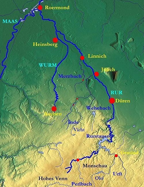
The Rur inter alia with the courses of the Urft, Inde, Merzbach and Wurm

Urft Reservoir basin at low water and the Victor Neels Bridge, Urft and, on the horizon, the tower of the Vogelsang Fortress

Urft Reservoir and immediately below it the upper basin of the Rur Dam