San Bernardino National Forest
The San Bernardino National Forest is a United States National Forest in Southern California encompassing 823,816 acres (3,333.87 km2) of which 677,982 acres (2,743.70 km2) are federal. The forest is made up of two main divisions, the eastern portion of the San Gabriel Mountains and the San Bernardino Mountains on the easternmost of the Transverse Ranges, and the San Jacinto and Santa Rosa Mountains on the northernmost of the Peninsular Ranges. Elevations range from 2,000 to 11,499 feet. The forest includes seven wilderness areas: San Gorgonio, Cucamonga, San Jacinto, South Fork, Santa Rosa, Cahuilla Mountain and Bighorn Mountain. Forest headquarters are located in the city of San Bernardino. There are district offices in Lytle Creek, Idyllwild, and Fawnskin.
Forest near Fawnskin
After the Blue Cut Fire in the summer of 2016 along State Route 138.
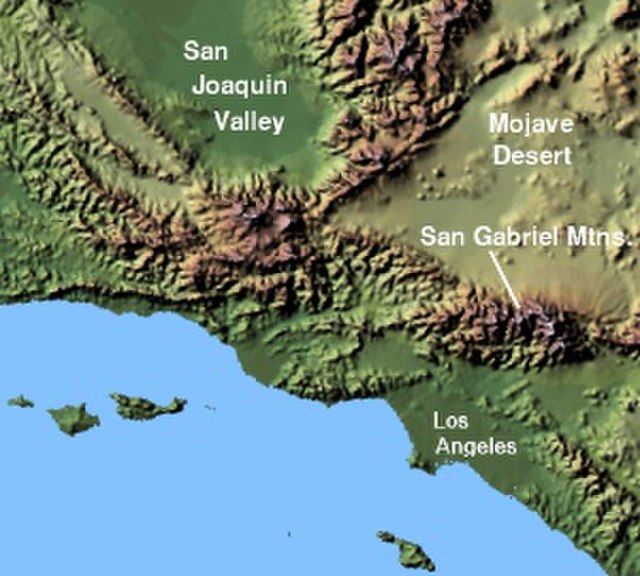
The San Gabriel Mountains comprise a mountain range located in northern Los Angeles County and western San Bernardino County, California, United States. The mountain range is part of the Transverse Ranges and lies between the Los Angeles Basin and the Mojave Desert, with Interstate 5 to the west and Interstate 15 to the east. The range lies in, and is surrounded by, the Angeles and San Bernardino National Forests, with the San Andreas Fault as its northern border.
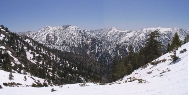
Summits in the eastern San Gabriel Mountains, Angeles National Forest, San Bernardino County, California. The main peaks are: Telegraph Peak 8,985 feet (2,739 m) (left), Cucamonga Peak, 8,859 feet (2,700 m) (center), and Ontario Peak 8,693 feet (2,650 m) (center right), as seen from Baldy Bowl on Mount Baldy.
Image: Wpdms shdrlfi 020l san gabriel mountains
East Fork San Gabriel River canyon, looking west.
Mount Harwood, from Devils Backbone