Santa Clarita Valley
Videos
The Santa Clarita Valley (SCV) is part of the upper watershed of the Santa Clara River in Southern California. The valley was part of the 48,612-acre (19,673 ha) Rancho San Francisco Mexican land grant. Located in Los Angeles County, its main population center is the city of Santa Clarita which includes the neighborhoods of Canyon Country, Newhall, Saugus, and Valencia. Adjacent unincorporated communities include Castaic, Stevenson Ranch, Val Verde, and Valencia.

View from the Sierra Pelona Mountains
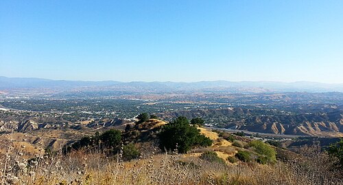
Overlooking Santa Clarita from Ed Davis Park at Towsley Canyon.

The Sand Fire burning in the foothills of the San Gabriel Mountains in 2016. Wildfires of varying strengths occur periodically around the valley.

Coastal sage and chaparral typical of the southwestern and central portions of the valley.
Valencia, California
Videos
Valencia is an unincorporated community in northwestern Los Angeles County, California, United States. The area, west of Interstate 5, is expanding with residential development and already includes major commercial and industrial parks. It straddles State Route 126 and the Santa Clara River.

Valencia with Magic Mountain theme park in background