Seismic magnitude scales are used to describe the overall strength or "size" of an earthquake. These are distinguished from seismic intensity scales that categorize the intensity or severity of ground shaking (quaking) caused by an earthquake at a given location. Magnitudes are usually determined from measurements of an earthquake's seismic waves as recorded on a seismogram. Magnitude scales vary based on what aspect of the seismic waves are measured and how they are measured. Different magnitude scales are necessary because of differences in earthquakes, the information available, and the purposes for which the magnitudes are used.
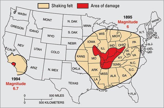
Differences in the crust underlying North America east of the Rocky Mountains makes that area more sensitive to earthquakes. Shown here: the 1895 New Madrid earthquake, M ~6, was felt through most of the central U.S., while the 1994 Northridge quake, though almost ten times stronger at M 6.7, was felt only in southern California. From USGS Fact Sheet 017–03.
An earthquake – also called a quake, tremor, or temblor – is the shaking of the Earth's surface resulting from a sudden release of energy in the lithosphere that creates seismic waves. Earthquakes can range in intensity, from those so weak they cannot be felt, to those violent enough to propel objects and people into the air, damage critical infrastructure, and wreak destruction across entire cities. The seismic activity of an area is the frequency, type, and size of earthquakes experienced over a particular time. The seismicity at a particular location in the Earth is the average rate of seismic energy release per unit volume.
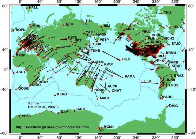
Global plate tectonic movement
Aerial photo of the San Andreas Fault in the Carrizo Plain, northwest of Los Angeles
Collapsed Gran Hotel building in the San Salvador metropolis, after the shallow 1986 San Salvador earthquake
The 2023 Turkey–Syria earthquakes ruptured along segments of the East Anatolian Fault at supershear speeds; more than 50,000 people died in both countries.


